Category:December 2007 in Ireland
Jump to navigation
Jump to search
Countries of Europe: Austria · Azerbaijan‡ · Belarus · Belgium · Bosnia and Herzegovina · Bulgaria · Croatia · Czech Republic · Denmark · Estonia · Finland · France‡ · Georgia‡ · Germany · Greece · Hungary · Iceland · Republic of Ireland · Italy · Kazakhstan‡ · Latvia · Lithuania · Luxembourg · Malta · Monaco · Netherlands‡ · Norway · Poland · Portugal‡ · Romania · Russia‡ · Serbia · Slovakia · Slovenia · Spain‡ · Sweden · Switzerland · Turkey‡ · Ukraine · United Kingdom
Specific status: Jersey
‡: partly located in Europe
Specific status: Jersey
‡: partly located in Europe
| ← | → | ||||||||||||
| ← | Jan | Feb | Mar | Apr | May | Jun | Jul | Aug | Sep | Oct | Nov | Dec | → |
|---|---|---|---|---|---|---|---|---|---|---|---|---|---|
| 38 | 64 | 2 | 115 | 17 | 169 | 221 | 395 | 3 | 128 | 106 | 75 | ||

Deutsch: Dezember 2007 in Irland
English: December 2007 in Ireland
Media in category "December 2007 in Ireland"
The following 75 files are in this category, out of 75 total.
-

-
-
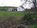
 Standing at Cloghran Stud Farm. - geograph.org.uk - 627135.jpg 640 × 427; 70 KB
-

-
 Martello Tower, Sandycove.jpg 2,272 × 1,704; 1 MB
-
 Trinity College, Dublin, Ireland (Sculpture of George Salmon).jpg 2,448 × 3,264; 2.89 MB
-
 Aghaloughan South - geograph.org.uk - 628303.jpg 640 × 479; 57 KB
-
 Aghaloughan South - geograph.org.uk - 628308.jpg 640 × 479; 63 KB
-
 Aghamore.jpg 3,718 × 2,088; 4.77 MB
-
 Ardnasallem Townland - geograph.org.uk - 628381.jpg 640 × 479; 75 KB
-
 Ballickmoyler4096.jpg 3,007 × 2,248; 941 KB
-
 BallickmoylerOnTheR429road4086.jpg 3,888 × 2,592; 1.56 MB
-
 Bridges at Laytown, Co. Meath - geograph.org.uk - 643444.jpg 640 × 480; 59 KB
-
 Carrickroe RC Church - geograph.org.uk - 628432.jpg 640 × 479; 70 KB
-
 Church at Ballinlough, Co. Meath - geograph.org.uk - 627011.jpg 640 × 480; 76 KB
-
 Cork City by night - geograph.org.uk - 126823.jpg 640 × 480; 55 KB
-
-
 Corragh Townland - geograph.org.uk - 628313.jpg 640 × 479; 50 KB
-
 Cottage at Aghaloughan South - geograph.org.uk - 628309.jpg 640 × 479; 61 KB
-
 Derryhee Townland - geograph.org.uk - 628379.jpg 640 × 479; 63 KB
-
 Derrykinnigh More - geograph.org.uk - 631772.jpg 640 × 479; 70 KB
-
 Derrykinnigh More - geograph.org.uk - 631776.jpg 640 × 479; 61 KB
-
 Derrykinnigh Townland - geograph.org.uk - 631770.jpg 640 × 479; 74 KB
-
 Derrylea Townland - geograph.org.uk - 628440.jpg 640 × 479; 60 KB
-
 Derrylea Townland - geograph.org.uk - 628443.jpg 640 × 479; 50 KB
-
 Derrylea Townland - geograph.org.uk - 631801.jpg 640 × 479; 59 KB
-
 Derrylea Townland - geograph.org.uk - 631804.jpg 640 × 479; 52 KB
-
 Drumbristan Townland - geograph.org.uk - 628433.jpg 640 × 479; 57 KB
-
 Drumbristan Townland - geograph.org.uk - 628434.jpg 640 × 479; 59 KB
-
 Drumbristan Townland - geograph.org.uk - 628436.jpg 640 × 479; 56 KB
-
 Drumgool Townland - geograph.org.uk - 673331.jpg 640 × 479; 53 KB
-
 Drumgool Townland - geograph.org.uk - 673336.jpg 640 × 479; 85 KB
-
 Footbridge and River Nore - geograph.org.uk - 638987.jpg 640 × 427; 75 KB
-
 Forest track - geograph.org.uk - 638999.jpg 640 × 427; 110 KB
-
 Forest walk - geograph.org.uk - 638981.jpg 640 × 427; 138 KB
-
 Forest walk - geograph.org.uk - 639015.jpg 640 × 427; 109 KB
-
 Gerry Adams Sinn Féin.jpg 2,154 × 1,731; 851 KB
-
 Grand Canal at Vicarswtown, Ireland.jpg 3,635 × 2,458; 957 KB
-
 Grand Canal Docks, Ringsend - geograph.org.uk - 645849.jpg 640 × 480; 50 KB
-
 IMG Vicarstown.jpg 3,567 × 2,175; 1.41 MB
-
 IMG VicarstownLaois.jpg 3,883 × 1,867; 1.47 MB
-
-
 Mullaghpeak Townland - geograph.org.uk - 628323.jpg 640 × 479; 50 KB
-
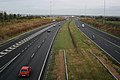
 N11 reassurance sign.jpg 2,138 × 1,904; 2.12 MB
-
 R185 Road at Kiltybegs - geograph.org.uk - 628274.jpg 640 × 479; 86 KB
-
 R280Leitrim.jpg 2,325 × 1,577; 1.8 MB
-
 R284bridge.jpg 3,817 × 1,994; 7.09 MB
-
 R427overGrandCanalVicarstown.jpg 3,888 × 2,592; 1.92 MB
-
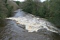 RiverAughrim.jpg 3,888 × 2,592; 1.96 MB
-
 Riverside walk - geograph.org.uk - 638991.jpg 640 × 427; 125 KB
-
 Road at Aghaloughan - geograph.org.uk - 628305.jpg 640 × 479; 44 KB
-
 Road at Crossnacaldoo - geograph.org.uk - 631672.jpg 640 × 479; 64 KB
-
 Road at Davagh Etra - geograph.org.uk - 628400.jpg 640 × 479; 51 KB
-
 Road at Derrylea - geograph.org.uk - 628442.jpg 640 × 479; 49 KB
-
 Road at Donagh - geograph.org.uk - 628317.jpg 640 × 290; 32 KB
-
 Road at Drumbristan - geograph.org.uk - 628426.jpg 640 × 479; 50 KB
-
 Road at Drumbristan - geograph.org.uk - 628435.jpg 640 × 277; 31 KB
-
 Road at Drumdart - geograph.org.uk - 628388.jpg 640 × 479; 76 KB
-
 Road at Drumfernasky - geograph.org.uk - 631786.jpg 640 × 479; 53 KB
-
 Road at Drumferrer - geograph.org.uk - 631663.jpg 640 × 479; 74 KB
-
 Road at Knockronaghan - geograph.org.uk - 628368.jpg 640 × 286; 23 KB
-
 Road at Tonycoogan - geograph.org.uk - 628392.jpg 640 × 479; 63 KB
-
 Road Junction - geograph.org.uk - 639003.jpg 640 × 427; 61 KB
-

-
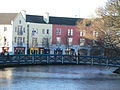 Rockwood Parade Sligo.jpg 2,272 × 1,704; 939 KB
-
-
 St Edna's Hall - geograph.org.uk - 628422.jpg 640 × 285; 28 KB
-
 St patricks dublin.JPG 1,024 × 768; 327 KB
-

-
 The Barnesmore Gap - geograph.org.uk - 644314.jpg 640 × 480; 71 KB
-
 Tonycoogan Townland - geograph.org.uk - 628394.jpg 640 × 479; 66 KB
-
 Trinity College Library-long room.jpg 2,880 × 1,800; 1.27 MB
-
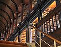 Trinity College Library-look in long room.jpg 2,880 × 2,220; 1.71 MB
-
 Trinity College Library-words in leather and wood.jpg 2,480 × 1,910; 1.05 MB
-
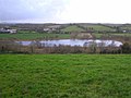 Tully Lough - geograph.org.uk - 628371.jpg 640 × 479; 51 KB
)_-_geograph.org.uk_-_627158.jpg)


.jpg)


