Category:De Stadsweide, Enschede
Jump to navigation
Jump to search
| Object location | | View all coordinates using: OpenStreetMap |
|---|
building in Enschede, Netherlands .jpg) | |||||
| Upload media | |||||
| Instance of | |||||
|---|---|---|---|---|---|
| Location | Enschede, Overijssel, Netherlands | ||||
| Street address |
| ||||
| Located on street |
| ||||
| Heritage designation |
| ||||
 | |||||
Nederlands: Openbare Lagere School
|
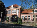
This is a category about rijksmonument number 510623
|
| Address |
|
Media in category "De Stadsweide, Enschede"
The following 3 files are in this category, out of 3 total.
-
 Overzicht van de voorgevel aan de straatkant - Enschede - 20427912 - RCE.jpg 1,200 × 924; 203 KB
-
 RM510623 - Enschede - Prinsestraat 10 (1).jpg 3,264 × 2,448; 2.75 MB
-
 RM510623 - Enschede - Prinsestraat 10 (2).jpg 3,264 × 2,448; 2.95 MB

.jpg)