Category:De Munt
Jump to navigation
Jump to search
| Object location | | View all coordinates using: OpenStreetMap |
|---|
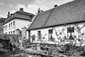
castle in Tegelen in use as a monastery, Netherlands .JPG) | |||||
| Upload media | |||||
| Instance of | |||||
|---|---|---|---|---|---|
| Location | Tegelen, Venlo, Limburg, Netherlands | ||||
| Street address |
| ||||
| Located on street |
| ||||
| Diocese | |||||
| Heritage designation |
| ||||
| Religion or worldview | |||||
 | |||||
|
This is a category about rijksmonument number 34983
|
| Address |
|
Media in category "De Munt"
The following 3 files are in this category, out of 3 total.
-

-
 Oude Munt-Tegelen (3).JPG 3,008 × 2,000; 1.38 MB
-
 Voormalige Huis de Munt, aanzicht - Tegelen - 20207029 - RCE.jpg 1,200 × 801; 274 KB

