Category:De Hoop, Haren
Jump to navigation
Jump to search
| Object location | | View all coordinates using: OpenStreetMap |
|---|
windmill in Haren, Netherlands  | |||||
| Upload media | |||||
| Instance of | |||||
|---|---|---|---|---|---|
| Location | |||||
| Has use | |||||
| Heritage designation |
| ||||
| Source of energy | |||||
 | |||||
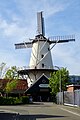
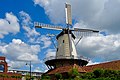
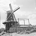
Nederlands: De Hoop, Haren, Groningen (Rijksstraatweg 133, in 1843 gebouwd als oliemolen, rm 20274) en bijbehorend complex woningen en schuren (Rijksstraatweg 137, 137, 138 en 141, rm 20275)
|
This is a category about rijksmonument number 20274
|
|
This is a category about rijksmonument number 20275
|
| Address |
|
Media in category "De Hoop, Haren"
The following 25 files are in this category, out of 25 total.
-
 20100922 De Hoop Haren Gn NL.jpg 2,100 × 2,800; 3.35 MB
-
 20130708 De Hoop Haren Gn NL.jpg 4,800 × 2,400; 2.82 MB
-
 20220509 molen de Hoop Haren.jpg 3,456 × 5,184; 3.16 MB
-
 20220602 molen de Hoop Haren.jpg 5,184 × 3,456; 5.02 MB
-
 Aanzicht - Haren - 20101442 - RCE.jpg 1,200 × 1,200; 238 KB
-
 Aanzicht - Haren - 20101443 - RCE.jpg 1,193 × 1,200; 245 KB
-
 Aanzicht - Haren - 20101444 - RCE.jpg 1,181 × 1,200; 248 KB
-
 Aanzicht - Haren - 20101445 - RCE.jpg 1,200 × 1,190; 265 KB
-
 Aanzicht - Haren - 20101446 - RCE.jpg 1,200 × 1,193; 347 KB
-
 Aanzicht - Haren - 20101447 - RCE.jpg 1,200 × 1,200; 357 KB
-
 Aanzicht - Haren - 20101448 - RCE.jpg 1,200 × 1,200; 280 KB
-
 De Hoop, Haren feb 2012.jpg 2,560 × 1,712; 1,021 KB
-
 Haren - De Hoop 1.JPG 4,272 × 2,848; 3.85 MB
-
 Haren - De Hoop 2.JPG 2,848 × 4,272; 1.53 MB
-
 Haren - De Hoop 3.JPG 4,272 × 2,848; 2.8 MB
-
 Haren - De Hoop 4.JPG 4,272 × 2,848; 4.27 MB
-
 Haren - molen De Hoop in restauratie.jpg 1,500 × 1,000; 931 KB
-
 Haren, koren-en oliemolen de Hoop RM20274 foto7 2016-04-09 17.53.jpg 3,136 × 4,352; 6.8 MB
-
 Nôt- en oaljemûne 'De Hoop', Haren (Grinslân).jpg 2,000 × 1,442; 1.62 MB
-
 Overzicht van de molen - Haren - 20420658 - RCE.jpg 1,200 × 800; 199 KB
-
 Overzicht van de molen - Haren - 20420659 - RCE.jpg 1,200 × 800; 154 KB
-
 Overzicht van de molen - Haren - 20420660 - RCE.jpg 1,200 × 800; 149 KB
-
 Overzicht van de molen - Haren - 20420661 - RCE.jpg 800 × 1,200; 149 KB
-
 Stellingmolen bij Haren (Gr), Bestanddeelnr 254-5161.jpg 2,590 × 2,637; 756 KB
-
 Stellingmolen bij Haren (Gr), Bestanddeelnr 254-5162.jpg 2,619 × 2,611; 687 KB


.jpg)


,_Bestanddeelnr_254-5161.jpg)
,_Bestanddeelnr_254-5162.jpg)