Category:De Achterhoek (Deventer)
Jump to navigation
Jump to search
| Object location | | View all coordinates using: OpenStreetMap |
|---|
| Object location | | View all coordinates using: OpenStreetMap |
|---|
building in Deventer, Netherlands  | |||||
| Upload media | |||||
| Instance of | |||||
|---|---|---|---|---|---|
| Part of |
| ||||
| Location | Colmschate, Deventer, Overijssel, Netherlands | ||||
| Street address |
| ||||
| Located on street |
| ||||
| Heritage designation |
| ||||
 | |||||
|
This is a category about rijksmonumentcomplex number 506109
|
Huis De Achterhoek
|
This is a category about rijksmonument number 506107
|
Historische aanleg
|
This is a category about rijksmonument number 506116
|
Koetshuis
|
This is a category about rijksmonument number 508139
|
| Address |
|
Media in category "De Achterhoek (Deventer)"
The following 3 files are in this category, out of 3 total.
-
 Landhuis De Achterhoek -01.jpg 4,288 × 3,216; 2.96 MB
-
 Landhuis De Achterhoek -02.jpg 4,288 × 3,216; 2.89 MB
-
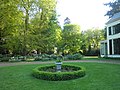 Tuin De Achterhoek -01.jpg 4,288 × 3,216; 3.04 MB

