Category:Darton
Jump to navigation
Jump to search
English: Darton is a large village in the Metropolitan Borough of Barnsley (part of South Yorkshire), on the border with West Yorkshire. At the time of the 2001 UK census, it had a population of 14,927.
Nederlands: Darton is een plaats in het bestuurlijke gebied Barnsley, in het Engelse graafschap South Yorkshire. De plaats telt 16000 inwoners.
Polski: Darton – wieś w Anglii, w hrabstwie ceremonialnym South Yorkshire, w dystrykcie (unitary authority) Barnsley. Leży 23 km na północ od miasta Sheffield i 250 km na północ od Londynu. Miejscowość liczy 14 927 mieszkańców.

village in the United Kingdom  | |||||
| Upload media | |||||
| Instance of | |||||
|---|---|---|---|---|---|
| Location | Barnsley, South Yorkshire, Yorkshire and the Humber, England | ||||
 | |||||
Subcategories
This category has the following 8 subcategories, out of 8 total.
Media in category "Darton"
The following 150 files are in this category, out of 150 total.
-
 140 Year old this year 2008 - geograph.org.uk - 659015.jpg 640 × 480; 119 KB
-
 A Dandelion - geograph.org.uk - 1286064.jpg 640 × 480; 59 KB
-
 A Field Of Yellow - geograph.org.uk - 1292941.jpg 640 × 480; 78 KB
-
 Baled for Winter - geograph.org.uk - 531668.jpg 640 × 475; 114 KB
-

-
 Barugh Bridge and the River Dearne - geograph.org.uk - 654374.jpg 640 × 480; 108 KB
-
 Bench by Ballfield Lane - geograph.org.uk - 1191713.jpg 640 × 480; 226 KB
-
 Birthwaite Hall - geograph.org.uk - 847291.jpg 640 × 491; 127 KB
-
 Bloomhouse Lane - geograph.org.uk - 599343.jpg 640 × 480; 103 KB
-
 Bloomhouse Lane - geograph.org.uk - 722084.jpg 640 × 480; 121 KB
-
 Bloomhouse Lane barns - geograph.org.uk - 722090.jpg 640 × 467; 68 KB
-
 Bloomhouse Lane with Mole - geograph.org.uk - 599361.jpg 640 × 480; 111 KB
-
 Cawthorne Dike from the A637 - geograph.org.uk - 477605.jpg 640 × 480; 86 KB
-

-

-
 Church Street Darton - geograph.org.uk - 1144323.jpg 640 × 480; 83 KB
-
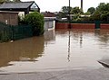
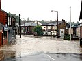 Church Street Darton Flooded - geograph.org.uk - 469154.jpg 640 × 476; 74 KB
-
 Church Street Darton Flooded - geograph.org.uk - 469159.jpg 640 × 471; 130 KB
-
 Church Street Darton Flooded - geograph.org.uk - 469198.jpg 640 × 480; 86 KB
-

-

-
 Corner shop, Ballfield Lane, Darton - geograph.org.uk - 791987.jpg 640 × 382; 44 KB
-
 Darton - The Grange.jpg 640 × 480; 73 KB
-
 Darton Fish Shop Flooded. - geograph.org.uk - 469191.jpg 640 × 475; 107 KB
-
 Darton from land at Bloomhouse Lane - geograph.org.uk - 1155107.jpg 640 × 480; 74 KB
-
 Darton to Barnsley Railway - geograph.org.uk - 1148868.jpg 640 × 480; 82 KB
-
 Darton Village from the Longfields - geograph.org.uk - 1148881.jpg 640 × 480; 66 KB
-
-
 Dog Roses - geograph.org.uk - 847285.jpg 640 × 480; 92 KB
-
 Footpath to Huddersfield Road - geograph.org.uk - 679953.jpg 640 × 480; 118 KB
-
 Former Sunday School, Darton.jpg 1,024 × 768; 138 KB
-
 Former Vicarage, Darton.jpg 1,024 × 768; 237 KB
-
 Gate into small quarry - geograph.org.uk - 847286.jpg 640 × 436; 91 KB
-
 Highwood, Kexborough - geograph.org.uk - 1210372.jpg 640 × 427; 65 KB
-
 Hogweed Snow Balls - geograph.org.uk - 1144638.jpg 640 × 480; 62 KB
-
 Husband Wood - geograph.org.uk - 1286031.jpg 640 × 480; 176 KB
-
 Husband Wood - geograph.org.uk - 1286042.jpg 640 × 480; 154 KB
-
 I'm Feeling Cold - geograph.org.uk - 1144333.jpg 640 × 480; 74 KB
-
 Jebb Lane, Darton - geograph.org.uk - 792026.jpg 640 × 477; 63 KB
-
 Junction 38 Tree - geograph.org.uk - 1209795.jpg 427 × 640; 123 KB
-
 Longfields picnic site flooded - geograph.org.uk - 469169.jpg 640 × 480; 102 KB
-
 Looking down towards Darton - geograph.org.uk - 1211060.jpg 640 × 480; 52 KB
-

-
 Milepost, Barnsley Road, Darton.jpg 1,200 × 1,600; 464 KB
-
 Milestone, Wilthorpe.jpg 480 × 640; 345 KB
-
 Mill Lane Darton Flooded - geograph.org.uk - 469164.jpg 640 × 480; 138 KB
-
 Mill Lane Flooded - geograph.org.uk - 469175.jpg 640 × 474; 143 KB
-
 Mill Lane from the Longfields - geograph.org.uk - 1148892.jpg 640 × 480; 77 KB
-
 New Darton Primary School entrance. - geograph.org.uk - 477629.jpg 640 × 474; 68 KB
-

-
 Old Pumber Pit Lane - geograph.org.uk - 1144714.jpg 640 × 480; 72 KB
-
 Oxeye Daisy and several insects - geograph.org.uk - 847266.jpg 640 × 480; 59 KB
-
 Park Hill A637, Darton - geograph.org.uk - 792142.jpg 640 × 480; 75 KB
-
 Pastoral hillside - geograph.org.uk - 1191684.jpg 640 × 480; 206 KB
-
 Pasture land east of Cawthorne Lane - geograph.org.uk - 1191691.jpg 640 × 480; 210 KB
-
 Pyronia tithonus - geograph.org.uk - 886336.jpg 640 × 480; 78 KB
-
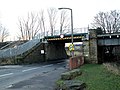
 Railway bridge Darton - geograph.org.uk - 722074.jpg 640 × 480; 80 KB
-
 Rainbow over Kexborough - geograph.org.uk - 1210338.jpg 427 × 640; 14 KB
-
 Rear entrance to Birthwaithe Hall - geograph.org.uk - 459657.jpg 640 × 472; 110 KB
-
 Round wood off Jebb lane - geograph.org.uk - 1210298.jpg 429 × 640; 44 KB
-
 Snow Covered Oak Sapling - geograph.org.uk - 1144769.jpg 480 × 640; 87 KB
-
 Snow on Rosehips - geograph.org.uk - 1144751.jpg 640 × 480; 46 KB
-
 Station Road Darton B6131 - geograph.org.uk - 1144307.jpg 640 × 480; 81 KB
-

-
 Stone cottage in Haigh (geograph 4604346).jpg 3,888 × 5,184; 5.89 MB
-
 The 140 Year old bridge plate - geograph.org.uk - 659020.jpg 640 × 475; 75 KB
-
 The B6131 Darton Lane - geograph.org.uk - 1144671.jpg 640 × 480; 66 KB
-
 The Dearne Way to Darton - geograph.org.uk - 587581.jpg 640 × 480; 99 KB
-

-
 The entrance to Birthwaite Hall - geograph.org.uk - 847273.jpg 640 × 554; 107 KB
-
 The entrance to Darton High School - geograph.org.uk - 1046005.jpg 640 × 345; 47 KB
-

-

-
 The Masons Arms, Darton - geograph.org.uk - 721906.jpg 640 × 519; 71 KB
-
 The New Darton Primary School - geograph.org.uk - 477627.jpg 640 × 480; 65 KB
-

-
 The new Woolley Colliery Road - geograph.org.uk - 702515.jpg 640 × 480; 81 KB
-
 The Old Post Office, Haigh, Darton - geograph.org.uk - 787049.jpg 640 × 463; 72 KB
-

-
 The River Dearne - geograph.org.uk - 1650225.jpg 640 × 480; 147 KB
-
 The River Dearne - geograph.org.uk - 380196.jpg 640 × 480; 125 KB
-
 The River Dearne - geograph.org.uk - 387764.jpg 640 × 480; 141 KB
-
 The River Dearne - geograph.org.uk - 407058.jpg 640 × 480; 115 KB
-
 The River Dearne - geograph.org.uk - 654625.jpg 640 × 480; 120 KB
-
 The River Dearne and Barugh Bridge - geograph.org.uk - 654605.jpg 640 × 480; 118 KB
-
 The River Dearne looking to Mill Lane - geograph.org.uk - 654634.jpg 640 × 477; 131 KB
-
 The River Dearne the day after flooding. - geograph.org.uk - 477610.jpg 640 × 480; 127 KB
-
 Towards Kexborough from Park Hill - geograph.org.uk - 1210277.jpg 640 × 482; 69 KB
-

-
 View from Jebb lane over to Barnsley - geograph.org.uk - 1210330.jpg 640 × 574; 67 KB
-
 View over the Dearne Valley - geograph.org.uk - 1191708.jpg 640 × 480; 224 KB
-
 What a combination. - geograph.org.uk - 545061.jpg 640 × 459; 75 KB
-
 Windhill - geograph.org.uk - 1211068.jpg 640 × 480; 92 KB
-
 Windhill Gate - geograph.org.uk - 404630.jpg 640 × 480; 91 KB
-
 Windhill Gate Farm - geograph.org.uk - 176088.jpg 640 × 480; 51 KB
-
 Winter Walk - Jebb Lane - geograph.org.uk - 1153028.jpg 640 × 480; 92 KB
-
 Winter Walk - Jebb Lane - geograph.org.uk - 1153059.jpg 640 × 480; 88 KB
-

-

-

-
 A man made pond - geograph.org.uk - 658985.jpg 640 × 474; 66 KB
-
 A tight squeeze - geograph.org.uk - 704623.jpg 640 × 477; 66 KB
-

-
 Barugh Hill - geograph.org.uk - 519174.jpg 640 × 480; 118 KB
-
 Barugh Hill and pylons. - geograph.org.uk - 519177.jpg 640 × 472; 71 KB
-
 Barugh Hill looking to High Hoyland - geograph.org.uk - 542039.jpg 640 × 480; 94 KB
-
 Barugh Hill looking to Kexborough - geograph.org.uk - 542036.jpg 640 × 480; 102 KB
-
 Barugh Hill Trig Pillar S4237 - geograph.org.uk - 542033.jpg 640 × 480; 111 KB
-

-
 Birthwaite Hall - geograph.org.uk - 426656.jpg 640 × 480; 80 KB
-
 Birthwaite Hall Farm - geograph.org.uk - 426653.jpg 640 × 480; 88 KB
-
 Birthwaite Hall, Darton - geograph.org.uk - 791953.jpg 640 × 480; 102 KB
-
 Bramble Flower - geograph.org.uk - 455721.jpg 640 × 480; 74 KB
-
 Cawthorne Dike - geograph.org.uk - 477603.jpg 640 × 480; 102 KB
-
 Cawthorne Lane - geograph.org.uk - 401482.jpg 640 × 480; 116 KB
-

-
 Cowcroft Farm between the trees. - geograph.org.uk - 426648.jpg 640 × 468; 106 KB
-
 Darton Cricket Field Flooded - geograph.org.uk - 469184.jpg 640 × 480; 78 KB
-
 Darton Lane - geograph.org.uk - 459286.jpg 640 × 468; 56 KB
-
 Darton Park - geograph.org.uk - 418275.jpg 640 × 473; 118 KB
-
 Dearne Hall Road - geograph.org.uk - 477541.jpg 640 × 480; 106 KB
-
 Disused railway line near Darton - geograph.org.uk - 131551.jpg 640 × 426; 115 KB
-
 Entrance to Birthwaite Hall from the A637 - geograph.org.uk - 459666.jpg 640 × 480; 171 KB
-
 Farm Track to Spark Lane - geograph.org.uk - 477539.jpg 640 × 480; 102 KB
-
 From Lombardy to Barnsley - geograph.org.uk - 131410.jpg 640 × 426; 131 KB
-
 Goat's Beard (Tragopogon pratensis) - geograph.org.uk - 455776.jpg 640 × 475; 55 KB
-
 Haigh from Darton Motorway Bridge - geograph.org.uk - 587561.jpg 640 × 480; 107 KB
-
 Harvest Time - geograph.org.uk - 542053.jpg 640 × 480; 77 KB
-
 Junction 38 Business Park - geograph.org.uk - 131542.jpg 640 × 417; 108 KB
-

-

-
 Longfields Parkland Darton - geograph.org.uk - 418288.jpg 640 × 480; 121 KB
-
 M1 underpass at Higham - geograph.org.uk - 131420.jpg 640 × 425; 91 KB
-
 Motor Cycle at Swallow Hill Road - geograph.org.uk - 477397.jpg 640 × 480; 169 KB
-
 Obstruction on B6131 Darton Lane - geograph.org.uk - 703998.jpg 640 × 480; 61 KB
-
 Old hedge south of Kexbrough - geograph.org.uk - 131397.jpg 640 × 426; 120 KB
-
 Old Pumber Colliery Site - geograph.org.uk - 596325.jpg 640 × 480; 62 KB
-
 Old Pumber Pit Site - geograph.org.uk - 401486.jpg 640 × 480; 120 KB
-
 Old Quarry - geograph.org.uk - 180472.jpg 640 × 480; 145 KB
-
 Ox-eye Daisy (Leucanthemun vulgare) - geograph.org.uk - 455787.jpg 640 × 480; 67 KB
-
 Part of Old Pumber Pit site - geograph.org.uk - 459297.jpg 640 × 480; 112 KB
-
 Part of the Old Pumber Pit Site. - geograph.org.uk - 459294.jpg 640 × 480; 106 KB
-
 Railway bridge near Darton Station - geograph.org.uk - 131553.jpg 640 × 426; 135 KB
-
 Swallow Hill Farmhouse - geograph.org.uk - 658975.jpg 640 × 480; 105 KB
-
 Swallow Hill Road Rescue - geograph.org.uk - 477383.jpg 640 × 480; 179 KB
-
 Swallow Hill Road second flood June 07 - geograph.org.uk - 477363.jpg 480 × 640; 159 KB
-
 The M1 Motorway Darton - geograph.org.uk - 587556.jpg 640 × 480; 62 KB
-
 The River Dearne below Barugh Bridge - geograph.org.uk - 658965.jpg 640 × 480; 95 KB
-
 The Rose And Crown - geograph.org.uk - 639227.jpg 640 × 475; 59 KB
-
 The Rose and Crown Kexborough. - geograph.org.uk - 545059.jpg 640 × 480; 86 KB


.jpg)


_-_geograph.org.uk_-_417466.jpg)


_-_geograph.org.uk_-_417497.jpg)


_-_geograph.org.uk_-_455776.jpg)


_-_geograph.org.uk_-_180469.jpg)


_-_geograph.org.uk_-_455787.jpg)


