Category:Dartmoor Way
Jump to navigation
Jump to search
English: The Dartmoor Way is a long-distance footpath and cycle route centred on the Dartmoor National Park in southern Devon, England. It is a circular route of approximately 140km (90 mi) that encompasses upland and moorland walking, deep Devon lanes, and also passes through towns and villages such as Okehampton, Chagford, Moretonhampstead, Buckfastleigh, Princetown and Tavistock.
long-distance footpath and cycle route in Devon, England, UK _-_geograph.org.uk_-_1013128.jpg) | |||||
| Upload media | |||||
| Instance of |
| ||||
|---|---|---|---|---|---|
| Location | Devon, South West England, England | ||||
 | |||||
Media in category "Dartmoor Way"
The following 16 files are in this category, out of 16 total.
-
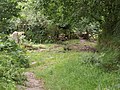
 At Swincombe - geograph.org.uk - 1501858.jpg 640 × 480; 108 KB
-
 Cottage in a dark lane - geograph.org.uk - 649007.jpg 640 × 480; 78 KB
-
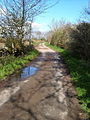
 Dartmoor Way approaching Dickford Bridge - geograph.org.uk - 163061.jpg 640 × 480; 151 KB
-
 Dartmoor Way at Whiddon Wood - geograph.org.uk - 145330.jpg 640 × 480; 115 KB
-
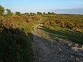
 Dartmoor Way below Rora Down (2) - geograph.org.uk - 1013120.jpg 480 × 640; 143 KB
-
 Dartmoor Way below Rora Down (3) - geograph.org.uk - 1013128.jpg 463 × 640; 92 KB
-
 Dartmoor Way below Rora Down (4) - geograph.org.uk - 1013148.jpg 640 × 480; 154 KB
-
-
 Dartmoor Way near Royal Mile - geograph.org.uk - 1501666.jpg 640 × 480; 108 KB
-
 Dr Blackall's Drive - geograph.org.uk - 178203.jpg 640 × 480; 92 KB
-
 Farmyard at Lower Whiddon - geograph.org.uk - 952576.jpg 640 × 427; 52 KB
-
 Fernworthy Down - geograph.org.uk - 316756.jpg 640 × 480; 107 KB
-
 Footpath to Dartmeet - geograph.org.uk - 1410308.jpg 640 × 480; 137 KB
-
 Gateways on the Dartmoor Way - geograph.org.uk - 593557.jpg 640 × 480; 116 KB
-
 Minehouse Farm - geograph.org.uk - 348378.jpg 640 × 480; 96 KB
-


_-_geograph.org.uk_-_1013120.jpg)
_-_geograph.org.uk_-_1013148.jpg)


