Category:Darenth
Jump to navigation
Jump to search
English: Category:Villages in Kent
Norsk bokmål: Darenth er en landsby og et verdslig sogn i Kent i England. Den ligger omkring fem km fra Dartford, ved elven Darent.
village in Dartford, United Kingdom  | |||||
| Upload media | |||||
| Instance of | |||||
|---|---|---|---|---|---|
| Location | Dartford, Kent, South East England, England | ||||
| Said to be the same as | Darenth (Wikimedia duplicated page, civil parish) | ||||
 | |||||
Subcategories
This category has the following 3 subcategories, out of 3 total.
B
- Beacon Wood Country Park (3 F)
O
- Oasts in Darenth (1 F)
Media in category "Darenth"
The following 200 files are in this category, out of 293 total.
(previous page) (next page)-
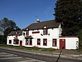
 'The Ship' public house - geograph.org.uk - 966939.jpg 640 × 408; 53 KB
-
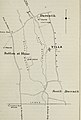
 20th Century Map of Darenth.png 754 × 484; 912 KB
-
 4 Levels on M25 Junction 3 with A2 - geograph.org.uk - 1245661.jpg 640 × 480; 66 KB
-
 A2 - geograph.org.uk - 2735295.jpg 640 × 430; 74 KB
-
 A2 - moving slowly in the fast lane - geograph.org.uk - 2620955.jpg 640 × 428; 68 KB
-
 A2 approaching the M25 - geograph.org.uk - 3103710.jpg 640 × 467; 44 KB
-
 A2 at Junction 2, M25 - geograph.org.uk - 3729680.jpg 640 × 430; 57 KB
-
 A2 Bridge - geograph.org.uk - 24065.jpg 640 × 314; 32 KB
-
 A2 Dartford by-pass, near Darenth Wood - geograph.org.uk - 2049801.jpg 2,048 × 1,536; 1.06 MB
-
 A2 eastbound - geograph.org.uk - 5968928.jpg 1,024 × 576; 75 KB
-
 A2 heading east - geograph.org.uk - 2620916.jpg 640 × 428; 72 KB
-
 A2 Looking east - geograph.org.uk - 23708.jpg 640 × 480; 45 KB
-
 A2 Passing Under the M25 - geograph.org.uk - 3631573.jpg 640 × 480; 261 KB
-
 A2, Darenth Wood - geograph.org.uk - 3631532.jpg 640 × 480; 263 KB
-
 A2-M25 Interchange - geograph.org.uk - 3631548.jpg 640 × 480; 249 KB
-
 A2-M25 junction 2 interchange - geograph.org.uk - 3103709.jpg 800 × 534; 65 KB
-
 Access Road to Darenth Country Park - geograph.org.uk - 4648726.jpg 2,304 × 1,728; 823 KB
-
 Access Road to Darenth Country Park - geograph.org.uk - 4648732.jpg 2,304 × 1,728; 838 KB
-
 Across a fallow field - geograph.org.uk - 2839264.jpg 640 × 480; 94 KB
-
 Apple orchard at St Margaret's - geograph.org.uk - 1247805.jpg 640 × 480; 192 KB
-
 Approaching St. Margaret's Farm - geograph.org.uk - 5169411.jpg 1,600 × 1,067; 697 KB
-
 Archaeologia cantiana (1897) (14598119920).jpg 1,978 × 2,922; 482 KB
-
 Archaeologia cantiana (1897) (14598151609).jpg 2,822 × 3,522; 911 KB
-
 Ascending Gill's Road - geograph.org.uk - 5169394.jpg 1,600 × 1,067; 579 KB
-
 B260, Green Street Green Road - geograph.org.uk - 6158288.jpg 1,024 × 685; 373 KB
-
 B260, Green Street Green Road - geograph.org.uk - 6158321.jpg 1,024 × 685; 270 KB
-
 B260, Green Street Green Road - geograph.org.uk - 6158325.jpg 1,024 × 685; 268 KB
-
 B260, Green Street Green Road - geograph.org.uk - 6158835.jpg 1,024 × 684; 348 KB
-
 B262 Sandbanks Hill - geograph.org.uk - 6159613.jpg 1,024 × 684; 494 KB
-
 Bridge over River Darent, Darenth - geograph.org.uk - 6158083.jpg 1,024 × 684; 437 KB
-
 Car Park in Darenth Country Park - geograph.org.uk - 2489824.jpg 3,072 × 2,304; 1.98 MB
-
 Care home, Darenth - geograph.org.uk - 3494284.jpg 640 × 430; 107 KB
-
 Chapel Orchard - geograph.org.uk - 2489693.jpg 3,072 × 2,304; 2.93 MB
-
 Chapel Orchards Information Panel - geograph.org.uk - 2489696.jpg 3,072 × 2,304; 1.89 MB
-
 Children's Play park in Darenth Country Park - geograph.org.uk - 2489860.jpg 3,072 × 2,304; 3.06 MB
-
 Clay pigeon shooting at Badger's Mount - geograph.org.uk - 2827003.jpg 4,000 × 3,000; 4.29 MB
-
 Clement St Bridge over M25 - geograph.org.uk - 191041.jpg 426 × 640; 115 KB
-
 Coombfield Drive - geograph.org.uk - 2838743.jpg 640 × 428; 83 KB
-
 Coombfield Drive, Darenth - geograph.org.uk - 6158245.jpg 1,024 × 685; 369 KB
-
 Coppicing in Darenth Wood - geograph.org.uk - 2826988.jpg 4,000 × 3,000; 4.16 MB
-
 Cottage, Darenth - geograph.org.uk - 3494322.jpg 640 × 430; 123 KB
-
 Court Cottages - geograph.org.uk - 3494335.jpg 640 × 430; 89 KB
-
 Court Road, Darenth - geograph.org.uk - 4157748.jpg 3,488 × 2,616; 2.53 MB
-
 Darent Valley from Roman Villa Road - geograph.org.uk - 2818039.jpg 4,000 × 3,000; 3.99 MB
-
 Darent Valley from Roman Villa Road - geograph.org.uk - 2877348.jpg 4,320 × 3,240; 3.9 MB
-
 Darent Valley Hospital - geograph.org.uk - 1324436.jpg 640 × 427; 74 KB
-
 Darent Valley Hospital AandE - geograph.org.uk - 1324459.jpg 640 × 428; 77 KB
-
 Darent Valley Path - geograph.org.uk - 2025038.jpg 640 × 426; 83 KB
-
 Darent Valley Path - geograph.org.uk - 2025049.jpg 640 × 426; 79 KB
-
 Darent Valley Path - geograph.org.uk - 3097980.jpg 4,000 × 3,000; 4.36 MB
-
 Darent Valley Path - geograph.org.uk - 3494229.jpg 640 × 430; 104 KB
-
 Darent Valley Path - geograph.org.uk - 3499292.jpg 640 × 430; 92 KB
-
 Darent Valley Path - geograph.org.uk - 3499302.jpg 640 × 430; 140 KB
-
 Darent Valley Path - geograph.org.uk - 3499306.jpg 640 × 430; 157 KB
-
 Darent Valley Path - geograph.org.uk - 3499319.jpg 640 × 430; 72 KB
-
 Darent Valley Path - geograph.org.uk - 3499325.jpg 640 × 430; 91 KB
-
 Darent Valley Path - geograph.org.uk - 3499392.jpg 640 × 430; 64 KB
-
 Darent Valley Path - geograph.org.uk - 3499402.jpg 640 × 430; 66 KB
-
 Darent Valley Path - geograph.org.uk - 3499407.jpg 640 × 430; 75 KB
-
 Darent Valley Path - geograph.org.uk - 4306739.jpg 640 × 480; 49 KB
-

-
 Darent Valley scenery - geograph.org.uk - 3499311.jpg 640 × 430; 80 KB
-
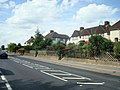
 Darent Valley Walk on Darenth Road South - geograph.org.uk - 1245647.jpg 640 × 480; 115 KB
-
 Darenth Community Primary School - geograph.org.uk - 1247766.jpg 640 × 480; 181 KB
-
 Darenth Country Park Information Board - geograph.org.uk - 2489673.jpg 3,072 × 2,304; 1.98 MB
-
 Darenth Grange - geograph.org.uk - 1245652.jpg 640 × 480; 89 KB
-
 Darenth Hill - geograph.org.uk - 2877376.jpg 4,320 × 3,240; 4.68 MB
-
 Darenth Hill - geograph.org.uk - 3499283.jpg 640 × 430; 91 KB
-
 Darenth Hill - geograph.org.uk - 3499287.jpg 640 × 430; 80 KB
-
 Darenth Hill - geograph.org.uk - 4653178.jpg 2,304 × 1,728; 849 KB
-
 Darenth Hill - geograph.org.uk - 4653180.jpg 2,304 × 1,728; 845 KB
-
 Darenth Hill - geograph.org.uk - 4653184.jpg 2,304 × 1,728; 827 KB
-
 Darenth Hill - geograph.org.uk - 6157896.jpg 1,024 × 684; 411 KB
-
 Darenth Hill - geograph.org.uk - 6158062.jpg 1,024 × 768; 361 KB
-
 Darenth Hill - geograph.org.uk - 6158144.jpg 1,024 × 684; 439 KB
-
 Darenth Hill - geograph.org.uk - 6158148.jpg 1,024 × 685; 381 KB
-
 Darenth Hill - geograph.org.uk - 6158208.jpg 1,024 × 684; 441 KB
-
 Darenth Hill, Darenth - geograph.org.uk - 4157706.jpg 3,488 × 2,616; 4.15 MB
-
 Darenth Meadow - geograph.org.uk - 2489674.jpg 3,072 × 2,304; 1.43 MB
-
 Darenth Meadow in Darenth Country Park - geograph.org.uk - 2489672.jpg 3,072 × 1,728; 1.48 MB
-
 Darenth Park Avenue - geograph.org.uk - 2489885.jpg 3,072 × 2,304; 1.98 MB
-
 Darenth Park Avenue, Dartford - geograph.org.uk - 4786289.jpg 2,272 × 1,704; 1.37 MB
-
 Darenth Park Hospital.jpg 434 × 679; 196 KB
-
 Darenth Rd - geograph.org.uk - 3494275.jpg 640 × 430; 135 KB
-
 Darenth Rest Cemetery in Darenth Country Park - geograph.org.uk - 2489817.jpg 3,072 × 2,304; 3.16 MB
-
 Darenth Road - end of public access - geograph.org.uk - 1247609.jpg 640 × 480; 163 KB
-
 Darenth Road South - geograph.org.uk - 3494278.jpg 640 × 430; 121 KB
-
 Darenth Road South - geograph.org.uk - 5169715.jpg 1,600 × 1,067; 480 KB
-
 Darenth Road South - geograph.org.uk - 5207700.jpg 640 × 427; 103 KB
-
 Darenth Road South, Darenth - geograph.org.uk - 4157759.jpg 3,488 × 2,616; 3.38 MB
-
 Darenth Road South, Darenth - geograph.org.uk - 4157769.jpg 3,488 × 2,616; 2.21 MB
-
 Darenth Training Colony. Wellcome L0006809EA.jpg 1,510 × 1,177; 924 KB
-
 Darenth Wood - geograph.org.uk - 2826992.jpg 640 × 480; 160 KB
-
 Darenth Wood from Watling Street - geograph.org.uk - 2829242.jpg 4,000 × 3,000; 4.23 MB
-
 Darenth Wood from Wood Lane - geograph.org.uk - 2829202.jpg 4,000 × 3,000; 4.23 MB
-
 Darenth Wood Road in Darenth Wood - geograph.org.uk - 1245801.jpg 640 × 480; 143 KB
-
 Darenth Wood Road, Dartford - geograph.org.uk - 4786286.jpg 2,272 × 1,704; 720 KB
-
 Durham House and Durham Cottage - geograph.org.uk - 1245494.jpg 640 × 480; 107 KB
-
 Easter circus at Green Street Green - geograph.org.uk - 1247842.jpg 640 × 480; 121 KB
-
 Entrance to Darenth Country Park - geograph.org.uk - 2489668.jpg 3,072 × 2,304; 2.79 MB
-
 Erosion in Darenth Wood - geograph.org.uk - 2827011.jpg 4,000 × 3,000; 4.35 MB
-
 Exit slip road from M25 to A2 - geograph.org.uk - 2433385.jpg 640 × 480; 53 KB
-
 Fallen leaves at Hill Rise - geograph.org.uk - 5207732.jpg 640 × 427; 130 KB
-
 Farmland and woodland, Darenth - geograph.org.uk - 3494254.jpg 640 × 430; 67 KB
-
 Farmland, Darent Valley - geograph.org.uk - 3499315.jpg 640 × 430; 66 KB
-
 Farmland, Darent Valley - geograph.org.uk - 3499327.jpg 640 × 430; 63 KB
-
 Farmland, Darent Valley - geograph.org.uk - 3499373.jpg 640 × 430; 63 KB
-
 Field alongside Watling Street - geograph.org.uk - 2829353.jpg 4,000 × 3,000; 4.01 MB
-
 Field alongside Wood Lane - geograph.org.uk - 2828878.jpg 4,000 × 3,000; 4.14 MB
-
 Field by Old Mill Farm, Darenth - geograph.org.uk - 4653182.jpg 2,304 × 1,728; 988 KB
-
 Field by Old Mill Farm, Darenth - geograph.org.uk - 4653183.jpg 2,304 × 1,728; 1.34 MB
-
 Flyover at A2-M25 Interchange - geograph.org.uk - 3631576.jpg 640 × 480; 239 KB
-
 Follow the hedge - geograph.org.uk - 3494246.jpg 640 × 430; 118 KB
-
 Footpath heading North West towards Darenth - geograph.org.uk - 5169694.jpg 1,600 × 1,067; 566 KB
-
 Footpath in Darenth Wood - geograph.org.uk - 2828838.jpg 4,000 × 3,000; 4.27 MB
-
 Footpath leading to Darenth Road South - geograph.org.uk - 5169720.jpg 1,600 × 1,067; 642 KB
-
 Footpath off Darenth Road South - geograph.org.uk - 3494313.jpg 640 × 430; 165 KB
-
 Footpath Through Darenth Wood - geograph.org.uk - 48933.jpg 482 × 640; 160 KB
-
 Footpath to Darenth Valley Hospital - geograph.org.uk - 2489908.jpg 3,072 × 2,304; 1.78 MB
-
 Footpath to Roman Villa Road - geograph.org.uk - 3499358.jpg 640 × 430; 80 KB
-
 Fox and Hounds, Darenth - geograph.org.uk - 4157713.jpg 3,488 × 2,616; 2.11 MB
-
 Gore Road, Dartford - geograph.org.uk - 4786294.jpg 2,272 × 1,704; 662 KB
-
 Graffiti under the M25 - geograph.org.uk - 5169849.jpg 1,600 × 1,067; 353 KB
-
 Grassland near South Darent - geograph.org.uk - 3499397.jpg 640 × 430; 65 KB
-
 Grassland, Darent Valley - geograph.org.uk - 3499404.jpg 640 × 430; 59 KB
-
 Green and houses at Hill Rise - geograph.org.uk - 5207727.jpg 640 × 427; 90 KB
-
 Green and play area, Hill Rise, Darenth - geograph.org.uk - 6158224.jpg 1,024 × 684; 426 KB
-
 Green at Green Street Green - geograph.org.uk - 2842467.jpg 4,000 × 3,000; 4.08 MB
-
 Green space beside Green Road - geograph.org.uk - 5207738.jpg 640 × 427; 61 KB
-
 Green Spice, Green Street Green - geograph.org.uk - 2877314.jpg 4,320 × 3,240; 4.27 MB
-
 Green Street Green - geograph.org.uk - 1247761.jpg 640 × 480; 139 KB
-
 Green Street Green Road - geograph.org.uk - 2877322.jpg 4,320 × 3,240; 4.1 MB
-
 Green Street Green Road - geograph.org.uk - 4649854.jpg 2,304 × 1,728; 825 KB
-
 Green Street Green Road - geograph.org.uk - 4651677.jpg 2,304 × 1,728; 825 KB
-
 Green Street Green Road - geograph.org.uk - 931456.jpg 640 × 480; 57 KB
-

-
 Green Street Green Road going under the A2 - geograph.org.uk - 4653140.jpg 2,257 × 1,598; 922 KB
-
 Green Street Green Road, Darenth - geograph.org.uk - 1402852.jpg 640 × 480; 74 KB
-
 Green Street Green Road, Darenth - geograph.org.uk - 4157725.jpg 3,488 × 2,616; 2.59 MB
-
 Green Street Green Road, Darenth - geograph.org.uk - 4650431.jpg 2,304 × 1,728; 796 KB
-
 Green Street Green Road, Grubb Street - geograph.org.uk - 4651678.jpg 2,304 × 1,728; 1.18 MB
-
 Green Street Green Road, Grubb Street - geograph.org.uk - 4653133.jpg 1,278 × 2,028; 1,016 KB
-
 Green Street Green Road, Lane End - geograph.org.uk - 4157716.jpg 3,488 × 2,616; 3.04 MB
-

-
 Greenlands Primary School from the air - geograph.org.uk - 6250214.jpg 1,024 × 768; 299 KB
-
 Hawkspare Limited Works - geograph.org.uk - 1245496.jpg 640 × 480; 57 KB
-
 Hawley - 2013 - geograph.org.uk - 4078661.jpg 3,648 × 2,736; 3.8 MB
-
 Hedgerow, Darent Valley - geograph.org.uk - 3499411.jpg 640 × 430; 84 KB
-
 Highcross Road meets Betsham Road - geograph.org.uk - 6159599.jpg 1,024 × 684; 515 KB
-
 Hill Rise, Darenth - geograph.org.uk - 4157733.jpg 3,488 × 2,616; 2.11 MB
-
 Hill Rise, Darenth - geograph.org.uk - 4157736.jpg 3,488 × 2,616; 2.74 MB
-
 Hill Rise, Darenth - geograph.org.uk - 6158219.jpg 1,024 × 684; 357 KB
-
 Hillside, Darenth - geograph.org.uk - 4157741.jpg 3,488 × 2,616; 2.44 MB
-
 House at Darenth - geograph.org.uk - 3494319.jpg 640 × 430; 111 KB
-
 House by the Darent Valley Path - geograph.org.uk - 3499323.jpg 640 × 430; 79 KB
-
 House on the edge of Darenth - geograph.org.uk - 3494249.jpg 640 × 430; 102 KB
-

-
 J Chubb quarry - geograph.org.uk - 1247599.jpg 640 × 480; 117 KB
-
 Joining the M25 at junction 2 - geograph.org.uk - 2982731.jpg 800 × 600; 67 KB
-
 Ladywood Road, Darenth - geograph.org.uk - 4157754.jpg 3,488 × 2,616; 2.15 MB
-
 Ladywood Road, Darenth - geograph.org.uk - 6158230.jpg 1,024 × 684; 402 KB
-
 Lake in the Darent Valley - geograph.org.uk - 3499341.jpg 640 × 430; 114 KB
-
 Lane End water treatment works - geograph.org.uk - 1247780.jpg 640 × 480; 152 KB
-
 Legion Car Sales, Lane End - geograph.org.uk - 4653144.jpg 2,208 × 1,592; 869 KB
-
 Light and Life Mission - geograph.org.uk - 1245791.jpg 640 × 480; 58 KB
-
 Littledale, Darenth - geograph.org.uk - 4157727.jpg 3,488 × 2,616; 2.9 MB
-
 Looking east down Darenth Hill - geograph.org.uk - 6158213.jpg 1,024 × 684; 385 KB
-
 Looking towards Roman Villa Rd - geograph.org.uk - 3499335.jpg 640 × 430; 54 KB
-
 Lorry on Mini-Roundabout - geograph.org.uk - 1918802.jpg 1,024 × 683; 221 KB
-
 M2 Motorway near Darenth Country Park - geograph.org.uk - 2489820.jpg 3,072 × 2,304; 1.62 MB
-
 M25 - geograph.org.uk - 3494231.jpg 640 × 430; 58 KB
-
 M25 Junction 2 - geograph.org.uk - 3450022.jpg 1,692 × 1,075; 787 KB
-
 M25 Near Sutton Hone - geograph.org.uk - 191024.jpg 640 × 426; 99 KB
-
 M25, Junction 2 - geograph.org.uk - 2584828.jpg 640 × 430; 65 KB
-
 Mast in the trees - geograph.org.uk - 3494238.jpg 640 × 430; 59 KB
-
 Mill House - geograph.org.uk - 3494309.jpg 640 × 430; 53 KB
-
 Millis Brewery - geograph.org.uk - 1427273.jpg 640 × 480; 96 KB
-
 Mobile Phone Mast in Caravan Park - geograph.org.uk - 1245795.jpg 640 × 480; 73 KB
-

-
 Near Darenth - geograph.org.uk - 3494267.jpg 640 × 430; 71 KB
-
 New flyover bridge on Junction 2 M25 - geograph.org.uk - 1245769.jpg 640 × 480; 65 KB
-
 North end of St Margaret's Road - geograph.org.uk - 1247798.jpg 640 × 480; 237 KB
-
 Northbound A2 - geograph.org.uk - 3631537.jpg 640 × 480; 257 KB
-

-
 Note the CCTV - geograph.org.uk - 3103695.jpg 800 × 569; 96 KB
-
 Oast House - geograph.org.uk - 5170594.jpg 3,888 × 2,919; 2.33 MB
-
 Oast House - geograph.org.uk - 5170596.jpg 4,000 × 3,000; 2.97 MB
-
 Pallets by the Darent Valley Path - geograph.org.uk - 3499309.jpg 640 × 430; 134 KB
-
 Pastures at Grubb Street - geograph.org.uk - 5169390.jpg 1,600 × 1,067; 205 KB
-
 Path from Green Street Green Road to Ridgeway - geograph.org.uk - 4650378.jpg 2,304 × 1,728; 823 KB
-
 Path from Green Street Green Road to Ridgeway - geograph.org.uk - 4650379.jpg 2,304 × 1,728; 801 KB
-

-
 Path marker in Darenth Country Park - geograph.org.uk - 2489843.jpg 3,072 × 2,304; 2.53 MB
-
 Paths in Candle Field - geograph.org.uk - 2489879.jpg 3,072 × 2,304; 2.62 MB
-
 Picnic Area in Darenth Country Park - geograph.org.uk - 2489850.jpg 3,072 × 2,304; 1.76 MB
-
 Playground at Hill Rise - geograph.org.uk - 5207721.jpg 640 × 427; 98 KB
-
 Ploughed Field North West of St. Margaret's Farm - geograph.org.uk - 5169699.jpg 1,600 × 1,067; 528 KB
-
 Ploughed field west of Roman Villa Road - geograph.org.uk - 1248235.jpg 640 × 480; 164 KB
-
 Public footpath leading away from St Margaret's Road - geograph.org.uk - 2818058.jpg 4,000 × 3,000; 4.19 MB
-
 Public footpath, Darenth - geograph.org.uk - 2877364.jpg 4,320 × 3,240; 4.83 MB


_(14598119920).jpg)
_(14598151609).jpg)


