Category:Danish-language SVG maps
Jump to navigation
Jump to search
Subcategories
This category has only the following subcategory.
Media in category "Danish-language SVG maps"
The following 23 files are in this category, out of 23 total.
-
 African continent-da.svg 1,525 × 1,440; 739 KB
-
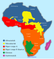 African language families da.svg 600 × 650; 53 KB
-
 Anaximander world map-da.svg 1,063 × 1,063; 14 KB
-
 Andorra map-da.svg 329 × 354; 43 KB
-
 Bjørnøya Location Map-da.svg 1,010 × 1,267; 240 KB
-
 Coalition action against Libya text da.svg 972 × 1,022; 836 KB
-
 Course Channeltunnel da.svg 472 × 387; 28 KB
-
 Euro2008 venues da.svg 730 × 320; 102 KB
-
 Falkland Islands topographic map-da.svg 2,550 × 1,990; 1.93 MB
-
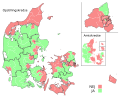 Folkeafstemning 1992 - Opstillingskredse version 2.svg 786 × 639; 2.32 MB
-
 Folkeafstemning 1993 - Opstillingskredse version 2.svg 786 × 639; 2.32 MB
-
 Jerusalem kort over den gamle by.svg 480 × 360; 18 KB
-
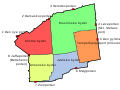
 Kreise Schleswig-Holstein-da.svg 757 × 641; 82 KB
-
 London boundaries-da.svg 463 × 450; 34 KB
-
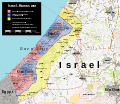 October 2023 Gaza−Israel conflict.svg 3,763 × 3,258; 8.38 MB
-
 Plan Troy-Hisarlik-da.svg 1,280 × 1,155; 158 KB
-
 Plates tect2 da.svg 4,217 × 3,169; 450 KB
-
 Topographic map of Cape Verde-da.svg 1,464 × 1,087; 274 KB
-
 Topographic map of Surtsey-da.svg 2,453 × 1,911; 857 KB
-
 US National Football League Teams Location-da.svg 844 × 643; 99 KB
-
 Wahlkarte Folketing Dänemark 2015 da.svg 956 × 784; 2.33 MB
-
 Wahlkarte Folketing Dänemark 2019 da.svg 956 × 784; 1.94 MB
-
 World map ocean locator-da.png 1,000 × 570; 207 KB


