Category:Dalton Holme
Jump to navigation
Jump to search
English: Dalton Holme a civil parish in the East Riding of Yorkshire in England. It is made up of two villages - South Dalton and Holme on the Wolds, which over the years have come to join together. Both the villages are run by the Dalton Estate, which is owned by the Hotham Family and are occupied by estate workers as well as paying tenants. The 18th Century Hall is the home of Lord Hotham whose family have owned land in the area for generations.
civil parish in East Riding of Yorkshire, UK  | |||||
| Upload media | |||||
| Instance of | |||||
|---|---|---|---|---|---|
| Location | East Riding of Yorkshire, Yorkshire and the Humber, England | ||||
 | |||||
Subcategories
This category has the following 3 subcategories, out of 3 total.
Media in category "Dalton Holme"
The following 160 files are in this category, out of 160 total.
-

-
 A footpath towards Lockington - geograph.org.uk - 2210129.jpg 800 × 600; 340 KB
-
 Alongside Lockington Wood - geograph.org.uk - 3186936.jpg 1,024 × 768; 149 KB
-
 Arable fields northwest of Holme on the Wolds - geograph.org.uk - 3979915.jpg 4,000 × 3,000; 2.91 MB
-
 At the South Side of Lockington Wood - geograph.org.uk - 2172541.jpg 3,426 × 2,286; 2.1 MB
-
 B1248 at East Street - geograph.org.uk - 6323453.jpg 1,024 × 768; 203 KB
-
 B1248 towards Bainton - geograph.org.uk - 6356168.jpg 800 × 600; 112 KB
-
 B1248 towards Bainton - geograph.org.uk - 6358246.jpg 800 × 600; 86 KB
-
 Becks Drain - geograph.org.uk - 1861767.jpg 640 × 480; 124 KB
-
 Becks Drain - geograph.org.uk - 6356174.jpg 800 × 600; 139 KB
-
 Bracken Lane, near Etton - geograph.org.uk - 3954478.jpg 640 × 480; 199 KB
-
 By Park Road, South Dalton - geograph.org.uk - 3187403.jpg 640 × 479; 172 KB
-
 Cattle grid on Park Road - geograph.org.uk - 5712063.jpg 1,600 × 1,126; 665 KB
-
 Cattle near South Dalton - geograph.org.uk - 3187505.jpg 640 × 432; 210 KB
-
 Chantry Lane north of Etton shortly to join the B1248 - geograph.org.uk - 4391117.jpg 4,608 × 3,456; 7.47 MB
-
 Chantry Lane, Etton - geograph.org.uk - 2310224.jpg 1,024 × 768; 162 KB
-
 Cottages in West End - geograph.org.uk - 4411709.jpg 640 × 479; 67 KB
-

-
 Cottages on East Street, Holme on the Wolds - geograph.org.uk - 6354132.jpg 4,783 × 3,467; 3.09 MB
-

-

-

-

-
 Cottages on Main Street, South Dalton - geograph.org.uk - 6355114.jpg 4,000 × 3,237; 2.67 MB
-

-

-
 Cottages, Holme on the Wolds - geograph.org.uk - 3181462.jpg 1,024 × 768; 130 KB
-
 Country road passing Lockington Wood - geograph.org.uk - 4388756.jpg 4,606 × 3,452; 6.43 MB
-
 Crossing the B1248 towards South Dalton - geograph.org.uk - 2389773.jpg 800 × 600; 309 KB
-
 Dalton Hall from the north-west - geograph.org.uk - 3187412.jpg 640 × 417; 205 KB
-
 Dalton Hall in Dalton Park - geograph.org.uk - 6169725.jpg 1,024 × 768; 295 KB
-
 Dalton Hall, South Dalton - geograph.org.uk - 3387820.jpg 640 × 399; 135 KB
-
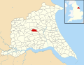 Dalton Holme UK parish locator map.svg 1,425 × 1,107; 1.68 MB
-
 Dalton Holme War Memorial - geograph.org.uk - 5461745.jpg 799 × 1,200; 626 KB
-
 Dalton Wood bathed in bright afternoon sun - geograph.org.uk - 4244938.jpg 4,608 × 3,456; 6.26 MB
-
 Derelict Staff Housing - geograph.org.uk - 2310214.jpg 1,024 × 768; 346 KB
-
 East Street toward Holme on the Wolds - geograph.org.uk - 3979928.jpg 4,000 × 3,000; 2.27 MB
-
 East Street toward the B1248 junction - geograph.org.uk - 3979922.jpg 4,000 × 3,000; 3.04 MB
-
 East towards Middleton-on-the-Wolds - geograph.org.uk - 2389497.jpg 800 × 600; 288 KB
-

-
 Entering Holme on the Wolds - geograph.org.uk - 6358247.jpg 800 × 600; 122 KB
-
 Entering Holme on the Wolds from the west - geograph.org.uk - 3979909.jpg 4,000 × 3,000; 3.81 MB
-
 Entering South Dalton - geograph.org.uk - 2210121.jpg 800 × 600; 247 KB
-
 Evening sunlight near South Dalton - geograph.org.uk - 4277281.jpg 1,024 × 768; 185 KB
-
 Farm track off Park Lane - geograph.org.uk - 6169731.jpg 1,024 × 768; 180 KB
-
 Farm track off Park Road - geograph.org.uk - 5712070.jpg 1,600 × 1,065; 870 KB
-
 Farmland east of South Dalton - geograph.org.uk - 3234729.jpg 640 × 427; 215 KB
-
 Field edge toward Money Hill - geograph.org.uk - 4321075.jpg 4,608 × 3,456; 4.17 MB
-
 Field entrance, near South Dalton - geograph.org.uk - 3187527.jpg 426 × 640; 200 KB
-
 Field off Main Street, South Dalton - geograph.org.uk - 6358252.jpg 800 × 600; 101 KB
-
 Field off Mere Lane - geograph.org.uk - 6358241.jpg 800 × 600; 129 KB
-
 Field towards Admirals - geograph.org.uk - 2333502.jpg 640 × 480; 52 KB
-
 Field track and Footpath onto High Wold Fall - geograph.org.uk - 4322427.jpg 4,608 × 3,456; 4.01 MB
-
 Field track western edge of Dalton Wood - geograph.org.uk - 4244944.jpg 4,608 × 3,456; 6.99 MB
-
 Fields on the Yorkshire Wolds - geograph.org.uk - 4322434.jpg 4,608 × 3,456; 4.58 MB
-
 Fields south to Reservoir Clump - geograph.org.uk - 3979900.jpg 4,000 × 3,000; 2.1 MB
-
 Firtree Cottage, South Dalton Wold - geograph.org.uk - 5712081.jpg 1,600 × 1,065; 668 KB
-
 Footpath to Kiplingcotes Farm - geograph.org.uk - 2305221.jpg 1,024 × 768; 191 KB
-
 Former pit near Holme Wold House - geograph.org.uk - 3181465.jpg 1,024 × 768; 173 KB
-
 George V postbox on Main Street, South Dalton - geograph.org.uk - 6355109.jpg 1,559 × 3,838; 1.14 MB
-
 Grazing land near Holme Farm - geograph.org.uk - 1861765.jpg 640 × 480; 51 KB
-
 Grazing towards Heads Plantation - geograph.org.uk - 6356172.jpg 800 × 600; 109 KB
-
 Great West Field - geograph.org.uk - 5411593.jpg 1,024 × 768; 164 KB
-
 Heads Plantation - geograph.org.uk - 1861766.jpg 640 × 480; 134 KB
-
 Holme on the Wolds - geograph.org.uk - 6169688.jpg 1,024 × 768; 141 KB
-
 Holme on the Wolds, western end - geograph.org.uk - 3187582.jpg 640 × 426; 173 KB
-
 Holme Wold - geograph.org.uk - 3181481.jpg 1,024 × 768; 169 KB
-
 Holme Wold road junction - geograph.org.uk - 3187435.jpg 640 × 400; 186 KB
-
 Horse Keld Pond hidden among trees - geograph.org.uk - 3979925.jpg 4,000 × 3,000; 4.49 MB
-
 House south of Moneypot Hill Farm - geograph.org.uk - 5712085.jpg 1,600 × 1,065; 678 KB
-

-

-
 Lane to Middleton on the Wolds - geograph.org.uk - 2305225.jpg 1,024 × 768; 165 KB
-
 Late afternoon sun on St Mary's South Dalton - geograph.org.uk - 4322455.jpg 3,456 × 4,608; 2.11 MB
-
 Looking south along Chantry Lane, Etton - geograph.org.uk - 2644219.jpg 800 × 600; 259 KB
-
 Looking towards Money Hill - geograph.org.uk - 5712093.jpg 1,600 × 1,065; 811 KB
-

-
 Lychgate at St Mary's Church, South Dalton - geograph.org.uk - 5717575.jpg 1,600 × 1,065; 726 KB
-
 Mere Lane - geograph.org.uk - 6358240.jpg 5,184 × 3,888; 7.02 MB
-
 Mere Lane, South Dalton - geograph.org.uk - 6169711.jpg 1,024 × 768; 167 KB
-
 Minor road from B1248 toward Lockington - geograph.org.uk - 1869375.jpg 2,816 × 2,112; 2.94 MB
-
 Minor road from Holme on the Wolds - geograph.org.uk - 3979904.jpg 4,000 × 3,000; 2.44 MB
-
 Minor road from Holme on the Wolds - geograph.org.uk - 6323523.jpg 1,024 × 694; 156 KB
-
 Minor road Junction on Holme Wold - geograph.org.uk - 3979863.jpg 4,000 × 3,000; 1.69 MB
-
 Minor road to Holme on the Wolds - geograph.org.uk - 3979890.jpg 4,000 × 3,000; 3 MB
-
 Minor Road Towards Beverley - geograph.org.uk - 1519259.jpg 640 × 480; 74 KB
-
 Minor road towards Holme on the Wolds - geograph.org.uk - 6323532.jpg 1,024 × 734; 105 KB
-
 Moor Plantation - geograph.org.uk - 2336605.jpg 640 × 480; 43 KB
-

-
 Over field to Dalton Wood - geograph.org.uk - 4244923.jpg 4,608 × 3,456; 5.04 MB
-
 Over the Great West Field - geograph.org.uk - 3979880.jpg 4,000 × 3,000; 2.11 MB
-
 Park Lane - geograph.org.uk - 6169737.jpg 1,024 × 768; 136 KB
-
 Park Lane and Keepers Cottage - geograph.org.uk - 4244967.jpg 4,608 × 3,456; 3.94 MB
-
 Park Lane on South Dalton Wold - geograph.org.uk - 4322413.jpg 4,608 × 3,456; 4.37 MB
-
 Park Lane toward Dalton Park - geograph.org.uk - 4322401.jpg 3,456 × 4,608; 5.33 MB
-
 Park Road towards South Dalton Wold - geograph.org.uk - 5712077.jpg 1,600 × 1,065; 911 KB
-
 Park Road, Dalton Park Estate - geograph.org.uk - 5712055.jpg 1,600 × 1,065; 1.04 MB
-
 Park Road, Dalton Park Estate - geograph.org.uk - 5712056.jpg 1,600 × 1,065; 642 KB
-
 Park Road, near South Dalton - geograph.org.uk - 3187644.jpg 575 × 640; 206 KB
-
 Private road to parish church in the grounds of Dalton Park - geograph.org.uk - 4322467.jpg 4,608 × 3,456; 4.46 MB
-
 Red Gates at Holme Wold - geograph.org.uk - 1970359.jpg 3,648 × 2,736; 2.9 MB
-
 Road from South Dalton toward Etton - geograph.org.uk - 6258116.jpg 4,608 × 3,456; 3.81 MB
-
 Road junction near Lockington - geograph.org.uk - 6349426.jpg 1,024 × 644; 183 KB
-
 Road sign near Wood Flats - geograph.org.uk - 5712091.jpg 1,600 × 1,065; 765 KB
-
 Road to Kiplingcotes - geograph.org.uk - 3979870.jpg 4,000 × 3,000; 1.93 MB
-
 Road to the church, South Dalton - geograph.org.uk - 3187423.jpg 426 × 640; 182 KB
-
 Small Thorns Plantation - geograph.org.uk - 4277245.jpg 1,024 × 768; 222 KB
-
 South Dalton - geograph.org.uk - 1821130.jpg 3,200 × 2,400; 5.33 MB
-
 South Dalton War Memorial - geograph.org.uk - 4322441.jpg 3,456 × 4,608; 5.94 MB
-
 South Dalton Wold - geograph.org.uk - 3187635.jpg 640 × 418; 205 KB
-
 South Dalton Wold farmland - geograph.org.uk - 3187637.jpg 640 × 426; 204 KB
-
 South side of Lockington Wood - geograph.org.uk - 4388729.jpg 4,594 × 3,436; 5.68 MB
-
 Spudded Furrows - geograph.org.uk - 3565495.jpg 4,592 × 3,448; 6.79 MB
-
 Spuds below Money Hill - geograph.org.uk - 3565493.jpg 4,133 × 3,104; 4.21 MB
-
 St Mary's Church, South Dalton - geograph.org.uk - 3187402.jpg 486 × 640; 186 KB
-
 St Mary's Church, South Dalton - geograph.org.uk - 5717271.jpg 1,065 × 1,600; 456 KB
-
 St Mary's Church, South Dalton - geograph.org.uk - 5717293.jpg 1,065 × 1,600; 449 KB
-
 St Mary's Church, South Dalton - geograph.org.uk - 5717456.jpg 880 × 1,600; 696 KB
-
 St Mary's Church, South Dalton - geograph.org.uk - 5717459.jpg 1,065 × 1,600; 378 KB
-
 St Mary's Church, South Dalton - geograph.org.uk - 5717461.jpg 806 × 1,600; 650 KB
-
 St Mary's Church, South Dalton - geograph.org.uk - 5717467.jpg 848 × 1,600; 637 KB
-
 St Mary's Church, South Dalton - geograph.org.uk - 5717469.jpg 1,600 × 1,065; 486 KB
-
 St Mary's Church, South Dalton - geograph.org.uk - 5717474.jpg 1,193 × 1,600; 993 KB
-
 St Mary's Church, South Dalton - geograph.org.uk - 5717479.jpg 1,600 × 1,065; 635 KB
-
 St Mary's Church, South Dalton - geograph.org.uk - 5717560.jpg 862 × 1,600; 623 KB
-
 St Mary's Church, South Dalton - geograph.org.uk - 5717571.jpg 1,065 × 1,600; 495 KB
-
 St Mary's Church, South Dalton - geograph.org.uk - 6358254.jpg 800 × 722; 64 KB
-
 St Mary's Church, South Dalton - geograph.org.uk - 6358255.jpg 600 × 800; 73 KB
-
 St Mary's Church, South Dalton - geograph.org.uk - 6358260.jpg 540 × 800; 70 KB
-
 St. Mary, South Dalton - geograph.org.uk - 2184748.jpg 768 × 1,024; 119 KB
-
 St. Mary, South Dalton, East Riding - geograph.org.uk - 2300481.jpg 768 × 1,024; 138 KB
-
 Stream and shrine beside the B1248 - geograph.org.uk - 6356164.jpg 800 × 600; 149 KB
-
 Stream and shrine beside the B1248 - geograph.org.uk - 6356167.jpg 600 × 800; 242 KB
-
 Stubble field west of the B1248 - geograph.org.uk - 6358243.jpg 640 × 447; 58 KB
-
 The beginning of the bridleway to Scorborough - geograph.org.uk - 3182604.jpg 1,024 × 768; 220 KB
-
 The church and the oak tree - geograph.org.uk - 3235577.jpg 640 × 504; 154 KB
-
 The end of Chantry Lane - geograph.org.uk - 6349414.jpg 1,024 × 727; 221 KB
-
 The entrance to Etton Pasture School - geograph.org.uk - 2644210.jpg 800 × 600; 262 KB
-
 The former South Wolds School - geograph.org.uk - 2305614.jpg 1,024 × 768; 181 KB
-
 The Pipe and Glass Inn - geograph.org.uk - 6169701.jpg 1,024 × 768; 201 KB
-
 The Pipe ^ Glass, South Dalton - geograph.org.uk - 5717758.jpg 1,600 × 1,065; 562 KB
-

-
 The road to Holme on the Wolds - geograph.org.uk - 2115055.jpg 800 × 600; 184 KB
-
 The stables at Dalton Park - geograph.org.uk - 5712059.jpg 1,600 × 1,065; 729 KB
-
 Tom Fisher Plantation - geograph.org.uk - 3234725.jpg 640 × 339; 115 KB
-
 Towards South Dalton - geograph.org.uk - 3234737.jpg 499 × 640; 247 KB
-
 Track alongside Nut Balks - geograph.org.uk - 4277261.jpg 1,024 × 768; 164 KB
-
 Track in toward village sewage works - geograph.org.uk - 6258112.jpg 4,608 × 3,456; 3.51 MB
-
 Track to Holmedale Farm - geograph.org.uk - 2333506.jpg 640 × 480; 60 KB
-
 Track to Moorfield Farm - geograph.org.uk - 3181450.jpg 1,024 × 768; 195 KB
-
 Trees beside the B1248 - geograph.org.uk - 6356161.jpg 800 × 542; 158 KB
-
 Trees in Dalton Park - geograph.org.uk - 4277272.jpg 1,024 × 768; 207 KB
-
 Up the hill towards Holme on the Wolds - geograph.org.uk - 6323538.jpg 1,024 × 768; 118 KB
-
 View towards Admirals - geograph.org.uk - 2305236.jpg 1,024 × 768; 209 KB
-
 View towards Holmedale Farm - geograph.org.uk - 2305234.jpg 1,024 × 768; 181 KB
-
 View towards the end of the lane to Lockington - geograph.org.uk - 4277291.jpg 1,024 × 768; 148 KB
-

-
 Western exit to Dalton Park - geograph.org.uk - 4244978.jpg 4,608 × 3,456; 4.38 MB
-
 Wheat Fields West of Holme-on-the-Wolds - geograph.org.uk - 1970341.jpg 3,648 × 2,736; 4.51 MB
-
 Wheat Fields West of Holme-on-the-Wolds - geograph.org.uk - 1970350.jpg 3,648 × 2,736; 3.29 MB


_(24776640104).jpg)


