Category:Dalton-on-Tees
Jump to navigation
Jump to search
village in the United Kingdom  | |||||
| Upload media | |||||
| Instance of | |||||
|---|---|---|---|---|---|
| Location | Richmondshire, North Yorkshire, Yorkshire and the Humber, England | ||||
 | |||||
Subcategories
This category has the following 3 subcategories, out of 3 total.
C
T
Media in category "Dalton-on-Tees"
The following 72 files are in this category, out of 72 total.
-
 "The Chequers Inn", Dalton-on-Tees - geograph.org.uk - 6220644.jpg 4,603 × 3,246; 2.51 MB
-

-

-
 A167 heading south - geograph.org.uk - 3237072.jpg 640 × 480; 33 KB
-
 A167 heading towards Northallerton. - geograph.org.uk - 3237086.jpg 640 × 480; 49 KB
-
 Air-Raid Shelter. - geograph.org.uk - 149088.jpg 640 × 479; 112 KB
-
 Approaching Tower - geograph.org.uk - 1930290.jpg 640 × 480; 205 KB
-
 B1263 heading west - geograph.org.uk - 3237224.jpg 640 × 480; 41 KB
-
 Biker approaching tower - geograph.org.uk - 1564149.jpg 640 × 480; 116 KB
-
 Charles Burrell (Thetford) traction engine at rally - geograph.org.uk - 5904103.jpg 3,039 × 2,547; 1.21 MB
-
 Christmas Stages Rally - geograph.org.uk - 5235968.jpg 2,048 × 1,536; 958 KB
-
 Christmas Stages Rally 2017 - geograph.org.uk - 5638724.jpg 2,048 × 1,536; 897 KB
-
 Classic Truck (261911573).jpeg 2,048 × 1,365; 1.16 MB
-
 Croft on a race day - geograph.org.uk - 1294941.jpg 640 × 478; 161 KB
-
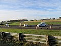
 Croft racing circuit - geograph.org.uk - 6188928.jpg 1,024 × 683; 182 KB
-
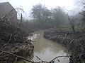 Dalton Beck - geograph.org.uk - 3237089.jpg 640 × 480; 82 KB
-
 Dalton-on-Tees.jpg 640 × 480; 130 KB
-
 Eryholme Lane - geograph.org.uk - 3237112.jpg 640 × 480; 60 KB
-
 Eryholme Lane - geograph.org.uk - 3237117.jpg 640 × 480; 62 KB
-
 Eryholme Lane - geograph.org.uk - 3237124.jpg 640 × 480; 45 KB
-
 Eryholme Lane - geograph.org.uk - 3237131.jpg 640 × 480; 35 KB
-
 Farm building near Dalton Beck - geograph.org.uk - 3237099.jpg 640 × 480; 48 KB
-
 Farmhouse, Dalton-on-Tees - geograph.org.uk - 3237049.jpg 640 × 480; 49 KB
-
 Farmland near Dalton Beck - geograph.org.uk - 3237102.jpg 640 × 480; 55 KB
-
 Farmland near Darlton Bridge - geograph.org.uk - 2876430.jpg 640 × 480; 40 KB
-
 Farmland off Eryholme Lane - geograph.org.uk - 3237111.jpg 640 × 480; 57 KB
-
 Farmland off Eryholme Lane - geograph.org.uk - 3237115.jpg 640 × 480; 54 KB
-
 Farmland off Northallerton Road - geograph.org.uk - 3237060.jpg 640 × 480; 63 KB
-
 Farmland off the B1263 - geograph.org.uk - 3237227.jpg 640 × 480; 46 KB
-
 Farmland, Dalton-on-Tees - geograph.org.uk - 6166432.jpg 1,024 × 768; 263 KB
-
 Farmland, Dalton-on-Tees - geograph.org.uk - 6166450.jpg 1,024 × 768; 287 KB
-
 Field edge on north side of A167 - geograph.org.uk - 2741035.jpg 1,500 × 843; 1.24 MB
-
 Field entrance off Eryholme Lane - geograph.org.uk - 3237105.jpg 640 × 480; 93 KB
-

-
 Footpath off Eryholme Lane - geograph.org.uk - 3237126.jpg 640 × 480; 73 KB
-
 Ford at Dalton-on-Tees - geograph.org.uk - 4341092.jpg 3,872 × 2,592; 4.69 MB
-
 Ginetta approaching the Jim Clark Esses - geograph.org.uk - 6188980.jpg 1,024 × 683; 98 KB
-
 Ginettas waiting to race, Croft circuit - geograph.org.uk - 6188931.jpg 1,024 × 683; 203 KB
-
 Hairpin at Croft Circuit - geograph.org.uk - 3908352.jpg 1,024 × 768; 453 KB
-
 Hawthorn Banking - geograph.org.uk - 1927901.jpg 640 × 480; 217 KB
-
 Lane heading north - geograph.org.uk - 3237092.jpg 640 × 480; 69 KB
-
 Miniature steam engine, Dalton airfield (1970) - geograph.org.uk - 5904074.jpg 2,355 × 2,518; 971 KB
-
 Miniature Traction Engine, Dalton Airfield (1970) - geograph.org.uk - 5904090.jpg 2,479 × 2,443; 868 KB
-
 Motorcycle racing at Croft - geograph.org.uk - 771814.jpg 640 × 478; 210 KB
-
 Northallerton Road (A167) - geograph.org.uk - 3237066.jpg 640 × 480; 39 KB
-
 Pasture Near Dalton Bridge - geograph.org.uk - 1005766.jpg 640 × 427; 269 KB
-
 Pasture, Dalton-on-Tees - geograph.org.uk - 6166429.jpg 1,024 × 768; 289 KB
-
 Pasture, Dalton-on-Tees - geograph.org.uk - 6166434.jpg 1,024 × 768; 233 KB
-
 Pillbox, Dalton-on-Tees 01.jpg 4,752 × 3,168; 7.17 MB
-
 Pillbox, Dalton-on-Tees 02.jpg 4,752 × 3,168; 8.92 MB
-
 Pillbox, Dalton-on-Tees 03.jpg 4,752 × 3,168; 6.76 MB
-
 Pillbox, Dalton-on-Tees 04.jpg 4,752 × 3,168; 6.08 MB
-
 Pillbox, Dalton-on-Tees 05.jpg 4,752 × 3,168; 5.71 MB
-
 Podium finishers in the last race of the day - geograph.org.uk - 6188966.jpg 1,024 × 683; 192 KB
-

-
 Private drive, Thorntree House - geograph.org.uk - 3237082.jpg 640 × 480; 55 KB
-
 Red Arrows at Croft - geograph.org.uk - 4697271.jpg 3,267 × 2,235; 4.08 MB
-
 Steam Engine Rally (1970) - geograph.org.uk - 2827026.jpg 414 × 499; 57 KB
-
 Steam Engine Rally (1970), Dalton-on-Tees - geograph.org.uk - 5904068.jpg 3,876 × 2,821; 1.53 MB
-
 Tewit Castle Farm. - geograph.org.uk - 144689.jpg 640 × 479; 82 KB
-
 The Pits - geograph.org.uk - 1005751.jpg 640 × 427; 250 KB
-
 Thorntree House - geograph.org.uk - 3237078.jpg 640 × 458; 40 KB
-
 Thorntree House. - geograph.org.uk - 148453.jpg 640 × 479; 88 KB
-
 Trade stands at croft racing circuit - geograph.org.uk - 6188919.jpg 1,024 × 683; 184 KB
-
 Traffic queue approaching Dalton Bridge - geograph.org.uk - 6188914.jpg 1,024 × 683; 234 KB
-
 Tyre smoke at the hairpin, Croft circuit - geograph.org.uk - 6188974.jpg 1,024 × 683; 124 KB
-
 War Memorial, Dalton-on-Tees - geograph.org.uk - 3237055.jpg 640 × 480; 99 KB
-
 West Lane, Dalton-on-Tees - geograph.org.uk - 3237052.jpg 640 × 480; 46 KB
-
 WW2 building, Croft racing circuit - geograph.org.uk - 6188923.jpg 1,024 × 683; 227 KB
-
 You're going the wrong way^ - geograph.org.uk - 5235990.jpg 2,048 × 1,536; 1,009 KB
-
 Hawthorn Bend - geograph.org.uk - 1430831.jpg 640 × 479; 45 KB
-
 Village Green, Dalton-on-Tees - geograph.org.uk - 403724.jpg 640 × 480; 163 KB

_-_geograph.org.uk_-_2827055.jpg)
_-_geograph.org.uk_-_2827108.jpg)


_traction_engine_at_rally_-_geograph.org.uk_-_5904103.jpg)


.jpeg)


_-_geograph.org.uk_-_5904074.jpg)
_-_geograph.org.uk_-_5904090.jpg)

_-_geograph.org.uk_-_3237066.jpg)


_-_geograph.org.uk_-_2827026.jpg)
,_Dalton-on-Tees_-_geograph.org.uk_-_5904068.jpg)


