Category:Dalmeny (civil parish)
Jump to navigation
Jump to search
Scottish parish in Edinburgh, Scotland, UK | |||||
| Upload media | |||||
| Instance of | |||||
|---|---|---|---|---|---|
| Part of |
| ||||
| Named after | |||||
| Location |
| ||||
| Population |
| ||||
| Area |
| ||||
 | |||||
Subcategories
This category has the following 3 subcategories, out of 3 total.
D
- Dundas Loch Bridge (4 F)
P
- Port Edgar (197 F)
Media in category "Dalmeny (civil parish)"
The following 200 files are in this category, out of 1,058 total.
(previous page) (next page)-
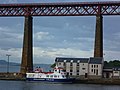
 "The Maid of the Forth" approaches Hawes Pier - geograph.org.uk - 5895643.jpg 687 × 1,024; 109 KB
-
 'Iona' at Port Edgar - geograph.org.uk - 5304642.jpg 3,264 × 2,448; 4.59 MB
-
-
 1 and 3 Edinburgh Road, Queensferry - geograph.org.uk - 4079974.jpg 3,456 × 5,184; 3.59 MB
-
 5 to 9 Edinburgh Road, Queensferry - geograph.org.uk - 4079667.jpg 4,939 × 3,292; 3.91 MB
-
 A Fine View - geograph.org.uk - 2884773.jpg 640 × 266; 238 KB
-
 A Seal in its Element - geograph.org.uk - 1862072.jpg 1,600 × 1,200; 537 KB
-
 A Shortage of Grass - geograph.org.uk - 2761300.jpg 640 × 427; 375 KB
-
 A8000 near Milton - geograph.org.uk - 2884644.jpg 640 × 427; 389 KB
-
 A90 and cycle path - geograph.org.uk - 2049607.jpg 1,024 × 768; 168 KB
-
 A90 and cycle path - geograph.org.uk - 6411445.jpg 1,024 × 683; 230 KB
-
 A90 and Cyclepath - geograph.org.uk - 3280542.jpg 4,000 × 2,248; 3.3 MB
-
 A90 approaches the Forth Road Bridge - geograph.org.uk - 2494512.jpg 3,478 × 2,330; 891 KB
-
 A90 at Burnshot from the air - geograph.org.uk - 3069068.jpg 1,024 × 768; 150 KB
-
 A90 at the south end of the Forth Road Bridge - geograph.org.uk - 4196420.jpg 1,024 × 678; 148 KB
-
 A90 Between Dalmeny and Queensferry - geograph.org.uk - 2676044.jpg 640 × 427; 130 KB
-
 A90 Burnshot - geograph.org.uk - 1900502.jpg 800 × 600; 103 KB
-
 A90 cycle path - geograph.org.uk - 6411448.jpg 1,024 × 683; 283 KB
-
 A90 from the B924 slip road - geograph.org.uk - 2746240.jpg 2,816 × 2,112; 1.3 MB
-
 A90 leaving the Forth Road Bridge - geograph.org.uk - 3540385.jpg 640 × 480; 56 KB
-
 A90 south of the Forth Road bridge - geograph.org.uk - 2494514.jpg 3,648 × 2,736; 1.2 MB
-
 A90 towards Edinburgh - geograph.org.uk - 3540624.jpg 640 × 480; 66 KB
-
 A90 towards Edinburgh - geograph.org.uk - 4570184.jpg 640 × 480; 65 KB
-
 A90 towards Edinburgh - geograph.org.uk - 5098603.jpg 759 × 476; 157 KB
-
 A90, Burnshot - geograph.org.uk - 6411453.jpg 1,024 × 683; 192 KB
-
 A90, Queensferry - geograph.org.uk - 4066067.jpg 640 × 480; 254 KB
-
 A90, Queensferry - geograph.org.uk - 5003954.jpg 1,024 × 683; 248 KB
-
 Access to Bankhead Farm - geograph.org.uk - 2047756.jpg 1,296 × 972; 474 KB
-
 Access to Dalmeny Estate at Chapel Gate - geograph.org.uk - 4421133.jpg 800 × 599; 418 KB
-
 Access to Dalmeny House - geograph.org.uk - 2049597.jpg 1,600 × 1,200; 407 KB
-
 Access to Dalmeny Station - geograph.org.uk - 2047752.jpg 1,296 × 972; 316 KB
-
 Agriculture seen from the Air - geograph.org.uk - 5660511.jpg 480 × 640; 37 KB
-
 Almond Autumn - geograph.org.uk - 2150644.jpg 1,251 × 1,267; 1.62 MB
-
 Almost finished^ - geograph.org.uk - 5513351.jpg 3,264 × 2,448; 2.05 MB
-
 Along the shore to Cramond - geograph.org.uk - 3280495.jpg 4,000 × 2,248; 3.22 MB
-
-
 Approach to A90 offtake - geograph.org.uk - 2048005.jpg 1,024 × 768; 127 KB
-
 Approach to The Queensferry Crossing - geograph.org.uk - 3777221.jpg 3,264 × 2,448; 2.04 MB
-
 Approach Viaduct at Society Road - geograph.org.uk - 4039011.jpg 3,264 × 2,448; 3.63 MB
-

-
 Approaching The Forth Road Bridge - geograph.org.uk - 2676112.jpg 640 × 480; 169 KB
-

-

-
 Arable field with Queensferry Crossing in background - geograph.org.uk - 5813886.jpg 1,600 × 1,669; 241 KB
-
 Arable field, Dalmeny - geograph.org.uk - 2808911.jpg 640 × 480; 281 KB
-
 Arable land, Milton - geograph.org.uk - 4402297.jpg 800 × 533; 238 KB
-
 Arable land, West Lothian - geograph.org.uk - 4402269.jpg 800 × 533; 193 KB
-
 Ashburnham Road, Queensferry - geograph.org.uk - 5004000.jpg 1,024 × 683; 297 KB
-
 At the Crossroads - geograph.org.uk - 2626311.jpg 640 × 427; 412 KB
-
 B9035 - geograph.org.uk - 6410618.jpg 1,024 × 683; 359 KB
-
 B9035 - geograph.org.uk - 6410623.jpg 1,024 × 683; 351 KB
-
 B924 Dalmeny Park - geograph.org.uk - 1900268.jpg 800 × 600; 174 KB
-
 B924 towards the A90 - geograph.org.uk - 3540583.jpg 640 × 480; 97 KB
-
 Bales - geograph.org.uk - 2626306.jpg 427 × 640; 391 KB
-
 Bankhead Road - geograph.org.uk - 2047980.jpg 1,296 × 972; 430 KB
-
 Bankhead Road - geograph.org.uk - 2760904.jpg 640 × 427; 360 KB
-
 Bankhead Road - geograph.org.uk - 5004012.jpg 1,024 × 683; 324 KB
-
 Bare branches - geograph.org.uk - 3845756.jpg 2,048 × 1,536; 1.36 MB
-
 Barley, Totleywells - geograph.org.uk - 4333812.jpg 800 × 600; 464 KB
-
 Barnbougle Castle - geograph.org.uk - 5245726.jpg 800 × 600; 152 KB
-
 Barnbougle Castle and Dalmeny House - geograph.org.uk - 2102744.jpg 2,048 × 1,536; 1.18 MB
-
 Barnbougle Castle from below Dalmeny House - geograph.org.uk - 5356337.jpg 1,024 × 682; 147 KB
-
 Barnbougle Castle from Cramond - geograph.org.uk - 2128928.jpg 640 × 434; 53 KB
-
 Barnbougle Castle, Dalmeny, from the sea - geograph.org.uk - 5359104.jpg 1,024 × 682; 174 KB
-
 Barnton from the air - geograph.org.uk - 2423154.jpg 640 × 480; 169 KB
-
 Barrels in a wood - geograph.org.uk - 4402264.jpg 800 × 533; 192 KB
-
 Beach and Barnbougle - geograph.org.uk - 2626379.jpg 421 × 640; 465 KB
-
 Beach at Hound Point - geograph.org.uk - 2626531.jpg 640 × 417; 326 KB
-
 Beach at Hound Point - geograph.org.uk - 2931802.jpg 3,264 × 2,448; 4.67 MB
-
 Beach at Hound Point - geograph.org.uk - 5019269.jpg 800 × 600; 114 KB
-
 Beach at Long Green on the Dalmeny Estate - geograph.org.uk - 5338185.jpg 1,024 × 682; 238 KB
-
 Beach at the mouth of Linklin Burn - geograph.org.uk - 3280502.jpg 4,000 × 2,248; 2.82 MB
-
 Beach below Dalmeny House - geograph.org.uk - 5356336.jpg 1,024 × 682; 224 KB
-
 Beech Tree - geograph.org.uk - 2150648.jpg 888 × 1,420; 1.58 MB
-
 Beer by Gas Light - geograph.org.uk - 4203231.jpg 3,648 × 2,736; 2.27 MB
-
 Beware of cyclists - geograph.org.uk - 2746230.jpg 2,816 × 2,112; 1.09 MB
-
 Bike park, Queensferry - geograph.org.uk - 6413012.jpg 1,024 × 683; 208 KB
-
 Bittern on the Bridge 2 - geograph.org.uk - 2959948.jpg 640 × 459; 39 KB
-
 Bittern on the Bridge 3 - geograph.org.uk - 2959950.jpg 640 × 429; 39 KB
-
 Bittern on the Bridge 4 - geograph.org.uk - 2959952.jpg 640 × 480; 59 KB
-
 Blades of Ice - geograph.org.uk - 5638454.jpg 640 × 522; 101 KB
-

-
 Bo'ness Road, Queensferry - geograph.org.uk - 5232966.jpg 800 × 450; 222 KB
-
 Boat lift, Port Edgar Marina - geograph.org.uk - 5004053.jpg 1,024 × 683; 253 KB
-
 Boat Park at Port Edgar - geograph.org.uk - 2877551.jpg 640 × 427; 373 KB
-
 Boathouse - geograph.org.uk - 2884694.jpg 640 × 427; 393 KB
-
 Borrowman Square - geograph.org.uk - 6410585.jpg 1,024 × 683; 195 KB
-
 Borrowman Square - geograph.org.uk - 6410589.jpg 1,024 × 683; 213 KB
-
 BP Pipeline Installation - geograph.org.uk - 2626558.jpg 640 × 418; 315 KB
-
 Bridge building - geograph.org.uk - 3777219.jpg 3,264 × 2,448; 2.25 MB
-
 Bridge over M90 - geograph.org.uk - 6167354.jpg 1,024 × 576; 91 KB
-
 Bridges - geograph.org.uk - 5232968.jpg 800 × 450; 169 KB
-
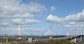 Bridges across the Forth - geograph.org.uk - 4912053.jpg 3,105 × 1,638; 1.31 MB
-
 Bridges across the Forth from Mons Hill - geograph.org.uk - 5314322.jpg 1,024 × 682; 190 KB
-
 Bridges old and new - geograph.org.uk - 5273769.jpg 3,264 × 2,448; 2.74 MB
-
 Bridges old and new - geograph.org.uk - 5592516.jpg 800 × 597; 55 KB
-
 Bridges over the M90 at Queensferry - geograph.org.uk - 5603759.jpg 1,024 × 731; 89 KB
-
 Broken Pine near Hound Point - geograph.org.uk - 2931483.jpg 3,264 × 2,448; 6.47 MB
-
 Building the bridge - geograph.org.uk - 3817204.jpg 3,264 × 2,448; 2.34 MB
-
 Building the Queensferry Crossing - geograph.org.uk - 3817210.jpg 3,264 × 2,448; 2.41 MB
-
 Buildings at Port Edgar - geograph.org.uk - 5891909.jpg 640 × 480; 276 KB
-
 Burgess Road - geograph.org.uk - 2884332.jpg 640 × 427; 377 KB
-
 Burgess Road - geograph.org.uk - 2884347.jpg 640 × 427; 399 KB
-
 Burnshot flyover - geograph.org.uk - 4194572.jpg 2,816 × 2,112; 1.14 MB
-
 Bus stop, Bo'ness Road - geograph.org.uk - 5232963.jpg 800 × 450; 268 KB
-
 Bus stops at a road junction - geograph.org.uk - 2746220.jpg 2,816 × 2,112; 1.07 MB
-

-
 Cables, Queensferry Crossing - geograph.org.uk - 5233292.jpg 800 × 636; 203 KB
-
 Car park, Dalmeny - geograph.org.uk - 2307305.jpg 640 × 480; 286 KB
-
 Carlowrie Cottages - geograph.org.uk - 2763814.jpg 565 × 640; 494 KB
-
 Carlowrie Farm - geograph.org.uk - 2714499.jpg 3,264 × 2,448; 3.19 MB
-
 Carlowrie Farm - geograph.org.uk - 2762861.jpg 640 × 382; 312 KB
-
 Carlowrie Farm - geograph.org.uk - 2763831.jpg 640 × 427; 418 KB
-
 Carlowrie Farm Cottages - geograph.org.uk - 2763817.jpg 640 × 427; 412 KB
-
 Carlowrie Farm Cottages - geograph.org.uk - 2763825.jpg 640 × 427; 336 KB
-
 Carrie Grove - geograph.org.uk - 6410606.jpg 1,024 × 683; 218 KB
-
 Castle Craig - geograph.org.uk - 3845766.jpg 2,048 × 1,536; 1.38 MB
-
 Chapel Gate - geograph.org.uk - 4354249.jpg 2,560 × 1,920; 1.5 MB
-
 Chapel Gate, Dalmeny Estate - geograph.org.uk - 4198652.jpg 1,024 × 678; 175 KB
-
 Cherry Blossom - geograph.org.uk - 2884454.jpg 640 × 427; 507 KB
-
 Children's playground, Queensferry - geograph.org.uk - 3540392.jpg 640 × 480; 78 KB
-
 Chimneys, Hopetoun Road - geograph.org.uk - 4262959.jpg 2,057 × 1,545; 1.52 MB
-
 Classic car at Queensferry - geograph.org.uk - 4460512.jpg 3,264 × 2,448; 3.49 MB
-
 Clove Craig - geograph.org.uk - 2762831.jpg 640 × 427; 411 KB
-

-

-
 Coast path, Dalmeny - geograph.org.uk - 6412229.jpg 1,024 × 683; 349 KB
-
 Coast path, Dalmeny - geograph.org.uk - 6412230.jpg 1,024 × 683; 357 KB
-
 Coast path, Dalmeny - geograph.org.uk - 6412231.jpg 1,024 × 762; 385 KB
-
 Coast path, Dalmeny - geograph.org.uk - 6412234.jpg 1,024 × 683; 375 KB
-
 Coastline below Dalmeny House - geograph.org.uk - 5338195.jpg 1,024 × 682; 195 KB
-
 Coastline below Dalmeny House - geograph.org.uk - 5356331.jpg 1,024 × 682; 168 KB
-

-
 Cobble Cottage, Cramond - geograph.org.uk - 3887657.jpg 3,264 × 2,448; 5.11 MB
-
 Coble Cottage - geograph.org.uk - 6281674.jpg 1,024 × 768; 345 KB
-
 Cockle Berm - geograph.org.uk - 2626373.jpg 418 × 640; 546 KB
-
 Cockle Burn - geograph.org.uk - 2626391.jpg 640 × 411; 412 KB
-
 Cockle Burn - geograph.org.uk - 2626406.jpg 640 × 420; 390 KB
-
 Cockle Burn - geograph.org.uk - 6412248.jpg 1,024 × 683; 365 KB
-
 Cockle Shells - geograph.org.uk - 2626398.jpg 640 × 413; 477 KB
-

-
 Construction yard at the Queensferry Crossing - geograph.org.uk - 3817202.jpg 3,264 × 2,448; 2.32 MB
-
 Construction, Forth Replacement Crossing - geograph.org.uk - 3493993.jpg 640 × 426; 244 KB
-
 Construction, Queensferry Crossing - geograph.org.uk - 5005218.jpg 1,024 × 1,024; 219 KB
-
 Contact and Education Centre at the Forth Road Bridge - geograph.org.uk - 4037467.jpg 3,264 × 2,448; 2.24 MB
-
 Cottage and the Cramond Brig pub - geograph.org.uk - 3280476.jpg 4,000 × 2,248; 3.29 MB
-
 Cottages, Dalmeny - geograph.org.uk - 3540558.jpg 640 × 480; 48 KB
-
 Country road towards New Burnshot - geograph.org.uk - 3540601.jpg 640 × 480; 113 KB
-
 Couple at South Queensferry - geograph.org.uk - 5379056.jpg 3,174 × 2,539; 1.47 MB
-
 Cow ^ Calves from Dalmeny - geograph.org.uk - 5355855.jpg 1,024 × 683; 100 KB
-
 Craigie Hill - geograph.org.uk - 4349633.jpg 2,560 × 1,920; 3.22 MB
-
 Craigie's Farm Shop - geograph.org.uk - 2762823.jpg 640 × 390; 371 KB
-
 Craigiehall from the air - geograph.org.uk - 2216363.jpg 640 × 480; 129 KB
-
 Craigiehall from the air - geograph.org.uk - 3873495.jpg 640 × 408; 113 KB
-
 Craigiehall from the air - geograph.org.uk - 4081594.jpg 640 × 480; 121 KB
-
 Craigiehall from the air - geograph.org.uk - 5542672.jpg 546 × 640; 159 KB
-
 Craigiehall from the air - geograph.org.uk - 5544824.jpg 640 × 466; 144 KB
-
 Craigiehall Temple - geograph.org.uk - 5466588.jpg 3,264 × 2,448; 3.79 MB
-
 Craigiehall Temple from the air - geograph.org.uk - 2423282.jpg 640 × 480; 135 KB
-
 Craigies Farm Shop - geograph.org.uk - 5638451.jpg 640 × 333; 51 KB
-
 Cramond Bridge, looking west - geograph.org.uk - 6017123.jpg 1,024 × 768; 566 KB
-
 Cramond bridges from the air - geograph.org.uk - 3109724.jpg 640 × 480; 167 KB
-
 Cramond Brig pub - geograph.org.uk - 2048014.jpg 1,296 × 972; 371 KB
-
 Cramond Brig Toll - geograph.org.uk - 6411465.jpg 1,024 × 683; 269 KB
-
 Cramond Island and Leith from Dalmeny Estate - geograph.org.uk - 5314360.jpg 1,024 × 697; 126 KB
-
 Cramond Old Bridge - geograph.org.uk - 6188474.jpg 1,600 × 1,200; 470 KB
-
 Crop field beside woodland - geograph.org.uk - 4567198.jpg 640 × 480; 56 KB
-
 Crop field north of Westfield Farm - geograph.org.uk - 5438728.jpg 640 × 480; 47 KB
-
 Crop field towards woodland - geograph.org.uk - 4567200.jpg 640 × 480; 74 KB
-
 Crop field, New Burnshot - geograph.org.uk - 3540597.jpg 640 × 480; 75 KB
-
 Crossall Hill near Dalmeny - geograph.org.uk - 2946733.jpg 640 × 342; 48 KB
-
 Crossing the Forth - geograph.org.uk - 2812965.jpg 640 × 424; 162 KB
-
 Crossing the Forth - geograph.org.uk - 4569313.jpg 1,529 × 1,069; 582 KB
-
 Crossing the Forth Bridge - geograph.org.uk - 5882234.jpg 1,024 × 683; 193 KB
-
 Crow Thickets - geograph.org.uk - 3451133.jpg 640 × 412; 426 KB
-
 Cruise ship visiting - geograph.org.uk - 3642468.jpg 640 × 480; 59 KB
-
 Cul-de-sac, off The Loan - geograph.org.uk - 2047748.jpg 1,247 × 905; 381 KB
-
 Cycle Path alongside Railway - geograph.org.uk - 3280513.jpg 4,000 × 2,248; 2.3 MB
-
 Cycle Path through South Queensferry - geograph.org.uk - 3280508.jpg 4,000 × 2,248; 3.61 MB
-
 Cycle path through the Dalmeny Estate - geograph.org.uk - 6141128.jpg 640 × 480; 400 KB
-
 Cycle route, Queensferry - geograph.org.uk - 3540389.jpg 640 × 480; 77 KB
-
 Cycle shelter at Dalmeny Station - geograph.org.uk - 6141120.jpg 640 × 480; 304 KB
-
 Cyclists on National Cycle Route 1, heading west - geograph.org.uk - 6017133.jpg 1,024 × 768; 524 KB
-
 Dakota Hotel Ferrymuir - geograph.org.uk - 2708681.jpg 800 × 534; 232 KB
-
 Dalmeny and Dalmeny Junction - geograph.org.uk - 2795964.jpg 1,809 × 1,095; 405 KB
-
 Dalmeny Estate - geograph.org.uk - 6411442.jpg 1,024 × 683; 220 KB
-
 Dalmeny Estate Golf Course - geograph.org.uk - 5019335.jpg 800 × 739; 120 KB
-
 Dalmeny Estate woodland - geograph.org.uk - 6412220.jpg 1,024 × 683; 361 KB
-
 Dalmeny Estate, Edinburgh (51225990082).jpg 6,000 × 4,000; 10.71 MB
-
 Dalmeny House - geograph.org.uk - 5019450.jpg 800 × 515; 96 KB
-
 Dalmeny House - geograph.org.uk - 5245735.jpg 800 × 579; 103 KB
-
 Dalmeny House - geograph.org.uk - 5338200.jpg 1,024 × 682; 129 KB
-
 Dalmeny House - geograph.org.uk - 6141135.jpg 640 × 480; 239 KB
-

-
 Dalmeny House from the air - geograph.org.uk - 5634393.jpg 1,024 × 683; 86 KB
-
 Dalmeny House, Edinburgh - geograph.org.uk - 4568971.jpg 1,602 × 1,057; 651 KB
-
 Dalmeny Junction - geograph.org.uk - 3540553.jpg 640 × 480; 89 KB
-
 Dalmeny oil storage depot - geograph.org.uk - 3557639.jpg 3,264 × 2,448; 3.2 MB
-
 Dalmeny Oil Storage Depot - geograph.org.uk - 6149206.jpg 3,264 × 2,448; 3.49 MB
-
 Dalmeny oil storage depot from the air - geograph.org.uk - 3928838.jpg 640 × 431; 100 KB


.jpg)


&filefrom=Dalmeny+Parish+Church+-+geograph.org.uk+-+6410643.jpg#mw-category-media)