Category:Cycling maps of the United States
Jump to navigation
Jump to search
Media in category "Cycling maps of the United States"
The following 20 files are in this category, out of 20 total.
-
 Atlantic Coast Bicycle Route.png 1,000 × 2,000; 192 KB
-
 BCLPTrails.jpg 640 × 480; 71 KB
-
 BCTBCGmap.JPG 640 × 480; 50 KB
-
 Bikeable-map-3.jpg 2,000 × 1,424; 195 KB
-
 BikeMetroMapResearchTriangle2017.jpg 7,950 × 5,596; 3.03 MB
-
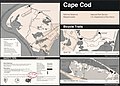 Cape Cod National Seashore, Massachusetts, bicycle trails LOC 97687169.jpg 4,924 × 3,544; 2.28 MB
-
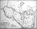
 Colorado bicycle route map - DPLA - 8ed5fe8500354e1a21d4cbce3c37a53b.jpg 9,000 × 6,805; 4.97 MB
-
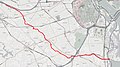
 CustisTrail.jpg 706 × 590; 453 KB
-
 Cycle Oregon 2012 (7967879988).jpg 3,000 × 4,000; 2.6 MB
-
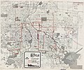 Denver bicycle map - DPLA - ca4d95ee97434bc4a5738bac2271dce7.jpg 9,000 × 7,505; 10.16 MB
-
 Denver bikeway system - DPLA - 7924eae90a3c72a2e9115f70f03401c6.jpg 9,000 × 5,778; 7.64 MB
-
 FourMileRunTrail.jpg 1,703 × 954; 661 KB
-
 Guide map to Seattle bicycle paths, probably 1900 (SEATTLE 5895).jpg 768 × 613; 86 KB
-
 HolmesRunTrail.jpg 1,047 × 845; 637 KB
-
 Lasouthbaybiketrail.gif 285 × 527; 46 KB
-
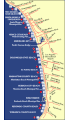
 NPS cape-cod-biking-nauset-trail.jpg 1,194 × 594; 111 KB
-
 NPS national-mall-bike-map.jpg 3,810 × 2,303; 2.49 MB
-
 OpenStreetMap bike layer.png 1,291 × 834; 1.13 MB
-

-
 Vancouver Bike Lanes.svg 418 × 650; 758 KB


.jpg)


.jpg)


