Category:Culbone
Jump to navigation
Jump to search
English: Culbone (also called Kilner) is a small village, consisting of little more than the parish church and a few houses, in the parish of Oare in the Exmoor National Park, Somerset, England. As there is no road access it is a two-mile walk from Porlock Weir, and some four miles from Porlock itself.
village in United Kingdom  | |||||
| Upload media | |||||
| Instance of | |||||
|---|---|---|---|---|---|
| Location | Oare, Somerset West and Taunton, Somerset, South West England, England | ||||
 | |||||
Subcategories
This category has the following 2 subcategories, out of 2 total.
C
- St Beuno's, Culbone (20 F)
- Culbone Stone (3 F)
Media in category "Culbone"
The following 34 files are in this category, out of 34 total.
-
 A39 at Pitcombe Head - geograph.org.uk - 148914.jpg 568 × 425; 92 KB
-

-

-
 Just What's Needed! (10250093336).jpg 960 × 720; 132 KB
-
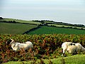 Pitt Farm Land - geograph.org.uk - 7189.jpg 618 × 462; 144 KB
-
 Stone lodge, Culbone - geograph.org.uk - 3225923.jpg 1,024 × 768; 323 KB
-
 The Lodge, Culbone. - geograph.org.uk - 870735.jpg 640 × 428; 115 KB
-
 The South West Coast Path at Culbone - geograph.org.uk - 1401784.jpg 640 × 480; 138 KB
-

-
 West Somerset , Bristol Channel - geograph.org.uk - 4650195.jpg 4,157 × 2,761; 4.78 MB
-
 Yearnor Mill cottage - geograph.org.uk - 143846.jpg 532 × 425; 119 KB
-
 Broomstreet Farm - geograph.org.uk - 178096.jpg 640 × 428; 116 KB
-
 By Oare Water - geograph.org.uk - 108156.jpg 640 × 417; 82 KB
-
 Culbone Inn on the A39 - geograph.org.uk - 148913.jpg 568 × 425; 93 KB
-
 Exmoor Coastal View - geograph.org.uk - 163682.jpg 640 × 480; 67 KB
-
 Heather on Porlock Hill - geograph.org.uk - 938.jpg 640 × 206; 23 KB
-
 Oare Post - geograph.org.uk - 178075.jpg 640 × 472; 99 KB
-
 Oare, 2007 - permitted path closed - geograph.org.uk - 358229.jpg 640 × 427; 259 KB
-
 Oare, above Oareford - geograph.org.uk - 221405.jpg 640 × 427; 150 KB
-
 Oare, by South Common - geograph.org.uk - 221411.jpg 640 × 427; 106 KB
-
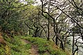 Oare, Culbone Wood - geograph.org.uk - 98335.jpg 640 × 426; 215 KB
-

-
 Oare, Yenworthy Combe - geograph.org.uk - 48214.jpg 640 × 432; 161 KB
-
 Oare, Yenworthy Farm - geograph.org.uk - 48215.jpg 640 × 433; 167 KB
-
 Porlock, nearing Culbone - geograph.org.uk - 358223.jpg 640 × 427; 263 KB
-
 Porlock, towards Pittcombe Head - geograph.org.uk - 221414.jpg 640 × 427; 133 KB
-
 Posts at Robber's Bridge - geograph.org.uk - 497688.jpg 640 × 480; 133 KB
-
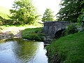 Robber's Bridge - geograph.org.uk - 178838.jpg 640 × 480; 95 KB
-
 Somerset and South Wales - geograph.org.uk - 218964.jpg 640 × 426; 105 KB
-
 South West Coast Path, Silcombe Farm - geograph.org.uk - 143840.jpg 640 × 392; 110 KB
-
 The Tunnels - geograph.org.uk - 255524.jpg 640 × 426; 199 KB
-
 Waterfall in Yenworthy Coombe - geograph.org.uk - 165325.jpg 480 × 640; 73 KB
-
 Worthy Wood, Exmoor - geograph.org.uk - 7190.jpg 624 × 464; 373 KB
-
 Yenworthy Combe - geograph.org.uk - 163671.jpg 640 × 480; 57 KB


.jpg)


