Category:Crowle, Worcestershire
Jump to navigation
Jump to search
village and civil parish in Worcestershire, UK  | |||||
| Upload media | |||||
| Instance of | |||||
|---|---|---|---|---|---|
| Location | Wychavon, Worcestershire, West Midlands, England | ||||
| Population |
| ||||
| Area |
| ||||
| Said to be the same as | Crowle (Wikimedia duplicated page, civil parish) | ||||
 | |||||
Subcategories
This category has the following 3 subcategories, out of 3 total.
Media in category "Crowle, Worcestershire"
The following 138 files are in this category, out of 138 total.
-

-
 A long time since this was used - geograph.org.uk - 2873615.jpg 640 × 480; 118 KB
-
 A thatched house, Crowle, Worcestershire - geograph.org.uk - 5154080.jpg 1,600 × 1,200; 512 KB
-

-

-
 Barn at Rectory Farm, Lower Crowle (1) - geograph.org.uk - 6270678.jpg 1,600 × 1,200; 604 KB
-
 Barn at Rectory Farm, Lower Crowle (2) - geograph.org.uk - 6270680.jpg 1,600 × 1,200; 560 KB
-
 Barn Conversion on Shoots Hill - geograph.org.uk - 6016623.jpg 1,600 × 1,200; 203 KB
-
 Bow Brook - geograph.org.uk - 6130595.jpg 683 × 1,024; 292 KB
-
 Bow Brook near Froxmere Court - geograph.org.uk - 808213.jpg 640 × 426; 105 KB
-
 Bredicot Lane After Passing Thrift Wood - geograph.org.uk - 5675620.jpg 640 × 469; 101 KB
-
 Bredicot Lane at Thrift Wood - geograph.org.uk - 5675616.jpg 640 × 465; 91 KB
-
 Bredicot Lane Bridge Over Stream - geograph.org.uk - 5675637.jpg 640 × 487; 105 KB
-

-
 Bredicot Lane, Crowle - geograph.org.uk - 1767914.jpg 640 × 480; 195 KB
-
 Building Site, Crowle Green - geograph.org.uk - 4636692.jpg 1,600 × 1,200; 502 KB
-
 Chequers Cottages, Crowle Green, Crowle, Worcestershire - geograph.org.uk - 5152941.jpg 1,600 × 1,200; 559 KB
-

-
 Church View - geograph.org.uk - 2584094.jpg 800 × 600; 184 KB
-
 Climer's Hill, Netherwood Lane, Crowle - geograph.org.uk - 4636662.jpg 1,600 × 1,200; 606 KB
-
 Close up, George V postbox on Crowle Green - geograph.org.uk - 5355914.jpg 1,245 × 2,416; 602 KB
-
 Commandery Farm, Crowle - geograph.org.uk - 808234.jpg 640 × 426; 89 KB
-
 Converted farm buildings - geograph.org.uk - 6420217.jpg 800 × 533; 151 KB
-
 Converted Tithe Barns By Crowle Church - geograph.org.uk - 1767912.jpg 640 × 480; 207 KB
-
 Crop field, Crowle - geograph.org.uk - 5345680.jpg 640 × 480; 71 KB
-
 Crossroads on Froxmere Road, Crowle - geograph.org.uk - 5154088.jpg 1,600 × 1,200; 466 KB
-
 Crowle - Froxmere Road Housing - geograph.org.uk - 1767921.jpg 640 × 480; 111 KB
-
 Crowle Converted Barn - geograph.org.uk - 4942443.jpg 640 × 480; 54 KB
-
 Crowle Court Farm - geograph.org.uk - 5154074.jpg 1,600 × 1,200; 435 KB
-
 Crowle Green - Church Road Junction - geograph.org.uk - 1767935.jpg 640 × 480; 181 KB
-
 Crowle Green - geograph.org.uk - 2584076.jpg 640 × 480; 96 KB
-
 Crowle Green - Village Shop - geograph.org.uk - 1767936.jpg 640 × 480; 170 KB
-

-

-
 Crowle School - geograph.org.uk - 113943.jpg 640 × 480; 150 KB
-
 Crowle Village Sign - geograph.org.uk - 4941185.jpg 640 × 480; 49 KB
-
 Cutlers Croft, Church Road, Crowle - geograph.org.uk - 5152945.jpg 1,600 × 1,200; 728 KB
-

-
 Disused windpump near Crowle - geograph.org.uk - 4544276.jpg 480 × 640; 118 KB
-
 Entering Crowle - geograph.org.uk - 5345661.jpg 640 × 480; 65 KB
-
 Field before Thrift Wood, Crowle, Worcestershire - geograph.org.uk - 5153211.jpg 1,600 × 1,200; 394 KB
-
 Field boundary with distant Malvern Hills - geograph.org.uk - 5153352.jpg 1,600 × 1,200; 477 KB
-
 Field entrance and footpath off Netherwood Lane - geograph.org.uk - 2508736.jpg 1,024 × 680; 221 KB
-
 Field of Brendicot Lane, Crowle - geograph.org.uk - 5153218.jpg 1,600 × 1,092; 475 KB
-
 Field view - geograph.org.uk - 2584408.jpg 800 × 600; 186 KB
-

-
 Footpath and Power cables, Crowle, Worcestershire - geograph.org.uk - 5152947.jpg 1,600 × 1,200; 472 KB
-
 Footpath off Old Turnpike Road - geograph.org.uk - 5345672.jpg 640 × 480; 110 KB
-

-

-
 Friesland Farm, Crowle - geograph.org.uk - 5152922.jpg 1,600 × 1,200; 554 KB
-
 Froxmere Court chimneys - geograph.org.uk - 2333460.jpg 480 × 640; 81 KB
-
 Froxmere Court From Its Access Road - geograph.org.uk - 1767922.jpg 640 × 480; 158 KB
-
 Gable Cottage, Churchill - geograph.org.uk - 569428.jpg 640 × 426; 136 KB
-
 Gap Between The Woods - geograph.org.uk - 1767945.jpg 640 × 480; 199 KB
-

-
 George V postbox on Crowle Green - geograph.org.uk - 5355912.jpg 1,304 × 1,674; 507 KB
-
 Grazing and barn, Crowle - geograph.org.uk - 5345676.jpg 640 × 480; 68 KB
-
 Grazing Crowle - geograph.org.uk - 5345688.jpg 640 × 480; 79 KB
-
 Grazing land at Crowle - geograph.org.uk - 1306657.jpg 640 × 480; 109 KB
-
 Grazing land at Crowle - geograph.org.uk - 1306665.jpg 640 × 480; 113 KB
-
 Grazing Land Off Bredicot Lane - geograph.org.uk - 1767917.jpg 640 × 480; 161 KB
-
 Guinea Fowl at the Green Farm, Crowle - geograph.org.uk - 5841299.jpg 640 × 480; 376 KB
-
 Hillside House, Netherwood Lane, Crowle - geograph.org.uk - 4636637.jpg 1,600 × 1,181; 601 KB
-
 House down a lane - geograph.org.uk - 5153099.jpg 1,600 × 1,200; 305 KB
-
 House on Crowle Green - geograph.org.uk - 5355916.jpg 2,848 × 2,136; 1.37 MB
-
 Lane beyond Friesland Farm, Crowle - geograph.org.uk - 5152685.jpg 1,600 × 1,200; 612 KB
-
 Lane Junction Near Spring Ridge - geograph.org.uk - 1767929.jpg 640 × 480; 137 KB
-
 Lane outside Friesland Farm, Crowle - geograph.org.uk - 5152680.jpg 1,600 × 1,200; 738 KB
-
 Lane To Commandery Farm - geograph.org.uk - 1767923.jpg 640 × 480; 182 KB
-
 Looking towards Brendicot Court Farm from near Crowle - geograph.org.uk - 5153699.jpg 1,600 × 1,196; 379 KB
-
 Manor House, near Crowle - geograph.org.uk - 808225.jpg 640 × 426; 96 KB
-
 Minor road, Crowle - geograph.org.uk - 5345683.jpg 640 × 480; 61 KB
-
 Moor End Footbridge - geograph.org.uk - 2584933.jpg 800 × 600; 205 KB
-
 Near Friesland Farm, Crowle - geograph.org.uk - 5152907.jpg 1,600 × 1,200; 503 KB
-
 Netherwood Lane - geograph.org.uk - 1767942.jpg 640 × 480; 157 KB
-
 Netherwood Lane - geograph.org.uk - 2508742.jpg 1,024 × 680; 297 KB
-
 Netherwood Lane At Climer's Hill - geograph.org.uk - 1767941.jpg 480 × 640; 140 KB
-
 Netherwood Lane Crowle - geograph.org.uk - 4942448.jpg 640 × 480; 66 KB
-
 Netherwood Lane Crowle Green - geograph.org.uk - 4942705.jpg 640 × 480; 84 KB
-

-

-
 Oak House, Crowle - geograph.org.uk - 5152925.jpg 1,600 × 1,200; 301 KB
-
 Old Turnpike Road - geograph.org.uk - 5345678.jpg 640 × 480; 81 KB
-
 Old Turnpike Road - geograph.org.uk - 5345692.jpg 640 × 480; 75 KB
-

-

-
 Outcast Cow - geograph.org.uk - 2584925.jpg 800 × 600; 217 KB
-
 Overgrown Pond and Cottage at Crowle Green - geograph.org.uk - 4636676.jpg 1,600 × 1,200; 696 KB
-

-
 Path marked by hedge - geograph.org.uk - 4636609.jpg 1,600 × 1,200; 330 KB
-

-
 Path to Thrift Wood - geograph.org.uk - 2584192.jpg 800 × 600; 131 KB
-
 Personal telephone box - geograph.org.uk - 4636649.jpg 1,600 × 1,200; 597 KB
-
 Pond and Cottage at Crowle Green - geograph.org.uk - 4604325.jpg 1,600 × 1,200; 629 KB
-
 Pub Footpath - geograph.org.uk - 2584866.jpg 800 × 600; 177 KB
-
 Re-thatching, Church Road, Crowle - geograph.org.uk - 5153179.jpg 1,600 × 1,200; 522 KB
-
 Ridge North Of Commandery Farm - geograph.org.uk - 1767927.jpg 640 × 480; 181 KB
-
 Road to Crowle - geograph.org.uk - 1306661.jpg 640 × 480; 62 KB
-
 Road to Froxmere Court - geograph.org.uk - 809576.jpg 426 × 640; 110 KB
-
 Sale Green Methodist Church - geograph.org.uk - 2309223.jpg 480 × 640; 98 KB
-
 Sign for the Chequers at Crowle - geograph.org.uk - 5345670.jpg 498 × 640; 63 KB
-
 Signpost On Old Turnpike Road - geograph.org.uk - 1767932.jpg 480 × 640; 139 KB
-
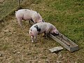 Snouts in the trough - geograph.org.uk - 5841305.jpg 640 × 480; 367 KB
-
 St John The Baptist, Crowle showing 14th C porch - geograph.org.uk - 5153117.jpg 1,200 × 1,600; 480 KB
-

-

-

-

-

-
-

-
 Thatched cottage in Crowle - geograph.org.uk - 1306670.jpg 640 × 480; 69 KB
-
 Thatched Cottage, Crowle.jpg 640 × 480; 83 KB
-
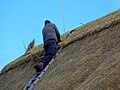 Thatcher, Church Road, Crowle - geograph.org.uk - 5153187.jpg 1,600 × 1,200; 472 KB
-
 The Green Farm, Crowle - geograph.org.uk - 5841296.jpg 640 × 480; 359 KB
-
 The Green Farm, Crowle - geograph.org.uk - 5841298.jpg 480 × 640; 299 KB
-
 The Green Farm, Crowle - geograph.org.uk - 5841825.jpg 640 × 480; 270 KB
-
 Thrift Wood Hill - geograph.org.uk - 2584886.jpg 800 × 600; 163 KB
-
 Thrift Wood View - geograph.org.uk - 2584204.jpg 800 × 600; 105 KB
-
 Tree View - geograph.org.uk - 2584177.jpg 800 × 600; 164 KB
-
 Two thatched houses, Crowle, Worcestershire - geograph.org.uk - 5154084.jpg 1,600 × 1,200; 497 KB
-
 View from Friesland Farm, Crowle - geograph.org.uk - 5152909.jpg 1,600 × 1,200; 267 KB
-
 View from near Wood Cottages, Netherwood Lane, Crowle - geograph.org.uk - 4636573.jpg 1,600 × 1,200; 395 KB
-
 View south-west from Trench Wood - geograph.org.uk - 2043116.jpg 640 × 480; 59 KB
-
 View to Sale Green - geograph.org.uk - 2873609.jpg 640 × 480; 67 KB
-
 Village pond and cottage, Crowle - geograph.org.uk - 2508751.jpg 1,024 × 680; 282 KB
-
 Village pond at Crowle Green - geograph.org.uk - 5841307.jpg 640 × 480; 375 KB
-

-
 West From Crowle Green - geograph.org.uk - 1767937.jpg 480 × 640; 196 KB
-
 Wheatfield at Sale Green - geograph.org.uk - 2508760.jpg 1,024 × 680; 247 KB
-

-
 Friesland Farm - geograph.org.uk - 80527.jpg 640 × 479; 91 KB
-
 Kids young and old enjoying snow - geograph.org.uk - 495133.jpg 640 × 480; 100 KB
-
 Netherwood Lane - geograph.org.uk - 80524.jpg 640 × 479; 149 KB
-
 North Farm, Broughton Hackett - geograph.org.uk - 569410.jpg 640 × 426; 94 KB
-
 Shaftland Cross - geograph.org.uk - 6911.jpg 480 × 640; 83 KB
-
 Thrift Wood - geograph.org.uk - 6894.jpg 640 × 480; 88 KB


_-_geograph.org.uk_-_6270678.jpg)
_-_geograph.org.uk_-_6270680.jpg)


_-_geograph.org.uk_-_4881382.jpg)
_-_geograph.org.uk_-_4881388.jpg)
_-_geograph.org.uk_-_4881390.jpg)
_-_geograph.org.uk_-_4881393.jpg)


