Category:Crofton, West Yorkshire
Jump to navigation
Jump to search
village and civil parish in West Yorkshire, England, UK  | |||||
| Upload media | |||||
| Instance of | |||||
|---|---|---|---|---|---|
| Location | Wakefield, West Yorkshire, Yorkshire and the Humber, England | ||||
 | |||||
English: Crofton is a village near Wakefield in West Yorkshire, England. It is located roughly from the town of Featherstone.
Nederlands: Crofton is een dorp (village) en civil parish in het bestuurlijke gebied City of Wakefield, in het Engelse graafschap West Yorkshire. De civil parish telt
Subcategories
This category has the following 7 subcategories, out of 7 total.
O
- Oakenshaw railway station (1 F)
Media in category "Crofton, West Yorkshire"
The following 200 files are in this category, out of 214 total.
(previous page) (next page)-
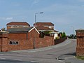
 A blue plaque at The Lord of the Manor - geograph.org.uk - 3055553.jpg 800 × 600; 127 KB
-
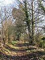
 A path leading to New Crofton - geograph.org.uk - 3054400.jpg 800 × 600; 147 KB
-
 A path leading to New Crofton - geograph.org.uk - 3054410.jpg 800 × 600; 122 KB
-
 A path leading to New Crofton - geograph.org.uk - 3054412.jpg 800 × 600; 97 KB
-
 A path leading to New Crofton - geograph.org.uk - 3054415.jpg 800 × 600; 166 KB
-
 A path leading to New Crofton - geograph.org.uk - 3054422.jpg 800 × 600; 140 KB
-
 A path leading to New Crofton - geograph.org.uk - 3054426.jpg 800 × 600; 120 KB
-
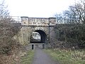
 A rail bridge on Shay Lane - geograph.org.uk - 3077002.jpg 800 × 600; 95 KB
-
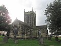
 All Saints Church and stocks, Crofton - geograph.org.uk - 2009237.jpg 1,024 × 841; 264 KB
-
 All Saints Church, Crofton - geograph.org.uk - 2616760.jpg 1,600 × 1,200; 478 KB
-
 All Saints Church, Crofton - geograph.org.uk - 4655866.jpg 5,091 × 3,819; 5.16 MB
-
 All Saints Church, Crofton - geograph.org.uk - 5299592.jpg 1,600 × 1,200; 573 KB
-
 All Saints' Church, Crofton - geograph.org.uk - 5934225.jpg 2,592 × 1,936; 1.68 MB
-
 Allotment shed near Hare Park Junction - geograph.org.uk - 4655839.jpg 5,184 × 3,888; 6.74 MB
-
 Angel watching over The Wilson Family - geograph.org.uk - 4655869.jpg 3,888 × 5,184; 5.59 MB
-
 Approaching Wakefield - geograph.org.uk - 3246096.jpg 3,974 × 2,200; 1.9 MB
-
 Ash Street - Santingley Lane - geograph.org.uk - 4863029.jpg 640 × 480; 85 KB
-
 Ash Street, New Crofton - geograph.org.uk - 2535353.jpg 1,024 × 768; 155 KB
-
 Ashdene Approach - Harrison Road - geograph.org.uk - 4726995.jpg 640 × 480; 82 KB
-
 Ashdene Avenue - Ashdene Drive - geograph.org.uk - 4726915.jpg 640 × 480; 59 KB
-
 Ashdene Avenue - Cock Lane - geograph.org.uk - 4726922.jpg 640 × 480; 65 KB
-
 Ashdene Crescent - Ashdene Drive - geograph.org.uk - 4726904.jpg 640 × 480; 54 KB
-
 Ashdene Crescent - Ashdene Drive - geograph.org.uk - 4726909.jpg 640 × 480; 83 KB
-

-

-

-
 Ashdene Drive, Crofton - geograph.org.uk - 4655875.jpg 4,896 × 3,722; 5.4 MB
-
 B6378, Crofton - geograph.org.uk - 2616756.jpg 1,600 × 1,200; 414 KB
-
 Bedford Close - Towers Close - geograph.org.uk - 4862999.jpg 640 × 480; 69 KB
-

-
 Birkwood Avenue - West Lane - geograph.org.uk - 1357384.jpg 640 × 480; 274 KB
-

-
 Brand Hill Drive - Shay Lane - geograph.org.uk - 4727539.jpg 640 × 480; 70 KB
-
 Bridge under the railway at Walton Colliery Nature Park - geograph.org.uk - 5298991.jpg 1,600 × 1,200; 823 KB
-
 Burcroft Farm - geograph.org.uk - 286561.jpg 640 × 480; 128 KB
-

-

-
 Childrens playground at Crofton - geograph.org.uk - 6373485.jpg 5,184 × 3,888; 4.77 MB
-
 Church Close - West Lane - geograph.org.uk - 1357396.jpg 640 × 480; 277 KB
-
 Church Hill Farm - Harrison Road - geograph.org.uk - 4726997.jpg 640 × 480; 84 KB
-
 Church Way - Ashdene Drive - geograph.org.uk - 4726840.jpg 640 × 480; 55 KB
-
 Churchfields - Church Way - geograph.org.uk - 4726843.jpg 640 × 480; 71 KB
-
 Cock and Crown, Crofton (15926091795).jpg 3,297 × 1,978; 3.74 MB
-
 Cock Lane - viewed from Parkway - geograph.org.uk - 4726930.jpg 640 × 480; 98 KB
-
 Cock Lane - viewed from Parkway - geograph.org.uk - 4726979.jpg 640 × 480; 80 KB
-

-
 Continuation of Spring Lane - geograph.org.uk - 4863093.jpg 640 × 480; 110 KB
-
 Costcutter - Santingley Lane - geograph.org.uk - 4863065.jpg 640 × 480; 74 KB
-
 Crayford Drive - Sandown Avenue - geograph.org.uk - 4726654.jpg 640 × 480; 62 KB
-
 Crofton Academy - High Street - geograph.org.uk - 4726667.jpg 640 × 480; 66 KB
-
 Crofton Academy - High Street - geograph.org.uk - 4726672.jpg 640 × 480; 110 KB
-

-
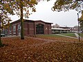
 Crofton Junior School - geograph.org.uk - 4655882.jpg 4,994 × 3,783; 5.5 MB
-

-
 Disused bus stop on Pontefract Road - geograph.org.uk - 1692444.jpg 691 × 923; 433 KB
-
 Dovedale Close - Wentworth Drive - geograph.org.uk - 4726810.jpg 640 × 480; 61 KB
-

-

-

-

-

-

-
 Elm Street - Santingley Lane - geograph.org.uk - 4863068.jpg 640 × 410; 47 KB
-
 Entrance to Blackholme Bank Farm, on the B6378 - geograph.org.uk - 1692443.jpg 1,024 × 768; 126 KB
-
 Entrance to the Priory Ridge development - geograph.org.uk - 2535340.jpg 1,024 × 768; 96 KB
-
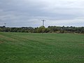 Farmland off Shay Lane - geograph.org.uk - 2616748.jpg 1,600 × 1,200; 333 KB
-
 Farnham Way - Sandown Avenue - geograph.org.uk - 4726656.jpg 640 × 480; 61 KB
-
 Fence to Railway cutting - geograph.org.uk - 608992.jpg 404 × 640; 96 KB
-
 Fernlea Close - geograph.org.uk - 5958190.jpg 1,280 × 750; 800 KB
-
 Fernlea Close - Slack Lane - geograph.org.uk - 4726687.jpg 640 × 480; 57 KB
-
 Field north of the Crofton footpath - geograph.org.uk - 2535419.jpg 1,024 × 768; 143 KB
-
 Florist's shop in Crofton - geograph.org.uk - 4655861.jpg 3,851 × 4,995; 5.13 MB
-
 Footbridge on the path to Horse Race End - geograph.org.uk - 5299604.jpg 1,600 × 1,200; 708 KB
-
 Footbridge over Railway - geograph.org.uk - 367267.jpg 640 × 480; 158 KB
-
 Footpath - Ashdene Crescent - geograph.org.uk - 4726908.jpg 480 × 640; 88 KB
-
 Footpath - Brand Hill Approach - geograph.org.uk - 4727544.jpg 480 × 640; 84 KB
-
 Footpath - Brand Hill Drive - geograph.org.uk - 4727542.jpg 480 × 640; 91 KB
-
 Footpath - Church Way - geograph.org.uk - 4726848.jpg 480 × 640; 61 KB
-
 Footpath - Pinfold Drive - geograph.org.uk - 4726827.jpg 480 × 640; 110 KB
-
 Footpath - Priory Ridge - geograph.org.uk - 4863147.jpg 640 × 480; 101 KB
-
 Footpath - Priory Ridge - geograph.org.uk - 4863165.jpg 640 × 480; 118 KB
-
 Footpath - Slack Lane - geograph.org.uk - 4726831.jpg 480 × 640; 99 KB
-
 Footpath - Slack Lane - geograph.org.uk - 4726838.jpg 480 × 640; 106 KB
-
 Footpath - Thorntree Avenue - geograph.org.uk - 4727015.jpg 480 × 640; 75 KB
-
 Footpath - West Lane - geograph.org.uk - 2119702.jpg 480 × 640; 140 KB
-
 Footpath - West Lane - geograph.org.uk - 2119704.jpg 640 × 480; 62 KB
-
 Footpath - West Lane - geograph.org.uk - 2119716.jpg 480 × 640; 68 KB
-
 Footpath - West Lane - geograph.org.uk - 2119720.jpg 480 × 640; 65 KB
-
 Footpath and access to Burcroft Farm - geograph.org.uk - 5299603.jpg 1,600 × 1,200; 902 KB
-
 Footpath to Larkdale Farm - geograph.org.uk - 6373474.jpg 3,369 × 4,468; 5.59 MB
-
 Former chapel in Crofton - geograph.org.uk - 4655848.jpg 5,012 × 3,717; 3.71 MB
-
 Former Police Station - The Avenue - geograph.org.uk - 4726991.jpg 640 × 480; 81 KB
-
 Former Roman Catholic church, New Crofton - geograph.org.uk - 2535360.jpg 1,024 × 768; 137 KB
-
 Formerly The Slipper public house at New Crofton - geograph.org.uk - 5299013.jpg 1,600 × 1,200; 497 KB
-
 Garden Row - off Slack Lane - geograph.org.uk - 4863950.jpg 640 × 481; 100 KB
-
 Garden Row, Crofton - geograph.org.uk - 4655886.jpg 4,890 × 3,622; 4.07 MB
-
 Gate into snowy field on the B6378 - geograph.org.uk - 1692439.jpg 1,024 × 768; 194 KB
-

-
 Glenn Way - Priory Ridge - geograph.org.uk - 4863142.jpg 640 × 480; 70 KB
-
 Greenside Court - Greenside Park - geograph.org.uk - 4863088.jpg 640 × 480; 66 KB
-
 Greenside Park - Spring Lane - geograph.org.uk - 4863084.jpg 640 × 480; 61 KB
-
 Greentop - Middle Lane - geograph.org.uk - 4863076.jpg 640 × 480; 62 KB
-
 Greenview - Greenside Park - geograph.org.uk - 4863087.jpg 640 × 473; 62 KB
-

-

-
 Hawthorn Avenue - Thorntree Avenue - geograph.org.uk - 4727536.jpg 640 × 480; 50 KB
-

-
 Henry Daley's memorial garden - geograph.org.uk - 1576066.jpg 640 × 480; 56 KB
-
 High Street, Crofton - geograph.org.uk - 2616765.jpg 1,600 × 1,200; 457 KB
-
 High Street, Crofton - geograph.org.uk - 2616770.jpg 1,600 × 1,200; 405 KB
-
 High Street, Crofton - geograph.org.uk - 3055693.jpg 800 × 600; 90 KB
-
 Holly Close - Thorntree Avenue - geograph.org.uk - 4727532.jpg 640 × 480; 58 KB
-
 Holly Crescent - Holly Close - geograph.org.uk - 4727533.jpg 640 × 480; 59 KB
-
 Holly Crescent - Holly Close - geograph.org.uk - 4727535.jpg 640 × 480; 55 KB
-
 Houses in Hare Park View - geograph.org.uk - 2535400.jpg 1,024 × 768; 109 KB
-

-
 Houses on High Street, Crofton - geograph.org.uk - 2616769.jpg 1,600 × 1,200; 530 KB
-
 Houses on Smithy Close - geograph.org.uk - 2535392.jpg 1,024 × 768; 145 KB
-
 King Coal - geograph.org.uk - 3246100.jpg 4,000 × 2,248; 1.74 MB
-
 Lanark Rise - Wentworth Drive - geograph.org.uk - 4726801.jpg 640 × 392; 49 KB
-
 Level crossing near Larkdale Farm, Crofton - geograph.org.uk - 5298995.jpg 1,600 × 1,200; 697 KB
-
 Line towards Wakefield - geograph.org.uk - 6373479.jpg 5,184 × 3,888; 6.29 MB
-
 Looking from Crofton to Wakefield - geograph.org.uk - 4655926.jpg 3,629 × 5,068; 4.59 MB
-
 Looking towards the Lord of the Manor - geograph.org.uk - 3055538.jpg 800 × 600; 170 KB
-

-
 Lord of the Manor, Crofton - geograph.org.uk - 1087774.jpg 640 × 480; 102 KB
-
 Lost railways ^2 - geograph.org.uk - 4143273.jpg 4,146 × 2,918; 2.74 MB
-
 Lovell View - Priory Ridge - geograph.org.uk - 4863163.jpg 640 × 480; 66 KB
-

-

-
 Manorfields Avenue - Priory Ridge - geograph.org.uk - 4863150.jpg 640 × 480; 69 KB
-
 Manorfields Court - High Street - geograph.org.uk - 4863017.jpg 640 × 480; 76 KB
-

-
 Meadowfields Drive - Bedford Close - geograph.org.uk - 4863003.jpg 640 × 480; 85 KB
-

-
 Meadowfields Road - High Street - geograph.org.uk - 4863014.jpg 640 × 480; 54 KB
-

-

-
 Middle Lane - Spring Lane - geograph.org.uk - 4863074.jpg 640 × 480; 79 KB
-
 Minimalist gate into field on the B6378 - geograph.org.uk - 1692438.jpg 1,024 × 768; 224 KB
-
 Newer houses in Oak Street - geograph.org.uk - 2535352.jpg 1,024 × 768; 107 KB
-
 Nostell.jpg 3,104 × 3,104; 2.92 MB
-
 Oak Street - Manor Drive - geograph.org.uk - 4863025.jpg 640 × 480; 72 KB
-
 Oakdene Drive - Priory Ridge - geograph.org.uk - 4863153.jpg 640 × 480; 67 KB
-
 Oakenshaw Lane heading south - geograph.org.uk - 2616723.jpg 1,600 × 1,200; 409 KB
-
 Parkway - Cock Lane - geograph.org.uk - 4726926.jpg 640 × 437; 73 KB
-

-

-
 Pontefract Road, looking towards Crofton - geograph.org.uk - 1692436.jpg 1,024 × 768; 135 KB
-
 Railway bridge next to Walton Colliery. - geograph.org.uk - 73594.jpg 640 × 480; 125 KB
-
 Railway from the level crossing near Burcroft Farm - geograph.org.uk - 5299596.jpg 1,600 × 1,200; 474 KB
-
 Railway towards Doncaster - geograph.org.uk - 2616721.jpg 1,600 × 1,200; 447 KB
-
 Railway, Oakenshaw Lane - geograph.org.uk - 367258.jpg 640 × 480; 124 KB
-
 Richmond Court - Wentworth Drive - geograph.org.uk - 4726808.jpg 640 × 480; 52 KB
-
 Rose Garth - High Street - geograph.org.uk - 4726658.jpg 640 × 480; 55 KB
-
 Royal Oak (15754758687).jpg 2,214 × 2,423; 3.65 MB
-
 Sandown Avenue - High Street - geograph.org.uk - 4726649.jpg 640 × 480; 52 KB
-
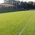
 School grounds, Crofton - geograph.org.uk - 2616763.jpg 1,600 × 1,200; 512 KB
-
 Scott Drive - Priory Ridge - geograph.org.uk - 4863154.jpg 640 × 480; 62 KB
-
 Shay Court, Crofton - geograph.org.uk - 2616753.jpg 1,600 × 1,200; 437 KB
-
 Shay Lane towards Crofton - geograph.org.uk - 2616751.jpg 1,600 × 1,200; 395 KB
-
 Slack Lane - High Street - geograph.org.uk - 4726675.jpg 640 × 480; 72 KB
-

-

-
 Slack Lane towards the A638 - geograph.org.uk - 2617106.jpg 1,600 × 1,200; 389 KB
-
 Spring Green Garden Centre - geograph.org.uk - 361285.jpg 640 × 480; 80 KB
-
 Spring Green Nurseries - geograph.org.uk - 1692434.jpg 1,024 × 768; 155 KB
-
 Spring Lane - Santingley Lane - geograph.org.uk - 4863071.jpg 640 × 480; 88 KB
-
-
 Springhill Avenue - Pinfold Drive - geograph.org.uk - 4726693.jpg 640 × 480; 63 KB
-

-
 Springhill Drive - Pinfold Drive - geograph.org.uk - 4726825.jpg 640 × 480; 74 KB
-

-
 Springhill Grove - Springhill Drive - geograph.org.uk - 4726821.jpg 640 × 480; 53 KB
-
 Springhill Mount - Springhill Avenue - geograph.org.uk - 4726696.jpg 640 × 433; 47 KB
-
 Springhill Mount - Springhill Drive - geograph.org.uk - 4726812.jpg 640 × 480; 53 KB
-
 Star over Oak Street - geograph.org.uk - 2535348.jpg 1,024 × 768; 111 KB
-
 Telephone Exchange, Crofton - geograph.org.uk - 3724259.jpg 3,072 × 2,304; 1.78 MB
-
 The Avenue - viewed from Cock Lane - geograph.org.uk - 4726984.jpg 640 × 480; 73 KB
-
 The Avenue at Brand Hill Drive - geograph.org.uk - 3076998.jpg 800 × 600; 83 KB
-
 The Barnsley Canal near Walton - geograph.org.uk - 3247151.jpg 800 × 533; 131 KB
-

-
 The edge of the wheat - geograph.org.uk - 2535423.jpg 1,024 × 768; 179 KB
-
 The entrance to Crofton Cricket Club - geograph.org.uk - 3076999.jpg 800 × 600; 97 KB
-
 The Goose and Cowslip Public House - geograph.org.uk - 3516770.jpg 4,608 × 3,456; 3.48 MB
-
 The Goose and Cowslip, Crofton - geograph.org.uk - 3228901.jpg 800 × 600; 196 KB
-
 The Goose and Cowslip, Crofton - geograph.org.uk - 3228906.jpg 800 × 600; 162 KB
-
 The Goose and Cowslip, Crofton - geograph.org.uk - 3228914.jpg 800 × 600; 176 KB
-
 The Goose and Cowslip, Crofton - geograph.org.uk - 3512881.jpg 768 × 1,024; 166 KB
-
 The Goose and Cowslip, Crofton - geograph.org.uk - 3512886.jpg 768 × 1,024; 258 KB
-
 The Lord of the Manor - geograph.org.uk - 3055542.jpg 800 × 600; 174 KB
-
 The Lord of the Manor - geograph.org.uk - 3055546.jpg 800 × 600; 150 KB
-
 The Lord of the Manor - geograph.org.uk - 3055548.jpg 600 × 800; 70 KB
-
 The Lord of the Manor - geograph.org.uk - 3055550.jpg 800 × 600; 150 KB
-
 The Old Chapel, Hare Park Lane, Crofton - geograph.org.uk - 2012673.jpg 1,024 × 768; 142 KB
-
 The Royal Oak - geograph.org.uk - 2535409.jpg 1,024 × 768; 156 KB
-
 The royal oak - High Street - geograph.org.uk - 4726668.jpg 491 × 640; 62 KB
-
 The Stocks, Crofton - geograph.org.uk - 5934230.jpg 2,592 × 1,936; 2.44 MB
-
 The Weavers Green, Spring Hill - geograph.org.uk - 2617103.jpg 1,600 × 1,200; 335 KB
-
 Thorntree Avenue - Shay Lane - geograph.org.uk - 4727538.jpg 640 × 480; 53 KB


.jpg)


.jpg)


