Category:Crimplesham
Jump to navigation
Jump to search
English: Crimplesham is a village and civil parish in the English county of Norfolk. It is situated 4 km west of the small town of Downham Market, 20 km south of the larger town of King's Lynn, and 60 km west of the city of Norwich.
village and civil parish in Norfolk, United Kingdom  | |||||
| Upload media | |||||
| Instance of | |||||
|---|---|---|---|---|---|
| Location | King's Lynn and West Norfolk, Norfolk, East of England, England | ||||
| Area |
| ||||
 | |||||
Media in category "Crimplesham"
The following 85 files are in this category, out of 85 total.
-
-

-
 Close up, Elizabeth II postbox on Main Road, Crimplesham - geograph.org.uk - 5392297.jpg 1,671 × 2,569; 821 KB
-
 Coach parked in a layby on the A1122 - geograph.org.uk - 2172298.jpg 580 × 435; 115 KB
-

-
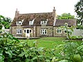 Cottage in Crimplesham - geograph.org.uk - 5043712.jpg 640 × 480; 372 KB
-
 Country Road at Stradsett, Norfolk - geograph.org.uk - 2172496.jpg 580 × 435; 135 KB
-
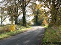
 Country road in Autumn - geograph.org.uk - 2172309.jpg 580 × 435; 139 KB
-
 Country road in Autumn - geograph.org.uk - 2172314.jpg 580 × 435; 116 KB
-
 Crimplesham Hall - geograph.org.uk - 4443237.jpg 4,320 × 3,240; 3.61 MB
-
 Crimplesham village hall (detail) - geograph.org.uk - 5043731.jpg 640 × 468; 474 KB
-
 Crimplesham village hall - geograph.org.uk - 5043723.jpg 640 × 480; 325 KB
-
 Crimplesham village hall - the entrance - geograph.org.uk - 5043726.jpg 640 × 527; 506 KB
-
 Crimplesham village hall in Market Lane - geograph.org.uk - 5043725.jpg 640 × 480; 434 KB
-
 Crimplesham village sign (close-up) - geograph.org.uk - 4443217.jpg 4,320 × 3,240; 4.51 MB
-
 Crimplesham village sign - geograph.org.uk - 4443202.jpg 4,320 × 3,240; 4.53 MB
-
 Crimplesham village sign - geograph.org.uk - 525429.jpg 426 × 640; 159 KB
-
 Crimplesham village sign - geograph.org.uk - 6082177.jpg 2,592 × 3,456; 3.21 MB
-
 CrimpleshamHall1881.jpg 216 × 171; 52 KB
-
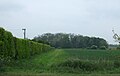
 Crop field towards Old Covert - geograph.org.uk - 5391702.jpg 2,848 × 2,136; 1.35 MB
-
 Disused Laing hut - geograph.org.uk - 5033725.jpg 640 × 480; 156 KB
-
 Disused Laing hut - geograph.org.uk - 5063927.jpg 640 × 480; 480 KB
-
 Disused Laing hut - geograph.org.uk - 5063929.jpg 640 × 480; 524 KB
-
 Double five-barred gated field entrance - geograph.org.uk - 2172247.jpg 580 × 435; 111 KB
-
 Downham Road (A1122) - geograph.org.uk - 5391704.jpg 640 × 480; 56 KB
-
 Electricity poles beside New Road - geograph.org.uk - 4075966.jpg 640 × 480; 137 KB
-
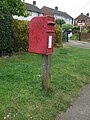 Elizabeth II postbox on Main Road, Crimplesham - geograph.org.uk - 5392292.jpg 2,136 × 2,848; 1.28 MB
-
 Farm track off Downham Road - geograph.org.uk - 5391695.jpg 640 × 405; 45 KB
-
 Farmland north of Mast Farm, Bexwell, Norfolk - geograph.org.uk - 5112765.jpg 4,309 × 3,233; 3.61 MB
-
 Field and bridleway - geograph.org.uk - 886366.jpg 3,008 × 2,000; 3.51 MB
-
 Field boundary and Crimplesham Wood in Norfolk - geograph.org.uk - 5111675.jpg 4,320 × 3,240; 5.78 MB
-
 Field entrance off Willow Heath Road - geograph.org.uk - 5391728.jpg 640 × 480; 71 KB
-
 Field margin beside drain - geograph.org.uk - 5432314.jpg 640 × 480; 77 KB
-
 Field near Mast Farm - geograph.org.uk - 5391484.jpg 640 × 480; 39 KB
-
 Fields north of New Road - geograph.org.uk - 4075964.jpg 640 × 480; 201 KB
-
 Former contractors' site - geograph.org.uk - 5033722.jpg 640 × 480; 370 KB
-

-
 Home Farm, Crimplesham - geograph.org.uk - 5391698.jpg 640 × 422; 39 KB
-
 Houses on Main Road, Crimplesham - geograph.org.uk - 5391723.jpg 640 × 480; 87 KB
-

-

-

-
 Main Road, Crimplesham - geograph.org.uk - 5391707.jpg 640 × 399; 52 KB
-
 Main Road, Crimplesham - geograph.org.uk - 5391726.jpg 640 × 480; 67 KB
-
 Main Road, Crimplesham - geograph.org.uk - 5392301.jpg 2,848 × 2,136; 1.28 MB
-
 Memorial seat at Crimplesham - geograph.org.uk - 4521897.jpg 1,024 × 768; 436 KB
-
 Mill Farm, Crimplesham - geograph.org.uk - 2172562.jpg 640 × 485; 121 KB
-
 Mill Lane past Mill Farm, Crimplesham - geograph.org.uk - 2172564.jpg 640 × 480; 115 KB
-

-

-
 New Road, Bexwell - geograph.org.uk - 4075952.jpg 640 × 480; 152 KB
-

-
 Oilseed rape stubble - geograph.org.uk - 5063950.jpg 640 × 435; 369 KB
-
 Old fuel tank - geograph.org.uk - 5033679.jpg 640 × 480; 129 KB
-
 Petrol station and Volvo car dealership - geograph.org.uk - 5033672.jpg 640 × 415; 234 KB
-
 Petrol station and Volvo car dealership - geograph.org.uk - 5033673.jpg 640 × 446; 219 KB
-
 Petrol station and Volvo car dealership - geograph.org.uk - 5033674.jpg 640 × 566; 284 KB
-
 Petrol station on A1122 - geograph.org.uk - 525427.jpg 640 × 426; 119 KB
-
 Phone box in Crimplesham - geograph.org.uk - 1244893.jpg 3,008 × 2,000; 2.35 MB
-

-
 PRIVATE ROAD KEEP OUT - geograph.org.uk - 5110759.jpg 4,047 × 3,035; 4.01 MB
-

-

-
 Stow Barn Road junction with the A1122 - geograph.org.uk - 2172278.jpg 637 × 435; 122 KB
-
 Straw bales - geograph.org.uk - 525446.jpg 640 × 426; 152 KB
-
 Sugar beet crop north of New Road - geograph.org.uk - 4075962.jpg 640 × 480; 193 KB
-
 The Chase, Stow Hall, looking north - geograph.org.uk - 886313.jpg 3,008 × 2,000; 3.06 MB
-
 The road into Crimplesham - geograph.org.uk - 521852.jpg 640 × 426; 129 KB
-
 To Stow Bardolph on Fincham Road - geograph.org.uk - 2172551.jpg 640 × 576; 174 KB
-
 Tractor working near Crimplesham in Norfolk - geograph.org.uk - 5111696.jpg 4,043 × 3,033; 2.45 MB
-
 Tree archway and cottage - geograph.org.uk - 525445.jpg 402 × 640; 146 KB
-
 Trig point north of Crimplesham in Norfolk - geograph.org.uk - 5112761.jpg 3,800 × 2,850; 4.77 MB
-
 Trig point on a field boundary - geograph.org.uk - 5112740.jpg 4,147 × 3,111; 4.46 MB
-
 View across cornfield - geograph.org.uk - 525414.jpg 640 × 426; 133 KB
-
 View across field - geograph.org.uk - 525408.jpg 640 × 426; 130 KB
-
 View across field - geograph.org.uk - 525430.jpg 640 × 426; 131 KB
-

-
 View across fields - geograph.org.uk - 525442.jpg 640 × 426; 118 KB
-
 View across the southern perimeter track - geograph.org.uk - 5033734.jpg 640 × 480; 438 KB
-
 View down track across field - geograph.org.uk - 525406.jpg 640 × 426; 107 KB
-
 Village green and cottage in Crimplesham, Norfolk - geograph.org.uk - 5112713.jpg 4,320 × 3,240; 2.94 MB
-
 Wheat crop field in Bexwell - geograph.org.uk - 4075957.jpg 640 × 480; 155 KB
-

-
 Woodland view - geograph.org.uk - 525440.jpg 640 × 426; 168 KB
-
 Stow Bardolph Hall Grounds - geograph.org.uk - 577084.jpg 640 × 426; 109 KB


_-_geograph.org.uk_-_5043731.jpg)


_-_geograph.org.uk_-_4443217.jpg)


_-_geograph.org.uk_-_5391704.jpg)


_near_Mast_Farm_-_geograph.org.uk_-_5391487.jpg)


_-_geograph.org.uk_-_5432332.jpg)


_-_geograph.org.uk_-_5391489.jpg)


