Category:Creu de terme del cementiri
Jump to navigation
Jump to search
| Object location | | View all coordinates using: OpenStreetMap |
|---|
building in Barcelona Province, Spain  | |||||
| Upload media | |||||
| Instance of | |||||
|---|---|---|---|---|---|
| Location | Castellgalí, Bages, Barcelona Province, Catalonia | ||||
| Heritage designation |
| ||||
| Elevation above sea level |
| ||||
 | |||||
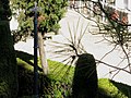
Català: Creu de terme del cementiri. Cementiri municipal (Castellgalí)
This is a category about a building listed in the Catalan heritage register as Bé Cultural d'Interès Local (BCIL) under the reference IPA-30710. |
Media in category "Creu de terme del cementiri"
This category contains only the following file.
-
 Creu de Terme del Cementiri - Castellgalí CIC 20110926 00594.jpg 1,600 × 1,199; 499 KB