Category:Cresswell, Staffordshire
Jump to navigation
Jump to search
hamlet in Staffordshire, United Kingdom  | |||||
| Upload media | |||||
| Instance of | |||||
|---|---|---|---|---|---|
| Location | Draycott in the Moors, Staffordshire Moorlands, Staffordshire, West Midlands, England | ||||
 | |||||
Subcategories
This category has the following 2 subcategories, out of 2 total.
Media in category "Cresswell, Staffordshire"
The following 13 files are in this category, out of 13 total.
-
 25060 and 25044 Elmton and Creswell.jpg 2,048 × 1,418; 514 KB
-
 Blakelow Farm - geograph.org.uk - 459476.jpg 640 × 480; 75 KB
-
 Footpath Near Morrilow Heath - geograph.org.uk - 459442.jpg 640 × 480; 87 KB
-
 Footpath To Morrilow Moor Farm - geograph.org.uk - 459427.jpg 640 × 480; 88 KB
-
 Overgrown Footpath To New House - geograph.org.uk - 459479.jpg 640 × 480; 79 KB
-
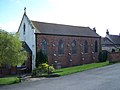 St Mary's Church, Cresswell.jpg 1,496 × 1,122; 569 KB
-
 The Hunter - geograph.org.uk - 437265.jpg 640 × 478; 67 KB
-
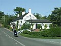 The Izaak Walton - geograph.org.uk - 438740.jpg 640 × 481; 77 KB
-
 Track To Blakelow - geograph.org.uk - 459474.jpg 640 × 480; 91 KB
-
 Water Tower - geograph.org.uk - 376482.jpg 640 × 480; 69 KB
-
 Level Crossing Near Lower Newton Farm - geograph.org.uk - 618371.jpg 640 × 480; 104 KB
-
 River Blithe Near Lower Newton Farm - geograph.org.uk - 618375.jpg 640 × 480; 115 KB
-
 Rookery Farm - geograph.org.uk - 463158.jpg 640 × 480; 63 KB


