Category:Craster
Jump to navigation
Jump to search
village in Northumberland, England, UK  | |||||
| Upload media | |||||
| Instance of | |||||
|---|---|---|---|---|---|
| Location | Northumberland, North East England, England | ||||
| Said to be the same as | Craster (Wikimedia duplicated page, civil parish) | ||||
 | |||||
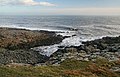
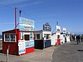
English: Craster is a small fishing village on the Northumbrian coast of England. It has a small and attractive harbour and offers a view northwards along the rocky shore to the spectacular ruins of Dunstanburgh Castle. This is the nearest point of access to the castle and the approach must be made on foot as there is just a grassy path. The next village to the north is Embleton.
Subcategories
This category has the following 8 subcategories, out of 8 total.
Media in category "Craster"
The following 200 files are in this category, out of 1,038 total.
(previous page) (next page)-
 'The Key', west of Dunstanburgh Castle - geograph.org.uk - 4850580.jpg 1,024 × 768; 314 KB
-
 2014 Landscape Photography Workshop, Northumberland (12039539595).jpg 3,264 × 4,928; 1.48 MB
-
 2014 Landscape Photography Workshop, Northumberland (12040383736).jpg 4,928 × 2,664; 1.58 MB
-
 A bright spot in a world of grey (12039820323).jpg 4,928 × 3,264; 2.8 MB
-

-

-
 A geo near Craster - geograph.org.uk - 1930332.jpg 640 × 480; 97 KB
-
 A Geo or Inlet - geograph.org.uk - 109792.jpg 480 × 640; 126 KB
-

-
 A muddy corner - geograph.org.uk - 5286111.jpg 1,024 × 683; 398 KB
-

-
 A poultry shed - geograph.org.uk - 2570542.jpg 640 × 359; 238 KB
-
 A Quiet Day at Craster Harbour - geograph.org.uk - 5524796.jpg 3,707 × 2,449; 1.44 MB
-

-
 Abandoned limestone quarries - geograph.org.uk - 6237446.jpg 800 × 600; 120 KB
-
 Above Rumble Churn - geograph.org.uk - 6235188.jpg 1,024 × 683; 496 KB
-
 Across the rockpools - geograph.org.uk - 2567903.jpg 640 × 427; 103 KB
-
 Across the sea - geograph.org.uk - 3594497.jpg 640 × 428; 67 KB
-
 Along Castle Point - geograph.org.uk - 6235182.jpg 1,024 × 683; 501 KB
-
 Along Heugh Wynd - geograph.org.uk - 6318596.jpg 1,024 × 683; 417 KB
-
 Along NCN 1 - geograph.org.uk - 3432591.jpg 640 × 480; 95 KB
-
 Along St Oswald's Way - geograph.org.uk - 5886144.jpg 5,376 × 3,024; 6.11 MB
-
 Along the coast towards Craster - geograph.org.uk - 5067501.jpg 640 × 427; 136 KB
-
 Along the harbour wall - geograph.org.uk - 3594500.jpg 640 × 428; 83 KB
-

-
 Along the shore to Craster Harbour - geograph.org.uk - 5067078.jpg 640 × 427; 134 KB
-
 Along the shore to the harbour - geograph.org.uk - 4202160.jpg 640 × 428; 72 KB
-
 An iced-up stone - geograph.org.uk - 2242175.jpg 640 × 427; 214 KB
-
 Anglers on the shore - geograph.org.uk - 1188744.jpg 640 × 480; 105 KB
-
 Animals grazing by St Oswald's Way - geograph.org.uk - 2575837.jpg 640 × 430; 83 KB
-
 Approaching Craster from the South - geograph.org.uk - 3213514.jpg 4,320 × 3,240; 3.6 MB
-
 Approaching Craster Harbour - geograph.org.uk - 4368605.jpg 1,024 × 678; 179 KB
-
 Approaching Dunstan Steads - geograph.org.uk - 3606724.jpg 640 × 428; 100 KB
-

-
 Approaching Howick Scar - geograph.org.uk - 4229952.jpg 640 × 428; 86 KB
-
 Approaching Spitalford - geograph.org.uk - 3334721.jpg 1,600 × 1,170; 354 KB
-
 Arable field beside Mustardhill Plantation - geograph.org.uk - 5902744.jpg 2,000 × 1,333; 417 KB
-
 Arable field near Craster West Farm - geograph.org.uk - 5902748.jpg 2,000 × 1,333; 401 KB
-
 Arable fields beside the bridleway - geograph.org.uk - 6235034.jpg 1,024 × 683; 419 KB
-
 Arable land, Dunstan Square - geograph.org.uk - 2570537.jpg 640 × 359; 225 KB
-
 Arch on the breakwater - geograph.org.uk - 6311999.jpg 1,024 × 683; 452 KB
-
 Arched strata, Swine Den - geograph.org.uk - 6236604.jpg 800 × 600; 129 KB
-
 Bagged concrete pillbox - geograph.org.uk - 2570531.jpg 640 × 430; 264 KB
-
 Baithouse Studio - geograph.org.uk - 2569087.jpg 640 × 430; 68 KB
-
 Bales on route 1 - geograph.org.uk - 3456613.jpg 640 × 480; 83 KB
-
 Barley field with wild flower border - geograph.org.uk - 3563525.jpg 1,600 × 1,343; 408 KB
-
 Barley fields and plantations - geograph.org.uk - 2482918.jpg 3,648 × 2,736; 5.73 MB
-
 Barn at Dunstan Square - geograph.org.uk - 3456632.jpg 640 × 480; 76 KB
-
 Barn between Dunstan Square and Embleton - geograph.org.uk - 5060083.jpg 640 × 427; 115 KB
-
 Barn south of Dunstan Steads - geograph.org.uk - 4825682.jpg 1,024 × 767; 205 KB
-
 Barn with Route 1 - geograph.org.uk - 6224971.jpg 800 × 600; 104 KB
-

-
 Beach and Muckle Carr - geograph.org.uk - 4202157.jpg 640 × 428; 85 KB
-
 Beach west of Rumble Churn - geograph.org.uk - 5507451.jpg 1,024 × 754; 218 KB
-
 Beacon on Little Carr - geograph.org.uk - 4495165.jpg 1,600 × 1,144; 279 KB
-
 Bean fields - geograph.org.uk - 5067531.jpg 640 × 427; 114 KB
-
 Below Lilburn Tower - geograph.org.uk - 6235146.jpg 1,024 × 683; 405 KB
-
 Below the tideline - geograph.org.uk - 5067496.jpg 640 × 427; 117 KB
-
 Bench Mark, South Craster Farm House - geograph.org.uk - 2589364.jpg 480 × 640; 85 KB
-

-

-
 Beside Craster Harbour - geograph.org.uk - 5524867.jpg 1,600 × 1,181; 439 KB
-
 Between Craster and Dunstanburgh - geograph.org.uk - 3604173.jpg 640 × 428; 82 KB
-
 Bird home on Cullernose Point - geograph.org.uk - 3511667.jpg 3,872 × 2,592; 4.59 MB
-
 Bird watching,Rumble Churn - geograph.org.uk - 2479956.jpg 3,648 × 2,736; 5.46 MB
-
 Bird ^ Bathing House from Cullernose Point - geograph.org.uk - 4860930.jpg 1,024 × 769; 90 KB
-
 BK280 - geograph.org.uk - 4153590.jpg 640 × 428; 99 KB
-
 Black Hole - geograph.org.uk - 1563340.jpg 640 × 412; 100 KB
-
 Black Hole - geograph.org.uk - 3051870.jpg 1,600 × 1,200; 361 KB
-
 Black Hole - geograph.org.uk - 3212691.jpg 4,320 × 3,240; 4.66 MB
-
 Black Hole - geograph.org.uk - 4202177.jpg 640 × 428; 89 KB
-
 Black Hole - geograph.org.uk - 6237847.jpg 3,927 × 2,345; 1.64 MB
-
 Black Hole near Craster - geograph.org.uk - 6015586.jpg 800 × 494; 126 KB
-
 Black Hole near Craster - geograph.org.uk - 6407440.jpg 5,184 × 3,888; 708 KB
-
 Boat on the beach - geograph.org.uk - 4144927.jpg 640 × 428; 81 KB
-
 Boat returning to harbour - geograph.org.uk - 4144921.jpg 640 × 428; 72 KB
-
 Boat, Craster Harbour - geograph.org.uk - 6362992.jpg 2,676 × 1,616; 499 KB
-
 Boats moored - geograph.org.uk - 3594461.jpg 640 × 428; 106 KB
-
 Boats on the shore at Craster - geograph.org.uk - 5784887.jpg 2,048 × 1,536; 849 KB
-
 Boggy hollow, Cushat Knock - geograph.org.uk - 3987994.jpg 640 × 480; 76 KB
-

-
 Breakwater at Craster - geograph.org.uk - 6311996.jpg 1,024 × 683; 387 KB
-

-
 Brick built water tank or cistern - geograph.org.uk - 4328605.jpg 1,600 × 1,253; 570 KB
-
 Bridleway approaching Dunstan Steads - geograph.org.uk - 4760113.jpg 800 × 531; 118 KB
-
 Bright Spot In A Grey World (61073162).jpeg 2,048 × 1,356; 1.28 MB
-
 Bus terminus at Craster - geograph.org.uk - 2591085.jpg 3,872 × 2,592; 951 KB
-
 Bus turnround in Craster - geograph.org.uk - 1187948.jpg 640 × 480; 63 KB
-
 Canoe as planter - geograph.org.uk - 1187955.jpg 640 × 480; 92 KB
-
 Car park, Craster - geograph.org.uk - 6362931.jpg 4,284 × 2,672; 1.62 MB
-
 Carved sign at entrance to Craster - geograph.org.uk - 3641838.jpg 768 × 1,024; 354 KB
-
 Castle and boat - geograph.org.uk - 4144918.jpg 640 × 428; 69 KB
-
 Castle Point - geograph.org.uk - 2459342.jpg 2,000 × 1,500; 2.18 MB
-
 Castle Point - geograph.org.uk - 2580740.jpg 640 × 430; 75 KB
-
 Castle Point - geograph.org.uk - 2580757.jpg 640 × 430; 71 KB
-
 Castle Point - geograph.org.uk - 2675353.jpg 640 × 426; 68 KB
-
 Castle Point - geograph.org.uk - 3213569.jpg 4,320 × 3,240; 3.17 MB
-
 Castle Point - geograph.org.uk - 3511762.jpg 3,872 × 2,592; 4.48 MB
-
 Castle Point - geograph.org.uk - 4214487.jpg 640 × 480; 84 KB
-
 Castle Point - geograph.org.uk - 5506352.jpg 640 × 427; 97 KB
-
 Castle Point - geograph.org.uk - 6363713.jpg 4,288 × 2,848; 1.64 MB
-
 Castle Point and Rumble Churn - geograph.org.uk - 2999311.jpg 1,600 × 1,200; 307 KB
-
 Castle Point at Dunstanburgh Castle - geograph.org.uk - 6017871.jpg 800 × 481; 87 KB
-
 Castle Point, Dunstanburgh - geograph.org.uk - 5241321.jpg 1,280 × 960; 436 KB
-
 Castle Point, Dunstanburgh - geograph.org.uk - 926573.jpg 640 × 480; 133 KB
-
 Castle walls - geograph.org.uk - 4238438.jpg 640 × 428; 108 KB
-
 Castle Well - geograph.org.uk - 2581265.jpg 640 × 430; 108 KB
-
 Cattle by the shore - geograph.org.uk - 6235196.jpg 1,024 × 683; 507 KB
-
 Cattle drinking trough - geograph.org.uk - 3559864.jpg 1,600 × 1,174; 318 KB
-
 Cattle grazing in front of Dunstanburgh Castle - geograph.org.uk - 3641711.jpg 1,024 × 768; 234 KB
-
 Cattle, St Oswald's Way - geograph.org.uk - 2575648.jpg 640 × 430; 64 KB
-
 Cattle, St Oswald's Way - geograph.org.uk - 2575667.jpg 640 × 430; 62 KB
-
 Cemetery House, Embleton Cemetery - geograph.org.uk - 4471738.jpg 640 × 480; 52 KB
-
 Church from the footpath - geograph.org.uk - 3489339.jpg 640 × 480; 111 KB
-
 Circular wave front, Craster Harbour - geograph.org.uk - 2129205.jpg 640 × 480; 73 KB
-
 Cliff at Castle Point - geograph.org.uk - 5525920.jpg 3,728 × 2,336; 1.7 MB
-
 Cliff at Rumble Churn - geograph.org.uk - 5506355.jpg 640 × 427; 103 KB
-
 Cliff below Dunstanburgh Castle - geograph.org.uk - 2580759.jpg 640 × 430; 103 KB
-
 Cliff near Cullernose Point - geograph.org.uk - 1898473.jpg 640 × 480; 110 KB
-
 Cliff on Castle Point - geograph.org.uk - 3511751.jpg 3,872 × 2,592; 3.94 MB
-
 Cliff path near Howick - geograph.org.uk - 3594812.jpg 640 × 428; 106 KB
-
 Cliff, Queen Margaret's Cove - geograph.org.uk - 2580706.jpg 640 × 430; 84 KB
-
 Cliff-top path - geograph.org.uk - 6237825.jpg 3,344 × 5,016; 4.1 MB
-
 Cliffs at Castle Point - geograph.org.uk - 6227759.jpg 1,600 × 1,200; 414 KB
-
 Cliffs at Rumble Churn, Dunstanburgh - geograph.org.uk - 4368924.jpg 1,024 × 678; 161 KB
-
 Cliffs at Rumble Churn, Dunstanburgh Castle - geograph.org.uk - 3230340.jpg 3,008 × 2,000; 707 KB
-
 Cliffs below Dunstanburgh Castle - geograph.org.uk - 4756968.jpg 800 × 531; 133 KB
-
 Cliffs below Dunstanburgh Castle - geograph.org.uk - 4759086.jpg 800 × 531; 142 KB
-
 Cliffs near Cullernose Point - geograph.org.uk - 1898482.jpg 640 × 480; 111 KB
-
 Cliffs near Cullernose Point - geograph.org.uk - 3457153.jpg 640 × 480; 114 KB
-
 Cliffs, Rumble Churn - geograph.org.uk - 2581219.jpg 640 × 430; 66 KB
-
 Clifftop Pillbox - geograph.org.uk - 6237944.jpg 4,782 × 3,188; 3.46 MB
-

-
 Coast and Castles Craster.JPG 2,048 × 1,536; 804 KB
-
 Coast at Cullernose Point - geograph.org.uk - 4202201.jpg 640 × 428; 89 KB
-
 Coast at Dunstanburgh - geograph.org.uk - 5241330.jpg 1,280 × 799; 208 KB
-
 Coast at Dunstanburgh Castle - geograph.org.uk - 6235163.jpg 1,024 × 683; 487 KB
-
 Coast beyond Dunstanburgh - geograph.org.uk - 3489227.jpg 640 × 480; 94 KB
-
 Coast from Dunstanburgh Castle - geograph.org.uk - 3489230.jpg 640 × 480; 84 KB
-
 Coast near Black Hole - geograph.org.uk - 4202180.jpg 640 × 428; 92 KB
-
 Coast near Dunstanburgh Castle - geograph.org.uk - 3488380.jpg 640 × 480; 92 KB
-
 Coast north of Craster - geograph.org.uk - 3600220.jpg 640 × 428; 96 KB
-
 Coast north of Craster - geograph.org.uk - 4238413.jpg 640 × 428; 76 KB
-

-
 Coast path at The Due - geograph.org.uk - 6363826.jpg 4,288 × 2,848; 2.03 MB
-
 Coast path at The Due - geograph.org.uk - 6363850.jpg 4,288 × 2,848; 2.04 MB
-
 Coast path below Dunstanburgh Castle - geograph.org.uk - 6363701.jpg 4,288 × 2,848; 1.62 MB
-
 Coast path near Dunstan Steads - geograph.org.uk - 6363857.jpg 4,268 × 2,480; 1.86 MB
-
 Coast path north of Dunstanburgh Castle - geograph.org.uk - 4759094.jpg 800 × 531; 139 KB
-
 Coast path to Dunstanburgh Castle - geograph.org.uk - 6363300.jpg 3,226 × 1,805; 587 KB
-
 Coast path to Dunstanburgh Castle - geograph.org.uk - 6363528.jpg 2,531 × 1,257; 368 KB
-
 Coast, Oxberry Law - geograph.org.uk - 6363227.jpg 4,288 × 2,848; 2.2 MB
-
 Coastal Arable Field - geograph.org.uk - 4138119.jpg 2,048 × 1,152; 556 KB
-

-
 Coastal footpath - geograph.org.uk - 6311994.jpg 1,024 × 683; 433 KB
-
 Coastal footpath at Cullernose Point - geograph.org.uk - 4138102.jpg 2,048 × 1,536; 801 KB
-
 Coastal footpath north of Craster - geograph.org.uk - 3641715.jpg 1,024 × 768; 233 KB
-
 Coastal lane north of Howick - geograph.org.uk - 5836416.jpg 1,024 × 730; 79 KB
-
 Coastal Northumberland , A Pair Of Houses at Craster - geograph.org.uk - 2992384.jpg 1,600 × 1,200; 332 KB
-
 Coastal Northumberland , Beached Boat At Craster - geograph.org.uk - 4099201.jpg 1,200 × 1,600; 299 KB
-
 Coastal Northumberland , Boats at Craster - geograph.org.uk - 2992324.jpg 1,600 × 1,200; 388 KB
-
 Coastal Northumberland , Bus Terminus At Craster - geograph.org.uk - 4620270.jpg 1,600 × 1,200; 322 KB
-

-

-

-
 Coastal Northumberland , Letterbox Format - geograph.org.uk - 4099171.jpg 1,600 × 1,200; 307 KB
-
 Coastal Northumberland , Liverpool Hole, Near Craster - geograph.org.uk - 2992391.jpg 1,600 × 1,200; 488 KB
-
 Coastal Northumberland , Small Craft At Craster - geograph.org.uk - 4099197.jpg 1,200 × 1,600; 369 KB
-
 Coastal Northumberland , Sunshine at Craster - geograph.org.uk - 2992339.jpg 1,600 × 1,200; 396 KB
-
 Coastal Northumberland , Terrace Of Houses at Craster - geograph.org.uk - 2992373.jpg 1,600 × 1,200; 312 KB
-
 Coastal Northumberland , That's Not The Way In^ - geograph.org.uk - 2991479.jpg 1,600 × 1,200; 505 KB
-
 Coastal Northumberland , The Bus Stop at Craster - geograph.org.uk - 2992351.jpg 1,600 × 1,200; 269 KB
-
 Coastal Northumberland , Watch Your Head On The Way In - geograph.org.uk - 2991491.jpg 1,600 × 1,200; 376 KB
-
 Coastal Northumberland , Widescreen Presentation - geograph.org.uk - 4099164.jpg 1,600 × 1,200; 254 KB
-

-
 Coastal Pasture, North of Craster - geograph.org.uk - 3935039.jpg 1,600 × 1,200; 309 KB
-
 Coastal Path - geograph.org.uk - 3454414.jpg 1,600 × 1,200; 721 KB
-
 Coastal path and Little Carr - geograph.org.uk - 5067511.jpg 640 × 427; 96 KB
-
 Coastal path at Craster - geograph.org.uk - 6015952.jpg 800 × 473; 96 KB
-
 Coastal path on Dunstanstead Links - geograph.org.uk - 6235141.jpg 1,024 × 683; 452 KB
-
 Coastal path towards Cullernose Point - geograph.org.uk - 6015552.jpg 800 × 627; 157 KB
-

-
 Coastal Road between Howick and Craster - geograph.org.uk - 3211859.jpg 4,320 × 3,240; 3.65 MB
-

-
 Coastal scene near Dunstanburgh - geograph.org.uk - 5241337.jpg 1,280 × 863; 276 KB
-
 Coastal sheep - geograph.org.uk - 1930328.jpg 640 × 480; 86 KB
-
 Coastal view at Craster - geograph.org.uk - 5241301.jpg 1,280 × 960; 500 KB
-
 Coastal view at Craster - geograph.org.uk - 5241304.jpg 1,280 × 960; 405 KB
-
 Coastal View from Cullernose Point - geograph.org.uk - 6407441.jpg 5,184 × 3,888; 602 KB
-
 Coastline below Dunstanburgh Castle - geograph.org.uk - 3988063.jpg 640 × 480; 62 KB
-
 Coastline from Craster harbour - geograph.org.uk - 3594477.jpg 640 × 428; 77 KB
-

-
 Coastline near Dunstanburgh Castle - geograph.org.uk - 6016155.jpg 800 × 600; 148 KB
-
 Coastline near Dunstanburgh Castle - geograph.org.uk - 6017876.jpg 800 × 531; 101 KB
-
 Coastline near Heugh Road - geograph.org.uk - 3594484.jpg 640 × 428; 92 KB
-
 Coastline near Hole o' the Dike - geograph.org.uk - 3489241.jpg 640 × 480; 92 KB
-
 Coastline north of Craster - geograph.org.uk - 4222514.jpg 4,300 × 3,212; 2.4 MB
-

-
 Coastline south of Craster - geograph.org.uk - 4202169.jpg 640 × 428; 82 KB
-
 Coastline, Dunstanburgh - geograph.org.uk - 4368913.jpg 1,024 × 713; 183 KB

.jpg)
.jpg)
.jpg)


.jpeg)


