Category:Crantock
Jump to navigation
Jump to search
village in Cornwall, UK  | |||||
| Upload media | |||||
| Instance of | |||||
|---|---|---|---|---|---|
| Named after | |||||
| Location | Cornwall, South West England, England | ||||
 | |||||
Subcategories
This category has the following 6 subcategories, out of 6 total.
B
- The Bowgie Inn, West Pentire (2 F)
C
- St Carantoc's Church, Crantock (27 F)
- Crantock Memorial Hall (1 F)
G
- Gannel Ferry (2 F)
P
- Porth Joke, Cornwall (24 F)
Media in category "Crantock"
The following 200 files are in this category, out of 215 total.
(previous page) (next page)-
 A corner of Treago Farm Holiday Park - geograph.org.uk - 1013739.jpg 640 × 480; 58 KB
-
 Agricultural Land near Crantock - geograph.org.uk - 138071.jpg 640 × 427; 107 KB
-
 Bench by the Southwest Coast Path - geograph.org.uk - 2507620.jpg 1,500 × 1,000; 260 KB
-

-
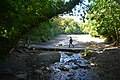
 Bridge over the Gannel at Crantock Beach (6051).jpg 4,288 × 2,848; 6.39 MB
-
 Bridge over the Gannel at Crantock Beach (6053).jpg 4,288 × 2,848; 6.27 MB
-
 Cauliflowers near Treringey - geograph.org.uk - 1844575.jpg 640 × 480; 99 KB
-
 Church Town Cottage, Crantock.jpg 3,601 × 5,402; 9.27 MB
-
 Coast path near Crantock Beach - geograph.org.uk - 1844769.jpg 640 × 480; 79 KB
-
 Coast viewed from Pentire Point West - geograph.org.uk - 1844774.jpg 640 × 480; 71 KB
-
 Corn marigold on Pentire West Point - geograph.org.uk - 2510331.jpg 1,094 × 1,500; 133 KB
-
 Corn marigolds and poppies - geograph.org.uk - 960115.jpg 640 × 427; 138 KB
-

-
 Corn marigolds at Porth Joke - geograph.org.uk - 2510318.jpg 1,500 × 984; 368 KB
-
 Corn Marigolds at West Pentire - geograph.org.uk - 4071571.jpg 640 × 480; 92 KB
-
 Corn marigolds by the footpath - geograph.org.uk - 2510326.jpg 1,500 × 1,000; 317 KB
-
 Corn Marigolds ^ Poppies at West Pentire - geograph.org.uk - 4071593.jpg 640 × 480; 117 KB
-
 Cornish hedge on Pentire Point West - geograph.org.uk - 1313723.jpg 640 × 480; 93 KB
-
 Cornwall Newquay Crantock beach.jpg 5,000 × 3,324; 11.91 MB
-
 Cowslips (Primula veris) - geograph.org.uk - 1864912.jpg 479 × 640; 133 KB
-

-

-
 Crantock Beach (0506).jpg 4,288 × 2,848; 4.75 MB
-
 Crantock Beach (6037).jpg 4,288 × 2,848; 6.58 MB
-
 Crantock Beach (6039).jpg 4,288 × 2,848; 6.37 MB
-
 Crantock Beach (6040).jpg 4,288 × 2,848; 6.16 MB
-
 Crantock Beach (6043).jpg 4,288 × 2,848; 6.01 MB
-
 Crantock Beach (6044).jpg 4,288 × 2,848; 5.65 MB
-
 Crantock Beach (6045).jpg 4,288 × 2,848; 6.54 MB
-
 Crantock Beach (6046).jpg 4,288 × 2,848; 5.62 MB
-
 Crantock Beach (6054).jpg 4,288 × 2,848; 5.59 MB
-
 Crantock Beach (6055).jpg 4,288 × 2,848; 4.95 MB
-
 Crantock Beach (6056).jpg 4,288 × 2,848; 4.28 MB
-
 Crantock Beach (6057).jpg 4,288 × 2,848; 4.99 MB
-
 Crantock Beach (6058).jpg 4,288 × 2,848; 6.48 MB
-
 Crantock Beach (6059).jpg 4,288 × 2,848; 5.67 MB
-
 Crantock Beach (6060).jpg 4,288 × 2,848; 6.39 MB
-
 Crantock Beach (6061).jpg 4,288 × 2,848; 5.03 MB
-
 Crantock Beach (6062).jpg 4,288 × 2,848; 4.35 MB
-
 Crantock Beach (6063).jpg 4,288 × 2,848; 4.82 MB
-
 Crantock Beach (6064).jpg 4,288 × 2,848; 6.32 MB
-
 Crantock Beach (6065).jpg 4,288 × 2,848; 6.94 MB
-
 Crantock Beach (6066).jpg 4,288 × 2,848; 6.4 MB
-
 Crantock Beach - geograph.org.uk - 1844771.jpg 640 × 480; 43 KB
-
 Crantock Beach - geograph.org.uk - 3024481.jpg 2,160 × 432; 267 KB
-
 Crantock Beach from The Warren - geograph.org.uk - 2502841.jpg 1,500 × 1,000; 225 KB
-
 Crantock Beach, Newquay - geograph.org.uk - 6206400.jpg 1,024 × 768; 225 KB
-
 Crantock bus shelter - geograph.org.uk - 885582.jpg 640 × 480; 80 KB
-
 Crantock Church - geograph.org.uk - 2806844.jpg 2,592 × 1,944; 1.14 MB
-
 Crantock Ford - geograph.org.uk - 4680507.jpg 6,000 × 4,000; 6.34 MB
-
 Crantock Holy Well Cornwall - geograph.org.uk - 879606.jpg 640 × 427; 133 KB
-
 Crantock Memorial Hall - geograph.org.uk - 2502958.jpg 1,500 × 1,000; 259 KB
-
 Crantock Plains Touring Park - geograph.org.uk - 1775611.jpg 640 × 480; 90 KB
-
 Crantock Sands holiday park - geograph.org.uk - 1712013.jpg 640 × 427; 37 KB
-
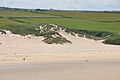
 Crantook bay dunes.jpg 3,072 × 1,728; 794 KB
-
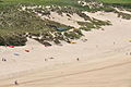
 Dunes by Crantock Beach - geograph.org.uk - 2502848.jpg 1,500 × 1,000; 169 KB
-
 Entrance to the Crantock Round Garden - geograph.org.uk - 885524.jpg 640 × 480; 121 KB
-
 Farmland and sand cliffs, Crantock - geograph.org.uk - 6144406.jpg 1,024 × 768; 258 KB
-
 Farmland, Cubert - geograph.org.uk - 6144418.jpg 1,024 × 768; 248 KB
-
 Field at West Pentire - geograph.org.uk - 1864923.jpg 640 × 480; 80 KB
-
 Field boundary at West Pentire - geograph.org.uk - 6191645.jpg 480 × 640; 95 KB
-
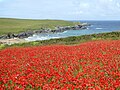 Field of poppies above Porth Joke beach - geograph.org.uk - 6191636.jpg 640 × 480; 109 KB
-
-
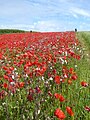
 Field of poppies at West Pentire - geograph.org.uk - 6191652.jpg 480 × 640; 114 KB
-
 Footbridge at head of Porth Joke near W Pentire - geograph.org.uk - 5247219.jpg 5,184 × 2,920; 5.56 MB
-
 Footbridge over the River Gannel - geograph.org.uk - 1842728.jpg 640 × 480; 79 KB
-
 Footbridge over the River Gannel, Newquay - geograph.org.uk - 4454028.jpg 2,448 × 1,624; 1.13 MB
-
 Footpath down to Porth Joke - geograph.org.uk - 2510310.jpg 1,500 × 1,000; 257 KB
-
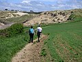
 Footpath to West Pentire - geograph.org.uk - 2510837.jpg 1,500 × 995; 284 KB
-
 Gannet off Pentire Point West (6071).jpg 4,288 × 2,848; 6.69 MB
-
 Gannet off Pentire Point West (6072).jpg 4,288 × 2,848; 6.64 MB
-
 Gannet off Pentire Point West (6073).jpg 4,288 × 2,848; 6.01 MB
-
 Gannet off Pentire Point West (6074).jpg 4,288 × 2,848; 6.18 MB
-
 Gannet off Pentire Point West (6075).jpg 4,288 × 2,848; 6.43 MB
-
 Gates to Porth Joke beach - geograph.org.uk - 2510236.jpg 1,500 × 1,000; 288 KB
-
 Great Weston, Crantock.jpg 4,000 × 6,000; 8.98 MB
-
 High tide on Crantock Beach - geograph.org.uk - 6277529.jpg 1,024 × 768; 671 KB
-
 Holywell Bay - geograph.org.uk - 138034.jpg 640 × 427; 86 KB
-
 Inlet at Penpol - geograph.org.uk - 1844591.jpg 640 × 480; 99 KB
-

-
 K6 Telephone Kiosk, Crantock.jpg 3,296 × 4,944; 8.45 MB
-
 Kidney vetch on Pentire West Point - geograph.org.uk - 2510176.jpg 1,500 × 935; 383 KB
-
 Kissing gate on coast path SW of Crantock Beach - geograph.org.uk - 5247227.jpg 5,184 × 2,920; 5.75 MB
-
 Kissing gate on the Southwest Coast Path - geograph.org.uk - 2507610.jpg 1,500 × 1,000; 276 KB
-
 Kissing gate on the Southwest Coast Path - geograph.org.uk - 2510218.jpg 1,500 × 1,000; 413 KB
-
 Lamb feeder near Trevemper - geograph.org.uk - 1842763.jpg 640 × 480; 87 KB
-

-
 Looking across a field of poppies towards Crantock Beach - geograph.org.uk - 2510835.jpg 1,500 × 1,000; 288 KB
-

-

-
 Looking across a field towards Vugga Cove - geograph.org.uk - 2505951.jpg 1,500 × 1,000; 226 KB
-

-

-

-
 Looking in to the Crantock Round Garden - geograph.org.uk - 885521.jpg 640 × 480; 118 KB
-
 Marker on the Southwest Coast Path - geograph.org.uk - 2507604.jpg 1,500 × 1,000; 270 KB
-
 Milk churns and phone box - geograph.org.uk - 2502948.jpg 1,500 × 1,000; 328 KB
-
 Montrose House, Crantock.jpg 3,554 × 5,331; 8.15 MB
-
 Newquay viewed from the south - geograph.org.uk - 1844580.jpg 640 × 480; 74 KB
-
 Old Albion Inn, Crantock.jpg 5,534 × 3,689; 7.54 MB
-

-
 On Pentire Point West - geograph.org.uk - 1844772.jpg 640 × 480; 73 KB
-
 Pasture on the road to Crantock - geograph.org.uk - 1775640.jpg 640 × 480; 101 KB
-
 Pasture, Crantock - geograph.org.uk - 6144408.jpg 1,024 × 768; 255 KB
-
 Peacock butterfly (Inachis io) - geograph.org.uk - 1864937.jpg 640 × 481; 136 KB
-
 Penlyn, Crantock.jpg 4,000 × 6,000; 11.35 MB
-
 Pentire Point West (0507).jpg 4,288 × 2,848; 5.73 MB
-
 Pentire Point West - geograph.org.uk - 6277532.jpg 1,024 × 761; 673 KB
-
 Pentire Point West and The Goose, Crantock - geograph.org.uk - 6144403.jpg 1,024 × 768; 165 KB
-
 Pentire Point West, near Newquay - geograph.org.uk - 649861.jpg 640 × 469; 50 KB
-
 Polly Joke campsite - geograph.org.uk - 690214.jpg 640 × 427; 194 KB
-

-

-
 Poppies at West Pentire - geograph.org.uk - 6191641.jpg 640 × 480; 97 KB
-

-
 Porth Joke (6076).jpg 4,288 × 2,848; 6.32 MB
-
 Porth Joke (6078).jpg 4,288 × 2,848; 6.78 MB
-
 Porth Joke (6079).jpg 4,288 × 2,848; 6.25 MB
-
 Porth Joke (6080).jpg 4,288 × 2,848; 6.71 MB
-
 Porth Joke (6081).jpg 4,288 × 2,848; 6.25 MB
-
 Porth Joke (6085).jpg 4,288 × 2,848; 6.96 MB
-
 Porth Joke (6086).jpg 4,288 × 2,848; 6.45 MB
-
 Porth Joke (6087).jpg 4,288 × 2,848; 5.73 MB
-
 Porth Joke (6088).jpg 4,288 × 2,848; 5.26 MB
-
 Porth Joke (6089).jpg 4,288 × 2,848; 6.47 MB
-
 Porth Joke - geograph.org.uk - 1844775.jpg 640 × 480; 70 KB
-
 Porth Joke - geograph.org.uk - 1864851.jpg 640 × 480; 106 KB
-
 Porth Joke - geograph.org.uk - 2510214.jpg 1,500 × 1,000; 208 KB
-
 Porth Joke - geograph.org.uk - 2608268.jpg 640 × 480; 50 KB
-
 Porth Joke beach - geograph.org.uk - 2510239.jpg 1,500 × 993; 314 KB
-
 Porth Joke from the Southwest Coast Path - geograph.org.uk - 2510224.jpg 1,500 × 983; 220 KB
-
 Porth Joke near W Pentire - geograph.org.uk - 5247221.jpg 5,184 × 2,920; 5.1 MB
-
 Porth Joke. - panoramio (1).jpg 3,648 × 2,736; 4.08 MB
-
 Porth Joke. - panoramio.jpg 2,816 × 2,112; 2.67 MB
-

-
 Remains of boat near The Gannel - geograph.org.uk - 875518.jpg 480 × 640; 133 KB
-
 River Gannel and Crantock beach, Newquay, Cornwall panorama 2 by Thomas Tolkien (14683579345).jpg 15,053 × 5,349; 13.34 MB
-
 River Gannel and Crantock beach, Newquay, Cornwall panorama by Thomas Tolkien (14680384021).jpg 11,868 × 6,916; 17.36 MB
-
 Rocks below cliff, Porth Joke, 1975 - geograph.org.uk - 4284479.jpg 427 × 640; 118 KB
-
 Rocky coastline in Porth Joke - geograph.org.uk - 2510189.jpg 1,500 × 1,000; 254 KB
-
 Sand dunes, Crantock Beach - geograph.org.uk - 1844765.jpg 640 × 480; 69 KB
-
 Sea Pink or Thrift (Armeria maritima) - geograph.org.uk - 1864840.jpg 640 × 480; 141 KB
-
 Sheep near Treringay - geograph.org.uk - 1844578.jpg 640 × 480; 91 KB
-
 Ship Inn Farmhouse, Crantock.jpg 3,697 × 5,545; 7.31 MB
-
 Small barn at Trevemper - geograph.org.uk - 1775551.jpg 640 × 480; 91 KB
-
 Small cove facing Crantock Beach - geograph.org.uk - 2507596.jpg 1,500 × 1,000; 291 KB
-
 St Ambrusca's Holy Well Crantock - geograph.org.uk - 879622.jpg 640 × 427; 193 KB
-
 St Carantoc's church, Crantock - geograph.org.uk - 3214458.jpg 1,600 × 1,067; 344 KB
-
 Thatching - geograph.org.uk - 138292.jpg 640 × 406; 94 KB
-
 The Bowgie at West Pentire - geograph.org.uk - 2510843.jpg 1,500 × 1,000; 215 KB
-
 The Chick (6068).jpg 4,288 × 2,848; 5.66 MB
-
 The Chick and Kelsey Head (6077).jpg 4,288 × 2,848; 6.42 MB
-
 The Chick, off Kelsey Head - geograph.org.uk - 690203.jpg 640 × 427; 252 KB
-
 The coast path near Crantock - geograph.org.uk - 1844593.jpg 640 × 480; 102 KB
-
 The entrance to Trevella Park - geograph.org.uk - 1775598.jpg 640 × 480; 90 KB
-
 The Gannel above Crantock Beach (6049).jpg 4,288 × 2,848; 5.94 MB
-
 The Gannel above Crantock Beach (6050).jpg 4,288 × 2,848; 6.45 MB
-
 The Gannel above Crantock Beach (6052).jpg 4,288 × 2,848; 5.97 MB
-
 The Gannel estuary - geograph.org.uk - 1844592.jpg 640 × 480; 65 KB
-
 The Gannel estuary at low tide, Crantock - geograph.org.uk - 4969396.jpg 1,500 × 1,125; 230 KB
-
 The Gannel estuary, Crantock , near Newquay, Cornwall. (17973463099).jpg 3,896 × 2,183; 2.5 MB
-
 The Gannel estuary, Crantock , near Newquay, Cornwall. (18160793091).jpg 3,831 × 2,051; 1.97 MB
-
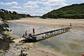
 The Gannel Ferry - geograph.org.uk - 6277528.jpg 1,024 × 652; 607 KB
-
 The Goose. - geograph.org.uk - 289522.jpg 640 × 472; 127 KB
-
 The Hatch, Crantock.jpg 3,648 × 5,472; 9.3 MB
-
 The Hermitage, Crantock.jpg 3,742 × 5,613; 11.51 MB
-
 The Old Albion Inn, Crantock, near Newquay, Cornwall - geograph.org.uk - 4969107.jpg 1,431 × 1,093; 763 KB
-
 The Old Malt House, Crantock.jpg 3,554 × 5,331; 8.73 MB
-
 The parish church of St. Carantoc, Crantock, Cornwall - geograph.org.uk - 4969087.jpg 1,500 × 1,106; 880 KB
-
 The River Gannel, Newquay - geograph.org.uk - 4454025.jpg 2,448 × 1,624; 1.19 MB
-
 The Rushy Green, Crantoc - geograph.org.uk - 2806860.jpg 2,592 × 1,944; 946 KB
-
 The Southwest Coast Path at Pentire Point West - geograph.org.uk - 2507585.jpg 1,500 × 983; 297 KB
-
 The Southwest Coast Path at Pentire Point West - geograph.org.uk - 2507628.jpg 1,500 × 1,000; 220 KB
-
 The Southwest Coast Path at Porth Joke - geograph.org.uk - 2510216.jpg 1,500 × 972; 195 KB
-
 The Southwest Coast Path at West Pentire - geograph.org.uk - 2505956.jpg 1,500 × 1,000; 247 KB
-
 The Southwest Coast Path on Pentire Point West - geograph.org.uk - 2509140.jpg 1,500 × 994; 319 KB
-
 The Southwest Coast Path to Crantock - geograph.org.uk - 2507608.jpg 1,500 × 1,000; 285 KB
-
 The Southwest Coast Path to Crantock - geograph.org.uk - 2507622.jpg 1,500 × 1,000; 220 KB
-
 The Southwest Coast Path to Pentire West Point - geograph.org.uk - 2510179.jpg 1,500 × 974; 179 KB
-
 The Southwest Coast Path to Porth Joke - geograph.org.uk - 2510173.jpg 1,500 × 1,000; 196 KB
-
-
 The village green in Crantock - geograph.org.uk - 2502966.jpg 1,500 × 1,000; 188 KB
-
 Thrift in the rock - geograph.org.uk - 2509136.jpg 1,500 × 1,074; 406 KB
-
 Thrift on Pentire Point West - geograph.org.uk - 2507631.jpg 1,500 × 999; 324 KB
-
 Towan Head and Fistral Beach - geograph.org.uk - 1834.jpg 576 × 432; 25 KB
-
 Track above the River Gannel - geograph.org.uk - 1842739.jpg 640 × 480; 103 KB
-
 Trevose Head and the Goose (6067).jpg 4,288 × 2,848; 6.1 MB
-
 Two snails - geograph.org.uk - 392046.jpg 640 × 480; 95 KB
-
 View to Pentire across the mouth of The Gannel - geograph.org.uk - 5247237.jpg 5,184 × 2,920; 5.52 MB
-
 Village Well, Crantock.jpg 3,671 × 5,507; 7.73 MB
-
 Wall on the point - geograph.org.uk - 2510197.jpg 1,500 × 1,000; 316 KB
-
 West Pentire - geograph.org.uk - 749832.jpg 640 × 480; 84 KB
-
 West Pentire Road in Crantock - geograph.org.uk - 2502979.jpg 1,500 × 1,000; 237 KB
-
 Wild flowers at West Pentire - geograph.org.uk - 3565769.jpg 640 × 480; 128 KB
-
 Wild flowers at West Pentire - geograph.org.uk - 3565778.jpg 427 × 640; 127 KB
-
 Wild flowers at West Pentire - geograph.org.uk - 4071556.jpg 640 × 480; 106 KB
-
 Wild flowers at West Pentire - geograph.org.uk - 4071581.jpg 640 × 480; 86 KB
-
 Wild flowers on West Pentire - geograph.org.uk - 4071590.jpg 640 × 480; 160 KB
-
 Wild poppy at West Pentire - geograph.org.uk - 3565779.jpg 640 × 427; 48 KB
-
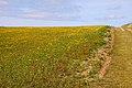
 A field of red and yellow - geograph.org.uk - 960127.jpg 640 × 427; 93 KB


.jpg)
.jpg)


_-_geograph.org.uk_-_1864912.jpg)


.jpg)
.jpg)
.jpg)
.jpg)
.jpg)
.jpg)
.jpg)
.jpg)
.jpg)
.jpg)
.jpg)
.jpg)
.jpg)
.jpg)
.jpg)
.jpg)
.jpg)
.jpg)
.jpg)
.jpg)
.jpg)


.jpg)
.jpg)
.jpg)
.jpg)
.jpg)


_-_geograph.org.uk_-_1864937.jpg)

.jpg)


_Joke_beach,_Cornwall_1979_-_geograph.org.uk_-_5165859.jpg)
.jpg)
.jpg)
.jpg)
.jpg)
.jpg)
.jpg)
.jpg)
.jpg)
.jpg)
.jpg)


.jpg)


.jpg)


_-_geograph.org.uk_-_1864840.jpg)


.jpg)
.jpg)


.jpg)
.jpg)
.jpg)


.jpg)
.jpg)


.jpg)


.jpg)