Category:Craigavon Borough Council
Jump to navigation
Jump to search

local council in counties Armagh, Down and Antrim, in Northern Ireland ,_September_2009.JPG)  | |||||
| Upload media | |||||
| Instance of |
| ||||
|---|---|---|---|---|---|
| Location | Northern Ireland | ||||
| Capital | |||||
| Population |
| ||||
| Area |
| ||||
| Religion or worldview | |||||
| official website | |||||
 | |||||
English: Should only contain files relating to Craigavon Borough Council itself eg facilities, activities, members etc
Subcategories
This category has the following 5 subcategories, out of 5 total.
Media in category "Craigavon Borough Council"
The following 119 files are in this category, out of 119 total.
-
 Bantam tug, Lough Neagh - geograph.org.uk - 857031.jpg 640 × 413; 92 KB
-
 Brackagh Moss - geograph.org.uk - 1327710.jpg 640 × 480; 109 KB
-
 Brackagh moss - geograph.org.uk - 1327940.jpg 480 × 640; 145 KB
-
 Brackagh Moss - geograph.org.uk - 1327964.jpg 640 × 480; 155 KB
-
 Brackagh Moss - geograph.org.uk - 1327979.jpg 480 × 640; 135 KB
-
 Brackagh Moss - geograph.org.uk - 1327988.jpg 640 × 480; 135 KB
-
 Brackagh Moss - geograph.org.uk - 1328008.jpg 640 × 480; 122 KB
-
 Brackagh Moss - geograph.org.uk - 1328016.jpg 640 × 480; 135 KB
-
 Brackagh Moss - geograph.org.uk - 1328023.jpg 640 × 480; 110 KB
-
-
 Cattle Grid - geograph.org.uk - 1549059.jpg 640 × 480; 101 KB
-

-

-

-

-

-
-

-
 Craigavon (01), September 2009.JPG 4,272 × 2,848; 3.85 MB
-
 Craigavon (Balancing) Lakes - geograph.org.uk - 1338352.jpg 640 × 480; 82 KB
-
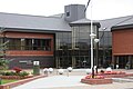
 Craigavon Civic and Conference Centre.jpg 640 × 480; 85 KB
-
 Craigavon Water Sports Centre, 2 - geograph.org.uk - 1701871.jpg 640 × 480; 62 KB
-
 Craigavon Water Sports Centre, 3 - geograph.org.uk - 1701884.jpg 640 × 480; 80 KB
-
 Craigavon Watersports Centre, 1 - geograph.org.uk - 1701863.jpg 640 × 480; 86 KB
-
 Debenhams, Craigavon - geograph.org.uk - 1448609.jpg 640 × 480; 63 KB
-
 Directional Sign - geograph.org.uk - 844176.jpg 640 × 480; 120 KB
-

-

-

-

-

-

-

-

-

-

-

-

-
-

-

-
 Drumcree Parish Church - geograph.org.uk - 1158995.jpg 480 × 640; 40 KB
-

-
 Esther's Coffee Shop and Restaurant - geograph.org.uk - 1281775.jpg 640 × 480; 82 KB
-
 Flooded field at Derrymacash - geograph.org.uk - 1591464.jpg 640 × 422; 73 KB
-
 Flooding at Derrymacash - geograph.org.uk - 1591454.jpg 640 × 480; 89 KB
-
 Flooding near Portadown - geograph.org.uk - 1590638.jpg 640 × 394; 108 KB
-
 Former Portadown College - geograph.org.uk - 1093247.jpg 640 × 480; 80 KB
-
 Garden waste - geograph.org.uk - 1202966.jpg 640 × 480; 64 KB
-
 How's Meadow - geograph.org.uk - 787448.jpg 640 × 480; 112 KB
-

-
 Lough Neagh - geograph.org.uk - 1210613.jpg 640 × 479; 47 KB
-
 Lychgate of Tartaraghan Parish Church - geograph.org.uk - 1517949.jpg 640 × 480; 117 KB
-
 Lylo Chapel - geograph.org.uk - 1373668.jpg 640 × 480; 89 KB
-
 Magowan West shopping centre - geograph.org.uk - 1509247.jpg 640 × 480; 50 KB
-
 Magowan West shopping centre - geograph.org.uk - 1509261.jpg 640 × 480; 61 KB
-
 Magowan West shopping centre - geograph.org.uk - 1509420.jpg 480 × 640; 68 KB
-
 Marley Street car park Portadown - geograph.org.uk - 1509399.jpg 640 × 480; 49 KB
-
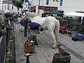
 Metal Waves Sculpture - geograph.org.uk - 890848.jpg 640 × 480; 83 KB
-
 Mill pond at Aghagallon - geograph.org.uk - 715909.jpg 640 × 480; 72 KB
-
-

-

-
-

-

-
 Mill Race - geograph.org.uk - 715925.jpg 640 × 480; 130 KB
-

-
-
 Mural of Workhouse, Union Street, Lurgan - geograph.org.uk - 761701.jpg 640 × 480; 111 KB
-
 Mural, Union Street, Lurgan - geograph.org.uk - 761706.jpg 640 × 480; 91 KB
-
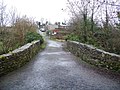
 Narrow bridge - geograph.org.uk - 1051607.jpg 640 × 426; 126 KB
-
 Ornament - geograph.org.uk - 739055.jpg 640 × 480; 82 KB
-

-

-
 Oxford Island's Reedbeds - geograph.org.uk - 748158.jpg 640 × 480; 57 KB
-
 Pair of swans, Lough Neagh - geograph.org.uk - 1210610.jpg 640 × 479; 38 KB
-
-
 Path to Kinnegoe Bay Bird Hide - geograph.org.uk - 748122.jpg 640 × 480; 123 KB
-
 Pillbox, Cranny Road, Craigavon - geograph.org.uk - 748632.jpg 640 × 480; 65 KB
-
 Plaque at Lough Neagh Discovery Centre - geograph.org.uk - 748614.jpg 640 × 480; 104 KB
-

-
 Portmore Lough - geograph.org.uk - 1133245.jpg 640 × 427; 78 KB
-
 Recycling of waste oil - geograph.org.uk - 1202969.jpg 640 × 285; 42 KB
-
 Remembering the fisherfolk - geograph.org.uk - 1160409.jpg 640 × 480; 120 KB
-
 Ripening Corn, Boggle Hill Road - geograph.org.uk - 863335.jpg 640 × 480; 87 KB
-
 Roundabout on Central Way, Craigavon - geograph.org.uk - 1216044.jpg 640 × 427; 91 KB
-
 Russell plaque, Lurgan - geograph.org.uk - 1528645.jpg 640 × 453; 72 KB
-

-
 Sculpture of a Fish - geograph.org.uk - 836582.jpg 640 × 480; 113 KB
-
 Sign on Ballynacor Lane - geograph.org.uk - 1591517.jpg 640 × 480; 127 KB
-
 Sink Garden - geograph.org.uk - 739063.jpg 640 × 480; 125 KB
-
 Stables and bothy - geograph.org.uk - 1085592.jpg 640 × 480; 127 KB
-
 Swans don't mind the floods^ - geograph.org.uk - 1591477.jpg 640 × 480; 120 KB
-

-
 Tartaraghan Church from a distance - geograph.org.uk - 1153920.jpg 640 × 480; 370 KB
-

-
 Terrace View, Waringstown - geograph.org.uk - 1432628.jpg 640 × 413; 96 KB
-
 Thatched house near Magheralin - geograph.org.uk - 877677.jpg 640 × 411; 100 KB
-
 The Civic Centre Craigavon - geograph.org.uk - 1340193.jpg 640 × 480; 74 KB
-
 The Lagan at Donaghcloney - geograph.org.uk - 1051578.jpg 640 × 426; 114 KB
-
 The old Regal Cinema Portadown - geograph.org.uk - 1509407.jpg 640 × 480; 64 KB
-

-
 The pond in Hoy's Meadow - geograph.org.uk - 787427.jpg 640 × 480; 120 KB
-
 The tunnel at Hoy's Meadow - geograph.org.uk - 787442.jpg 640 × 480; 116 KB
-
 The Tunnel leading to Obin Street - geograph.org.uk - 1501882.jpg 640 × 480; 94 KB
-

-

-
 The weir at Donaghcloney - geograph.org.uk - 1591079.jpg 640 × 480; 104 KB
-
 Unfinished Chalet House at Kiln Lane. - geograph.org.uk - 527943.jpg 640 × 480; 77 KB
-

-
 Waringstown post office - geograph.org.uk - 1433203.jpg 640 × 408; 112 KB
-
 Warning signs - geograph.org.uk - 1085525.jpg 640 × 480; 93 KB
-
-
 Waves on Lough Neagh - geograph.org.uk - 890854.jpg 640 × 480; 80 KB
-
 Waves sculpture, Lough Neagh - geograph.org.uk - 1210612.jpg 640 × 479; 45 KB
-
 Welcome to Waringstown Sign. - geograph.org.uk - 567696.jpg 640 × 480; 92 KB
-

-
 Wright's Petrol Station - geograph.org.uk - 568714.jpg 640 × 480; 61 KB


_Lakes_-_geograph.org.uk_-_1338352.jpg)


