Category:County roads in Wisconsin
Jump to navigation
Jump to search
States of the United States: Alabama · Arkansas · California · Colorado · Florida · Hawaii · Illinois · Indiana · Iowa · Louisiana · Michigan · Minnesota · Mississippi · Missouri · Nevada · New Jersey · New Mexico · New York · North Dakota · Ohio · South Dakota · Texas · Utah · Washington · Wisconsin · Wyoming
Subcategories
This category has the following 6 subcategories, out of 6 total.
P
Media in category "County roads in Wisconsin"
The following 19 files are in this category, out of 19 total.
-
 County Road J Comstock Bog-Meadow State Natural Area Montello Wisconsin (32026528316).jpg 5,640 × 3,331; 11.98 MB
-
 County Trunk Highway A Overpass - panoramio (1).jpg 4,896 × 3,672; 5.76 MB
-
 County Trunk Highway CV - panoramio.jpg 4,896 × 3,193; 5.32 MB
-
 County Trunk Highway ID - panoramio.jpg 4,896 × 3,672; 5.79 MB
-
 County Trunk Highway KP - panoramio.jpg 4,608 × 3,456; 3.15 MB
-
 County Trunk Highway O Overpass - panoramio (1).jpg 4,896 × 3,672; 5.58 MB
-
 County Trunk Highway P - panoramio (2).jpg 4,887 × 3,063; 4.41 MB
-
 County Trunk Highway P - panoramio (3).jpg 4,859 × 3,110; 4.83 MB
-
 County Trunk Highway P at Enchanted Valley Road - panoramio.jpg 4,362 × 3,606; 4.89 MB
-
 County Trunk Highway P at Hillpoint Road - panoramio.jpg 4,877 × 3,232; 5.68 MB
-
 CountyPPwestSign-Int43ramp (34220314435).jpg 2,400 × 1,600; 1.41 MB
-
 CTH-AnRoadSign (29844788855).jpg 2,400 × 1,600; 2.43 MB
-
 Entering Roxbury on CTH Y.JPG 4,000 × 3,000; 2.53 MB
-
 Farm on Hwy M - panoramio.jpg 4,429 × 3,483; 4.81 MB
-
 Junction of county trunks P and S, Gregorville, Wisconsin.jpg 4,000 × 3,000; 3.61 MB
-
 Looking West On County Trunk Highway V - panoramio.jpg 4,896 × 3,672; 5.09 MB
-
 New Dell Creek channel via County Highway A draining Lake Delton.jpg 2,592 × 3,872; 7.24 MB
-
 Wisconsin Track Length and Predicted Track Length.png 1,158 × 752; 240 KB
-
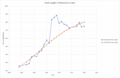 Wisconsin Track Length.png 2,066 × 1,342; 623 KB
.jpg)
.jpg)


.jpg)
.jpg)
.jpg)


.jpg)
.jpg)


