Category:Council area boundaries in Glasgow
Jump to navigation
Jump to search
Subcategories
This category has the following 6 subcategories, out of 6 total.
A
- Auchenshuggle Bridge (7 F)
D
- Dalmarnock Bridge (10 F)
- Dalmarnock railway bridge (8 F)
R
- Rutherglen Bridge (7 F)
S
- Shawfield Stadium (10 F)
W
- Westburn Viaduct (4 F)
Media in category "Council area boundaries in Glasgow"
The following 21 files are in this category, out of 21 total.
-
 Beneath the Clydeford Bridge - geograph.org.uk - 1359090.jpg 640 × 480; 153 KB
-
 Bogleshole Road Bridge. - geograph.org.uk - 962077.jpg 640 × 480; 65 KB
-
 Boy Wonder - geograph.org.uk - 5093014.jpg 1,600 × 900; 215 KB
-
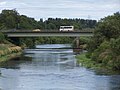
 Cambuslang Bridge (geograph 5316987).jpg 1,600 × 1,200; 581 KB
-
 Cambuslang Bridge - geograph.org.uk - 1304496.jpg 640 × 480; 92 KB
-
 Carmyle Heron by the Clyde - geograph.org.uk - 131398.jpg 640 × 480; 124 KB
-
 Clyde between Cambuslang and Carmyle - geograph.org.uk - 1321997.jpg 640 × 480; 110 KB
-
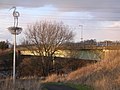
 Clydeford Bridge - geograph.org.uk - 1304440.jpg 640 × 359; 108 KB
-
 Clydeford Bridge - geograph.org.uk - 2635825.jpg 640 × 480; 80 KB
-
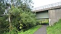
 Clydeford Road Bridge. - geograph.org.uk - 962083.jpg 640 × 480; 69 KB
-

-
 Former Spittal Sports Ground - geograph.org.uk - 5410033.jpg 640 × 480; 139 KB
-
 King of the Castle, Fernhill Road - geograph.org.uk - 4121399.jpg 3,456 × 5,184; 6.49 MB
-
 Leaving Glasgow on Robroyston Road - geograph.org.uk - 1336433.jpg 640 × 480; 117 KB
-
 On Cambuslang Bridge (geograph 6657484).jpg 1,600 × 1,200; 487 KB
-

-
 Railway Bridge near Carmyle (geograph 1697931).jpg 1,024 × 768; 248 KB
-
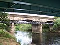 Railway Viaduct near Carmyle. - geograph.org.uk - 962075.jpg 640 × 480; 94 KB
-
 River Clyde - geograph.org.uk - 2484829.jpg 640 × 480; 242 KB
-
 River Clyde near Cambuslang - geograph.org.uk - 4495663.jpg 3,504 × 2,336; 3.03 MB
-
 Tree in island on Great Western Road - geograph.org.uk - 711352.jpg 640 × 480; 54 KB


.jpg)


.jpg)

.jpg)


