Category:Cottisford
Jump to navigation
Jump to search
village and civil parish in Cherwell district, Oxfordshire, England  | |||||
| Upload media | |||||
| Instance of | |||||
|---|---|---|---|---|---|
| Location | Cherwell, Oxfordshire, South East England, England | ||||
| Population |
| ||||
| Area |
| ||||
 | |||||
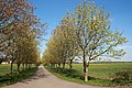
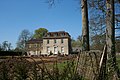
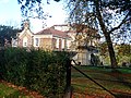
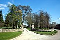
Cottisford is a village and civil parish in Oxfordshire, about 3.5 miles (about 5.5 km) south of Brackley in neighbouring Northamptonshire.
Subcategories
This category has only the following subcategory.
Media in category "Cottisford"
The following 79 files are in this category, out of 79 total.
-
 A43 by Cottisford - geograph.org.uk - 5805131.jpg 1,600 × 1,066; 447 KB
-
 A43 northbound near Barley Mow - geograph.org.uk - 2987662.jpg 640 × 480; 47 KB
-
 A43 northbound near Cottisford - geograph.org.uk - 2987646.jpg 640 × 480; 33 KB
-
 A43 south of Barley Mow Farm - geograph.org.uk - 3342356.jpg 3,519 × 2,584; 1.01 MB
-
 A43 towards Northampton - geograph.org.uk - 2987651.jpg 640 × 480; 47 KB
-
 Allotments at Juniper Hill - geograph.org.uk - 5178521.jpg 1,024 × 768; 176 KB
-
 Approach to Heath Farm - geograph.org.uk - 1877135.jpg 3,888 × 2,592; 4.16 MB
-
 Approaching Cottisford - geograph.org.uk - 1836434.jpg 1,852 × 1,434; 948 KB
-
 Bare field near Juniper Hill - geograph.org.uk - 5175652.jpg 1,024 × 768; 267 KB
-
 Barn Refurbishment, Cottisford - geograph.org.uk - 2083447.jpg 3,888 × 2,592; 2.46 MB
-
 Buckingham Lane byway - geograph.org.uk - 5811307.jpg 1,600 × 1,066; 408 KB
-
 Cherwell , Roadside - geograph.org.uk - 6113558.jpg 6,000 × 4,000; 6.93 MB
-
 Cherwell , The A43 - geograph.org.uk - 6113557.jpg 6,000 × 4,000; 7.16 MB
-
 Cherwell , The A43 - geograph.org.uk - 6113560.jpg 6,000 × 4,000; 7.71 MB
-
 Juniper Hill - geograph.org.uk - 344125.jpg 640 × 480; 136 KB
-
 Juniper Hill - geograph.org.uk - 344132.jpg 640 × 480; 121 KB
-
 Kennel cottages, Cottisford - geograph.org.uk - 344203.jpg 640 × 480; 64 KB
-
 Cottisford Bridge - geograph.org.uk - 344188.jpg 428 × 640; 135 KB
-
 Cottisford Bus Stop - geograph.org.uk - 344169.jpg 640 × 480; 116 KB
-
 Cottisford Church - geograph.org.uk - 1901234.jpg 3,656 × 2,560; 3.14 MB
-
 Cottisford Crossroads - geograph.org.uk - 344171.jpg 640 × 501; 130 KB
-
 Cottisford House - geograph.org.uk - 1901207.jpg 3,888 × 2,592; 2.92 MB
-
 Cottisford House - geograph.org.uk - 4247416.jpg 4,320 × 3,240; 6.56 MB
-
 Daisies by the A43 - geograph.org.uk - 5805130.jpg 1,600 × 1,066; 554 KB
-
 Electricity cables by the Seven Shires Way - geograph.org.uk - 5804123.jpg 1,066 × 1,600; 389 KB
-
 Entrance to Cottisford - geograph.org.uk - 2737604.jpg 640 × 480; 115 KB
-
 Entrance to Cottisford House - geograph.org.uk - 1953201.jpg 3,888 × 2,592; 3.49 MB
-
 Field Corner with Blobs - geograph.org.uk - 1877148.jpg 2,048 × 1,536; 901 KB
-
 Footpath across Hardwick Heath - geograph.org.uk - 4116400.jpg 1,024 × 768; 154 KB
-
 Footpath across Hardwick Heath - geograph.org.uk - 4116402.jpg 1,024 × 768; 199 KB
-
 Footpath into Juniper Hill - geograph.org.uk - 5804121.jpg 1,600 × 1,066; 588 KB
-
 Footpath to Cottisford - geograph.org.uk - 5804097.jpg 1,600 × 1,066; 496 KB
-
 Footpath to Cottisford - geograph.org.uk - 5804102.jpg 1,600 × 1,066; 527 KB
-
 Footpath to Cottisford - geograph.org.uk - 5804108.jpg 1,600 × 1,066; 604 KB
-
 Footpath to Hardwick - geograph.org.uk - 4385157.jpg 1,024 × 768; 261 KB
-
 Footpath to Hardwick Heath - geograph.org.uk - 5805127.jpg 1,600 × 1,066; 586 KB
-
 Footpath to Juniper Hill - geograph.org.uk - 5804125.jpg 1,600 × 1,066; 361 KB
-
 Footpath to Juniper Hill - geograph.org.uk - 5804141.jpg 1,066 × 1,600; 576 KB
-
 Footpath to Juniper Hill and Evenley - geograph.org.uk - 4387334.jpg 1,024 × 768; 146 KB
-
 Footpath to Twigyard Woods - geograph.org.uk - 5131415.jpg 1,600 × 1,066; 609 KB
-
 Footpath towards Coldharbour Farm - geograph.org.uk - 5131400.jpg 1,600 × 1,066; 627 KB
-
 Footpath towards Hardwicke - geograph.org.uk - 5804135.jpg 1,600 × 1,066; 610 KB
-
 Footpath towards Juniper Hill - geograph.org.uk - 5804080.jpg 1,600 × 1,066; 528 KB
-
 Footpath towards Twigyard Woods - geograph.org.uk - 5811300.jpg 1,600 × 1,066; 379 KB
-
 Gate and stile at Juniper Hill - geograph.org.uk - 5175655.jpg 1,024 × 768; 304 KB
-
 Gateway at Cottisford House - geograph.org.uk - 4173712.jpg 1,024 × 768; 272 KB
-
 Gateway at Cottisford House - geograph.org.uk - 4173716.jpg 1,024 × 768; 298 KB
-
 Hardwick Heath - geograph.org.uk - 4116397.jpg 1,024 × 768; 181 KB
-
 Harrowed field and antennae at RAF Croughton - geograph.org.uk - 5178524.jpg 1,024 × 768; 281 KB
-
 Juniper Hill - geograph.org.uk - 344135.jpg 480 × 640; 97 KB
-
 Road at the Old Pump house - geograph.org.uk - 344161.jpg 640 × 461; 63 KB
-
 The Old Pump House - geograph.org.uk - 344157.jpg 640 × 480; 108 KB
-
 The Old Pump House - geograph.org.uk - 344164.jpg 640 × 397; 61 KB
-
 Juniper Hill - geograph.org.uk - 1160251.jpg 640 × 427; 32 KB
-
 Juniper Hill - geograph.org.uk - 344107.jpg 640 × 480; 89 KB
-
 Juniper Hill - geograph.org.uk - 5804116.jpg 1,600 × 1,066; 419 KB
-
 Lake by Shelswell Plantation - geograph.org.uk - 1840476.jpg 2,048 × 1,536; 1.03 MB
-
 Northbound A43 - geograph.org.uk - 6191744.jpg 1,024 × 684; 224 KB
-
 Northbound A43 - geograph.org.uk - 6191992.jpg 1,024 × 684; 227 KB
-
 Oil Seed with Blobs - geograph.org.uk - 2083468.jpg 3,700 × 2,592; 2.88 MB
-
 Orchard at Juniper Hill - geograph.org.uk - 5178527.jpg 1,024 × 768; 177 KB
-
 Oxfordshire, Northamptonshire border - geograph.org.uk - 344234.jpg 640 × 480; 94 KB
-
 Plantation by the lane to Cottisford - geograph.org.uk - 5804139.jpg 1,600 × 1,066; 431 KB
-
 Radar array RAF Croughton - geograph.org.uk - 2538084.jpg 3,159 × 2,409; 754 KB
-
 Roadside Water Garden, Cottisford - geograph.org.uk - 1932583.jpg 2,592 × 3,888; 2.59 MB
-
 Seven Shires Way - geograph.org.uk - 2736829.jpg 640 × 480; 77 KB
-
 Seven Shires Way - geograph.org.uk - 2736853.jpg 640 × 480; 85 KB
-
 Seven Shires Way - geograph.org.uk - 2736861.jpg 640 × 480; 91 KB
-
 Sheep near Cottisford - geograph.org.uk - 143120.jpg 640 × 427; 73 KB
-
 Shelswell Plantation - geograph.org.uk - 5131398.jpg 1,600 × 1,066; 592 KB
-
 Smallholding at Juniper Hill - geograph.org.uk - 5178529.jpg 1,024 × 768; 161 KB
-
 Stream by the footpath - geograph.org.uk - 5811321.jpg 1,600 × 1,066; 574 KB
-
 Stream running through Twigyard Wood - geograph.org.uk - 5811239.jpg 1,600 × 1,066; 619 KB
-
 The beginning of the footpath to Hethe - geograph.org.uk - 4173721.jpg 1,024 × 768; 347 KB
-
 The road to Cottisford - geograph.org.uk - 344174.jpg 480 × 640; 111 KB
-
 The stream at Cottisford - geograph.org.uk - 344197.jpg 640 × 480; 128 KB
-
 Tusmore Park Obelisk - geograph.org.uk - 4111590.jpg 1,024 × 768; 132 KB
-
 Water Garden at Cottisford House - geograph.org.uk - 1932591.jpg 3,512 × 2,592; 3.82 MB
-
 Waymarker, Hardwick Heath - geograph.org.uk - 4111656.jpg 1,024 × 768; 217 KB


