Category:Cosham
Jump to navigation
Jump to search
suburb of Portsmouth, England  | |||||
| Upload media | |||||
| Instance of | |||||
|---|---|---|---|---|---|
| Location | Portsmouth, City of Portsmouth, Hampshire, South East England, England | ||||
 | |||||
Subcategories
This category has the following 14 subcategories, out of 14 total.
B
C
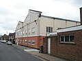
- Carlton Cinema, Cosham (3 F)
- Cosham Baptist Church (4 F)
- Cosham Park House (6 F)
- Cosham railway station (26 F)
H
- Highbury College (13 F)
K
M
- Moat Club, Cosham (4 F)
P
- Portsdown Park Estate (9 F)
Q
S
Media in category "Cosham"
The following 200 files are in this category, out of 350 total.
(previous page) (next page)-
 "Colin Peets" - geograph.org.uk - 784218.jpg 480 × 640; 74 KB
-
 "The Dame Judith" - geograph.org.uk - 666409.jpg 640 × 480; 46 KB
-
 ....gone^ - geograph.org.uk - 2517910.jpg 640 × 480; 58 KB
-
 15 Mulberry Lane, Cosham - 52945220649.jpg 4,608 × 2,592; 7.44 MB
-
 31-33 Park Lane, Cosham.jpg 4,608 × 3,456; 5.26 MB
-
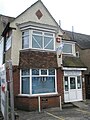
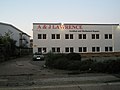 A and J Lawrence in Northarbour Road - geograph.org.uk - 1492316.jpg 640 × 480; 47 KB
-
 A buzz for the Geograph Hunter - geograph.org.uk - 675680.jpg 640 × 480; 90 KB
-
 A room with a view^ - geograph.org.uk - 663812.jpg 640 × 480; 65 KB
-
 A27 - M275 junction - geograph.org.uk - 3183874.jpg 640 × 376; 32 KB
-
 A27 west approaching start of M27 - geograph.org.uk - 2864693.jpg 640 × 431; 60 KB
-
 Abutment of former Portsmouth & Horndean Light Railway bridge 4.jpg 4,000 × 3,000; 5.19 MB
-
 Accountants in Cosham High Street - geograph.org.uk - 1960154.jpg 480 × 640; 92 KB
-
 Active Health in London Road - geograph.org.uk - 1921688.jpg 480 × 640; 79 KB
-
 Admiral House - geograph.org.uk - 784174.jpg 640 × 480; 64 KB
-

-

-
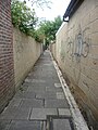
 Alley off Knowsley Road - geograph.org.uk - 4113637.jpg 1,024 × 768; 229 KB
-

-

-

-
-
-
 Alleyway to Colwell Road - geograph.org.uk - 664761.jpg 640 × 480; 78 KB
-
 Almost the same- but not quite - geograph.org.uk - 1981340.jpg 640 × 480; 77 KB
-

-
-

-

-

-
 Apartments, Havant Road - geograph.org.uk - 4758770.jpg 1,024 × 768; 118 KB
-
 Apartments, Mallow Close - geograph.org.uk - 4758789.jpg 1,024 × 768; 129 KB
-
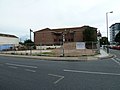
 Army Reserve Centre, Cosham.jpg 4,608 × 2,508; 8.27 MB
-
 Behind Cosham High Street - geograph.org.uk - 662005.jpg 640 × 480; 43 KB
-
 Bend at the start of Cheltenham Road - geograph.org.uk - 1146405.jpg 640 × 480; 85 KB
-

-
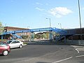
 Blue footbridge in Northern Road (1) - geograph.org.uk - 2395111.jpg 640 × 428; 63 KB
-
 Blue footbridge in Northern Road (2) - geograph.org.uk - 2395115.jpg 640 × 428; 59 KB
-
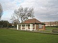
 Bowling Green at Cosham Park - geograph.org.uk - 729182.jpg 640 × 480; 51 KB
-
 Bowling Green-Cosham - geograph.org.uk - 708691.jpg 640 × 413; 63 KB
-
 BP garage in Northern Road - geograph.org.uk - 784229.jpg 640 × 480; 44 KB
-
 Bridge in Tudor Crescent (1) - geograph.org.uk - 2382263.jpg 640 × 416; 78 KB
-
 Bridge in Tudor Crescent (2) - geograph.org.uk - 2382292.jpg 640 × 428; 57 KB
-
 Bridge in Tudor Crescent (3) - geograph.org.uk - 2382307.jpg 640 × 428; 57 KB
-
 Bridge in Tudor Crescent (4) - geograph.org.uk - 2382445.jpg 640 × 423; 62 KB
-
 Bridge in Tudor Crescent (5) - geograph.org.uk - 2382458.jpg 640 × 428; 68 KB
-
 Bridge in Tudor Crescent (6) - geograph.org.uk - 2382483.jpg 640 × 428; 52 KB
-
 Bridge in Tudor Crescent (7) - geograph.org.uk - 2383235.jpg 640 × 428; 52 KB
-
 Bridge in Tudor Crescent (8) - geograph.org.uk - 2383239.jpg 640 × 428; 47 KB
-
-
 Car park behind Cosham Station - geograph.org.uk - 1141152.jpg 480 × 640; 60 KB
-
 Car park beneath Cosham Health Centre - geograph.org.uk - 783819.jpg 640 × 480; 67 KB
-
-
 Cemetery opposite St Peter and St Paul's - geograph.org.uk - 675765.jpg 640 × 480; 103 KB
-
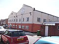
 Church of the Nazarene, Cosham.jpg 4,608 × 2,592; 8.48 MB
-
 Churchers Solicitors in Northern Road - geograph.org.uk - 784227.jpg 640 × 480; 70 KB
-
-
 City of Portsmouth , M27 Motorway - geograph.org.uk - 5738949.jpg 6,000 × 4,000; 7.75 MB
-
 City of Portsmouth , The A27 - geograph.org.uk - 5738951.jpg 6,000 × 4,000; 5.39 MB
-
 City of Portsmouth - Cosham House - 20221022095911.jpg 2,255 × 1,269; 683 KB
-
 City of Portsmouth - Cosham House - 20221022095942.jpg 3,120 × 4,160; 4.92 MB
-
 City of Portsmouth - East Cosham House - 20221022100539.jpg 2,985 × 1,680; 1.01 MB
-
 Clockhouse Carsales - geograph.org.uk - 784209.jpg 640 × 480; 68 KB
-

-
-
 Colwell Road looking north - geograph.org.uk - 664789.jpg 640 × 480; 44 KB
-

-

-
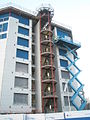
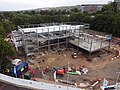 Construction of New Cosham Fire Station 3 - 53023468447.jpg 4,000 × 3,000; 5.17 MB
-
 Converted Pub - Cosham - geograph.org.uk - 894355.jpg 640 × 480; 77 KB
-
 Cosham Baptist Church - geograph.org.uk - 4758793.jpg 1,024 × 768; 113 KB
-
 Cosham Baptist Church - geograph.org.uk - 613261.jpg 640 × 480; 53 KB
-
 Cosham Baptist Church - geograph.org.uk - 783990.jpg 640 × 480; 59 KB
-
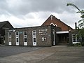
 Cosham Community Centre - geograph.org.uk - 664432.jpg 640 × 480; 50 KB
-
 Cosham Court - Cosham - geograph.org.uk - 894342.jpg 640 × 480; 55 KB
-
 Cosham Court - geograph.org.uk - 783952.jpg 640 × 480; 51 KB
-
 Cosham Decor - geograph.org.uk - 784193.jpg 640 × 480; 83 KB
-
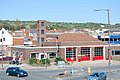 Cosham Fire Station - geograph.org.uk - 2393274.jpg 640 × 428; 74 KB
-
 Cosham Fire Station - geograph.org.uk - 430779.jpg 640 × 427; 182 KB
-

-
 Cosham Health Centre - geograph.org.uk - 662365.jpg 640 × 480; 43 KB
-
 Cosham High St Level Crossing - geograph.org.uk - 3386179.jpg 640 × 480; 83 KB
-
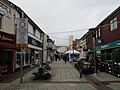 Cosham High Street - geograph.org.uk - 4758783.jpg 1,024 × 768; 153 KB
-
 Cosham High Street.jpg 4,000 × 3,000; 5.17 MB
-
 Cosham House.jpg 2,304 × 1,728; 917 KB
-
 Cosham Independent Barbers - geograph.org.uk - 662220.jpg 640 × 480; 65 KB
-
 Cosham Library 2 - 53024519728.jpg 2,316 × 1,737; 4.16 MB
-
-
-

-

-

-

-

-

-
 Cosham Masonic Hall - geograph.org.uk - 784100.jpg 640 × 480; 75 KB
-
 Cosham Mobility - geograph.org.uk - 664420.jpg 640 × 480; 50 KB
-
 Cosham Osteopathic Centre - geograph.org.uk - 784196.jpg 480 × 640; 71 KB
-
 Cosham Park - geograph.org.uk - 5099927.jpg 4,415 × 3,311; 2.97 MB
-
 Cosham Park - geograph.org.uk - 5099928.jpg 4,608 × 3,456; 3.34 MB
-
 Cosham Park - geograph.org.uk - 729191.jpg 640 × 480; 113 KB
-
 Cosham Park Bowling Club - geograph.org.uk - 729194.jpg 640 × 480; 61 KB
-
 Cosham Park House - geograph.org.uk - 662002.jpg 640 × 480; 69 KB
-
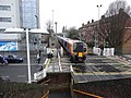
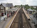 Cosham railway station, Hampshire - geograph.org.uk - 5084797.jpg 1,600 × 1,200; 412 KB
-
 Cosham Royal British legion Club - geograph.org.uk - 668144.jpg 640 × 480; 28 KB
-
 Cosham Salisbury Road - geograph.org.uk - 5886786.jpg 3,456 × 2,592; 3.51 MB
-
 Cosham Social Club.jpg 4,608 × 3,456; 4.55 MB
-
 Cosham station - geograph.org.uk - 5099923.jpg 4,608 × 3,456; 3.52 MB
-
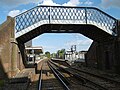 Cosham station underneath the footbridge - geograph.org.uk - 5099925.jpg 4,608 × 3,456; 3.43 MB
-
 Cosham, Wayte Street from the corner of Wootton Street - geograph.org.uk - 5886781.jpg 3,456 × 2,592; 3.81 MB
-
 Cul de sac on "The Isle of Wight" - geograph.org.uk - 664820.jpg 640 × 480; 45 KB
-

-
 Date stone on "The Salisbury" - geograph.org.uk - 1981377.jpg 480 × 640; 67 KB
-

-
 Drayton Park - geograph.org.uk - 5886795.jpg 3,456 × 2,592; 4.28 MB
-
 Drayton Park - geograph.org.uk - 5886796.jpg 3,456 × 2,592; 4.3 MB
-
 Dumper truck in Vectis Way - geograph.org.uk - 783801.jpg 640 × 480; 68 KB
-
 Dumper truck in Wootton Street - geograph.org.uk - 3768616.jpg 640 × 480; 48 KB
-
 East Cosham House.jpg 4,608 × 3,456; 7.03 MB
-
 East of Highbury College - geograph.org.uk - 4118214.jpg 4,608 × 3,456; 4.27 MB
-
 Empty playground - geograph.org.uk - 4118218.jpg 2,972 × 2,227; 1.62 MB
-

-
 Entrance to Beatrice Mews - geograph.org.uk - 783945.jpg 640 × 480; 88 KB
-

-
 Fareham lines 1848.png 1,036 × 1,034; 89 KB
-
-
 Flats in Portsmouth Road, Cosham - geograph.org.uk - 3488697.jpg 3,872 × 2,592; 4.47 MB
-
 Flats in Southampton Road - geograph.org.uk - 667987.jpg 640 × 480; 41 KB
-
 Flooding in The Droke - geograph.org.uk - 662584.jpg 640 × 480; 65 KB
-
 Football field overshadowed by QA - geograph.org.uk - 667973.jpg 640 × 480; 56 KB
-
 Footbridge - Cosham - geograph.org.uk - 894403.jpg 640 × 480; 80 KB
-
 Footbridge at the start of M275 and M27 - geograph.org.uk - 3570201.jpg 1,024 × 527; 68 KB
-
 Footbridge over Ports Creek at Hilsea - geograph.org.uk - 2006320.jpg 640 × 480; 123 KB
-

-
 Footpath downhill - geograph.org.uk - 540916.jpg 640 × 480; 114 KB
-

-

-
 Footpath from Park Lane to Cosham High Street - geograph.org.uk - 5886778.jpg 2,592 × 3,456; 4.29 MB
-

-
 Former Hampshire Contabulary Police Station - 53024424470.jpg 4,608 × 3,456; 5.61 MB
-

-
 Formerly The Swan pub.jpg 4,608 × 3,456; 4.73 MB
-
 Formerly Uncle Tom's Cabin - geograph.org.uk - 783995.jpg 640 × 480; 47 KB
-
-

-
-

-
 Headway in Cosham High Street - geograph.org.uk - 1960147.jpg 480 × 640; 87 KB
-
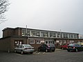
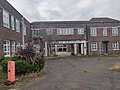
 High part of Highbury College - geograph.org.uk - 2385796.jpg 640 × 428; 39 KB
-
 Highbury College (1) - geograph.org.uk - 2385771.jpg 640 × 428; 48 KB
-
 Highbury College (2) - geograph.org.uk - 2385778.jpg 640 × 428; 60 KB
-
 Highbury College (3) - geograph.org.uk - 2385786.jpg 640 × 428; 55 KB
-

-
 Highbury Houses Advert 1934 - 53630754162.jpg 3,456 × 4,608; 4.88 MB
-
 Homes first in Cosham High Street - geograph.org.uk - 783837.jpg 480 × 640; 73 KB
-
-
 I'll wait then - geograph.org.uk - 775090.jpg 640 × 480; 76 KB
-
-
-
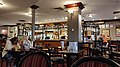 Inside the First Post pub, Cosham.jpg 4,608 × 2,592; 7.62 MB
-
 It's coming home, if a little slowly - geograph.org.uk - 1921695.jpg 480 × 640; 61 KB
-
 Ivy enveloping a house in Cosham.jpg 4,608 × 3,456; 5.36 MB
-

-
 Jobcentre near Cosham Railway Station - geograph.org.uk - 783826.jpg 640 × 480; 69 KB
-

-

-
-

-

-

-
 King George the Fifth Rec, Cosham - geograph.org.uk - 729201.jpg 640 × 480; 38 KB
-
 King George V Playing Fields - geograph.org.uk - 1177486.jpg 640 × 480; 70 KB
-
 Kings Carpets in Northern Road - geograph.org.uk - 2398772.jpg 640 × 428; 72 KB
-
 Kinross Crescent, Cosham - geograph.org.uk - 715039.jpg 640 × 480; 39 KB
-
 Kwiki Market in Halstead Road - geograph.org.uk - 675479.jpg 640 × 480; 60 KB
-
 Last of the snow in Southampton Road - geograph.org.uk - 1144858.jpg 480 × 640; 58 KB
-
 Lone cyclist in Old Manor Way - geograph.org.uk - 715046.jpg 480 × 640; 43 KB
-

-

-
-

-
-

-
-
 Looking down into Candy's Pit - geograph.org.uk - 1286240.jpg 640 × 480; 141 KB
-

-
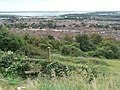
 Looking down the Solent from above the South Downs - geograph.org.uk - 4677096.jpg 3,264 × 2,448; 3.91 MB
-

-
-

-

-

-
-

-

-

-

-
-

-

-
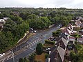
 Looking South along Northern Road - geograph.org.uk - 2395196.jpg 640 × 428; 57 KB


_-_geograph.org.uk_-_3702152.jpg)
_-_geograph.org.uk_-_3702221.jpg)
_-_geograph.org.uk_-_3702223.jpg)
_-_geograph.org.uk_-_3702228.jpg)


_-_geograph.org.uk_-_2395111.jpg)
_-_geograph.org.uk_-_2395115.jpg)


_-_geograph.org.uk_-_2382263.jpg)
_-_geograph.org.uk_-_2382292.jpg)
_-_geograph.org.uk_-_2382307.jpg)
_-_geograph.org.uk_-_2382445.jpg)
_-_geograph.org.uk_-_2382458.jpg)
_-_geograph.org.uk_-_2382483.jpg)
_-_geograph.org.uk_-_2383235.jpg)
_-_geograph.org.uk_-_2383239.jpg)


_-_geograph.org.uk_-_3785576.jpg)
_-_geograph.org.uk_-_3785577.jpg)
_-_geograph.org.uk_-_3785578.jpg)
_-_geograph.org.uk_-_3785579.jpg)
_-_geograph.org.uk_-_3786477.jpg)
_-_geograph.org.uk_-_3786479.jpg)
_-_geograph.org.uk_-_3786480.jpg)
_-_geograph.org.uk_-_3786482.jpg)


_-_geograph.org.uk_-_2385771.jpg)
_-_geograph.org.uk_-_2385778.jpg)
_-_geograph.org.uk_-_2385786.jpg)


_-_geograph.org.uk_-_2517946.jpg)