Category:Corton Denham
Jump to navigation
Jump to search
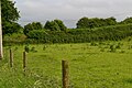
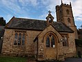
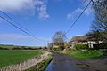
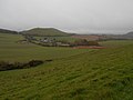
English: Corton Denham is a village and parish in Somerset, England, situated seven miles north east of Yeovil in the South Somerset district. The village has a population of 210.
village in the United Kingdom  | |||||
| Upload media | |||||
| Instance of | |||||
|---|---|---|---|---|---|
| Location | South Somerset, Somerset, South West England, England | ||||
| Said to be the same as | Corton Denham (Wikimedia duplicated page, civil parish) | ||||
 | |||||
Subcategories
This category has only the following subcategory.
A
Media in category "Corton Denham"
The following 63 files are in this category, out of 63 total.
-
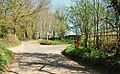
 Beacon Lane - geograph.org.uk - 4454660.jpg 800 × 533; 229 KB
-
 Beech Farm - geograph.org.uk - 4454688.jpg 800 × 533; 209 KB
-

-

-
 Big field, Whitcombe - geograph.org.uk - 4454646.jpg 800 × 533; 151 KB
-
 Cattle on Corton Hill - geograph.org.uk - 4454682.jpg 800 × 533; 166 KB
-
 Church path - Corton Denham - geograph.org.uk - 1476968.jpg 480 × 640; 153 KB
-

-
 Corton Denham Village Laundry - geograph.org.uk - 1635456.jpg 640 × 480; 83 KB
-
 Corton Denham War Memorial (geograph 7438931).jpg 683 × 1,024; 1.21 MB
-
 Corton Denham, church path - geograph.org.uk - 2968260.jpg 427 × 640; 467 KB
-
 Cottages at top of Whitcombe Farm Lane - geograph.org.uk - 5407696.jpg 640 × 427; 108 KB
-
 Field beside Beacon Lane - geograph.org.uk - 5407689.jpg 640 × 427; 90 KB
-
 Field beside Stonehill - geograph.org.uk - 5407711.jpg 640 × 427; 83 KB
-
 Fields near New Barn Farm - geograph.org.uk - 4929678.jpg 2,592 × 1,944; 938 KB
-
 Fields on Corton Hill - geograph.org.uk - 5407701.jpg 640 × 427; 68 KB
-
-
 Gate, Corton Denham - geograph.org.uk - 2276537.jpg 640 × 481; 99 KB
-
 Green lane, Sutton Montis - geograph.org.uk - 4454642.jpg 800 × 533; 297 KB
-
 Holway Hill House, Corton Denham - geograph.org.uk - 4355180.jpg 640 × 480; 72 KB
-
 Kember's Hill, Whitcombe - geograph.org.uk - 4454658.jpg 800 × 533; 286 KB
-
 New hedge, Seven Wells Down - geograph.org.uk - 4454695.jpg 800 × 533; 225 KB
-
 North Town, Corton Denham - geograph.org.uk - 3884889.jpg 3,776 × 2,520; 4.02 MB
-

-
 Old dyking - geograph.org.uk - 4454691.jpg 800 × 533; 231 KB
-
 Parrock Hill - geograph.org.uk - 1047420.jpg 640 × 480; 77 KB
-
 Parrock Hill - geograph.org.uk - 4454664.jpg 800 × 533; 101 KB
-
 Parrock Hill and Whitcombe Farm.jpg 5,152 × 3,864; 4.26 MB
-
 Path to The Beacon - geograph.org.uk - 4454665.jpg 800 × 533; 201 KB
-
-
 Putt's Lane leading to Corton Denham - geograph.org.uk - 3884852.jpg 3,776 × 2,520; 4 MB
-
 Quarry, The Beacon - geograph.org.uk - 4454675.jpg 800 × 533; 146 KB
-
 Running out of Somerset - geograph.org.uk - 4454698.jpg 800 × 533; 232 KB
-
 Scarp, Whitcombe - geograph.org.uk - 4454670.jpg 800 × 533; 163 KB
-
 Seven Wells Down, Bridleway - geograph.org.uk - 1816524.jpg 800 × 535; 587 KB
-
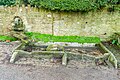 Spring and drinking trough (geograph 7439503).jpg 1,024 × 683; 1.16 MB
-
 Stonehill heading towards Cadbury Castle - geograph.org.uk - 3884917.jpg 3,776 × 2,520; 3.86 MB
-
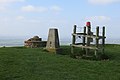 Summit, The Beacon - geograph.org.uk - 4454671.jpg 800 × 533; 147 KB
-
 The Beacon - geograph.org.uk - 2679698.jpg 1,920 × 1,080; 1,006 KB
-
 The Beacon - geograph.org.uk - 3275930.jpg 2,560 × 1,920; 2.73 MB
-
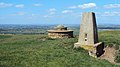
 The Beacon - geograph.org.uk - 4454669.jpg 800 × 533; 169 KB
-
 The end of Beacon Lane - geograph.org.uk - 5407692.jpg 640 × 427; 119 KB
-
 The lane to Corton Denham - geograph.org.uk - 3366378.jpg 2,592 × 1,944; 1.24 MB
-
 Track, Corton Denham - geograph.org.uk - 2276508.jpg 640 × 481; 83 KB
-

-
 View of the church from a holiday cottage - geograph.org.uk - 6010713.jpg 1,118 × 796; 256 KB
-
 View towards Corton Denham - geograph.org.uk - 4454677.jpg 800 × 533; 145 KB
-
 Village hall, Corton Denham - geograph.org.uk - 2233502.jpg 640 × 480; 71 KB
-
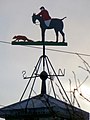 Weather vane, Corton Denham - geograph.org.uk - 2233471.jpg 480 × 640; 68 KB
-
 Whitcombe - geograph.org.uk - 4454657.jpg 800 × 533; 131 KB
-
 Whitcombe - geograph.org.uk - 4454661.jpg 800 × 533; 141 KB
-
 Along Corton Ridge - geograph.org.uk - 428847.jpg 640 × 477; 115 KB
-
 Corton Gorse - geograph.org.uk - 487112.jpg 640 × 477; 110 KB
-
 Down Farm from the end of Cowpath Lane - geograph.org.uk - 557375.jpg 601 × 442; 152 KB
-
 Gate into the next square - geograph.org.uk - 487121.jpg 640 × 477; 147 KB
-
 Getting ready for Monday - geograph.org.uk - 487133.jpg 640 × 477; 87 KB
-
 Gunville Farm entrance - geograph.org.uk - 557319.jpg 640 × 480; 169 KB
-
 Lane down to New Barn farm - geograph.org.uk - 560859.jpg 640 × 425; 122 KB
-
 Macmillan Way near Stafford Green Farm - geograph.org.uk - 487124.jpg 640 × 477; 119 KB
-
 Road past Wheatsheaf house - geograph.org.uk - 560868.jpg 640 × 425; 113 KB
-
 Slait farm - geograph.org.uk - 560854.jpg 640 × 425; 80 KB
-
 Stafford Green Farm buildings - geograph.org.uk - 487128.jpg 640 × 477; 70 KB
-
 Thatch and Tin - geograph.org.uk - 428879.jpg 640 × 477; 53 KB


.jpg)


.jpg)


