Category:Coppingford
Jump to navigation
Jump to search
village in Cambridgeshire, England  | |||||
| Upload media | |||||
| Instance of | |||||
|---|---|---|---|---|---|
| Location | Upton and Coppingford, Huntingdonshire, Cambridgeshire, East of England, England | ||||
 | |||||
English: Coppingford – in Huntingdonshire (now part of Cambridgeshire), England – is a village near Upton north west of Huntingdon. The main manor house, still in existence, dates from about 1200.
Nederlands: Coppingford is een dorp in het Engelse graafschap Cambridgeshire. Het dorp ligt in het district Huntingdonshire en telt 207 inwoners.
Media in category "Coppingford"
The following 34 files are in this category, out of 34 total.
-
 Boxing Day At The Mile Brook Bridge - geograph.org.uk - 1092195.jpg 480 × 640; 128 KB
-
 Coppingford Lodge - geograph.org.uk - 1021392.jpg 640 × 480; 91 KB
-
 Stangate Hill - geograph.org.uk - 1065132.jpg 640 × 480; 74 KB
-
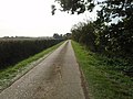 The Road From Coppingford Lodge - geograph.org.uk - 1021423.jpg 640 × 480; 89 KB
-
 The Sale Field - geograph.org.uk - 1021379.jpg 640 × 480; 57 KB
-
 Across The Field To Poplar Lodge - geograph.org.uk - 1092234.jpg 640 × 480; 82 KB
-
 Archers Wood and Farm - geograph.org.uk - 726273.jpg 640 × 480; 87 KB
-
 Barns at Manor Lodge, Buckworth - geograph.org.uk - 467583.jpg 640 × 480; 63 KB
-
 Brook near Holly Lodge - geograph.org.uk - 647781.jpg 640 × 480; 101 KB
-
 Bullock Road - geograph.org.uk - 613054.jpg 640 × 480; 79 KB
-
 Bullock Road eastwards from road - geograph.org.uk - 540308.jpg 640 × 480; 66 KB
-
 Bullock Road westwards - geograph.org.uk - 540307.jpg 640 × 480; 73 KB
-

-
 Fields - geograph.org.uk - 678396.jpg 640 × 480; 93 KB
-
 Fields and Coppingford Wood - geograph.org.uk - 540311.jpg 640 × 480; 97 KB
-
 Flush Bracket Bench mark no S6818 - geograph.org.uk - 726286.jpg 480 × 640; 123 KB
-
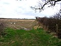
 Gateway to Archers Wood - geograph.org.uk - 726268.jpg 640 × 480; 88 KB
-
 Grange Farm seen from Aversley Wood - geograph.org.uk - 726293.jpg 640 × 480; 98 KB
-
 Holly Lodge - geograph.org.uk - 466966.jpg 640 × 480; 93 KB
-
 Honey Hill - geograph.org.uk - 249842.jpg 640 × 480; 64 KB
-
 Large Rural Traffic - geograph.org.uk - 540309.jpg 640 × 480; 70 KB
-

-
 Mile Brook Bridge East of Hamerton - geograph.org.uk - 459537.jpg 640 × 480; 165 KB
-
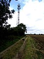 Mobile telephone mast and fields - geograph.org.uk - 540316.jpg 480 × 640; 82 KB
-
 Mobile telephone radio station - geograph.org.uk - 540315.jpg 640 × 480; 99 KB
-
 Pylons dominating the landscape - geograph.org.uk - 466957.jpg 640 × 480; 54 KB
-
 Road north of Alconbury Brook - geograph.org.uk - 678400.jpg 640 × 480; 77 KB
-
 Road past Holly Lodge - geograph.org.uk - 678397.jpg 640 × 480; 91 KB
-

-
 Small rural traffic - geograph.org.uk - 540310.jpg 640 × 480; 60 KB
-
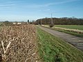
 Towards the A1(M) near to Coppingford - geograph.org.uk - 540312.jpg 640 × 480; 73 KB
-
 Towards Upton from Bullock Road - geograph.org.uk - 540313.jpg 640 × 480; 64 KB
-
 Track near to Holly Lodge - geograph.org.uk - 678399.jpg 640 × 480; 61 KB
-
 Wheat field with distant poplars - geograph.org.uk - 466963.jpg 640 × 480; 98 KB


_near_to_Coppingford_-_geograph.org.uk_-_540312.jpg)


