Category:Coombes
Jump to navigation
Jump to search
village in the United Kingdom  | |||||
| Upload media | |||||
| Instance of | |||||
|---|---|---|---|---|---|
| Located in protected area | |||||
| Location | Adur, West Sussex, South East England, England | ||||
| Area |
| ||||
 | |||||
Coombes, West Sussex
Subcategories
This category has the following 2 subcategories, out of 2 total.
B
- Beeding Cement Works (17 F)
C
Media in category "Coombes"
The following 151 files are in this category, out of 151 total.
-
 Badgerhole Shaw - geograph.org.uk - 1011641.jpg 479 × 640; 124 KB
-
 Bends in Coombes Road north to Coombes - geograph.org.uk - 2268275.jpg 4,000 × 3,000; 3.71 MB
-

-
 Bridleway 2061-1 climbing to Coombe Head - geograph.org.uk - 2269899.jpg 3,264 × 2,448; 4.15 MB
-
 Bridleway and entrance to Church Farm, Coombes - geograph.org.uk - 2268109.jpg 4,000 × 3,000; 3.64 MB
-
 Bridleway approaches field boundary - geograph.org.uk - 5115349.jpg 800 × 600; 157 KB
-

-
 Bridleway beside Coombes Copse - geograph.org.uk - 5115392.jpg 800 × 600; 180 KB
-

-

-
 Bridleway through Coombes Copse - geograph.org.uk - 1012102.jpg 479 × 640; 166 KB
-

-
 Cattle grid at Coombe Head - geograph.org.uk - 2269935.jpg 3,264 × 2,448; 4.29 MB
-

-
 Cattle on the slopes of Steep Down - geograph.org.uk - 6245634.jpg 849 × 1,024; 241 KB
-
 Church Farm Coombes - geograph.org.uk - 2269908.jpg 3,264 × 2,254; 3.3 MB
-
 Cliff House, Shoreham Road - geograph.org.uk - 1072552.jpg 479 × 640; 70 KB
-
 Coombe Head - geograph.org.uk - 1012117.jpg 640 × 440; 71 KB
-
 Coombe Head - geograph.org.uk - 1195318.jpg 640 × 480; 79 KB
-
 Coombehead Wood seen from bridleway - geograph.org.uk - 5115344.jpg 800 × 600; 131 KB
-
 Coombes - geograph.org.uk - 1012091.jpg 640 × 479; 65 KB
-
 Coombes Church - geograph.org.uk - 6228543.jpg 1,024 × 768; 262 KB
-
 Coombes Church Farm - geograph.org.uk - 4602952.jpg 5,045 × 2,768; 7.64 MB
-
 Coombes Church Farm - geograph.org.uk - 4602956.jpg 4,705 × 2,972; 6.55 MB
-
 Coombes Church, dedication unknown - geograph.org.uk - 4602823.jpg 4,286 × 2,849; 7.29 MB
-

-

-
 Coombes Church, dedication unknown, A sedilia^ - geograph.org.uk - 4603007.jpg 5,520 × 3,680; 7.47 MB
-

-

-

-

-

-

-

-

-
 Coombes Church, dedication unknown, The nave and chancel - geograph.org.uk - 4602973.jpg 4,504 × 3,564; 7.67 MB
-

-
 Coombes Church, dedication unknown, Western aspect - geograph.org.uk - 4602842.jpg 4,009 × 2,649; 7.79 MB
-
 Coombes Church, dedication unknown, Western aspect - geograph.org.uk - 4602848.jpg 4,221 × 2,700; 6.45 MB
-
 Coombes Church, dedication unknown. Southern aspect - geograph.org.uk - 4602829.jpg 4,206 × 2,593; 6.97 MB
-
 Coombes Church, dedication unknown. Southern aspect - geograph.org.uk - 4602834.jpg 4,841 × 2,950; 7.62 MB
-
 Coombes Church, dedication unknown. Southern aspect - geograph.org.uk - 4602838.jpg 3,678 × 2,455; 5.65 MB
-
 Coombes Church, dedication unknown. Southern aspect - geograph.org.uk - 4602854.jpg 4,379 × 2,896; 7.41 MB
-
 Coombes Copse - geograph.org.uk - 1012041.jpg 640 × 479; 140 KB
-
 Coombes Farmhouse.jpg 4,608 × 3,456; 5.29 MB
-
 Coombes from Above - geograph.org.uk - 1012114.jpg 640 × 479; 99 KB
-
 Coombes Pylons - geograph.org.uk - 60721.jpg 640 × 368; 60 KB
-
 Coombes Rectory.jpg 4,317 × 2,733; 2.88 MB
-
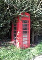 Coombes telephone box.jpg 2,537 × 3,631; 2.37 MB
-
 Coombes Village Street - geograph.org.uk - 1012082.jpg 640 × 479; 65 KB
-
 Coombes, the Old Rectory - geograph.org.uk - 6228579.jpg 1,024 × 820; 247 KB
-
 Course of an old railway - geograph.org.uk - 2511808.jpg 640 × 430; 77 KB
-
 Cow Bottom curving around towards Lancing College Chapel - geograph.org.uk - 2269881.jpg 3,264 × 2,448; 3.03 MB
-
 Cowbottom Hovel - geograph.org.uk - 1012144.jpg 640 × 479; 106 KB
-
 Cowbottom Hovel - geograph.org.uk - 1012318.jpg 640 × 479; 87 KB
-
 CRoW access land - geograph.org.uk - 1736054.jpg 640 × 428; 88 KB
-

-
 Dacre Villas and Dacre Gardens - geograph.org.uk - 1072573.jpg 640 × 479; 53 KB
-
 Descent to Cowbottom Hovel - geograph.org.uk - 2269738.jpg 3,264 × 2,448; 3.76 MB
-
 Dew Pond at Coombe Head - geograph.org.uk - 2043489.jpg 2,048 × 1,536; 640 KB
-
 Disused chalk pit in Winding Bottom - geograph.org.uk - 2271168.jpg 3,264 × 2,187; 2.45 MB
-
 Downland above Coombes - geograph.org.uk - 6228171.jpg 1,024 × 749; 154 KB
-
 Downland arable south of Coombes - geograph.org.uk - 6228345.jpg 1,024 × 768; 173 KB
-
 Downland valley with pylon - geograph.org.uk - 5115323.jpg 800 × 600; 115 KB
-
 Downland West of Cowbottom Hovel - geograph.org.uk - 1012149.jpg 640 × 479; 91 KB
-
 Downs Link bridleway - geograph.org.uk - 874207.jpg 640 × 480; 89 KB
-
 Drainage Ditch near Coombes - geograph.org.uk - 1011644.jpg 479 × 640; 95 KB
-

-
 Dry Valley near Coombes - geograph.org.uk - 1012126.jpg 640 × 407; 61 KB
-
 Earthworks, Winding Bottom - geograph.org.uk - 1736089.jpg 640 × 428; 110 KB
-
 Entrance to Passies Fishing Ponds - geograph.org.uk - 2268040.jpg 4,000 × 3,000; 3.51 MB
-
 Farm road to Valley Barn - geograph.org.uk - 5115421.jpg 800 × 600; 163 KB
-

-
 Five way junction at the north end of Steep Down - geograph.org.uk - 2272467.jpg 3,264 × 2,448; 4.5 MB
-
 Footpath 2064-1 on Lancing Hill - geograph.org.uk - 2269715.jpg 3,264 × 2,448; 3.78 MB
-
 Footpath goes northwards from farm road - geograph.org.uk - 5115425.jpg 800 × 600; 204 KB
-
 Footpath going down to Cow Bottom - geograph.org.uk - 5115430.jpg 800 × 600; 200 KB
-
 Footpath going south on the downs - geograph.org.uk - 5115404.jpg 800 × 600; 184 KB
-

-
 Footpath passes pen at Cow Bottom - geograph.org.uk - 5115435.jpg 800 × 600; 169 KB
-
 Footpath sign at Coombes - geograph.org.uk - 2305627.jpg 640 × 480; 82 KB
-
 Footpath to Coombes Copse - geograph.org.uk - 5115408.jpg 800 × 600; 150 KB
-
 Former Shoreham-Horsham Railway - geograph.org.uk - 633871.jpg 479 × 640; 85 KB
-
 Hedge cutting above Coombe Head - geograph.org.uk - 2271175.jpg 3,264 × 2,448; 3.18 MB
-

-
 Junction of ways above Coombes - geograph.org.uk - 1736162.jpg 640 × 428; 176 KB
-
 Ladywell Stream alongside Coombes Road - geograph.org.uk - 2268369.jpg 4,000 × 3,000; 3.47 MB
-
 Long narrow strip of Access Land - geograph.org.uk - 2271192.jpg 3,264 × 2,448; 3.99 MB
-

-

-

-

-
 Looking north in Coombes Road - geograph.org.uk - 2305556.jpg 640 × 480; 47 KB
-

-
 Mid March at Coombes Farm - geograph.org.uk - 2305905.jpg 640 × 480; 43 KB
-

-
 Mudbath at Cowbottom Hovel - geograph.org.uk - 1736208.jpg 640 × 428; 155 KB
-
 New Cottages, Coombes Road - geograph.org.uk - 1011626.jpg 640 × 479; 84 KB
-
 NW on Restricted Byway by Steep Down - geograph.org.uk - 2271195.jpg 3,264 × 2,448; 3.28 MB
-
 Ox Brook Cottage.jpg 3,367 × 4,489; 3.06 MB
-
 Picnic tables at Coombes Farm - geograph.org.uk - 2305644.jpg 640 × 480; 91 KB
-
 Postbox at Coombes - geograph.org.uk - 2305624.jpg 640 × 480; 106 KB
-
 Private road to Applesham Farm - geograph.org.uk - 2268258.jpg 4,000 × 3,000; 3.69 MB
-
 Red heifer, Steep Down - geograph.org.uk - 6247437.jpg 768 × 1,024; 122 KB
-
 River Adur - geograph.org.uk - 1075128.jpg 479 × 640; 66 KB
-
 River Adur - geograph.org.uk - 2511817.jpg 640 × 430; 68 KB
-
 River Adur at Sunrise - geograph.org.uk - 1072272.jpg 479 × 640; 39 KB
-
 River Adur near Dacre Villa - geograph.org.uk - 1860882.jpg 1,600 × 1,200; 403 KB
-
 Route to Coombe Head - geograph.org.uk - 1107201.jpg 640 × 480; 76 KB
-
 Route to Findon - geograph.org.uk - 2043298.jpg 2,048 × 1,536; 652 KB
-
 Sheep grazing in Cow Bottom - geograph.org.uk - 2269744.jpg 3,264 × 2,448; 4.12 MB
-
 South Downs - geograph.org.uk - 723341.jpg 640 × 480; 90 KB
-

-
 The final furrow - geograph.org.uk - 1736182.jpg 640 × 428; 158 KB
-
 The Old Rectory - geograph.org.uk - 1012054.jpg 640 × 479; 128 KB
-
 The Old Rectory - geograph.org.uk - 1012087.jpg 640 × 479; 138 KB
-
 The Old Rectory, Coombes - geograph.org.uk - 1529056.jpg 640 × 487; 119 KB
-
 Towards Coombe Head - geograph.org.uk - 6228197.jpg 781 × 1,024; 127 KB
-
 Towards Coombes from above Coombes Rocks - geograph.org.uk - 952338.jpg 640 × 480; 151 KB
-
 Track to Coombes - geograph.org.uk - 2043378.jpg 2,048 × 1,536; 657 KB
-
 Valley Barn from the north escarpment of Lancing Hill - geograph.org.uk - 2269725.jpg 3,264 × 2,448; 3.37 MB
-
 View east towards Coombe Head - geograph.org.uk - 4184697.jpg 1,024 × 768; 87 KB
-
 View north-east from Steep Down - geograph.org.uk - 6248371.jpg 1,024 × 769; 133 KB
-

-
 View over the Adur valley towards the disused cement works - geograph.org.uk - 3539109.jpg 3,264 × 2,448; 2.91 MB
-
 A2037 Shoreham-Steyning road - geograph.org.uk - 54099.jpg 640 × 479; 164 KB
-
 A283 Shoreham - Steyning Road - geograph.org.uk - 575855.jpg 640 × 425; 110 KB
-
 A283 Shoreham - Steyning Road - geograph.org.uk - 607918.jpg 640 × 435; 79 KB
-
 A283 Shoreham - Steyning Road - geograph.org.uk - 607941.jpg 640 × 480; 106 KB
-
 Access to Downs Link Footpath from A283 - geograph.org.uk - 607934.jpg 640 × 480; 132 KB
-
 Adur Valley - geograph.org.uk - 1072845.jpg 640 × 479; 72 KB
-
 Annington Hill Barn - geograph.org.uk - 24259.jpg 640 × 438; 47 KB
-
 Applesham Farm - geograph.org.uk - 1011606.jpg 640 × 479; 101 KB
-
 Coombes Church Farm - geograph.org.uk - 60723.jpg 640 × 480; 116 KB
-
 Copse and Grazing Land above Coombes. - geograph.org.uk - 60722.jpg 640 × 401; 82 KB
-
 Daisies in a sheep pen - geograph.org.uk - 597798.jpg 640 × 480; 84 KB
-
 Downs Footpath - geograph.org.uk - 613199.jpg 640 × 480; 85 KB
-
 Downs Footpath - geograph.org.uk - 613583.jpg 640 × 467; 61 KB
-
 Downs Footpath - geograph.org.uk - 613585.jpg 640 × 480; 56 KB
-
 Downs Footpath - geograph.org.uk - 613865.jpg 640 × 480; 75 KB
-
 Downs Link Footpath - geograph.org.uk - 607926.jpg 640 × 480; 125 KB
-
 Downs Link Footpath - geograph.org.uk - 607932.jpg 640 × 453; 127 KB
-
 Erringham Hill Trig Point - geograph.org.uk - 32295.jpg 640 × 480; 124 KB
-
 Mixed Grazing - geograph.org.uk - 20145.jpg 640 × 480; 124 KB
-
 River Adur - geograph.org.uk - 633886.jpg 640 × 479; 63 KB
-
 Steep Down (E) - geograph.org.uk - 24022.jpg 640 × 371; 34 KB
-
 Sussex Country - geograph.org.uk - 607923.jpg 640 × 486; 88 KB
-
 The River Adur - geograph.org.uk - 13413.jpg 640 × 480; 78 KB
-
 Towards Coombes - geograph.org.uk - 633882.jpg 640 × 479; 65 KB
-
 Valley Barn - geograph.org.uk - 24023.jpg 640 × 414; 30 KB


_-_geograph.org.uk_-_24022.jpg)


