Category:Conderton
Jump to navigation
Jump to search
human settlement in United Kingdom  | |||||
| Upload media | |||||
| Instance of | |||||
|---|---|---|---|---|---|
| Location | Wychavon, Worcestershire, West Midlands, England | ||||
 | |||||
Media in category "Conderton"
The following 62 files are in this category, out of 62 total.
-
 After the harvest - geograph.org.uk - 3091248.jpg 1,024 × 680; 235 KB
-
 Art in nature - geograph.org.uk - 4826382.jpg 800 × 531; 154 KB
-
 Barn near Overbury - geograph.org.uk - 759640.jpg 640 × 426; 93 KB
-
 Barn on Bredon Hill - geograph.org.uk - 524620.jpg 640 × 426; 125 KB
-
 Barn on Pigeon Lane - geograph.org.uk - 4826965.jpg 800 × 531; 136 KB
-
 Bridge over Carrant Brook - geograph.org.uk - 61590.jpg 480 × 640; 179 KB
-
 Bridleway approaching Shaldon Farm - geograph.org.uk - 4318011.jpg 800 × 531; 145 KB
-
 Bridleway near Conderton Hillfort - geograph.org.uk - 4318016.jpg 800 × 531; 161 KB
-
 Bridleway near Shalden Farm - geograph.org.uk - 4318008.jpg 800 × 531; 142 KB
-
 Bridleway on Bredon Hill - geograph.org.uk - 2304661.jpg 2,680 × 1,790; 2.34 MB
-
 Bridleway to Conderton - geograph.org.uk - 4826333.jpg 680 × 1,024; 400 KB
-
 Brook on the boundary - geograph.org.uk - 655131.jpg 640 × 480; 122 KB
-
 Clump of trees on Bredon Hill - geograph.org.uk - 4826338.jpg 800 × 531; 101 KB
-
 Conderton from the air - geograph.org.uk - 930037.jpg 640 × 426; 67 KB
-
 Conderton Hillfort - geograph.org.uk - 4298891.jpg 1,024 × 680; 298 KB
-
 Conderton Hillfort - geograph.org.uk - 4826347.jpg 1,024 × 680; 253 KB
-
 Conderton village - geograph.org.uk - 4626436.jpg 1,024 × 768; 167 KB
-
 Copse above Conderton hill fort - geograph.org.uk - 4294277.jpg 676 × 451; 166 KB
-
 Dovecote in Conderton (geograph 6683830).jpg 1,024 × 768; 364 KB
-
 Driveway to Overbury Stables - geograph.org.uk - 526111.jpg 640 × 426; 116 KB
-
 Drystone wall - geograph.org.uk - 4317998.jpg 1,024 × 680; 351 KB
-
 Farm buildings on Conderton Hill - geograph.org.uk - 759618.jpg 640 × 426; 96 KB
-
 Farm buildings, Conderton - geograph.org.uk - 3101140.jpg 1,200 × 676; 407 KB
-
 Farmland above Hill Barn - geograph.org.uk - 4826281.jpg 800 × 531; 151 KB
-
 Farmland at Conderton - geograph.org.uk - 5281702.jpg 1,024 × 768; 330 KB
-
 Harvested field - geograph.org.uk - 3092248.jpg 1,200 × 676; 373 KB
-
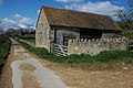
 Hill Barn - geograph.org.uk - 1712931.jpg 640 × 427; 233 KB
-
 Hill Barn - geograph.org.uk - 4826271.jpg 800 × 531; 140 KB
-
 Hill Barn - geograph.org.uk - 4826288.jpg 800 × 531; 111 KB
-
 Logs by the bridleway - geograph.org.uk - 1712937.jpg 640 × 427; 268 KB
-
 Pastoral South Worcestershire - geograph.org.uk - 3101132.jpg 1,200 × 676; 389 KB
-
 People on Conderton Hillfort - geograph.org.uk - 4826350.jpg 800 × 531; 111 KB
-
 Permissive path - geograph.org.uk - 1817722.jpg 4,000 × 3,000; 4.47 MB
-
 Redundant telephone box - geograph.org.uk - 4826974.jpg 531 × 800; 171 KB
-
 Road into Conderton - geograph.org.uk - 5281700.jpg 1,024 × 768; 298 KB
-
 Rolling farmland above Hill Barn - geograph.org.uk - 4826295.jpg 1,024 × 680; 313 KB
-
 Shalden Farm - geograph.org.uk - 4294271.jpg 800 × 451; 211 KB
-
 Shalden Farm - geograph.org.uk - 4318003.jpg 800 × 531; 194 KB
-
 The broad top of Bredon Hill - geograph.org.uk - 4298898.jpg 800 × 531; 129 KB
-
 The entrance to Overbury Stud - geograph.org.uk - 3794545.jpg 2,592 × 1,944; 1.5 MB
-
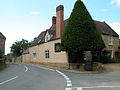
 The Yew Tree Inn, Conderton - geograph.org.uk - 3101154.jpg 1,200 × 676; 422 KB
-
 The Yew Tree Inn, Conderton - geograph.org.uk - 3794553.jpg 2,592 × 1,944; 1.38 MB
-
 The Yew Tree Inn, Conderton.jpg 640 × 480; 102 KB
-
 The Yew Tree public house, Conderton - geograph.org.uk - 4011935.jpg 1,600 × 1,064; 684 KB
-
 The Yew Tree public house, Conderton - geograph.org.uk - 4011942.jpg 1,600 × 1,064; 612 KB
-
 Track and bridleway - geograph.org.uk - 4318006.jpg 800 × 531; 130 KB
-
 Track and bridleway on Conderton Hill - geograph.org.uk - 4826303.jpg 531 × 800; 178 KB
-
 Track on Conderton Hill - geograph.org.uk - 759626.jpg 640 × 426; 110 KB
-
 Track to Beckford - geograph.org.uk - 4298879.jpg 800 × 531; 128 KB
-
 Track to Hill Barn - geograph.org.uk - 1712885.jpg 640 × 427; 270 KB
-
 Track to Shalden Farm - geograph.org.uk - 3091268.jpg 1,024 × 680; 248 KB
-
 Track, bridleway and footpath crossroads - geograph.org.uk - 4294264.jpg 800 × 451; 184 KB
-
 Traditional barns - geograph.org.uk - 4826969.jpg 800 × 531; 124 KB
-
 Trees on Bredon Hill - geograph.org.uk - 4318015.jpg 800 × 531; 134 KB
-
 Trees on Conderton Hill - geograph.org.uk - 4298894.jpg 800 × 531; 150 KB
-
 Trees on Conderton Hill - geograph.org.uk - 4826375.jpg 800 × 531; 130 KB
-
 Bridleway from Beckford - geograph.org.uk - 1481402.jpg 640 × 480; 209 KB
-
 Bridleway on Bredon Hill - geograph.org.uk - 524118.jpg 426 × 640; 131 KB
-
 Bridleway to Beckford - geograph.org.uk - 655126.jpg 640 × 480; 115 KB
-
 Fields near Conderton - geograph.org.uk - 61600.jpg 640 × 440; 118 KB
-
 Footpath to Conderton - geograph.org.uk - 759635.jpg 640 × 426; 85 KB
-
 Harvested wheatfield, Bredon Hill - geograph.org.uk - 524643.jpg 426 × 640; 105 KB


.jpg)


