Category:Comunidades de Villa y Tierra
Jump to navigation
Jump to search
- Español: Comunidades de Villa y Tierra - Forma de repoblación en el reino de Castilla durante los siglos X–XIII, que ocupan el espacio entre el río Duero y el Sistema Central, en España.
- English: Divisions of the Kingdom of Castile from the 10th through 13th centuries.
a form of political organization of Castilian Extremadura  | |||||
| Upload media | |||||
| Instance of | |||||
|---|---|---|---|---|---|
| Subclass of |
| ||||
| Location | Crown of Castile | ||||
| Dissolved, abolished or demolished date |
| ||||
| Different from | |||||
| |||||
Subcategories
This category has only the following subcategory.
C
Media in category "Comunidades de Villa y Tierra"
The following 52 files are in this category, out of 52 total.
-
 Bandera de la Comunidad de Ciudad y Tierra de Segovia.svg 400 × 267; 3 KB
-
 Bandera de la Comunidad de Villa y Tierra de Pedraza.png 550 × 550; 78 KB
-
 Bejar y su Tierra.jpg 826 × 1,169; 27 KB
-
 CCyTS.jpg 839 × 740; 126 KB
-
 CdCyTdSegovia.png 670 × 623; 71 KB
-
 Coat of Arms of Community of Coca.svg 458 × 902; 547 KB
-
 Coat of Arms of Community of Segovia.svg 522 × 881; 419 KB
-
 Comunidad de Béjar.xcf 826 × 1,169; 42 KB
-
 Comunidad de villa y tierra de Avila.jpg 3,444 × 3,340; 654 KB
-
 Comunidad de Villa y Tierra de Béjar.jpg 776 × 802; 111 KB
-
 Comunidad de Villa y Tierra de Cuéllar.jpg 4,327 × 4,363; 731 KB
-
 Comunidad de Villa y Tierra de Cuéllar.svg 778 × 413; 843 KB
-
 Comunidad de villa y tierra de Plasencia.jpg 1,058 × 900; 177 KB
-
 Comunidades de Villa y Tierra.jpg 4,327 × 4,363; 797 KB
-
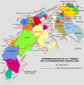 Comunidades de Villa y Tierra.svg 1,983 × 2,000; 914 KB
-
 Comunidades-Villa y Tierra.svg 5,000 × 4,539; 1.54 MB
-
 Condecoración de San Lorenzo hacia Losana de Pirón.jpg 2,000 × 3,088; 2.24 MB
-
 Detalle de la placa de la fuente (17 de julio de 2016, Los Huertos).jpg 2,160 × 3,840; 3.68 MB
-
 Escudo de la Comunidad de Ciudad y Tierra de Segovia.jpg 401 × 570; 78 KB
-
 Escudo de la Comunidad de Villa y Tierra de Pedraza.svg 550 × 958; 516 KB
-
 Fuente junto a la plaza Mayor (21 de agosto de 2016, Los Huertos).jpg 2,160 × 3,840; 3.47 MB
-
 Gacería.svg 512 × 512; 979 KB
-
 Mapa del actual Sexmo de Valcorba.svg 3,060 × 2,005; 17 KB
-
 Pedestal de crucero con inscripción, 02, Brieva.jpg 6,590 × 4,393; 11.53 MB
-
 Placa conmemorativa titulo de Pueblo de la Tierra de Segovia.jpg 3,352 × 4,415; 3.54 MB
-

-
 Placa de la comunidad de ciudad y tierra de Segovia (21 de agosto de 2016, Los Huertos).jpg 2,092 × 3,621; 3.36 MB
-
 Segovia - comunidad villaytierra pedraza.png 778 × 413; 64 KB
-
 Segovia - CVT Ayllon.svg 415 × 1,000; 328 KB
-
 Segovia - CVT Coca.svg 778 × 413; 72 KB
-
 Segovia - CVT Cuellar.svg 778 × 413; 346 KB
-
 Segovia - CVT Fresno.svg 450 × 413; 78 KB
-
 Segovia - CVT Fuentiduena.svg 500 × 400; 111 KB
-
 Segovia - CVT Maderuelo.svg 778 × 413; 77 KB
-
 Segovia - CVT Montejo.svg 400 × 400; 106 KB
-
 Segovia - CVT Sepulveda.svg 800 × 430; 244 KB
-
 Segovia - Sexmo San Lorenzo.svg 778 × 413; 363 KB
-
 Segovia - villaytierrapedraza svg.PNG 778 × 413; 73 KB
-
 Segovia - villaytierrapedraza.svg 455 × 376; 343 KB
-
 Segovia-SexmoTrinindad.png 712 × 558; 190 KB
-
 Sexmo de Casarrubios.png 670 × 623; 74 KB
-
 Sexmo de El Espinar.png 670 × 623; 74 KB
-
 Sexmo de la San Lorenzo.png 670 × 623; 74 KB
-
 Sexmo de la Trinidad.png 608 × 581; 69 KB
-
 Sexmo de Lozoya.png 670 × 623; 74 KB
-
 Sexmo de San Martín.svg 1,065 × 886; 323 KB
-
 Sexmo de Santa Eulalia.png 670 × 623; 74 KB
-
 Sexmo San Millán.png 670 × 623; 74 KB
-
 SxmSM.png 670 × 623; 73 KB
-
 Tierra de Plasencia en la prov. de Cáceres.jpg 1,153 × 825; 70 KB
-
 Villa y tierra de Avila.jpg 1,500 × 1,455; 183 KB
-
 Villa y tierra de Béjar.jpg 1,065 × 724; 105 KB


.jpg)


.jpg)


_02.jpg)
.jpg)


