Category:Combrook
Jump to navigation
Jump to search
village in United Kingdom  | |||||
| Upload media | |||||
| Instance of | |||||
|---|---|---|---|---|---|
| Location | Stratford-on-Avon, Warwickshire, West Midlands, England | ||||
| Population |
| ||||
| Area |
| ||||
 | |||||
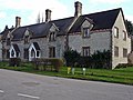
English: Combrook (also spelt Combroke and - more rarely - Combrooke) is a small village of about 65 houses in rural Warwickshire, located near the junction of the Fosse Way (B4455 road), and the B4086 road between the villages of Wellesbourne and Kineton.
Subcategories
This category has only the following subcategory.
Media in category "Combrook"
The following 78 files are in this category, out of 78 total.
-
 A Barn in a Field - geograph.org.uk - 4933666.jpg 3,628 × 2,484; 2.09 MB
-
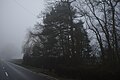 A foggy day - geograph.org.uk - 5633448.jpg 6,032 × 4,014; 6.03 MB
-
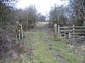
 Bridleway near Red House - geograph.org.uk - 1934264.jpg 640 × 480; 92 KB
-
 Chater's Bank Coppice, near Combrook - geograph.org.uk - 1809996.jpg 2,000 × 1,456; 166 KB
-
 Church Hill and Village Hall - geograph.org.uk - 4932096.jpg 3,602 × 2,657; 2.01 MB
-
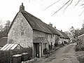
 Well, Combrook - geograph.org.uk - 100988.jpg 640 × 480; 162 KB
-
 Combrook - geograph.org.uk - 1057683.jpg 640 × 480; 262 KB
-
 Combrook - geograph.org.uk - 1057685.jpg 640 × 480; 277 KB
-
 Combrook Church - geograph.org.uk - 1057693.jpg 640 × 480; 294 KB
-
 Combrook Garage - geograph.org.uk - 1935241.jpg 640 × 480; 92 KB
-
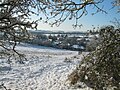 Combrook in the snow 2010 - geograph.org.uk - 4844246.jpg 604 × 453; 107 KB
-
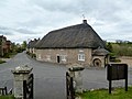
 Combrook Village Hall - geograph.org.uk - 1057691.jpg 640 × 480; 286 KB
-
 Combrook Village Hall - geograph.org.uk - 1936189.jpg 640 × 480; 92 KB
-
 Combrook-Church Hill - geograph.org.uk - 3951692.jpg 1,024 × 768; 157 KB
-
 Combrook-The Rides - geograph.org.uk - 3932823.jpg 1,024 × 768; 276 KB
-
 Compton Pool - geograph.org.uk - 5861263.jpg 775 × 1,024; 190 KB
-
 Compton Pools - geograph.org.uk - 4932100.jpg 4,000 × 3,000; 3.81 MB
-
 Compton Verney Lake - geograph.org.uk - 3932741.jpg 1,024 × 768; 183 KB
-
 Cottages 40 and 41 Combrook - geograph.org.uk - 1935240.jpg 640 × 480; 98 KB
-
 Cottages 8 and 9 Combrook - geograph.org.uk - 1935249.jpg 640 × 480; 126 KB
-
 Cottages adjacent to Red House - geograph.org.uk - 1934254.jpg 640 × 480; 85 KB
-
 Cottages and church, Combrook - geograph.org.uk - 1935255.jpg 640 × 480; 101 KB
-
 Crop in field at Brookhampton - geograph.org.uk - 1934317.jpg 640 × 480; 126 KB
-
 Derelict barn on footpath to Combrook - geograph.org.uk - 1809293.jpg 2,000 × 1,495; 157 KB
-

-
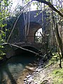 Double arch bridge on the S^MJR, near Combrook - geograph.org.uk - 1809277.jpg 1,500 × 1,989; 208 KB
-
 Driveway to Hampton House Farm - geograph.org.uk - 3519285.jpg 2,000 × 1,500; 1.04 MB
-
 Entrance to Compton Verney House - geograph.org.uk - 5059933.jpg 3,917 × 2,802; 2.92 MB
-
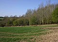
 Farmland east of Combrook - geograph.org.uk - 4163228.jpg 2,592 × 1,944; 1.84 MB
-
 Flock of geese on Compton Pools - geograph.org.uk - 1936203.jpg 640 × 480; 125 KB
-
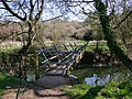 Footbridge on footpath to Combrook - geograph.org.uk - 1809243.jpg 2,000 × 1,503; 275 KB
-
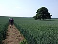
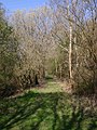
 Footpath into Combrook - geograph.org.uk - 5082264.jpg 1,600 × 991; 521 KB
-

-
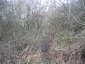
 Footpath near Combrook - geograph.org.uk - 2286383.jpg 640 × 480; 105 KB
-
 Footpath to Brookhampton - geograph.org.uk - 1934307.jpg 640 × 480; 79 KB
-
 Footpath to Butlers Marston - geograph.org.uk - 1810048.jpg 2,000 × 1,493; 180 KB
-
 Footpath to Combrook crosses route of the S^MJR - geograph.org.uk - 1810032.jpg 2,000 × 1,513; 317 KB
-
 Footpath to Herd Hill - geograph.org.uk - 187157.jpg 640 × 480; 81 KB
-
 Footpath to Marston Hill - geograph.org.uk - 188472.jpg 640 × 480; 59 KB
-
 Fosse Cottages - geograph.org.uk - 4021997.jpg 2,592 × 1,944; 1.88 MB
-
 Fosse Rides, Combrook - geograph.org.uk - 2286367.jpg 640 × 480; 134 KB
-
 Fosse Way near Combrook - geograph.org.uk - 2079430.jpg 640 × 480; 59 KB
-

-
 Hampton House Farm, Combrook - geograph.org.uk - 1809252.jpg 2,000 × 1,498; 145 KB
-
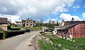 Houses and Sheds, Combrook - geograph.org.uk - 5227173.jpg 3,993 × 2,364; 2.01 MB
-
 Houses at the end of Church Hill - geograph.org.uk - 4932098.jpg 4,000 × 3,000; 3.04 MB
-
 Mansion, Combrook - geograph.org.uk - 100983.jpg 640 × 480; 135 KB
-
 Old railway fencing - geograph.org.uk - 118505.jpg 640 × 480; 117 KB
-
 Pond near Fossedene Manor - geograph.org.uk - 3519426.jpg 2,000 × 1,500; 497 KB
-
 Sheep on Park Farm - geograph.org.uk - 4932102.jpg 4,000 × 3,000; 3 MB
-
 Solitary Tree, Hampton House Farm - geograph.org.uk - 4933662.jpg 3,809 × 2,765; 3.19 MB
-
 Spring, Combrook - geograph.org.uk - 100993.jpg 640 × 480; 117 KB
-
 St Mary and St Margaret's church, Combrook - geograph.org.uk - 4163224.jpg 2,592 × 1,944; 1.53 MB
-
 The lane from Combrook to Kineton - geograph.org.uk - 4163226.jpg 2,592 × 1,944; 1.89 MB
-
 Trackbed and disused bridge on the S^MJR, near Combrook - geograph.org.uk - 1810107.jpg 2,000 × 1,504; 354 KB
-
 Trackbed of the S^MJR, near Combrook - geograph.org.uk - 1810008.jpg 1,500 × 1,992; 293 KB
-
 Trackbed on the S^MJR, near Combrook - geograph.org.uk - 1810178.jpg 2,000 × 1,496; 346 KB
-
 Two Footpaths - geograph.org.uk - 4933727.jpg 4,000 × 3,000; 2.88 MB
-
 View from Combrook Church - geograph.org.uk - 4932094.jpg 3,886 × 3,000; 3.09 MB
-
 View over Combrook - geograph.org.uk - 1809976.jpg 2,000 × 1,478; 167 KB
-
 View over the Combrook valley - geograph.org.uk - 4932313.jpg 1,600 × 1,075; 557 KB
-
 Bridleway crossing - geograph.org.uk - 99347.jpg 640 × 480; 150 KB
-
 BT repeater station - geograph.org.uk - 187151.jpg 640 × 480; 99 KB
-
 Combrook Village Hall - geograph.org.uk - 107982.jpg 640 × 480; 41 KB
-
-
 Farmland at Home Farm - geograph.org.uk - 180653.jpg 640 × 480; 99 KB
-
 Fields at Blacklands Farm - geograph.org.uk - 188482.jpg 640 × 480; 56 KB
-
 Gateway to Fossdene Manor - geograph.org.uk - 117188.jpg 640 × 480; 86 KB
-
 Green lane to Butlers Marston - geograph.org.uk - 188494.jpg 640 × 480; 96 KB
-
 Herd Hill - geograph.org.uk - 187361.jpg 640 × 480; 54 KB
-
 Home Farm - geograph.org.uk - 183242.jpg 640 × 480; 112 KB
-
 Oxhill Bridle Road - geograph.org.uk - 179174.jpg 640 × 480; 77 KB
-
 Park Slade Farm - geograph.org.uk - 180642.jpg 640 × 480; 130 KB
-

-
 Sign for Fossedene Manor - geograph.org.uk - 118503.jpg 640 × 480; 83 KB
-
 View over Combrook - geograph.org.uk - 100998.jpg 640 × 480; 67 KB
-
 View towards Bright Hill - geograph.org.uk - 188462.jpg 640 × 480; 69 KB
-
 Warning sign - geograph.org.uk - 118508.jpg 640 × 480; 84 KB


