Category:Colmonell (civil parish)
Jump to navigation
Jump to search
Scottish parish in South Ayrshire, Scotland, UK | |||||
| Upload media | |||||
| Instance of | |||||
|---|---|---|---|---|---|
| Named after | |||||
| Location |
| ||||
| Population |
| ||||
| Area |
| ||||
 | |||||
Subcategories
This category has the following 5 subcategories, out of 5 total.
Media in category "Colmonell (civil parish)"
The following 200 files are in this category, out of 2,781 total.
(previous page) (next page)-
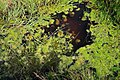 A bog pool on Knockdolian - geograph.org.uk - 1529033.jpg 640 × 427; 147 KB
-
 A Burn in Arecleoch Forest - geograph.org.uk - 3419188.jpg 640 × 426; 125 KB
-
 A Burn in Arecleoch Forest - geograph.org.uk - 3419900.jpg 640 × 480; 94 KB
-
 A bus stop and bridge on the B734 - geograph.org.uk - 3528337.jpg 3,786 × 2,688; 1.65 MB
-
 A bus stop outside Colmonell Primary School - geograph.org.uk - 3526855.jpg 4,000 × 3,000; 1.69 MB
-
 A Glaury Field Entrance - geograph.org.uk - 1579318.jpg 640 × 463; 91 KB
-
 A lay-by beside the A77 - geograph.org.uk - 3515833.jpg 4,000 × 3,000; 3.71 MB
-
 A lay-by beside the A77 - geograph.org.uk - 3517302.jpg 640 × 478; 51 KB
-
 A lay-by beside the A77 - geograph.org.uk - 3519076.jpg 3,794 × 2,702; 1.26 MB
-
 A lay-by beside the A77 looking northeast - geograph.org.uk - 3517313.jpg 3,930 × 2,904; 1.66 MB
-
 A Line Of Spooky Trees - geograph.org.uk - 1579297.jpg 640 × 388; 81 KB
-
 A little wooden cottage beside the A77 - geograph.org.uk - 3517322.jpg 4,000 × 3,000; 2.16 MB
-
 A lobster boat off Balchreuchan Port - geograph.org.uk - 5761884.jpg 1,024 × 683; 745 KB
-
 A minor road at Liggetcheek - geograph.org.uk - 3528411.jpg 3,914 × 2,882; 1.55 MB
-
 A minor road at Pinwherry - geograph.org.uk - 3528353.jpg 3,800 × 2,850; 2.55 MB
-
 A New Road in Chellis Forest - geograph.org.uk - 2381796.jpg 640 × 426; 114 KB
-
 A notice by the side of the A714 - geograph.org.uk - 3522347.jpg 4,000 × 3,000; 5.23 MB
-
 A pheasant with a broken tail on the B7044 - geograph.org.uk - 3523922.jpg 4,000 × 3,000; 2.54 MB
-
 A Quarry in Arecleoch Forest - geograph.org.uk - 3419921.jpg 640 × 480; 102 KB
-
 A Symbolic Stone in Colmonell Churchyard - geograph.org.uk - 3656090.jpg 640 × 480; 135 KB
-
 A Symbolic Stone in Colmonell Churchyard - geograph.org.uk - 3656103.jpg 485 × 640; 139 KB
-
 A Touch of Snow - geograph.org.uk - 4320255.jpg 1,920 × 1,280; 1.75 MB
-
 A view of Colmonell in the snow - geograph.org.uk - 2262031.jpg 640 × 472; 64 KB
-

-
 A Windswept Wood - geograph.org.uk - 5195782.jpg 640 × 425; 132 KB
-
 A714 by Asselfoot - geograph.org.uk - 3108743.jpg 480 × 640; 120 KB
-
 A714 by Oak Wood - geograph.org.uk - 3108702.jpg 640 × 480; 100 KB
-
 A714 crosses railway near Daljarrock Bridge - geograph.org.uk - 5913286.jpg 1,024 × 695; 245 KB
-
 A714 heading to Pinwherry - geograph.org.uk - 3528376.jpg 3,966 × 2,954; 2.56 MB
-
 A714 near Black Wood - geograph.org.uk - 5913280.jpg 1,024 × 735; 223 KB
-
 A714 near Eldrick - geograph.org.uk - 2443973.jpg 640 × 480; 62 KB
-
 A714 near Eldrick - geograph.org.uk - 2444046.jpg 640 × 480; 73 KB
-
 A714 north of Pinmore Bridge - geograph.org.uk - 5913271.jpg 1,024 × 768; 173 KB
-
 A714 Pinmore-Pinwherry road - geograph.org.uk - 3340288.jpg 1,600 × 1,200; 612 KB
-
 A714 south of High Letterpin - geograph.org.uk - 3108772.jpg 640 × 480; 86 KB
-
 A714 to Girvan - geograph.org.uk - 3340144.jpg 1,600 × 1,200; 592 KB
-
 A714 to Girvan - geograph.org.uk - 3340205.jpg 1,600 × 1,200; 870 KB
-
 A714 to Girvan - geograph.org.uk - 3340216.jpg 1,600 × 1,200; 865 KB
-
 A714 to Girvan - geograph.org.uk - 4963658.jpg 1,920 × 1,280; 1.69 MB
-
 A714 to Newton Stewart - geograph.org.uk - 3031579.jpg 2,272 × 1,704; 725 KB
-
 A714 to Newton Stewart - geograph.org.uk - 3031629.jpg 2,272 × 1,704; 742 KB
-
 A714 to Newton Stewart - geograph.org.uk - 3031680.jpg 2,272 × 1,704; 765 KB
-
 A714 to Pinmore - geograph.org.uk - 3340186.jpg 1,600 × 1,200; 887 KB
-
 A714 to Pinmore - geograph.org.uk - 3340253.jpg 1,600 × 1,200; 846 KB
-
 A714 to Pinmore - geograph.org.uk - 3340321.jpg 1,600 × 1,200; 905 KB
-
 A714 to Pinmore - geograph.org.uk - 3340365.jpg 1,600 × 1,200; 571 KB
-
 A714 to Pinwherry - geograph.org.uk - 3031352.jpg 2,272 × 1,704; 741 KB
-
 A714 to Pinwherry - geograph.org.uk - 3340148.jpg 1,600 × 1,200; 746 KB
-
 A714 to Pinwherry - geograph.org.uk - 3340190.jpg 1,600 × 1,200; 912 KB
-
 A714 to Pinwherry - geograph.org.uk - 3340219.jpg 1,600 × 1,200; 918 KB
-
 A714 to Pinwherry - geograph.org.uk - 3340246.jpg 1,600 × 1,200; 592 KB
-
 A714 to Pinwherry - geograph.org.uk - 3340314.jpg 1,600 × 1,200; 819 KB
-
 A714 to Pinwherry - geograph.org.uk - 3340324.jpg 1,600 × 1,200; 843 KB
-
 A714 to Pinwherry - geograph.org.uk - 3340352.jpg 1,600 × 1,200; 945 KB
-
 A77 at Bennane Head - geograph.org.uk - 6337166.jpg 1,600 × 861; 276 KB
-
 A77 at Bennane Hill - geograph.org.uk - 4067869.jpg 640 × 480; 55 KB
-
 A77 at Lendalfoot - geograph.org.uk - 4907636.jpg 1,920 × 1,280; 1.65 MB
-
 A77 at the Bennane - geograph.org.uk - 3338038.jpg 2,272 × 1,704; 712 KB
-
 A77 at The Whilk - geograph.org.uk - 3517326.jpg 3,842 × 2,628; 1.41 MB
-
 A77 at top of Bennane Hill - geograph.org.uk - 4908464.jpg 3,504 × 2,336; 3.78 MB
-
 A77 at top of Bennane Hill - geograph.org.uk - 4908482.jpg 3,504 × 2,336; 3.06 MB
-
 A77 by Fernwell - geograph.org.uk - 3106349.jpg 640 × 480; 83 KB
-
 A77 by Little Bennane - geograph.org.uk - 3106417.jpg 640 × 480; 82 KB
-
 A77 climbs over Bennane Head - geograph.org.uk - 4537612.jpg 640 × 482; 42 KB
-
 A77 going over the Bennane - geograph.org.uk - 3338024.jpg 2,272 × 1,704; 736 KB
-
 A77 going over the Bennane - geograph.org.uk - 3338042.jpg 2,272 × 1,704; 699 KB
-
 A77 heading for Ballantrae - geograph.org.uk - 3338025.jpg 2,272 × 1,704; 728 KB
-
 A77 heading for Ballantrae - geograph.org.uk - 3515852.jpg 4,000 × 3,000; 1.61 MB
-
 A77 heading for Ballantrae - geograph.org.uk - 3529631.jpg 3,568 × 2,584; 1.26 MB
-
 A77 heading for Girvan - geograph.org.uk - 3515822.jpg 4,000 × 3,000; 4.13 MB
-
 A77 heading for Girvan - geograph.org.uk - 3515854.jpg 3,996 × 2,992; 1.46 MB
-
 A77 heading for Girvan - geograph.org.uk - 3519069.jpg 3,749 × 2,626; 1.31 MB
-
 A77 lay-by north of Lendalfoot - geograph.org.uk - 4538899.jpg 640 × 480; 33 KB
-
 A77 Lendalfoot - geograph.org.uk - 3834082.jpg 1,920 × 1,280; 1.33 MB
-
 A77 near Lendalfoot - geograph.org.uk - 3580873.jpg 1,920 × 1,280; 1.65 MB
-
 A77 near Lendalfoot - geograph.org.uk - 3580877.jpg 1,920 × 1,280; 1.55 MB
-
 A77 north of Pinbain Bridge - geograph.org.uk - 4538904.jpg 640 × 480; 47 KB
-
 A77 north of Pinbain Bridge - geograph.org.uk - 4908519.jpg 3,504 × 2,336; 3.32 MB
-
 A77 northbound at Fernwell - geograph.org.uk - 4537618.jpg 640 × 481; 38 KB
-
 A77 northbound at Lendalfoot - geograph.org.uk - 4538889.jpg 640 × 480; 44 KB
-

-
 A77 northbound at The Whilk - geograph.org.uk - 4537627.jpg 640 × 481; 52 KB
-
 A77 northbound near Little Bennane - geograph.org.uk - 4537616.jpg 640 × 481; 40 KB
-

-
 A77 Road Signs - geograph.org.uk - 5512900.jpg 2,592 × 1,728; 1.9 MB
-
 A77 to Ballantrae at Carleton - geograph.org.uk - 3730532.jpg 1,920 × 1,280; 1.17 MB
-
 A77 to Ballantrae at Carleton - geograph.org.uk - 3730541.jpg 1,920 × 1,280; 1.29 MB
-
 A77 to Girvan - geograph.org.uk - 5512812.jpg 2,592 × 1,728; 2.61 MB
-
 A77 to Girvan - geograph.org.uk - 5512818.jpg 2,592 × 1,728; 2.27 MB
-
 A77 to Girvan - geograph.org.uk - 5512882.jpg 2,592 × 1,728; 2.21 MB
-
 A77 to Girvan at Lendalfoot - geograph.org.uk - 3730562.jpg 1,920 × 1,280; 1.36 MB
-
 A77 to Girvan at Lendalfoot - geograph.org.uk - 3834066.jpg 1,920 × 1,280; 1.24 MB
-
 A77 to Girvan at Lendalfoot - geograph.org.uk - 3834144.jpg 1,920 × 1,280; 1.17 MB
-
 A77 to Girvan at the Whilk - geograph.org.uk - 3833805.jpg 1,920 × 1,280; 1.3 MB
-
 A77 to Girvan at the Whilk - geograph.org.uk - 3833820.jpg 1,920 × 1,280; 1.44 MB
-
 A77 to Lendalfoot - geograph.org.uk - 3730527.jpg 1,920 × 1,280; 1.32 MB
-
 A77 to Lendalfoot - geograph.org.uk - 3833838.jpg 1,920 × 1,280; 1.76 MB
-
 A77 to Lendalfoot at Carleton - geograph.org.uk - 3730545.jpg 1,920 × 1,280; 1.5 MB
-
 A77 to Stranraer - geograph.org.uk - 5512863.jpg 2,592 × 1,728; 662 KB
-
 A77 to Stranraer at Lendalfoot - geograph.org.uk - 3834072.jpg 1,920 × 1,280; 1.31 MB
-
 A77 to Stranraer at Lendalfoot - geograph.org.uk - 3834097.jpg 1,920 × 1,280; 1.58 MB
-
 A77 to Stranraer at Lendalfoot - geograph.org.uk - 3834139.jpg 1,920 × 1,280; 1.37 MB
-
 A77 to Stranraer near Lendalfoot - geograph.org.uk - 3833849.jpg 1,920 × 1,280; 1.45 MB
-
 A77 Trunk Road - geograph.org.uk - 2995754.jpg 3,648 × 2,736; 4.66 MB
-
 A77 Trunk Road - geograph.org.uk - 2996120.jpg 3,648 × 2,736; 3.53 MB
-
 Abandoned cattle market building at Barrhill - geograph.org.uk - 3246314.jpg 1,200 × 797; 881 KB
-
 Above Balcreuchan Port - geograph.org.uk - 6039619.jpg 2,916 × 1,930; 602 KB
-
 Above Balcreuchan Port - geograph.org.uk - 6039628.jpg 2,976 × 1,984; 2.37 MB
-
 Access road for Arecleoch Windfarm - geograph.org.uk - 3246382.jpg 1,200 × 797; 569 KB
-
 Access road for Arecleoch Windfarm - geograph.org.uk - 3246387.jpg 1,200 × 797; 563 KB
-
 Access road for Arecleoch Windfarm - geograph.org.uk - 3246391.jpg 1,200 × 797; 585 KB
-
 Ailsa Craig - geograph.org.uk - 4908498.jpg 2,879 × 1,808; 1.82 MB
-
 Ailsa Craig - geograph.org.uk - 5497303.jpg 640 × 426; 69 KB
-
 Ailsa Craig - geograph.org.uk - 5761906.jpg 1,024 × 683; 701 KB
-
 Ailsa Craig - geograph.org.uk - 5973537.jpg 2,533 × 1,901; 575 KB
-
 Ailsa Craig and Arran - geograph.org.uk - 4908449.jpg 3,504 × 2,336; 3.48 MB
-
 Ailsa Craig and Arran - geograph.org.uk - 4908457.jpg 3,504 × 2,336; 3.93 MB
-
 Ailsa Craig View - geograph.org.uk - 5193808.jpg 640 × 404; 81 KB
-
 All at Sea - geograph.org.uk - 5089035.jpg 1,920 × 1,280; 679 KB
-
 Almont Farm - geograph.org.uk - 3526888.jpg 3,735 × 2,821; 1.52 MB
-
 Along Fell Hill - geograph.org.uk - 1579362.jpg 640 × 426; 104 KB
-
 Along the Fenceline - geograph.org.uk - 5512417.jpg 2,592 × 1,728; 2.34 MB
-
 Along the Fenceline - geograph.org.uk - 5512428.jpg 2,592 × 1,728; 2.61 MB
-
 Along The Road - geograph.org.uk - 1579343.jpg 640 × 480; 97 KB
-
 Alticane - geograph.org.uk - 2442345.jpg 640 × 480; 75 KB
-
 Alticane - geograph.org.uk - 2442362.jpg 640 × 480; 65 KB
-
 An anchor by Carleton Bay - geograph.org.uk - 3867389.jpg 3,888 × 2,592; 3.24 MB
-
 An area to be developed^ - geograph.org.uk - 3522334.jpg 4,000 × 3,000; 3.04 MB
-
 Anchor at the Varyag Memorial, Lendalfoot - geograph.org.uk - 5942390.jpg 2,976 × 1,984; 2.65 MB
-
 Anchor at the Varyag Memorial, Lendalfoot - geograph.org.uk - 5942422.jpg 2,976 × 1,984; 2.45 MB
-
 Anchor from Russian Cruiser Varyag - geograph.org.uk - 5123459.jpg 3,341 × 2,216; 4.66 MB
-
 Approaching Barrhill - geograph.org.uk - 3031324.jpg 2,272 × 1,704; 741 KB
-
 Approaching Barrhill - geograph.org.uk - 5032559.jpg 1,920 × 1,280; 597 KB
-
 Approaching Barrhill - geograph.org.uk - 5975674.jpg 2,592 × 1,944; 1.76 MB
-
 Approaching Climbing Lane - geograph.org.uk - 5512853.jpg 2,524 × 1,728; 592 KB
-
 Approaching Colmonell - geograph.org.uk - 3024093.jpg 2,272 × 1,704; 705 KB
-
 Approaching Colmonell Cemetery - geograph.org.uk - 5044404.jpg 1,920 × 1,280; 2.06 MB
-
 Approaching Colmonell Cemetery - geograph.org.uk - 5704250.jpg 2,976 × 1,984; 1.81 MB
-
 Approaching Colmonell Cemetery - geograph.org.uk - 5704263.jpg 2,976 × 1,984; 1.93 MB
-
 Approaching Colmonell on the B734 - geograph.org.uk - 3523980.jpg 3,906 × 2,872; 1.58 MB
-
 Approaching Hallowchapel Farm - geograph.org.uk - 4319828.jpg 1,920 × 1,280; 2.07 MB
-
 Approaching Knockdolian Lodge - geograph.org.uk - 3523890.jpg 3,862 × 2,806; 2.26 MB
-
 Approaching Lendalfoot - geograph.org.uk - 3056307.jpg 2,272 × 1,704; 756 KB
-
 Approaching Lendalfoot - geograph.org.uk - 3405071.jpg 1,920 × 1,280; 1.34 MB
-
 Approaching Lendalfoot - geograph.org.uk - 3834163.jpg 1,920 × 1,280; 1.29 MB
-
 Approaching Lendalfoot - geograph.org.uk - 3834184.jpg 1,920 × 1,280; 1.24 MB
-
 Approaching Lendalfoot - geograph.org.uk - 5535930.jpg 2,592 × 1,728; 2.02 MB
-
 Approaching Lendalfoot - geograph.org.uk - 5584315.jpg 2,592 × 1,728; 1.15 MB
-
 Approaching Little Bennane Farm - geograph.org.uk - 4448919.jpg 1,920 × 1,280; 1.66 MB
-
 Approaching Overtaking Lane - geograph.org.uk - 5512808.jpg 2,592 × 1,728; 2.37 MB
-
 Approaching Pinwherry - geograph.org.uk - 5044391.jpg 1,920 × 1,280; 1.6 MB
-
 Approaching Radio Mast on Glessal Hill - geograph.org.uk - 4319972.jpg 1,920 × 1,280; 812 KB
-
 Approaching the A77 - geograph.org.uk - 5162328.jpg 1,887 × 1,218; 414 KB
-
 Approaching the A77 at Bennane - geograph.org.uk - 3338022.jpg 2,272 × 1,704; 670 KB
-
 Approaching the A77 at Lendalfoot - geograph.org.uk - 3834395.jpg 1,920 × 1,280; 1.12 MB
-
 Approaching the B734 at Knockdolian - geograph.org.uk - 4348059.jpg 1,920 × 1,280; 2.05 MB
-
 Approaching the B734 at Liggetcheek - geograph.org.uk - 4449023.jpg 1,920 × 1,280; 1.74 MB
-
 Arctic on the A77 - geograph.org.uk - 5512227.jpg 2,592 × 1,728; 1.57 MB
-
 Arecleoch Forest - geograph.org.uk - 3419933.jpg 640 × 480; 120 KB
-
 Arecleoch Forest - geograph.org.uk - 3912937.jpg 1,920 × 1,280; 2.21 MB
-
 Arecleoch Forest - geograph.org.uk - 3912957.jpg 1,920 × 1,280; 1.7 MB
-
 Arecleoch Forest - geograph.org.uk - 5652998.jpg 3,984 × 2,656; 4.57 MB
-
 Arecleoch Forest Edge - geograph.org.uk - 3429548.jpg 640 × 478; 92 KB
-
 Arecleoch Forest Ride - geograph.org.uk - 3419194.jpg 640 × 426; 121 KB
-
 Arecleoch Forest Ride - geograph.org.uk - 3419200.jpg 640 × 480; 118 KB
-
 Arecleoch Forest Ride - geograph.org.uk - 3419905.jpg 640 × 453; 118 KB
-
 Arecleoch Forest Ride - geograph.org.uk - 3429435.jpg 640 × 464; 128 KB
-
 Arecleoch Forest Ride - geograph.org.uk - 3429517.jpg 640 × 480; 133 KB
-
 Arecleoch Forest Ride - geograph.org.uk - 3429541.jpg 640 × 480; 134 KB
-
 Arecleoch Forest Road - geograph.org.uk - 3419184.jpg 640 × 480; 105 KB
-
 Arecleoch Forest Road - geograph.org.uk - 3419863.jpg 640 × 477; 109 KB
-
 Arecleoch Forest Road - geograph.org.uk - 3419878.jpg 640 × 472; 126 KB
-
 Arecleoch Forest Road - geograph.org.uk - 3419991.jpg 640 × 481; 98 KB
-
 Arecleoch Forest Road - geograph.org.uk - 3419997.jpg 640 × 426; 111 KB
-
 Arecleoch Forest Road - geograph.org.uk - 3429423.jpg 640 × 446; 89 KB
-
 Arecleoch Forest Road - geograph.org.uk - 3429428.jpg 640 × 479; 129 KB
-
 Arecleoch Forest Road - geograph.org.uk - 3429444.jpg 640 × 474; 109 KB
-
 Arecleoch Forest Road - geograph.org.uk - 3429531.jpg 640 × 422; 104 KB
-
 Arecleoch Forest View - geograph.org.uk - 3420098.jpg 640 × 426; 110 KB
-
 Arecleoch Forest View - geograph.org.uk - 3429398.jpg 640 × 480; 99 KB
-
 Arecleoch Forest View - geograph.org.uk - 3429520.jpg 640 × 480; 121 KB
-
 Arecleoch Forest View - geograph.org.uk - 3429522.jpg 640 × 485; 127 KB
-
 Arecleoch Wind Farm - geograph.org.uk - 3419949.jpg 640 × 461; 102 KB
-
 Arecleoch Windfarm access road - geograph.org.uk - 3246761.jpg 1,200 × 797; 445 KB
-
 Arecleoch Windfarm access road - geograph.org.uk - 3246778.jpg 1,200 × 797; 503 KB
-
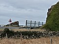
 Arnsheen Church (Former), Barrhill - geograph.org.uk - 4963655.jpg 1,920 × 1,280; 2.39 MB
-
 Arnsheen Church (Former), Barrhill - geograph.org.uk - 4963661.jpg 1,920 × 1,280; 2.09 MB
-
 Arnsheen Church (Former), Barrhill - geograph.org.uk - 4963665.jpg 1,280 × 1,920; 2.04 MB
-
 Arnsheen Church (Former), Barrhill - geograph.org.uk - 4963670.jpg 1,280 × 1,920; 1.1 MB
-
 Arnsheen Church (Former), Barrhill - geograph.org.uk - 4963719.jpg 1,920 × 1,280; 1.97 MB
-
 Arnsheen Church (Former), Barrhill - geograph.org.uk - 4963721.jpg 1,280 × 1,920; 1.08 MB
-
 Arnsheen Park - geograph.org.uk - 3031433.jpg 2,272 × 1,704; 710 KB
-
 Arnsheen Park - geograph.org.uk - 3031435.jpg 2,272 × 1,704; 662 KB
-
 Arnsheen Park - geograph.org.uk - 3031438.jpg 2,272 × 1,704; 730 KB
-
 Arnsheen Park - geograph.org.uk - 3031442.jpg 2,272 × 1,704; 725 KB
-
 Arriving at Barrhill - geograph.org.uk - 4963633.jpg 1,920 × 1,280; 1.76 MB
-
 Arriving at Barrhill - geograph.org.uk - 5033149.jpg 1,920 × 1,280; 1.88 MB
-
 Arriving at Lendalfoot - geograph.org.uk - 4508522.jpg 1,920 × 1,280; 1.3 MB
-
 Arriving at Lendalfoot - geograph.org.uk - 5584258.jpg 2,592 × 1,728; 1.95 MB
-
 Arriving in Poundland - geograph.org.uk - 3108109.jpg 480 × 640; 105 KB


,_Barrhill_-_geograph.org.uk_-_4963655.jpg)
,_Barrhill_-_geograph.org.uk_-_4963661.jpg)
,_Barrhill_-_geograph.org.uk_-_4963665.jpg)
,_Barrhill_-_geograph.org.uk_-_4963670.jpg)
,_Barrhill_-_geograph.org.uk_-_4963719.jpg)
,_Barrhill_-_geograph.org.uk_-_4963721.jpg)


&filefrom=Ash+Cottage+near+Pinwherry+-+geograph.org.uk+-+4320165.jpg#mw-category-media)