Category:Coleshill, Buckinghamshire
Jump to navigation
Jump to search
English: Coleshill (formerly Stoke) is a village and civil parish within Chiltern district in Buckinghamshire, England. It is near Amersham and just to the north of Beaconsfield. It used to be a small area of Hertfordshire, completely surrounded by Buckinghamshire. It is in modern Buckinghamshire.
Polski: Coleshill – miasteczko w Wielkiej Brytanii, w Anglii, w regionie South East England, w hrabstwie Buckinghamshire. W 2001 r. liczyło ono 578 mieszkańców.
village and civil parish in Buckinghamshire, United Kingdom  | |||||
| Upload media | |||||
| Instance of | |||||
|---|---|---|---|---|---|
| Location | Buckinghamshire, South East England, England | ||||
 | |||||
Subcategories
This category has only the following subcategory.
Media in category "Coleshill, Buckinghamshire"
The following 92 files are in this category, out of 92 total.
-
 A chilly winter’s day at the duck pond, Coleshill - geograph.org.uk - 6040557.jpg 4,129 × 3,097; 2.78 MB
-
 A wintry Chiltern Way near to Brentford Grange Farm - geograph.org.uk - 6040542.jpg 4,608 × 3,456; 4.65 MB
-
 A wintry Chiltern Way on the other side of Amersham Road - geograph.org.uk - 6040551.jpg 4,608 × 3,456; 5.78 MB
-
 A355 Amersham Road - geograph.org.uk - 5646213.jpg 640 × 428; 112 KB
-
 A355 Amersham Road, northbound - geograph.org.uk - 5646212.jpg 640 × 428; 110 KB
-
 A355 at Tower Road - geograph.org.uk - 4868960.jpg 640 × 479; 80 KB
-
 A355 towards Amersham - geograph.org.uk - 6131937.jpg 800 × 600; 153 KB
-
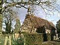 All Saints Church, Coleshill - geograph.org.uk - 3905781.jpg 2,048 × 1,536; 850 KB
-
 Amber Cottages, Barrack Hill, Coleshill - geograph.org.uk - 3391730.jpg 1,024 × 754; 210 KB
-
 Amersham Cricket Club grounds - geograph.org.uk - 49794.jpg 640 × 480; 115 KB
-
 Amersham Road (A355) - geograph.org.uk - 6131941.jpg 800 × 600; 166 KB
-
 Army camp at Bowers Farm in 1928 - geograph.org.uk - 3146768.jpg 621 × 960; 110 KB
-
 Army camp at Bowers Farm in 1928 - geograph.org.uk - 3146777.jpg 649 × 960; 148 KB
-
 Army camp at Bowers Farm in 1928 - geograph.org.uk - 3146784.jpg 783 × 1,216; 179 KB
-
 Barn and pond on Bowers Farm in 1928 - geograph.org.uk - 3145101.jpg 791 × 1,136; 182 KB
-
 Bend in the A355 towards Amersham - geograph.org.uk - 6121464.jpg 800 × 600; 171 KB
-
 Botterells Lane at Hodgemoor Wood - geograph.org.uk - 4868940.jpg 640 × 480; 111 KB
-
 Bottrells Lane - geograph.org.uk - 4402540.jpg 640 × 428; 158 KB
-
 Bottrells Lane at Hills Wood - geograph.org.uk - 4868953.jpg 640 × 480; 103 KB
-
 Bottrells Lane at Stockings Farm - geograph.org.uk - 4868947.jpg 640 × 479; 104 KB
-
 Bottrells Lane, Coleshill - geograph.org.uk - 4691930.jpg 2,560 × 1,920; 1.8 MB
-
 Bus stop on Amersham Road south of Amersham - geograph.org.uk - 4691824.jpg 2,560 × 1,920; 1.9 MB
-
 Chalk Hill at the junction of Barracks Hill - geograph.org.uk - 5665299.jpg 2,304 × 1,728; 839 KB
-
 Chalk Hill, Coleshill - geograph.org.uk - 4692644.jpg 2,560 × 1,920; 1.38 MB
-
 Church at Coleshill - geograph.org.uk - 6040556.jpg 4,608 × 3,456; 4.62 MB
-
 Church at Coleshill village, Buckinghamshire - geograph.org.uk - 2910265.jpg 3,968 × 2,976; 3.04 MB
-
 Coleshill and Rushymead from the air - geograph.org.uk - 2356243.jpg 640 × 480; 187 KB
-
 Coleshill Common - geograph.org.uk - 2524481.jpg 4,000 × 3,000; 2.3 MB
-
 Coleshill duck pond, Buckinghamshire - geograph.org.uk - 2910282.jpg 3,968 × 2,976; 2.78 MB
-
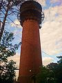
 Coleshill Tower - geograph.org.uk - 3395095.jpg 758 × 1,024; 226 KB
-
 Coleshill Village Hall, Bucks - geograph.org.uk - 6075043.jpg 2,592 × 1,944; 1.38 MB
-
 Coleshill Water Tower - geograph.org.uk - 165673.jpg 427 × 640; 160 KB
-
 Coleshill Water Tower - geograph.org.uk - 6131942.jpg 800 × 748; 225 KB
-
 Coleshill water tower and transmitter mast - geograph.org.uk - 3437267.jpg 4,320 × 3,240; 3.42 MB
-
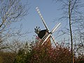
 Coleshill Windmill - geograph.org.uk - 769684.jpg 640 × 480; 80 KB
-
 Coleshill windmill, Bucks.jpg 640 × 480; 80 KB
-
 Coleshill, All Saints Church - geograph.org.uk - 5153980.jpg 5,184 × 3,456; 7.43 MB
-
 Coleshill, The Red Lion - geograph.org.uk - 5153983.jpg 5,184 × 2,604; 6.02 MB
-
 Crop field near Rushymead Farm - geograph.org.uk - 6121461.jpg 800 × 600; 110 KB
-
 Distant glimpse of a windmill on the horizon at Coleshill - geograph.org.uk - 2910244.jpg 3,968 × 2,976; 3.02 MB
-
 Donkey pasture by Fagnall Lane - geograph.org.uk - 2877194.jpg 1,024 × 989; 273 KB
-
 Ducks on the duck pond at Coleshill on a chilly winter’s day - geograph.org.uk - 6040564.jpg 4,608 × 3,456; 4.48 MB
-
 Entering Winchmore Hill on Coleshill Lane - geograph.org.uk - 5665302.jpg 2,304 × 1,728; 824 KB
-
 Entrance to the Chilterns Crematorium, Amersham - geograph.org.uk - 3341852.jpg 3,072 × 2,304; 1.79 MB
-
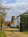
 Farm buildings, Red Barn Farm - geograph.org.uk - 6121452.jpg 800 × 558; 88 KB
-
 Farmland, Coleshill - geograph.org.uk - 5358222.jpg 640 × 480; 116 KB
-
 Field entrance off Amersham Road (A355) - geograph.org.uk - 6131320.jpg 800 × 600; 170 KB
-
 Footpath approaching Coleshill from Winchmore Hill - geograph.org.uk - 5153969.jpg 5,184 × 3,456; 6.33 MB
-
 Former KX300 Telephone Kiosk in Coleshill, Bucks - geograph.org.uk - 5388271.jpg 2,592 × 1,944; 1.4 MB
-
 Grazing near Red Barn Farm - geograph.org.uk - 6131936.jpg 800 × 600; 106 KB
-
 Hill's Wood - geograph.org.uk - 6131938.jpg 800 × 523; 145 KB
-
 Hornbeams near Fagnall Lane - geograph.org.uk - 2881096.jpg 768 × 1,024; 325 KB
-
 House on Sampsons Hill, Coleshill - geograph.org.uk - 4692660.jpg 2,560 × 1,920; 1.25 MB
-
 Looking back towards Amersham Road - geograph.org.uk - 2910256.jpg 3,968 × 2,976; 3.27 MB
-
 Magpie Lane is closed - geograph.org.uk - 4402601.jpg 640 × 480; 145 KB
-
 Magpie Lane, Coleshill - geograph.org.uk - 4692636.jpg 2,560 × 1,920; 1.51 MB
-
 Magpie Lane, Coleshill - geograph.org.uk - 4693237.jpg 2,560 × 1,920; 1.99 MB
-

-
 On the Chiltern Way near to Brentford Grange Farm - geograph.org.uk - 2910250.jpg 3,968 × 2,976; 2.79 MB
-
 Path at woodland edge - geograph.org.uk - 4402374.jpg 640 × 480; 209 KB
-
 Path near Cherry Tree farm - geograph.org.uk - 5154103.jpg 5,202 × 3,465; 4.17 MB
-
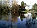
 Pond, Coleshill - geograph.org.uk - 4402590.jpg 640 × 428; 130 KB
-
 Power lines near Coleshill - geograph.org.uk - 5154105.jpg 5,202 × 3,465; 2.99 MB
-
 Red Lion Pub, Coleshill - geograph.org.uk - 3905784.jpg 2,048 × 1,536; 643 KB
-
 Reflections at Coleshill duck pond - geograph.org.uk - 2910280.jpg 3,968 × 2,976; 2.71 MB
-
 Ripples on the duck pond at Coleshill, Buckinghamshire - geograph.org.uk - 2910277.jpg 3,968 × 2,976; 2.74 MB
-

-

-
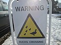 Sign warning of ducks crossing at Coleshill - geograph.org.uk - 6040559.jpg 4,608 × 3,456; 3.2 MB
-
 Snowy fields on the Chiltern Way near to Coleshill - geograph.org.uk - 6040553.jpg 4,608 × 3,456; 4.56 MB
-
 Stockings Farm, Coleshill - geograph.org.uk - 4692625.jpg 2,560 × 1,920; 1.9 MB
-
 Sunlight on a flood in a field - geograph.org.uk - 3905786.jpg 2,048 × 1,536; 613 KB
-
 The 'Bottle Cottages', Coleshill - geograph.org.uk - 3398909.jpg 1,024 × 801; 222 KB
-

-
 The converted water tower at Coleshill - geograph.org.uk - 2806635.jpg 600 × 800; 121 KB
-
 The entrance to Rushymead care home - geograph.org.uk - 2806632.jpg 800 × 600; 146 KB
-
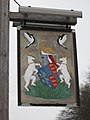
 The Harte and Magpies - geograph.org.uk - 4402572.jpg 640 × 480; 130 KB
-
 The Harte ^ Magpies public house - geograph.org.uk - 2806621.jpg 800 × 600; 92 KB
-
 The Harte ^ Magpies public house - geograph.org.uk - 2806623.jpg 600 × 800; 93 KB
-
 The Harte ^ Magpies public house - geograph.org.uk - 6121454.jpg 640 × 480; 79 KB
-
 The Mushroom Tree - geograph.org.uk - 2524465.jpg 4,000 × 3,000; 3.09 MB
-
 The village pond, Coleshill - geograph.org.uk - 3391550.jpg 1,024 × 761; 185 KB
-
 TheWaterTowerColeshill.jpg 1,536 × 2,048; 702 KB
-
 Track to Brentford Grange - geograph.org.uk - 6131939.jpg 800 × 600; 187 KB
-
 Tree reflections, Coleshill duck pond - geograph.org.uk - 3905783.jpg 2,048 × 1,536; 737 KB
-
 Village Road junction with Manor Way - geograph.org.uk - 769678.jpg 640 × 480; 70 KB
-

-
 Windmill at Coleshill village, Buckinghamshire - geograph.org.uk - 2910285.jpg 3,968 × 2,976; 2.79 MB
-
 Windmill Farm, Coleshill - geograph.org.uk - 3395154.jpg 768 × 1,024; 231 KB
-
 Windmill Hill, Coleshill - geograph.org.uk - 5665297.jpg 2,304 × 1,728; 821 KB
-
 “Please keep off the grass” sign - geograph.org.uk - 6040547.jpg 4,608 × 3,456; 3.08 MB
-
 “Tree island” near to Tower Road - geograph.org.uk - 3905787.jpg 2,048 × 1,536; 514 KB


_-_geograph.org.uk_-_6131941.jpg)


_-_geograph.org.uk_-_6131320.jpg)


