Category:Colebrooke, Devon
Jump to navigation
Jump to search
English: Colebrooke is a village in Devon, England about 8 km west of Crediton. The main point of interest is the church and the connection to Henry Kingsley's novel Recollections of Geoffrey Hamlyn. Also Uncle Tom Cobley, of the folk song, signed his will at Pascoe House,but is buried 4 miles west at Spreyton. The champion Devon wrestler, Abraham Cann was born and buried here. He won the all comers wrestling crown in London.
village and civil parish in Devon, UK  | |||||
| Upload media | |||||
| Instance of | |||||
|---|---|---|---|---|---|
| Location | Mid Devon, Devon, South West England, England | ||||
| Said to be the same as | Colebrooke (Wikimedia duplicated page, civil parish) | ||||
 | |||||
Subcategories
This category has the following 3 subcategories, out of 3 total.
Media in category "Colebrooke, Devon"
The following 200 files are in this category, out of 347 total.
(previous page) (next page)-
 A wet Two Moors Way - geograph.org.uk - 1723050.jpg 640 × 480; 230 KB
-
 Across the Troney valley - geograph.org.uk - 1892367.jpg 640 × 480; 101 KB
-
 Acute junction at Road Down Cross - geograph.org.uk - 1603115.jpg 480 × 640; 118 KB
-
 Appledore Farm - geograph.org.uk - 1894950.jpg 640 × 384; 76 KB
-
 Appledore Farm - geograph.org.uk - 1894961.jpg 640 × 480; 104 KB
-
 Approach to Coleford from Mill Bridge - geograph.org.uk - 5932512.jpg 640 × 480; 191 KB
-
 Approaching Ladywell Pond - geograph.org.uk - 1894485.jpg 640 × 480; 91 KB
-

-
 ArmsOfPrye OfHorwellColebrooke Devon.PNG 982 × 1,130; 200 KB
-
 Barley near Horwell Barton - geograph.org.uk - 1893584.jpg 640 × 480; 100 KB
-
 Barn near Pennyland - geograph.org.uk - 1772369.jpg 640 × 480; 123 KB
-
 Barns at Brocks - geograph.org.uk - 1739691.jpg 640 × 450; 75 KB
-
 Binneford Cross - geograph.org.uk - 1595302.jpg 480 × 640; 145 KB
-
 Bluebells above St Mary's Well - geograph.org.uk - 1894644.jpg 480 × 640; 135 KB
-
 Bridge near Horwell Barton - geograph.org.uk - 1893846.jpg 640 × 452; 116 KB
-
 Bridge near Horwell Barton - geograph.org.uk - 1893878.jpg 640 × 480; 120 KB
-
 Bridge over footpath at Coleford - geograph.org.uk - 3084139.jpg 2,048 × 1,536; 2.87 MB
-
 Bridge over the Troney - geograph.org.uk - 1893414.jpg 480 × 640; 144 KB
-
 Brocks Cross - geograph.org.uk - 2510653.jpg 600 × 800; 395 KB
-
 Brocks Cross - geograph.org.uk - 5700253.jpg 4,173 × 2,189; 1.43 MB
-
 Brocks Cross, the turning for Bow - geograph.org.uk - 1734896.jpg 640 × 480; 47 KB
-
 Broomhill Cross (crossroads) - geograph.org.uk - 121445.jpg 640 × 480; 124 KB
-
 Broomhill Cross - geograph.org.uk - 1734958.jpg 640 × 480; 117 KB
-
 Broomhill Cross looking north - geograph.org.uk - 121446.jpg 640 × 480; 103 KB
-

-
 Broomhill Gauging Station - geograph.org.uk - 2512021.jpg 800 × 600; 554 KB
-
 Broomsland (ruin) - geograph.org.uk - 2510683.jpg 800 × 600; 348 KB
-
 Broomsland - geograph.org.uk - 1890776.jpg 640 × 440; 47 KB
-
 Brown's farm, Coleford - geograph.org.uk - 1403423.jpg 640 × 480; 103 KB
-

-
 Butsford Bridge - geograph.org.uk - 2510699.jpg 800 × 600; 437 KB
-
 Butsford Bridge Cross - geograph.org.uk - 1734928.jpg 640 × 480; 91 KB
-
 Canada Geese near Paschoe House - geograph.org.uk - 1894806.jpg 640 × 480; 111 KB
-
 Cattle near Ladywell Pond - geograph.org.uk - 1894668.jpg 640 × 480; 104 KB
-
 Colebrooke , Bell House - geograph.org.uk - 3338588.jpg 4,288 × 2,848; 4.95 MB
-
 Colebrooke , Churchyard ^ Village Hall - geograph.org.uk - 3338565.jpg 4,288 × 2,848; 6.21 MB
-
 Colebrooke , Colebrooke Cross - geograph.org.uk - 3338535.jpg 4,288 × 2,848; 5.9 MB
-
 Colebrooke , Road - geograph.org.uk - 3338528.jpg 4,288 × 2,848; 6.23 MB
-
 Colebrooke , Rowes Farmhouse - geograph.org.uk - 3338543.jpg 4,288 × 2,848; 6.32 MB
-
 Colebrooke , Signpost ^ Road - geograph.org.uk - 3338520.jpg 4,288 × 2,848; 6.27 MB
-
 Colebrooke , St Andrew's Church - geograph.org.uk - 3338552.jpg 2,848 × 4,288; 6.91 MB
-
 Colebrooke , St Andrew's Church - geograph.org.uk - 3338556.jpg 2,848 × 4,288; 6.05 MB
-
 Colebrooke , Village Scenery - geograph.org.uk - 3338501.jpg 4,288 × 2,848; 6.43 MB
-
 Colebrooke , Village Sign ^ Road - geograph.org.uk - 3338512.jpg 4,288 × 2,848; 6.37 MB
-
 Colebrooke Ford - geograph.org.uk - 4188831.jpg 3,872 × 2,592; 4.68 MB
-
 Colebrooke Parish Hall - geograph.org.uk - 1739457.jpg 640 × 482; 95 KB
-
 Colebrooke Parish Hall - geograph.org.uk - 4490998.jpg 1,200 × 803; 1.33 MB
-
 Colebrooke Village 30mph slow - geograph.org.uk - 907369.jpg 640 × 427; 111 KB
-

-
 Colebrooke, Broomhill Cross - geograph.org.uk - 348430.jpg 640 × 427; 249 KB
-
 Colebrooke, by Tucker's Plot - geograph.org.uk - 348427.jpg 640 × 427; 194 KB
-
 Colebrooke, entrance to Great Wotton - geograph.org.uk - 202120.jpg 640 × 427; 283 KB
-
 Colebrooke, entrance to Lewis Cottage - geograph.org.uk - 202115.jpg 640 × 427; 216 KB
-

-
 Colebrooke, Penstone - geograph.org.uk - 330499.jpg 640 × 427; 181 KB
-
 Colebrooke, the railway to Okehampton - geograph.org.uk - 330503.jpg 640 × 427; 197 KB
-
 Colebrooke, the Two Moors Way - geograph.org.uk - 330560.jpg 640 × 427; 205 KB
-
 Colebrooke, the Two Moors Way - geograph.org.uk - 330566.jpg 640 × 427; 223 KB
-
 Colebrooke, towards Brocks - geograph.org.uk - 348421.jpg 640 × 427; 166 KB
-
 Colebrooke, towards Horwell Barton - geograph.org.uk - 330511.jpg 640 × 427; 198 KB
-
 Colebrooke, towards Pennyland - geograph.org.uk - 348409.jpg 640 × 427; 205 KB
-
 Colebrooke, towards Southcoombe - geograph.org.uk - 330485.jpg 640 × 427; 175 KB
-
 Colebrooke, towards the village - geograph.org.uk - 348415.jpg 640 × 427; 185 KB
-
 Coleford , New Inn - geograph.org.uk - 3338869.jpg 4,288 × 2,848; 5.25 MB
-
 Coleford , Old Car ^ Houses - geograph.org.uk - 3338832.jpg 4,288 × 2,848; 6.81 MB
-
 Coleford , Playground - geograph.org.uk - 3338883.jpg 4,288 × 2,848; 6.35 MB
-
 Coleford , Riverside Cottage - geograph.org.uk - 3338876.jpg 4,288 × 2,848; 5.23 MB
-
 Coleford , Small Lane - geograph.org.uk - 3338838.jpg 4,288 × 2,848; 5.53 MB
-
 Coleford , Small Lane - geograph.org.uk - 3338866.jpg 4,288 × 2,848; 6.61 MB
-
 Coleford , Village Road - geograph.org.uk - 3338846.jpg 4,288 × 2,848; 4.84 MB
-
 Coleford , Village Sign ^ Road - geograph.org.uk - 3338887.jpg 4,288 × 2,848; 6.34 MB
-
 Coleford Junction - GWR 150232+150261 first day of the Dartmoor Line.JPG 1,366 × 910; 677 KB
-
 Coleford, bridge over stream - geograph.org.uk - 5932497.jpg 640 × 480; 180 KB
-
 Corner of field near Paschoe House - geograph.org.uk - 1894432.jpg 640 × 480; 112 KB
-
 Corner of field near Pennyland - geograph.org.uk - 1772389.jpg 640 × 480; 104 KB
-
 Cottage at Penstone, Devon - geograph.org.uk - 448388.jpg 640 × 480; 109 KB
-
 Cottage, Paschoe House - geograph.org.uk - 1894694.jpg 640 × 480; 87 KB
-
 Countryside near East Coombe Head - geograph.org.uk - 1891486.jpg 640 × 404; 98 KB
-
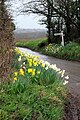 Daffodils at the Junction - geograph.org.uk - 5551035.jpg 683 × 1,024; 346 KB
-
 Damselfly near Paschoe House - geograph.org.uk - 1890789.jpg 640 × 444; 68 KB
-
 Dartmoor Railway from Butsford Bridge - geograph.org.uk - 2510705.jpg 600 × 800; 438 KB
-
 Drive to Great Heale - geograph.org.uk - 1892091.jpg 640 × 480; 73 KB
-
 East Studham Cross - geograph.org.uk - 1734848.jpg 640 × 480; 108 KB
-
 East Studham Cross - geograph.org.uk - 91373.jpg 640 × 480; 30 KB
-
 East Studham Farm - geograph.org.uk - 91371.jpg 640 × 480; 36 KB
-
 Elley - geograph.org.uk - 1772518.jpg 640 × 480; 102 KB
-
 Elley Cross - geograph.org.uk - 2510561.jpg 800 × 601; 439 KB
-
 Entrance to Great Wotton - geograph.org.uk - 1723062.jpg 640 × 480; 223 KB
-
 Entrance to Great Wotton - geograph.org.uk - 5700088.jpg 2,848 × 3,345; 2.04 MB
-
 Farm buildings at Brocks - geograph.org.uk - 2510660.jpg 800 × 600; 396 KB
-
 Farm road, South Coombe - geograph.org.uk - 1843050.jpg 640 × 480; 97 KB
-
 Farmland at South Coombe, Devon - geograph.org.uk - 448323.jpg 640 × 480; 98 KB
-
 Farmland at South Coombe, Devon - geograph.org.uk - 448325.jpg 640 × 480; 100 KB
-
 Farmland by Rag Lane - geograph.org.uk - 1739726.jpg 640 × 438; 80 KB
-
 Farmland near Binneford Cross - geograph.org.uk - 91385.jpg 640 × 480; 35 KB
-
 Farmland near Highfield Farm - geograph.org.uk - 91378.jpg 640 × 480; 38 KB
-
 Fence above Newpark - geograph.org.uk - 1891131.jpg 640 × 480; 100 KB
-
 Field and gate beside Ford Hill - geograph.org.uk - 2512013.jpg 800 × 600; 495 KB
-

-
 Field at Whelmstone Cross - geograph.org.uk - 1893899.jpg 640 × 448; 101 KB
-
 Field beside Great Heale Cross - geograph.org.uk - 1892396.jpg 640 × 480; 88 KB
-
 Field beside Webber Lane (Two Moors Way) - geograph.org.uk - 2510720.jpg 800 × 600; 429 KB
-
 Field beside Webber Lane (Two Moors Way) - geograph.org.uk - 2510725.jpg 800 × 600; 398 KB
-
 Field by the Two Moors Way - geograph.org.uk - 1890660.jpg 640 × 480; 85 KB
-
 Field by the Two Moors Way - geograph.org.uk - 1890689.jpg 480 × 640; 85 KB
-
 Field near Redhill - geograph.org.uk - 1893864.jpg 640 × 480; 98 KB
-
 Field north of Butsford Lane - geograph.org.uk - 1772692.jpg 640 × 480; 116 KB
-
 Field-side oaks - geograph.org.uk - 1772492.jpg 640 × 480; 104 KB
-
 Fields near Combe House, Knowle - geograph.org.uk - 2413223.jpg 640 × 480; 69 KB
-
 Fields near Horwell Barton - geograph.org.uk - 2510716.jpg 800 × 600; 301 KB
-
 Footbridge on Two Moors Way - geograph.org.uk - 2510730.jpg 600 × 800; 578 KB
-
 Footpath and farm track at Ford Farm - geograph.org.uk - 2511988.jpg 800 × 600; 543 KB
-
 Footpath sign near Paschoe House - geograph.org.uk - 1894687.jpg 640 × 480; 105 KB
-
 Footpath to Penstone - geograph.org.uk - 2510636.jpg 800 × 600; 404 KB
-

-

-
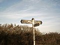
 For Sale at the Crossroads - geograph.org.uk - 5551027.jpg 1,024 × 683; 320 KB
-
 Ford at Penstone Barton - geograph.org.uk - 5924486.jpg 3,023 × 3,234; 4.71 MB
-
 Ford Hill - geograph.org.uk - 1722999.jpg 640 × 480; 248 KB
-
 Ford in Keymelford - geograph.org.uk - 2510530.jpg 600 × 800; 537 KB
-
 Former Coombe Head Chapel - geograph.org.uk - 5700047.jpg 4,288 × 2,848; 1.18 MB
-
 Foxes near Redhill - geograph.org.uk - 1893871.jpg 640 × 444; 112 KB
-

-
 Gate at South Coombe farm, Devon - geograph.org.uk - 448319.jpg 640 × 480; 90 KB
-
 Gate near Great Heale - geograph.org.uk - 1890690.jpg 640 × 480; 140 KB
-
 Gate to Southcoombe Farm - geograph.org.uk - 1589729.jpg 640 × 480; 76 KB
-
 Gateway to Paschoe and ploughed field - geograph.org.uk - 121444.jpg 640 × 480; 123 KB
-
 Grassland and Cornfields - geograph.org.uk - 912440.jpg 640 × 427; 91 KB
-
 Great Heale - geograph.org.uk - 1892143.jpg 640 × 480; 100 KB
-
 Great Heale Cross - geograph.org.uk - 1890745.jpg 480 × 640; 95 KB
-
 Great Heale Cross - geograph.org.uk - 91380.jpg 480 × 640; 38 KB
-
 Hawthorn near Highfield - geograph.org.uk - 1890746.jpg 640 × 480; 82 KB
-
 Headland path near Pennyland - geograph.org.uk - 1772424.jpg 640 × 480; 93 KB
-
 Hillside near Paschoe House - geograph.org.uk - 1894700.jpg 640 × 480; 103 KB
-
 Hittisleigh, lane near Coltsfoot Farm - geograph.org.uk - 348403.jpg 640 × 427; 321 KB
-
 Hollacombe Cross - geograph.org.uk - 2516335.jpg 800 × 600; 390 KB
-
 Horwell Barton from Redhill - geograph.org.uk - 1739659.jpg 640 × 436; 96 KB
-
 Horwell Lodge - geograph.org.uk - 1739641.jpg 640 × 462; 84 KB
-
 Housefield Copse - geograph.org.uk - 1739413.jpg 640 × 480; 91 KB
-
 Lane and views towards Exmoor - geograph.org.uk - 5799227.jpg 640 × 480; 190 KB
-
 Lane into Troney valley - geograph.org.uk - 1892373.jpg 480 × 640; 112 KB
-
 Lane near Coltsfoot Farm - geograph.org.uk - 4381154.jpg 1,920 × 1,440; 1.03 MB
-
 Lane past Coltsfoot Farm - geograph.org.uk - 1603109.jpg 640 × 480; 92 KB
-
 Lane past Tucker's Plot - geograph.org.uk - 1893519.jpg 640 × 480; 126 KB
-
 Lane to Colebrooke - geograph.org.uk - 1723070.jpg 640 × 480; 217 KB
-
 Lane to Ford Farm - geograph.org.uk - 1894007.jpg 640 × 480; 101 KB
-
 Lane to Hillerton - geograph.org.uk - 1723093.jpg 640 × 480; 252 KB
-
 Lane to Newbury - geograph.org.uk - 1892116.jpg 480 × 640; 128 KB
-
 Lane to Newbury - geograph.org.uk - 1892369.jpg 640 × 480; 85 KB
-
 Lane to Nymet Tracey - geograph.org.uk - 1895311.jpg 640 × 480; 98 KB
-
 Lane to Westcombe Hill - geograph.org.uk - 1723042.jpg 640 × 480; 245 KB
-
 Lane to Whelmstone Barton - geograph.org.uk - 1723025.jpg 640 × 480; 254 KB
-
 Lane to Whelmstone Barton - geograph.org.uk - 1893933.jpg 640 × 480; 112 KB
-

-
 Looking towards Broomhill - geograph.org.uk - 3433929.jpg 640 × 480; 120 KB
-
 Meadow at Penstone, Devon - geograph.org.uk - 448397.jpg 640 × 480; 132 KB
-
 Meadow at South Coombe, Devon - geograph.org.uk - 448315.jpg 640 × 480; 145 KB
-
 Mid Devon , A Horse - geograph.org.uk - 3338383.jpg 4,288 × 2,848; 6.46 MB
-
 Mid Devon , Brocks Farm - geograph.org.uk - 3338628.jpg 4,288 × 2,848; 5.33 MB
-
 Mid Devon , Brocks Farm - geograph.org.uk - 3338637.jpg 4,288 × 2,848; 6.36 MB
-
 Mid Devon , Brocks Farm - geograph.org.uk - 3338642.jpg 4,288 × 2,848; 6.32 MB
-
 Mid Devon , Brocks Farm - geograph.org.uk - 3338656.jpg 4,288 × 2,848; 5.75 MB
-
 Mid Devon , Broomhill Cross - geograph.org.uk - 5453984.jpg 6,000 × 4,000; 5.02 MB
-
 Mid Devon , Butsford Barton - geograph.org.uk - 3338608.jpg 4,288 × 2,848; 6.89 MB
-
 Mid Devon , Butsford Lane - geograph.org.uk - 3338783.jpg 2,848 × 4,288; 6.47 MB
-
 Mid Devon , Butsford Lane - geograph.org.uk - 3338793.jpg 4,288 × 2,848; 6.31 MB
-
 Mid Devon , Butsford Lane - geograph.org.uk - 3338798.jpg 4,288 × 2,848; 6.15 MB
-
 Mid Devon , Cattle at Brocks Farm - geograph.org.uk - 3338640.jpg 4,288 × 2,848; 4.97 MB
-
 Mid Devon , Cattle Grazing - geograph.org.uk - 3338817.jpg 4,288 × 2,848; 4.77 MB
-
 Mid Devon , Cattle Grazing - geograph.org.uk - 5453971.jpg 6,000 × 4,000; 5.7 MB
-
 Mid Devon , Coleford Bore Hole - geograph.org.uk - 5453972.jpg 6,000 × 4,000; 6.88 MB
-
 Mid Devon , Country Lane - geograph.org.uk - 3338458.jpg 4,288 × 2,848; 6.87 MB
-
 Mid Devon , Country Lane - geograph.org.uk - 3338465.jpg 4,288 × 2,848; 6.06 MB
-
 Mid Devon , Country Lane - geograph.org.uk - 3338469.jpg 4,288 × 2,848; 6.62 MB
-
 Mid Devon , Country Lane - geograph.org.uk - 3338719.jpg 4,288 × 2,848; 6.4 MB
-
 Mid Devon , Country Lane - geograph.org.uk - 3338909.jpg 4,288 × 2,848; 6.97 MB
-
 Mid Devon , Country Lane - geograph.org.uk - 5453966.jpg 4,000 × 6,000; 6.54 MB
-
 Mid Devon , Country Lane - geograph.org.uk - 5453975.jpg 6,000 × 4,000; 5.88 MB
-
 Mid Devon , Country Lane - geograph.org.uk - 5453976.jpg 6,000 × 4,000; 5.63 MB
-
 Mid Devon , Country Lane - geograph.org.uk - 5453985.jpg 4,000 × 6,000; 7.59 MB
-
 Mid Devon , Country Lane - geograph.org.uk - 5453989.jpg 6,000 × 4,000; 6.95 MB
-
 Mid Devon , Country Road - geograph.org.uk - 3338716.jpg 4,288 × 2,848; 5.06 MB
-
 Mid Devon , Country Road - geograph.org.uk - 3338897.jpg 4,288 × 2,848; 4.55 MB
-
 Mid Devon , Country Road - geograph.org.uk - 3338905.jpg 4,288 × 2,848; 5.93 MB
-
 Mid Devon , Countryside Road - geograph.org.uk - 3338371.jpg 4,288 × 2,848; 6.19 MB
-
 Mid Devon , Countryside Scenery - geograph.org.uk - 3338473.jpg 4,288 × 2,848; 6.19 MB
-
 Mid Devon , Countryside Scenery - geograph.org.uk - 3338488.jpg 4,288 × 2,848; 6.18 MB
-
 Mid Devon , Countryside Scenery - geograph.org.uk - 3338493.jpg 4,288 × 2,848; 6.05 MB
-
 Mid Devon , Countryside Scenery - geograph.org.uk - 3338600.jpg 4,288 × 2,848; 4.41 MB
-
 Mid Devon , Countryside Scenery - geograph.org.uk - 3338614.jpg 4,288 × 2,848; 5.01 MB
-
 Mid Devon , Countryside Scenery - geograph.org.uk - 3338811.jpg 4,288 × 2,848; 6.35 MB
-
 Mid Devon , Countryside Scenery - geograph.org.uk - 5453980.jpg 6,000 × 4,000; 6.46 MB
-
 Mid Devon , Countryside Scenery - geograph.org.uk - 5453981.jpg 6,000 × 4,000; 5.67 MB
-
 Mid Devon , Countryside Scenery - geograph.org.uk - 5453982.jpg 6,000 × 4,000; 6.32 MB
-
 Mid Devon , Countryside Scenery - geograph.org.uk - 5453987.jpg 6,000 × 4,000; 5.72 MB
-
 Mid Devon , Countryside ^ Brocks Farm - geograph.org.uk - 3338625.jpg 4,288 × 2,848; 5.37 MB
-
 Mid Devon , Elley Cross - geograph.org.uk - 3338481.jpg 4,288 × 2,848; 6.65 MB
-
 Mid Devon , Farm Track - geograph.org.uk - 5453974.jpg 6,000 × 4,000; 6.08 MB
-
 Mid Devon , Fields ^ Hillside - geograph.org.uk - 3338802.jpg 4,288 × 2,848; 6.31 MB
-
 Mid Devon , Grassy Field - geograph.org.uk - 3338706.jpg 4,288 × 2,848; 6.77 MB


_-_geograph.org.uk_-_121445.jpg)


_-_geograph.org.uk_-_2510683.jpg)


_-_geograph.org.uk_-_2510720.jpg)
_-_geograph.org.uk_-_2510725.jpg)


_-_geograph.org.uk_-_2516325.jpg)


