Category:Coldingham (civil parish)
Jump to navigation
Jump to search
Scottish parish in Scottish Borders, Scotland, UK | |||||
| Upload media | |||||
| Instance of | |||||
|---|---|---|---|---|---|
| Part of |
| ||||
| Named after | |||||
| Location |
| ||||
| Population |
| ||||
| Area |
| ||||
 | |||||
Subcategories
This category has the following 5 subcategories, out of 5 total.
Media in category "Coldingham (civil parish)"
The following 200 files are in this category, out of 1,770 total.
(previous page) (next page)-
 'Dunscroft', Fishers Brae, Coldingham - geograph.org.uk - 5778221.jpg 1,024 × 768; 266 KB
-
 'Widow ^ Bairns' sculpture, St Abbs - geograph.org.uk - 5778090.jpg 1,024 × 766; 184 KB
-
 A bench seat at Houndwood Crematorium - geograph.org.uk - 4773477.jpg 640 × 427; 172 KB
-
 A boat in St Abbs Harbour - geograph.org.uk - 4503458.jpg 640 × 428; 167 KB
-

-
 A cottage at Coveyheugh - geograph.org.uk - 2160077.jpg 800 × 600; 223 KB
-

-
 A detail on Coldingham Village sign - geograph.org.uk - 3510553.jpg 480 × 640; 174 KB
-
 A detail on the sculpture at Oatlee Hill - geograph.org.uk - 1769186.jpg 573 × 640; 159 KB
-
 A dualled section of the A1 road at Houndwood - geograph.org.uk - 5908344.jpg 1,024 × 768; 193 KB
-
 A festive scarecrow at Greenhead - geograph.org.uk - 4778195.jpg 445 × 640; 163 KB
-
 A festive scarecrow at Greenhead - geograph.org.uk - 4778199.jpg 471 × 640; 183 KB
-
 A festive scarecrow at Greenhead - geograph.org.uk - 4778205.jpg 640 × 467; 168 KB
-
 A flotilla passes Tod Rock - geograph.org.uk - 2613911.jpg 1,600 × 1,200; 443 KB
-
 A gaggle of greetings - geograph.org.uk - 3660265.jpg 2,175 × 1,632; 718 KB
-
 A grey seal and pup at Lumsdaine Shore - geograph.org.uk - 6341486.jpg 1,200 × 1,200; 753 KB
-
 A grey seal and pup at Lumsdaine Shore - geograph.org.uk - 6396000.jpg 1,024 × 683; 510 KB
-
 A grey seal and pup at Souter - geograph.org.uk - 6314418.jpg 1,024 × 1,024; 504 KB
-
 A heavy sea at St Abbs - geograph.org.uk - 2548529.jpg 640 × 427; 249 KB
-
 A hill fort near Coldingham Loch - geograph.org.uk - 1523765.jpg 640 × 427; 130 KB
-
 A Lammermuir wetland - geograph.org.uk - 2678713.jpg 640 × 359; 90 KB
-
 A Line of Boats at St Abbs Harbour - geograph.org.uk - 5873713.jpg 2,048 × 1,536; 852 KB
-
 A lively sea at St Abbs - geograph.org.uk - 3264905.jpg 640 × 480; 248 KB
-
 A long straight - geograph.org.uk - 2678719.jpg 640 × 359; 77 KB
-
 A memorial at Brander Heugh - geograph.org.uk - 5416724.jpg 638 × 1,024; 595 KB
-
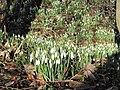 A million snowdrops^ - geograph.org.uk - 2163919.jpg 800 × 600; 175 KB
-
 A new fence, Grantshouse - geograph.org.uk - 2220646.jpg 640 × 480; 228 KB
-
 A newly planted hedge - geograph.org.uk - 2513479.jpg 640 × 480; 337 KB
-
 A phone box by the A1107 - geograph.org.uk - 2467232.jpg 640 × 427; 201 KB
-
 A play park at Coldingham - geograph.org.uk - 2596168.jpg 640 × 424; 270 KB
-
 A ploughing competition at Sunnyside - geograph.org.uk - 2706256.jpg 640 × 381; 183 KB
-
 A Ringlet (Aphantopus hyperantus) On Telegraph Hill - geograph.org.uk - 5456598.jpg 1,600 × 1,263; 312 KB
-
 A roe deer in Dowlaw Dean - geograph.org.uk - 2548994.jpg 640 × 437; 307 KB
-
 A ruined transport cafe - geograph.org.uk - 6346870.jpg 1,024 × 683; 283 KB
-
 A rusting wreck at Dowlaw - geograph.org.uk - 2550033.jpg 640 × 427; 247 KB
-
 A scarecrow near Greenhead - geograph.org.uk - 2701858.jpg 640 × 427; 201 KB
-
 A sculpture on Oatlee Hill - geograph.org.uk - 1769171.jpg 640 × 416; 142 KB
-

-
 A selfie on the cliffs at Bell Hill, St Abbs - geograph.org.uk - 5967905.jpg 1,024 × 683; 655 KB
-
 A sheep at Dowlaw - geograph.org.uk - 5416721.jpg 1,024 × 683; 559 KB
-
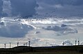 A skein of geese over Drone Hill Wind Farm - geograph.org.uk - 6408433.jpg 1,024 × 678; 350 KB
-
 A small cave near St Abbs - geograph.org.uk - 3956685.jpg 640 × 427; 177 KB
-
 A splash of white near Alemill - geograph.org.uk - 3660149.jpg 4,608 × 3,456; 3.29 MB
-

-
 A stormy scene at St Abb’s Harbour - geograph.org.uk - 5267519.jpg 640 × 640; 170 KB
-
 A stormy sea at Coldingham Bay - geograph.org.uk - 3264909.jpg 640 × 427; 276 KB
-
 A stormy sea at Yellow Craig - geograph.org.uk - 3264893.jpg 640 × 400; 286 KB
-
 A stormy sea at Yellow Craig - geograph.org.uk - 3264917.jpg 640 × 427; 297 KB
-
 A stripwood, Butterdean - geograph.org.uk - 6346864.jpg 1,024 × 683; 266 KB
-
 A Terrace of Coloured Cottages in St Abbs - geograph.org.uk - 5432902.jpg 2,048 × 1,536; 860 KB
-
 A trio of bulls at Lumsdaine - geograph.org.uk - 4538683.jpg 2,048 × 1,536; 1.3 MB
-
 A turbine at Drone Hill Wind Farm - geograph.org.uk - 3434137.jpg 640 × 480; 183 KB
-

-
 A Wall butterfly at St Abbs - geograph.org.uk - 6235677.jpg 1,024 × 683; 567 KB
-
 A wave-cut platform below Brander Heugh - geograph.org.uk - 5416732.jpg 1,024 × 683; 868 KB
-
 A weak point in the cliffs at Biter's Heugh - geograph.org.uk - 4537353.jpg 2,048 × 1,536; 1.64 MB
-
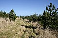 A young plantation on Telegraph Hill - geograph.org.uk - 1769206.jpg 640 × 427; 148 KB
-
 A1 - geograph.org.uk - 2220829.jpg 640 × 480; 313 KB
-
 A1 below Green Wood - geograph.org.uk - 2470147.jpg 640 × 430; 45 KB
-
 A1 between Grantshouse and Penmanshiel - geograph.org.uk - 6346871.jpg 1,024 × 683; 237 KB
-
 A1 in a thaw - geograph.org.uk - 3309499.jpg 640 × 360; 230 KB
-
 A1 near Houndwood - geograph.org.uk - 2309029.jpg 640 × 430; 39 KB
-
 A1 near Renton School House - geograph.org.uk - 5602340.jpg 1,024 × 731; 152 KB
-
 A1 northbound - geograph.org.uk - 2955589.jpg 640 × 429; 45 KB
-
 A1 northbound - geograph.org.uk - 2955590.jpg 640 × 453; 48 KB
-
 A1 northbound - geograph.org.uk - 2955595.jpg 640 × 423; 45 KB
-
 A1 northbound - geograph.org.uk - 2955597.jpg 640 × 430; 42 KB
-
 A1 northbound - geograph.org.uk - 2955744.jpg 640 × 428; 42 KB
-
 A1 northbound - geograph.org.uk - 2955750.jpg 640 × 432; 47 KB
-
 A1 northbound - geograph.org.uk - 2955752.jpg 640 × 480; 49 KB
-
 A1 northbound - geograph.org.uk - 2955754.jpg 640 × 428; 49 KB
-
 A1 northbound - geograph.org.uk - 2955756.jpg 640 × 480; 45 KB
-
 A1 northbound - geograph.org.uk - 2955759.jpg 640 × 480; 42 KB
-
 A1 northbound - geograph.org.uk - 2955763.jpg 640 × 480; 65 KB
-
 A1 northbound - geograph.org.uk - 2955771.jpg 640 × 428; 55 KB
-
 A1 northbound - geograph.org.uk - 2955776.jpg 640 × 424; 48 KB
-
 A1 northbound - geograph.org.uk - 2955778.jpg 640 × 446; 46 KB
-
 A1 westbound - geograph.org.uk - 3309526.jpg 640 × 360; 229 KB
-
 A1107 approaching Eastlaw - geograph.org.uk - 6252455.jpg 1,024 × 683; 209 KB
-
 A1107 at Coldingham Moor - geograph.org.uk - 5842631.jpg 640 × 480; 68 KB
-
 A1107 at Coldingham Moor - geograph.org.uk - 5842635.jpg 640 × 424; 68 KB
-
 A1107 at the Drone Hill Wind Farm - geograph.org.uk - 5842648.jpg 640 × 395; 69 KB
-

-
 A1107 heading towards Eyemouth - geograph.org.uk - 3009631.jpg 640 × 480; 60 KB
-
 A1107 heading towards Eyemouth - geograph.org.uk - 3009635.jpg 640 × 480; 55 KB
-
 A1107 heading towards Eyemouth - geograph.org.uk - 3009644.jpg 640 × 480; 38 KB
-
 A1107 near Drone Hill Wind Farm - geograph.org.uk - 6252727.jpg 1,024 × 683; 181 KB
-
 A1107 near Hallydown Hill - geograph.org.uk - 6252461.jpg 1,024 × 683; 225 KB
-
 A1107 near Hawthorn Bank - geograph.org.uk - 6252715.jpg 1,024 × 683; 221 KB
-
 A1107 near North Falaknowe - geograph.org.uk - 6252706.jpg 1,024 × 683; 241 KB
-
 A1107 School Road at North Falaknowe - geograph.org.uk - 5842415.jpg 640 × 402; 67 KB
-
 A1107 towards Coldingham - geograph.org.uk - 3008480.jpg 640 × 480; 53 KB
-
 A1107 towards Coldingham - geograph.org.uk - 3008485.jpg 640 × 480; 65 KB
-
 A1107 towards Coldingham - geograph.org.uk - 3008491.jpg 640 × 480; 51 KB
-
 A1107 towards Coldingham - geograph.org.uk - 3008497.jpg 640 × 480; 51 KB
-
 A1107 towards Coldingham - geograph.org.uk - 3008503.jpg 640 × 480; 70 KB
-
 A1107 towards Coldingham - geograph.org.uk - 3008509.jpg 640 × 480; 61 KB
-
 A1107 towards Coldingham - geograph.org.uk - 3008512.jpg 640 × 480; 50 KB
-
 A1107 towards Coldingham - geograph.org.uk - 3008539.jpg 640 × 480; 60 KB
-
 A1107 towards Hallydown - geograph.org.uk - 3660501.jpg 3,264 × 2,448; 3.6 MB
-
 A1107, Coldingham Moor - geograph.org.uk - 6252709.jpg 1,024 × 683; 204 KB
-
 A1107, Moor House - geograph.org.uk - 2214689.jpg 640 × 359; 76 KB
-
 A1107, Moor House - geograph.org.uk - 3311251.jpg 640 × 480; 253 KB
-
 A1107-NCN1 - geograph.org.uk - 2609800.jpg 640 × 359; 106 KB
-
 A6112 near Grantshouse - geograph.org.uk - 4005480.jpg 1,600 × 1,200; 451 KB
-
 Abbey Burn joining the North Sea - geograph.org.uk - 5845884.jpg 640 × 428; 97 KB
-
 Access road to Coldingham Bay - geograph.org.uk - 6252358.jpg 1,024 × 683; 171 KB
-
 Admiralty Distance Pole - geograph.org.uk - 5172882.jpg 600 × 800; 67 KB
-
 Admiralty Distance Pole - geograph.org.uk - 5172902.jpg 800 × 585; 104 KB
-
 Admiralty Measured Mile marker - geograph.org.uk - 4537335.jpg 2,048 × 1,536; 640 KB
-
 Admiralty Measured Mile Marker - geograph.org.uk - 4537344.jpg 1,536 × 2,048; 565 KB
-
 Admiralty Measured Mile Marker - geograph.org.uk - 4537426.jpg 1,536 × 2,048; 836 KB
-
 Alder wood, Lumsdaine Moor - geograph.org.uk - 2267230.jpg 640 × 480; 238 KB
-
 Alemill Bridge - geograph.org.uk - 3822830.jpg 768 × 1,024; 518 KB
-
 Alemill Farm - geograph.org.uk - 5778273.jpg 1,024 × 768; 249 KB
-

-
 Al’s Yurt by St Abbs - geograph.org.uk - 5873399.jpg 2,048 × 1,536; 1.22 MB
-
 An artist at St Abbs - geograph.org.uk - 2548515.jpg 640 × 417; 275 KB
-
 An artist's canvas at St Abbs - geograph.org.uk - 2548508.jpg 640 × 421; 222 KB
-
 Ancient Archway - geograph.org.uk - 2499190.jpg 450 × 600; 74 KB
-

-
 Andrew Redden Cars, Coldingham - geograph.org.uk - 6252397.jpg 1,024 × 683; 161 KB
-
 Angler on the jetty at Pettico Wick - geograph.org.uk - 4695512.jpg 480 × 640; 96 KB
-
 Angler on the jetty at Pettico Wick - geograph.org.uk - 4695517.jpg 480 × 640; 92 KB
-
 Animal track in rough grass - geograph.org.uk - 6372011.jpg 2,448 × 3,264; 6.46 MB
-

-

-
 Approaching Greenwood in the Scottish Borders - geograph.org.uk - 6255654.jpg 5,184 × 3,888; 6.21 MB
-
 Approaching Hallydown on the A1107 - geograph.org.uk - 3660508.jpg 3,264 × 2,448; 1.37 MB
-
 Approaching St Abbs - geograph.org.uk - 3902675.jpg 640 × 480; 103 KB
-

-
 Arable field gateway - geograph.org.uk - 4538723.jpg 2,048 × 1,536; 1.02 MB
-
 Arable field next to The Loan - geograph.org.uk - 4538729.jpg 2,048 × 1,536; 1,010 KB
-
 Arable Lammermuirs - geograph.org.uk - 2345738.jpg 640 × 480; 245 KB
-
 Arable land at The Loan - geograph.org.uk - 4538732.jpg 2,048 × 1,536; 1.14 MB
-
 Arable land by Reston - geograph.org.uk - 5765423.jpg 1,024 × 683; 311 KB
-
 Arable land east of Coldingham - geograph.org.uk - 4526232.jpg 2,048 × 1,536; 947 KB
-
 Arable land near Alemill - geograph.org.uk - 3660174.jpg 4,608 × 3,456; 4.28 MB
-
 Arable land near Cairncross - geograph.org.uk - 2593379.jpg 640 × 481; 52 KB
-
 Arable land near Reston - geograph.org.uk - 3309550.jpg 640 × 360; 215 KB
-
 Arable land, Brockholes - geograph.org.uk - 2345763.jpg 640 × 480; 253 KB
-
 Arable land, Cairncross - geograph.org.uk - 2610789.jpg 640 × 359; 65 KB
-
 Arable land, Coldingham - geograph.org.uk - 2758459.jpg 640 × 360; 210 KB
-

-
 Arch, Coldingham Priory - geograph.org.uk - 6252416.jpg 1,024 × 683; 174 KB
-
 Archaeological survey - geograph.org.uk - 1378962.jpg 640 × 480; 44 KB
-
 Artists at St Abbs - geograph.org.uk - 2548519.jpg 427 × 640; 262 KB
-
 Ash dieback (Hymenoscyphus fraxineus) - geograph.org.uk - 6252436.jpg 1,024 × 683; 204 KB
-
 Auchencrow Burn - geograph.org.uk - 4480544.jpg 640 × 480; 97 KB
-
 Auchencrow Phone Box - geograph.org.uk - 1579071.jpg 640 × 480; 79 KB
-
 B6437 heading south east - geograph.org.uk - 4482051.jpg 640 × 480; 56 KB
-

-
 B6437 near Auchencrow - geograph.org.uk - 4480528.jpg 640 × 480; 65 KB
-
 B6437 near Auchencrow Mains - geograph.org.uk - 4480532.jpg 640 × 480; 60 KB
-
 B6437 towards Chirnside - geograph.org.uk - 4480530.jpg 640 × 480; 53 KB
-
 B6438 approaching Alewater House - geograph.org.uk - 6253083.jpg 1,024 × 683; 243 KB
-
 B6438 approaching Cairncross - geograph.org.uk - 6253086.jpg 1,024 × 683; 198 KB
-
 B6438 heading east towards Reston - geograph.org.uk - 4480519.jpg 640 × 480; 81 KB
-
 B6438 heading for Coldingham - geograph.org.uk - 1908592.jpg 640 × 480; 67 KB
-
 B6438 junction with the A1 - geograph.org.uk - 6253090.jpg 1,024 × 683; 280 KB
-
 B6438 towards Coldingham - geograph.org.uk - 5842304.jpg 640 × 480; 74 KB
-
 B6438 towards Reston - geograph.org.uk - 3009101.jpg 640 × 480; 94 KB
-
 B6438 towards Reston - geograph.org.uk - 4480515.jpg 640 × 480; 74 KB
-
 B6438 towards Reston - geograph.org.uk - 4480516.jpg 640 × 480; 59 KB
-
 B6438 towards St Abbs - geograph.org.uk - 3009106.jpg 640 × 480; 42 KB
-
 B6438, Cairncross - geograph.org.uk - 2610788.jpg 640 × 359; 78 KB
-
 Bale, Linkim Shore - geograph.org.uk - 2130115.jpg 640 × 480; 102 KB
-
 Barley field, Abbey Park - geograph.org.uk - 2513512.jpg 640 × 359; 214 KB
-
 Barley with dash of wheat - geograph.org.uk - 2513515.jpg 640 × 359; 207 KB
-
 Barley, Horseley - geograph.org.uk - 3656451.jpg 640 × 480; 248 KB
-
 Barley, Lemington - geograph.org.uk - 3614686.jpg 640 × 480; 272 KB
-
 Barn demolition - geograph.org.uk - 4707065.jpg 640 × 480; 341 KB
-
 Barn off the B6437 - geograph.org.uk - 4470069.jpg 640 × 480; 85 KB
-
 Beach at Linkim Shore - geograph.org.uk - 5845860.jpg 640 × 379; 75 KB
-
 Beach Café - geograph.org.uk - 2236913.jpg 640 × 480; 122 KB
-
 Beach cairn, Milldown Bay - geograph.org.uk - 5780390.jpg 1,024 × 768; 293 KB
-
 Beach huts at Coldingham Bay - geograph.org.uk - 5173439.jpg 640 × 349; 55 KB
-
 Beach huts at Coldingham Bay - geograph.org.uk - 5337894.jpg 2,000 × 1,333; 2.8 MB
-
 Beach huts at Coldingham Bay - geograph.org.uk - 6101231.jpg 1,024 × 696; 672 KB
-
 Beach huts at Coldingham Sands - geograph.org.uk - 4518980.jpg 640 × 480; 583 KB
-
 Beach huts at Coldingham Sands - geograph.org.uk - 5845413.jpg 640 × 412; 53 KB
-
 Beach Huts at Coldingham Sands - geograph.org.uk - 6359572.jpg 4,608 × 3,456; 3.01 MB
-
 Beach Huts at Coldingham Sands - geograph.org.uk - 6359575.jpg 4,608 × 3,456; 2.5 MB
-
 Beach Huts at Coldingham Sands - geograph.org.uk - 6359577.jpg 4,608 × 3,456; 3.01 MB
-
 Beach huts, Coldingham Bay - geograph.org.uk - 5777930.jpg 1,024 × 768; 282 KB
-
 Beach huts, Coldingham Bay - geograph.org.uk - 5781609.jpg 1,024 × 769; 249 KB
-
 Beach huts, Coldingham Bay - geograph.org.uk - 5781610.jpg 1,024 × 768; 356 KB
-
 Beached boat - geograph.org.uk - 1201012.jpg 640 × 480; 69 KB
-

-
 Bell Hill - geograph.org.uk - 2220728.jpg 640 × 480; 218 KB
-
 Bell Hill at St Abbs - geograph.org.uk - 2646282.jpg 640 × 427; 396 KB
-
 Bench Mark, Reston Road - geograph.org.uk - 2593458.jpg 480 × 640; 82 KB
-
 Bench Mark, St Abbs - geograph.org.uk - 2605313.jpg 480 × 640; 78 KB
-
 Bench Mark, St Abbs Church - geograph.org.uk - 2605256.jpg 480 × 640; 74 KB
-
 Bend in the road at Coldingham - geograph.org.uk - 2550822.jpg 2,592 × 1,944; 2.27 MB
-
 Bendy lane south of Reston - geograph.org.uk - 2468275.jpg 640 × 430; 51 KB
-
 Berwickshire Architecture , Cludgie - geograph.org.uk - 4620544.jpg 1,600 × 1,200; 539 KB
-
 Berwickshire Architecture , Curved Roofs at Hallydown - geograph.org.uk - 3126402.jpg 1,600 × 1,200; 498 KB
-
 Berwickshire coast - geograph.org.uk - 1941279.jpg 640 × 480; 112 KB
-
 Berwickshire Coast - geograph.org.uk - 4883797.jpg 640 × 480; 310 KB


_On_Telegraph_Hill_-_geograph.org.uk_-_5456598.jpg)


_-_geograph.org.uk_-_6252436.jpg)


&filefrom=Berwickshire+coast+-+view+towards+West+in+Thirle+Bay+-+geograph.org.uk+-+6013113.jpg#mw-category-media)