Category:Coast of British Columbia
Jump to navigation
Jump to search
coastline alongside the Pacific Ocean in British Columbia, Canada | |||||
| Upload media | |||||
| Instance of | |||||
|---|---|---|---|---|---|
| Location | British Columbia, Canada | ||||
| Has part(s) | |||||
| Area |
| ||||
| Elevation above sea level |
| ||||
 | |||||
Subcategories
This category has the following 18 subcategories, out of 18 total.
Media in category "Coast of British Columbia"
The following 69 files are in this category, out of 69 total.
-
 Aerial view of Port Alice.jpg 1,443 × 988; 162 KB
-
 Babine Lake with huts (321870589).jpg 2,160 × 1,440; 734 KB
-
 Baby Munday Peak.jpg 3,648 × 2,736; 4.43 MB
-
 Brandywine Mountain.jpg 576 × 432; 229 KB
-
 Britannia Bay during sunset.jpg 5,995 × 3,372; 10.24 MB
-
 BRUMAS EN LA COSTA - panoramio.jpg 4,288 × 2,848; 3.6 MB
-
 Christensen Coast North Coast Trail.JPG 3,648 × 2,736; 3.33 MB
-
 Cortes Island sunrise.jpg 6,000 × 4,000; 14.12 MB
-
 Crescent Beach, South Surrey - panoramio.jpg 1,600 × 1,200; 642 KB
-
 DSC9365 Kayaks on island off shore of British Columbia, Canada.jpg 3,600 × 2,410; 4.78 MB
-
 Ferry Bear Cove to Bella Coola through Bentick Arm - panoramio.jpg 2,592 × 1,558; 1.28 MB
-

-
 FraserRiverPanorama.jpg 8,003 × 1,622; 3.88 MB
-
 High Rise black smoker.jpg 600 × 800; 77 KB
-
 High Tide Christensen Coast.JPG 3,648 × 2,736; 3.46 MB
-
 Klallam chief, Chits-a-man-han & his wife.jpg 361 × 508; 26 KB
-
 Klallam people near canoe.jpg 768 × 463; 59 KB
-
 Klewnuggit Inlet Marine Park.webp 4,000 × 3,000; 366 KB
-
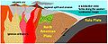 Late Cretaceous Coast Mountains plate tectonics.jpg 437 × 178; 27 KB
-
 Main Endeavour black smoker.jpg 220 × 283; 45 KB
-
 Main Endeavour hydrothermal map.png 250 × 226; 21 KB
-
 Main Endeavour hydrothermal plume.jpg 269 × 184; 5 KB
-
 Maritime Fur Trade-NorthWestCoast.png 1,173 × 819; 208 KB
-
 Mount Bishop.jpg 2,112 × 2,816; 2.24 MB
-
 Mount Washington Summer.jpg 1,600 × 1,200; 1.05 MB
-
 Mud North Coast Trail.JPG 3,648 × 2,736; 3.48 MB
-
 North Cowichan Coat of arms.gif 2,413 × 2,413; 473 KB
-
 North Cowichan Skyline.jpg 576 × 379; 39 KB
-
 Northwest-relief NassRiver.jpg 600 × 600; 418 KB
-
 Northwest-relief StikineRiver.jpg 660 × 660; 464 KB
-
 Oval Bay, Porcher Island.jpg 699 × 466; 110 KB
-
 Piers Island.JPG 3,648 × 2,736; 1.2 MB
-
 Plano del Archipielago de Clayocuat 1791.jpg 1,900 × 1,200; 1.86 MB
-
 Port Essington.gif 620 × 384; 84 KB
-
 Rocky coast with black bear on Juan de Fuca Trail, Vancouver Island, Canada 42.jpg 5,017 × 2,356; 6.94 MB
-
 Rocky coast with black bear on Juan de Fuca Trail, Vancouver Island, Canada 43.jpg 5,471 × 2,738; 8.69 MB
-
 Rosslake.jpg 375 × 180; 14 KB
-
 Rugged Point Provincial Park.jpg 6,000 × 4,000; 15.75 MB
-
 Russet Lake, Fissile Mountain.jpg 2,400 × 781; 430 KB
-
 Seagull Shower (4213705016).jpg 1,374 × 891; 463 KB
-
 South BC-NW USA-relief BendorRange2.png 708 × 600; 964 KB
-
 South BC-NW USA-relief CamelsfootRange.png 708 × 600; 964 KB
-
 South BC-NW USA-relief CantileverRng.png 708 × 600; 964 KB
-
 South BC-NW USA-relief LillooetRanges.png 708 × 600; 963 KB
-
 South BC-NW USA-relief niutrange.png 708 × 600; 964 KB
-
 Strandby River Cape Scott.JPG 3,648 × 2,736; 3.33 MB
-
 Sully Main Endeavor Field.jpg 400 × 300; 43 KB
-
 Sully Vent.jpg 2,560 × 1,920; 2.26 MB
-
 Tantalus Range.jpg 1,536 × 1,024; 660 KB
-
 TC 810 Prop.jpg 1,380 × 1,760; 563 KB
-
 Union Bank of Canada, Hazelton.gif 620 × 388; 97 KB
-

-
 Vancouver (BC, Canada), Stanley Park, Ufer zum Hafen -- 2022 -- 2023.jpg 6,720 × 4,480; 20.14 MB
-
 Vancouver (BC, Canada), Stanley Park, Ufer zum Hafen -- 2022 -- 2054.jpg 6,720 × 4,480; 20.38 MB
-
 Vancouver (BC, Canada), Stanley Park, Ufer zum Hafen -- 2022 -- 2061.jpg 6,720 × 4,480; 24.28 MB
-
 Vancouver (BC, Canada), Stanley Park, Ufer zum Hafen -- 2022 -- 2062.jpg 6,720 × 4,480; 23.22 MB
-
 Vancouver (BC, Canada), Stanley Park, Ufer zum Hafen -- 2022 -- 2067.jpg 6,720 × 4,480; 22.43 MB
-
 Vancouver (BC, Canada), Stanley Park, Ufer zum Hafen -- 2022 -- 2118.jpg 6,720 × 4,480; 22.83 MB
-
 Vancouver Island-relief CheakamusRiver.png 578 × 600; 643 KB
-
 Vancouver Island-relief ClendinningRng.png 578 × 600; 643 KB
-
 Vancouver Island-relief CowichanRiver.png 578 × 600; 644 KB
-
 Vancouver Island-relief DouglasRanges.png 578 × 600; 643 KB
-
 Vancouver Island-relief GaribaldiLk.png 578 × 600; 643 KB
-
 Vancouver Island-relief GaribaldiRanges.png 578 × 600; 642 KB
-
 Vancouver Island-relief+TantalusRange.png 578 × 600; 643 KB
-
 Vancouver Island-reliefPittRiver.png 578 × 600; 643 KB
-
 VancouverIsland.A2003154.1930.250m cutcontr VIRanges800 wnumbers.jpg 800 × 655; 422 KB
-
 West Vancouver—Sunshine Coast—Sea to Sky Country.png 364 × 397; 47 KB
-
 Wonder why they call it Sandspit (386750420).jpg 2,272 × 1,704; 1.25 MB

.jpg)


.jpg)


,_Stanley_Park,_Ufer_zum_Hafen_--_2022_--_2023.jpg)
,_Stanley_Park,_Ufer_zum_Hafen_--_2022_--_2054.jpg)
,_Stanley_Park,_Ufer_zum_Hafen_--_2022_--_2061.jpg)
,_Stanley_Park,_Ufer_zum_Hafen_--_2022_--_2062.jpg)
,_Stanley_Park,_Ufer_zum_Hafen_--_2022_--_2067.jpg)
,_Stanley_Park,_Ufer_zum_Hafen_--_2022_--_2118.jpg)


.jpg)
_shown_off_the_coast_of_Vancouver_during_the_test_of_its_new_torpedo_detection_system.jpg)