Category:Clayhanger, Devon
Jump to navigation
Jump to search
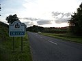
English: Clayhanger is a small hamlet in the County of Devon, England. It is close to the site of a Roman fort east of the Upper Exe Valley (Cudmore Farm).
village and civil parish in Devon, UK .jpg) | |||||
| Upload media | |||||
| Instance of | |||||
|---|---|---|---|---|---|
| Location | Mid Devon, Devon, South West England, England | ||||
 | |||||
Subcategories
This category has only the following subcategory.
P
Media in category "Clayhanger, Devon"
The following 181 files are in this category, out of 181 total.
-
 A road sign saying "beware" - geograph.org.uk - 4399546.jpg 1,024 × 1,022; 231 KB
-
 B3227 in Clayhanger Wood - geograph.org.uk - 4399624.jpg 1,600 × 899; 1.32 MB
-
 B3227 junction for Lower Potters - geograph.org.uk - 4399622.jpg 1,600 × 899; 892 KB
-
 Barn near Wellhayes Farm - geograph.org.uk - 4927858.jpg 1,024 × 814; 252 KB
-
 Bonny Cross - geograph.org.uk - 4927381.jpg 1,024 × 812; 213 KB
-
 Bonny Cross and telephone exchange - geograph.org.uk - 4399523.jpg 1,600 × 1,196; 1.03 MB
-
 Bridge at Denscombe Mill - geograph.org.uk - 4399565.jpg 1,600 × 1,067; 1.61 MB
-
 Bridge liable to flooding - geograph.org.uk - 4399547.jpg 1,600 × 1,065; 1.42 MB
-

-
 Bulcombe Copse - geograph.org.uk - 4399539.jpg 1,600 × 1,198; 1.76 MB
-
 Church Cottage, Clayhanger - geograph.org.uk - 4927485.jpg 1,024 × 768; 205 KB
-
 Clayhanger, towards the village - geograph.org.uk - 164632.jpg 640 × 427; 171 KB
-
 Clayhanger , Fleeds Farm - geograph.org.uk - 3920321.jpg 4,288 × 2,848; 4.34 MB
-
 Clayhanger , Grassy Field - geograph.org.uk - 3920323.jpg 4,288 × 2,848; 4.69 MB
-
 Clayhanger , Grassy Field - geograph.org.uk - 3920326.jpg 4,288 × 2,848; 5.54 MB
-
 Clayhanger , Grassy Field ^ Gate - geograph.org.uk - 3920329.jpg 4,288 × 2,848; 6.85 MB
-
 Clayhanger , Houses ^ Lane - geograph.org.uk - 3920336.jpg 4,288 × 2,848; 5.06 MB
-
 Clayhanger , Public Footpath - geograph.org.uk - 3920337.jpg 4,288 × 2,848; 6.15 MB
-
 Clayhanger , Village Lane - geograph.org.uk - 3920330.jpg 4,288 × 2,848; 6.11 MB
-
 Clayhanger , Village Lane - geograph.org.uk - 3920331.jpg 4,288 × 2,848; 5.6 MB
-
 Clayhanger , Village Lane - geograph.org.uk - 3920332.jpg 4,288 × 2,848; 5.47 MB
-
 Clayhanger , Village Lane - geograph.org.uk - 3920334.jpg 4,288 × 2,848; 6.21 MB
-
 Clayhanger , Village Scene - geograph.org.uk - 3920319.jpg 4,288 × 2,848; 5.7 MB
-
 Clayhanger - geograph.org.uk - 4927422.jpg 1,024 × 768; 317 KB
-
 Clayhanger - Village Lane (geograph 3920335).jpg 4,288 × 2,848; 6.16 MB
-
 Clayhanger Cottage - geograph.org.uk - 4985995.jpg 1,024 × 879; 150 KB
-
 Clayhanger Women's Institute Hall - geograph.org.uk - 4927500.jpg 1,024 × 768; 223 KB
-
 Clayhanger Wood and footpath to Berry Farm - geograph.org.uk - 4399615.jpg 1,600 × 1,067; 1.13 MB
-
 Clayhanger, Brockham Wood - geograph.org.uk - 164622.jpg 640 × 427; 230 KB
-
 Clayhanger, by Williams Farm - geograph.org.uk - 5751486.jpg 1,600 × 1,058; 516 KB
-
 Clayhanger, Denscombe Mill - geograph.org.uk - 164769.jpg 640 × 427; 211 KB
-
 Clayhanger, near Berry Farm - geograph.org.uk - 164781.jpg 640 × 427; 164 KB
-
 Clayhanger, south west from Bonny Cross - geograph.org.uk - 164636.jpg 640 × 427; 147 KB
-
 Clayhanger, the B3227 at Leigh Wood - geograph.org.uk - 164779.jpg 640 × 427; 191 KB
-
 Clayhanger, towards Bulcombe Copse - geograph.org.uk - 164642.jpg 640 × 427; 202 KB
-
 Clayhanger, towards Fleeds Farm - geograph.org.uk - 5751492.jpg 1,600 × 1,069; 447 KB
-
 Clayhanger, view from Sticklepath - geograph.org.uk - 164625.jpg 640 × 427; 188 KB
-
 Clayhanger, west to Fleeds Farm - geograph.org.uk - 49653.jpg 640 × 427; 75 KB
-
 Countryside east of the Tone from the air - geograph.org.uk - 5687647.jpg 2,628 × 1,908; 1.2 MB
-
 Dark Lane - geograph.org.uk - 4926809.jpg 1,024 × 768; 335 KB
-
-
 Electricity power line on Combe Downs - geograph.org.uk - 4927881.jpg 1,024 × 768; 204 KB
-
 Entrance drive, Denscombe Mill - geograph.org.uk - 4985103.jpg 1,024 × 768; 263 KB
-
 Farmland by Perry's Cottage - geograph.org.uk - 2512035.jpg 640 × 461; 93 KB
-
 Featherbed Lane at South Hele Cross - geograph.org.uk - 4399669.jpg 899 × 1,600; 1.27 MB
-
 Field at Cross's Farm - geograph.org.uk - 2512019.jpg 640 × 480; 90 KB
-
 Field by the B3227 - geograph.org.uk - 2563364.jpg 640 × 438; 76 KB
-
 Field of clover north of Combe Downs - geograph.org.uk - 2512339.jpg 640 × 499; 101 KB
-
 Fields between Bulcombe and Nutcombe - geograph.org.uk - 4399542.jpg 1,600 × 899; 1.15 MB
-
 Flag of Clayhanger, West Midlands.png 3,000 × 1,800; 57 KB
-
 Fleeds Farm - geograph.org.uk - 4927520.jpg 1,024 × 768; 213 KB
-
 Footpath sign at Denscombe Mill - geograph.org.uk - 4399569.jpg 1,600 × 1,202; 1.3 MB
-
 Footpath sign at North Hele - geograph.org.uk - 4399664.jpg 1,600 × 899; 960 KB
-
 Footpath to Hearne Farm - geograph.org.uk - 4399520.jpg 1,600 × 899; 1.29 MB
-
 Footpath to North Hele and Westcott Farms - geograph.org.uk - 4399665.jpg 899 × 1,600; 1.23 MB
-
 Ford at North Bulcombe - geograph.org.uk - 5135616.jpg 1,440 × 960; 2.24 MB
-
 Ford at North Bulcombe - geograph.org.uk - 5135620.jpg 1,440 × 960; 1.93 MB
-
 Freshly cut hayfield near Bulcombe - geograph.org.uk - 4985094.jpg 1,024 × 768; 218 KB
-
 Grazing sheep near Wellhayes Farm - geograph.org.uk - 4927533.jpg 1,024 × 768; 240 KB
-
 Helecombe Farm - geograph.org.uk - 4932456.jpg 1,024 × 768; 198 KB
-
 Isolated tree, near North Bulcombe - geograph.org.uk - 5107700.jpg 1,024 × 768; 161 KB
-
 Lane by the Batherm - geograph.org.uk - 2564232.jpg 492 × 640; 128 KB
-
 Lane in the Batherm valley - geograph.org.uk - 2564285.jpg 640 × 480; 97 KB
-
 Lees Farm - geograph.org.uk - 4986607.jpg 1,024 × 844; 273 KB
-
 Leigh Wood - geograph.org.uk - 4399631.jpg 1,024 × 575; 151 KB
-
 Little Copse - geograph.org.uk - 2563376.jpg 640 × 480; 88 KB
-
 Lone tree at Bonny Cross - geograph.org.uk - 4399527.jpg 899 × 1,600; 1.3 MB
-

-
 Lower Potters - geograph.org.uk - 4986619.jpg 1,024 × 817; 185 KB
-
 Mid Devon , Country Lane - geograph.org.uk - 3920264.jpg 4,288 × 2,848; 6.4 MB
-
 Mid Devon , Country Lane - geograph.org.uk - 3920270.jpg 4,288 × 2,848; 6.3 MB
-
 Mid Devon , Country Lane - geograph.org.uk - 3920275.jpg 4,288 × 2,848; 6.31 MB
-
 Mid Devon , Country Lane - geograph.org.uk - 3920280.jpg 4,288 × 2,848; 6.39 MB
-
 Mid Devon , Country Lane - geograph.org.uk - 3920285.jpg 4,288 × 2,848; 5.68 MB
-
 Mid Devon , Country Lane - geograph.org.uk - 3920347.jpg 4,206 × 2,720; 4.01 MB
-
 Mid Devon , Country Lane - geograph.org.uk - 3920348.jpg 4,288 × 2,848; 6.6 MB
-
 Mid Devon , Country Lane - geograph.org.uk - 3921722.jpg 4,288 × 2,848; 6.17 MB
-
 Mid Devon , Country Lane - geograph.org.uk - 3921724.jpg 4,288 × 2,848; 5.47 MB
-
 Mid Devon , Country Lane - geograph.org.uk - 3921728.jpg 4,288 × 2,848; 5.01 MB
-
 Mid Devon , Country Lane - geograph.org.uk - 3921746.jpg 4,288 × 2,848; 6.22 MB
-
 Mid Devon , Country Lane - geograph.org.uk - 3921747.jpg 4,288 × 2,848; 5.8 MB
-
 Mid Devon , Country Lane - geograph.org.uk - 3922968.jpg 4,288 × 2,848; 6.38 MB
-
 Mid Devon , Country Lane - geograph.org.uk - 3922969.jpg 4,288 × 2,848; 5.49 MB
-
 Mid Devon , Countryside Scenery - geograph.org.uk - 3389693.jpg 4,288 × 2,848; 5.17 MB
-
 Mid Devon , Countryside Scenery - geograph.org.uk - 3920290.jpg 4,210 × 2,726; 6.74 MB
-
 Mid Devon , Countryside Scenery - geograph.org.uk - 3920293.jpg 4,194 × 2,700; 6.21 MB
-
 Mid Devon , Countryside Scenery - geograph.org.uk - 3920344.jpg 4,288 × 2,848; 6.63 MB
-
 Mid Devon , Countryside Scenery - geograph.org.uk - 3921717.jpg 4,288 × 2,848; 5.55 MB
-
 Mid Devon , Countryside Scenery - geograph.org.uk - 3921723.jpg 4,288 × 2,848; 5.24 MB
-
 Mid Devon , Countryside Scenery - geograph.org.uk - 3921750.jpg 4,288 × 2,848; 5.55 MB
-
 Mid Devon , Denscombe - geograph.org.uk - 3920259.jpg 4,288 × 2,848; 6.3 MB
-
 Mid Devon , Farm Track - geograph.org.uk - 3920288.jpg 4,288 × 2,848; 6.69 MB
-
 Mid Devon , Farm Track - geograph.org.uk - 3921752.jpg 4,288 × 2,848; 6.3 MB
-
 Mid Devon , Featherbed Lane - geograph.org.uk - 3920343.jpg 4,288 × 2,848; 5.78 MB
-
 Mid Devon , Featherbed Lane - geograph.org.uk - 3920345.jpg 2,848 × 4,288; 6.43 MB
-
 Mid Devon , Featherbed Lane - geograph.org.uk - 3920346.jpg 4,288 × 2,848; 5.88 MB
-
 Mid Devon , Footbridge ^ Stream - geograph.org.uk - 3285334.jpg 4,288 × 2,848; 6.43 MB
-
 Mid Devon , Footpath Gate - geograph.org.uk - 3920300.jpg 2,848 × 4,288; 5.92 MB
-
 Mid Devon , Footpath Stile - geograph.org.uk - 3920316.jpg 4,288 × 2,848; 6.18 MB
-
 Mid Devon , Footpath ^ Gate - geograph.org.uk - 3920339.jpg 4,288 × 2,848; 6.33 MB
-
 Mid Devon , Gate ^ Field - geograph.org.uk - 3920283.jpg 4,288 × 2,848; 6.78 MB
-
 Mid Devon , Grassy Field - geograph.org.uk - 3285331.jpg 4,288 × 2,848; 5.89 MB
-
 Mid Devon , Grassy Field - geograph.org.uk - 3285339.jpg 4,288 × 2,848; 3.68 MB
-
 Mid Devon , Grassy Field - geograph.org.uk - 3389697.jpg 4,288 × 2,848; 6.25 MB
-
 Mid Devon , Grassy Field - geograph.org.uk - 3920273.jpg 4,288 × 2,848; 6.2 MB
-
 Mid Devon , Grassy Field - geograph.org.uk - 3920287.jpg 4,288 × 2,848; 5.82 MB
-
 Mid Devon , Grassy Field - geograph.org.uk - 3920338.jpg 4,288 × 2,848; 6.17 MB
-
 Mid Devon , Grassy Field - geograph.org.uk - 3920340.jpg 4,188 × 2,688; 3.95 MB
-
 Mid Devon , Grassy Field - geograph.org.uk - 3921745.jpg 4,288 × 2,848; 6.59 MB
-
 Mid Devon , Grassy Field ^ Tree - geograph.org.uk - 3920268.jpg 4,288 × 2,848; 4.49 MB
-
 Mid Devon , Grassy Field ^ Trees - geograph.org.uk - 3285326.jpg 4,288 × 2,848; 6.43 MB
-
 Mid Devon , Grassy Fields - geograph.org.uk - 3285328.jpg 4,288 × 2,848; 6.29 MB
-
 Mid Devon , Grassy Footpath - geograph.org.uk - 3285321.jpg 4,288 × 2,848; 5.85 MB
-
 Mid Devon , Grassy Footpath - geograph.org.uk - 3285338.jpg 4,288 × 2,848; 6.8 MB
-
 Mid Devon , Muddy Puddle - geograph.org.uk - 3920341.jpg 2,848 × 4,288; 4.25 MB
-
 Mid Devon , Oakdene Houses - geograph.org.uk - 3285337.jpg 4,288 × 2,848; 6.49 MB
-
 Mid Devon , Ploughed Field - geograph.org.uk - 3389691.jpg 4,288 × 2,848; 6.11 MB
-
 Mid Devon , River Batherm ^ Garden - geograph.org.uk - 3922963.jpg 4,288 × 2,848; 6.2 MB
-
 Mid Devon , Road ^ Houses - geograph.org.uk - 3285340.jpg 4,288 × 2,848; 6.22 MB
-
 Mid Devon , Road ^ Houses - geograph.org.uk - 3285341.jpg 4,158 × 2,640; 5.81 MB
-
 Mid Devon , Small Footbridge - geograph.org.uk - 3285332.jpg 2,848 × 4,288; 6.92 MB
-
 Mid Devon , Small Stream - geograph.org.uk - 3285330.jpg 4,288 × 2,848; 6.42 MB
-
 Mid Devon , Small Stream - geograph.org.uk - 3285335.jpg 4,288 × 2,848; 6.35 MB
-
 Mid Devon , South Hele Cross - geograph.org.uk - 3920342.jpg 4,288 × 2,848; 6.27 MB
-
 Mid Devon , St Petrock's Church - geograph.org.uk - 3285322.jpg 4,288 × 2,848; 6.1 MB
-
 Mid Devon , The B3227 - geograph.org.uk - 1222619.jpg 640 × 480; 63 KB
-
 Mid Devon , The B3227 - geograph.org.uk - 3285343.jpg 2,848 × 4,288; 6.01 MB
-
 Mid Devon , The B3227 - geograph.org.uk - 3285344.jpg 4,288 × 2,848; 6.18 MB
-
 Mid Devon , The B3227 - geograph.org.uk - 3921755.jpg 4,288 × 2,848; 6.52 MB
-
 Mid Devon , The B3227 - geograph.org.uk - 3921759.jpg 4,288 × 2,848; 6.22 MB
-
 Mid Devon , The B3227 Road - geograph.org.uk - 3921761.jpg 4,288 × 2,848; 6.96 MB
-
 Mid Devon , The B3227 ^ County Sign - geograph.org.uk - 3921762.jpg 4,288 × 2,848; 6.22 MB
-
 Mid Devon , The River Batherm - geograph.org.uk - 3285320.jpg 2,848 × 4,288; 6.57 MB
-
 Mid Devon , Track ^ Footpath - geograph.org.uk - 3285342.jpg 4,288 × 2,848; 6.76 MB
-
 Mid Devon , Woodland Path - geograph.org.uk - 3285323.jpg 4,288 × 2,848; 6.51 MB
-
 Mid Devon , Woodland Path - geograph.org.uk - 3285324.jpg 2,848 × 4,288; 6.07 MB
-
 Mid Devon , Woodland Track - geograph.org.uk - 3920266.jpg 4,288 × 2,848; 6.49 MB
-
 Mid Devon , Woodland ^ Path - geograph.org.uk - 3285336.jpg 4,288 × 2,848; 6.55 MB
-
 Mid Devon , Woodlands Farm - geograph.org.uk - 1222620.jpg 640 × 480; 66 KB
-
 Mid Devon , Woodlands Farm and B3227 - geograph.org.uk - 1222621.jpg 640 × 283; 44 KB
-
 Mid Devon , Woodlands ^ Grassy Path - geograph.org.uk - 3921751.jpg 4,288 × 2,848; 5.65 MB
-
 Minor road to Venn Cross - geograph.org.uk - 4927862.jpg 1,024 × 768; 206 KB
-
 Nutcombe Copse - geograph.org.uk - 4399532.jpg 1,076 × 1,600; 1.51 MB
-
 Nutcombe Manor, Devon-geograph.org.uk-3290291.jpg 4,113 × 2,728; 6.32 MB
-
 Pasture above Clayhanger - geograph.org.uk - 2512065.jpg 640 × 443; 103 KB
-
 Petton , The B3227 - geograph.org.uk - 3285345.jpg 4,288 × 2,848; 6.77 MB
-
 Petton , The B3227 - geograph.org.uk - 3285347.jpg 4,158 × 2,640; 6.01 MB
-
 Potter's Farm - geograph.org.uk - 4986043.jpg 1,024 × 880; 247 KB
-
 Power lines stretching towards Hele Farm - geograph.org.uk - 4927891.jpg 1,024 × 768; 129 KB
-

-
 Road by Zeal Ball Copse - geograph.org.uk - 4399558.jpg 1,600 × 1,200; 1.7 MB
-
 Road climbing Combe Downs - geograph.org.uk - 4399646.jpg 899 × 1,600; 1,000 KB
-
 Road south of Bonny Cross - geograph.org.uk - 5109822.jpg 1,600 × 1,589; 844 KB
-
 Road west of Bonny Cross - geograph.org.uk - 4399528.jpg 1,600 × 858; 1.13 MB
-
 Small bridge north of Zeal Ball Copse - geograph.org.uk - 4399562.jpg 1,600 × 1,198; 1.73 MB
-
 Solitary tree by Stickle Path - geograph.org.uk - 4400609.jpg 899 × 1,600; 1.13 MB
-
 South Hele Cross - geograph.org.uk - 4927385.jpg 1,024 × 795; 271 KB
-
 St Peters Church, Clayhanger - geograph.org.uk - 4927469.jpg 1,024 × 768; 205 KB
-
 Stickle Path - geograph.org.uk - 4927132.jpg 1,024 × 808; 213 KB
-
 Stickle Path and the valley south of Clayhanger - geograph.org.uk - 4400602.jpg 899 × 1,600; 1.12 MB
-
 Stickle Path at South Hele Cross - geograph.org.uk - 5104673.jpg 1,600 × 1,200; 822 KB
-
 Stickle Path south of South Hele Cross - geograph.org.uk - 4399674.jpg 1,600 × 899; 1.34 MB
-
 Stickle Path with high hedges - geograph.org.uk - 4400605.jpg 899 × 1,600; 1,018 KB
-
 Telephone Exchange at Bonny Cross - geograph.org.uk - 4927183.jpg 1,024 × 768; 216 KB
-
 Telephone exchange, Bonny Cross - geograph.org.uk - 2512048.jpg 480 × 640; 74 KB
-
 The B3227 enters Somerset - geograph.org.uk - 2154912.jpg 640 × 480; 67 KB
-
 The eastern edge of Clayhanger Wood - geograph.org.uk - 4399619.jpg 1,600 × 800; 945 KB
-
 The edge of Nutcombe Copse - geograph.org.uk - 4399530.jpg 1,600 × 1,066; 1.53 MB
-
 Track to Hearne Farm - geograph.org.uk - 4926810.jpg 1,024 × 768; 208 KB
-
 Track to the west of Zeal Ball Copse - geograph.org.uk - 5107688.jpg 1,024 × 850; 171 KB
-
 Trees by the River Batherm - geograph.org.uk - 2564265.jpg 640 × 480; 110 KB
-
 Trees near William's Farm - geograph.org.uk - 4399660.jpg 1,600 × 899; 1 MB
-
 Turning for North Bulcombe - geograph.org.uk - 4985080.jpg 1,024 × 847; 294 KB
-
 Valley east of Clayhanger - geograph.org.uk - 2512283.jpg 640 × 441; 83 KB
-
 View towards Fleeds Farm - geograph.org.uk - 4927874.jpg 1,024 × 804; 159 KB
-
 View towards Lower Potters - geograph.org.uk - 4986058.jpg 1,024 × 813; 204 KB
-
 View towards South Hele Cross - geograph.org.uk - 4399662.jpg 1,600 × 899; 868 KB
-
 Wellhayes Farm - geograph.org.uk - 4927545.jpg 1,024 × 864; 278 KB
-
 West from North Hele - geograph.org.uk - 2512302.jpg 640 × 432; 91 KB
-
 William's Farm - geograph.org.uk - 2512313.jpg 640 × 409; 86 KB
-
 Zeal Ball Copse - geograph.org.uk - 4399556.jpg 899 × 1,600; 1.35 MB


