Category:Clanfield, Oxfordshire
Jump to navigation
Jump to search
village and civil parish in West Oxfordshire, England  | |||||
| Upload media | |||||
| Instance of | |||||
|---|---|---|---|---|---|
| Location | West Oxfordshire, Oxfordshire, South East England, England | ||||
| Said to be the same as | Clanfield (Wikimedia duplicated page, civil parish) | ||||
| official website | |||||
 | |||||
Subcategories
This category has the following 3 subcategories, out of 3 total.
Media in category "Clanfield, Oxfordshire"
The following 96 files are in this category, out of 96 total.
-
 A4095 Clanfield - geograph.org.uk - 894186.jpg 640 × 480; 124 KB
-
 Allotment Gardens - geograph.org.uk - 294152.jpg 640 × 427; 69 KB
-
 Back towards the horseshoe - geograph.org.uk - 2282691.jpg 1,024 × 683; 92 KB
-
 Behind the willows - geograph.org.uk - 2286542.jpg 1,024 × 683; 279 KB
-
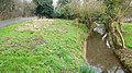
 Black Bourton Brook, east of Clanfield - geograph.org.uk - 894149.jpg 640 × 480; 176 KB
-
 Bridge or weir - geograph.org.uk - 2283998.jpg 1,024 × 683; 291 KB
-
 Bridge over the Radcot Cut - geograph.org.uk - 4954233.jpg 1,600 × 1,200; 779 KB
-
 Calcroft Lane - geograph.org.uk - 4397063.jpg 800 × 450; 174 KB
-
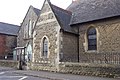 Clanfield Methodist Church - geograph.org.uk - 294149.jpg 640 × 427; 95 KB
-
-
 Clanfield Church - geograph.org.uk - 4839847.jpg 4,000 × 3,000; 4.22 MB
-
 Clanfield football club - geograph.org.uk - 1084887.jpg 640 × 480; 50 KB
-
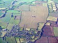 Clanfield from the air - geograph.org.uk - 5612630.jpg 3,264 × 2,448; 5.12 MB
-
 Clanfield sewage works - geograph.org.uk - 4398056.jpg 800 × 450; 222 KB
-
 Clanfield Tavern in the snow - geograph.org.uk - 1849441.jpg 640 × 480; 77 KB
-
 Clanfield Telephone Exchange, Oxon - geograph.org.uk - 1241202.jpg 640 × 480; 79 KB
-
 Clanfield war memorial - geograph.org.uk - 2518469.jpg 480 × 640; 208 KB
-
 Clanfield war memorial and The Plough - geograph.org.uk - 2518451.jpg 640 × 480; 207 KB
-
 Corner of the field - geograph.org.uk - 2284017.jpg 1,024 × 683; 285 KB
-
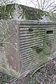
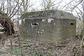 Corrugated pillbox - geograph.org.uk - 2284024.jpg 1,024 × 683; 381 KB
-
 Corrugations on inside - geograph.org.uk - 2285236.jpg 600 × 800; 85 KB
-
 D'Arcy Dalton Way - geograph.org.uk - 4756988.jpg 640 × 480; 59 KB
-
 D'Arcy Dalton Way - geograph.org.uk - 4756990.jpg 640 × 480; 82 KB
-
 D'Arcy Dalton Way - geograph.org.uk - 4756991.jpg 640 × 480; 124 KB
-
 Ditch and Flat Field - geograph.org.uk - 4839972.jpg 4,000 × 3,000; 3.41 MB
-
 Downstream to the pillbox - geograph.org.uk - 2286568.jpg 1,024 × 683; 182 KB
-
 Driveway to Bazeland Farm - geograph.org.uk - 1546726.jpg 640 × 427; 83 KB
-
 Elm Cottage, Little Clanfield - geograph.org.uk - 2518543.jpg 640 × 480; 204 KB
-

-
 Farm Buildings along Marsh Lane - geograph.org.uk - 4954164.jpg 4,000 × 3,000; 3.3 MB
-
 Farm buildings beside footpath from Little Clanfield - geograph.org.uk - 5733576.jpg 4,000 × 3,000; 4.7 MB
-
 Footpath along Marsh Lane - geograph.org.uk - 4954250.jpg 1,600 × 1,200; 676 KB
-
 Footpath by the Church - geograph.org.uk - 4839832.jpg 4,000 × 3,000; 3.63 MB
-
 Footpath to Little Clanfield - geograph.org.uk - 4397056.jpg 800 × 450; 189 KB
-
 Heading towards Clanfield - geograph.org.uk - 1235201.jpg 640 × 480; 103 KB
-
 Horseshoe Bend - geograph.org.uk - 2282644.jpg 2,093 × 755; 308 KB
-
 In the embrasure - geograph.org.uk - 2286524.jpg 1,024 × 768; 131 KB
-
 Interior view of St Stephen's church - geograph.org.uk - 2518386.jpg 480 × 640; 165 KB
-
 Junction of Bampton and Bourton Roads - geograph.org.uk - 2518433.jpg 640 × 480; 148 KB
-
 Langley Lane - geograph.org.uk - 1562681.jpg 640 × 427; 60 KB
-
 Little Clanfield mill - geograph.org.uk - 2518511.jpg 640 × 480; 211 KB
-
 Little Clanfield Mill - geograph.org.uk - 5733591.jpg 4,000 × 3,000; 4.97 MB
-
 Little Clanfield Mill Cottage - geograph.org.uk - 2518536.jpg 640 × 480; 246 KB
-
 Marsh Lane - geograph.org.uk - 4954194.jpg 1,600 × 1,200; 508 KB
-
 Marsh Lane, Clanfield - geograph.org.uk - 4398047.jpg 800 × 450; 190 KB
-
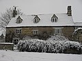
 Marsh lane, Clanfield, in the snow - geograph.org.uk - 1849472.jpg 640 × 480; 71 KB
-
 Meandering Thames - geograph.org.uk - 2427424.jpg 1,024 × 680; 177 KB
-
 Mill Lane, Clanfield - geograph.org.uk - 893838.jpg 640 × 480; 149 KB
-
 Mill Lane, Clanfield - geograph.org.uk - 894645.jpg 640 × 480; 113 KB
-
 Mill Lane, Clanfield - geograph.org.uk - 894651.jpg 640 × 480; 108 KB
-
 Next one in the willows - geograph.org.uk - 2284021.jpg 1,024 × 683; 441 KB
-
 No entry until the grass is cut - geograph.org.uk - 4956558.jpg 1,600 × 1,200; 488 KB
-
 Old Man's Bridge - geograph.org.uk - 2282719.jpg 1,024 × 683; 164 KB
-
 Old Toll House, Bampton Road, Clanfield - geograph.org.uk - 6114565.jpg 640 × 547; 150 KB
-
 One of the embrasures - geograph.org.uk - 2285248.jpg 1,024 × 683; 225 KB
-
 One smooth side - geograph.org.uk - 2284035.jpg 533 × 800; 187 KB
-

-

-

-
 River past the bridge - geograph.org.uk - 2282682.jpg 1,024 × 683; 97 KB
-
 Roadside Stream, Clanfield - geograph.org.uk - 4839838.jpg 3,782 × 2,790; 3.15 MB
-
 Sandbags at the entrance - geograph.org.uk - 2284029.jpg 1,024 × 683; 457 KB
-
 Scattered around - geograph.org.uk - 2286529.jpg 1,024 × 683; 315 KB
-

-
 Small bridge on Calcroft Lane - geograph.org.uk - 1546715.jpg 640 × 427; 120 KB
-
 St Stephen's church from the eastern end - geograph.org.uk - 2518381.jpg 640 × 480; 173 KB
-
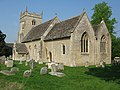
 St Stephen's church in Clanfield - geograph.org.uk - 4007268.jpg 4,752 × 3,168; 3.12 MB
-
 St Stephen's church, Clanfield - geograph.org.uk - 2518317.jpg 1,024 × 768; 240 KB
-
 St Stephen's Church, Clanfield - geograph.org.uk - 5592556.jpg 3,264 × 2,448; 2.6 MB
-
 Statue of St Stephen, Clanfield - geograph.org.uk - 5592565.jpg 2,448 × 3,264; 2.01 MB
-
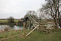 Stile on the bridge - geograph.org.uk - 2284009.jpg 1,024 × 683; 255 KB
-
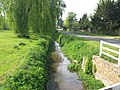
 Stream alongside Bourton Road, Clanfield - geograph.org.uk - 2548975.jpg 480 × 640; 229 KB
-
 Stream alongside the A4095 in Clanfield - geograph.org.uk - 2518440.jpg 640 × 480; 231 KB
-

-
 Thames at Radcot - geograph.org.uk - 309856.jpg 640 × 480; 85 KB
-
 The Clanfield Brook - geograph.org.uk - 4398039.jpg 800 × 450; 192 KB
-
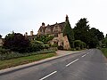
 The Clanfield Tavern - geograph.org.uk - 1243987.jpg 640 × 480; 105 KB
-

-

-
 The Cotswold Plough, Bourton Road (geograph 6565358).jpg 4,608 × 3,456; 5.24 MB
-
-
 The Plough on Bourton Road, Clanfield - geograph.org.uk - 2548973.jpg 640 × 480; 208 KB
-
 The Plough, Clanfield, Oxon - geograph.org.uk - 1243701.jpg 640 × 480; 94 KB
-

-

-

-
-
 Willows in front - geograph.org.uk - 2286534.jpg 1,024 × 683; 226 KB
-
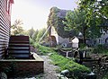
 Work on the weir - geograph.org.uk - 2288028.jpg 1,024 × 683; 210 KB
-
 A4095 near Clanfield, Oxon - geograph.org.uk - 261337.jpg 640 × 480; 90 KB
-
 Empty barn in Oxfordshire - geograph.org.uk - 294178.jpg 640 × 427; 96 KB
-
 Lane to Brookside - geograph.org.uk - 294169.jpg 640 × 427; 93 KB
-
 Looking towards Clanfield - geograph.org.uk - 622547.jpg 640 × 427; 55 KB
-
 Marsh Lane, Clanfield - geograph.org.uk - 294131.jpg 640 × 427; 77 KB
-
 Road from Grafton Lock - geograph.org.uk - 342133.jpg 640 × 414; 106 KB
-
 Wide road to Friar's Court - geograph.org.uk - 294165.jpg 640 × 427; 88 KB


.jpg)


