Category:Claife
Jump to navigation
Jump to search
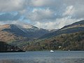
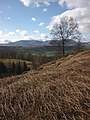
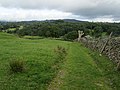
English: Claife is a civil parish in the South Lakeland local government district, in Cumbria, England. It is situated west of Windermere, and east of Esthwaite Water and the village of Hawkshead. In the 2001 census the parish had a population of 392. Settlements in the parish include two villages, Near and Far Sawrey in the south, and the hamlets of High Wray, Low Wray, Colthouse and Loanthwaite in the north. In the central area of the parish is Claife Heights, a hilly area which rises to above sea level at Latterbarrow and contains several tarns. There is one major road in the parish, the B5285 connecting Hawkshead to the Windermere Ferry terminus at Far Sawrey. At Low Wray there is Wray Castle, which is a 19th century house and grounds now owned by the National Trust. Many of the woodlands in the parish, including the area alongside Windermere are part of the National Trust's Hawkshead and Claife property.

civil parish in Cumbria, England, UK  | |||||
| Upload media | |||||
| Instance of | |||||
|---|---|---|---|---|---|
| Location |
| ||||
 | |||||
Subcategories
This category has the following 10 subcategories, out of 10 total.
Media in category "Claife"
The following 200 files are in this category, out of 650 total.
(previous page) (next page)-
 A cruise on Windermere - geograph.org.uk - 4427814.jpg 800 × 600; 103 KB
-
 A fine tree by the B5285 north-west of Near Sawrey - geograph.org.uk - 5214208.jpg 3,178 × 3,178; 1.52 MB
-
 A gesture of defiance on Claife Heights^ - geograph.org.uk - 2837836.jpg 800 × 600; 144 KB
-
 A rare road sign - geograph.org.uk - 6222393.jpg 3,240 × 4,320; 2.66 MB
-
 A track on Claife Heights - geograph.org.uk - 5168353.jpg 2,592 × 1,944; 1.81 MB
-
 A View from Latterbarrow - geograph.org.uk - 3627388.jpg 4,320 × 3,240; 4.28 MB
-
 Above Harrow Slack - geograph.org.uk - 3297232.jpg 1,350 × 728; 154 KB
-
 Above High Wray - geograph.org.uk - 4427461.jpg 640 × 480; 81 KB
-
 Above Moss Eccles Tarn - geograph.org.uk - 2359445.jpg 640 × 427; 187 KB
-
 Access Lane to Belle Grange - geograph.org.uk - 4217065.jpg 5,180 × 3,451; 6.46 MB
-
 Across Moss Eccles Tarn - geograph.org.uk - 5415184.jpg 640 × 427; 201 KB
-
 Across Windermere - geograph.org.uk - 4709082.jpg 530 × 800; 372 KB
-

-
 Ambleside from Latterbarrow - geograph.org.uk - 6176524.jpg 4,608 × 3,456; 3.96 MB
-
 Ararat - geograph.org.uk - 4543005.jpg 800 × 530; 547 KB
-
 Ararat - geograph.org.uk - 4708986.jpg 800 × 530; 434 KB
-
 Ash Landing Windermere - geograph.org.uk - 5719579.jpg 848 × 550; 214 KB
-
 Ash Landing Windermere - geograph.org.uk - 5722890.jpg 847 × 564; 234 KB
-
 B5285 south-east of Hawkshead - geograph.org.uk - 5214200.jpg 1,600 × 1,200; 204 KB
-
 B5285, Near Sawrey - geograph.org.uk - 4007857.jpg 640 × 480; 368 KB
-
 Banks of Esthwaite Water - geograph.org.uk - 2212993.jpg 640 × 424; 55 KB
-
 Bark Barn - geograph.org.uk - 4217073.jpg 5,179 × 3,451; 6.88 MB
-
 Basecamp - geograph.org.uk - 3394268.jpg 3,872 × 2,592; 4.72 MB
-
 Basecamp and entrance road - geograph.org.uk - 2502301.jpg 426 × 640; 395 KB
-
 Bass Rock - geograph.org.uk - 3297220.jpg 1,350 × 1,013; 159 KB
-
 Bass Rock - geograph.org.uk - 4217080.jpg 5,184 × 3,456; 5.31 MB
-
 Bass Rock, Windermere - geograph.org.uk - 6367345.jpg 3,360 × 1,506; 1.44 MB
-
 Beach with wild garlic (Allium ursinum) - geograph.org.uk - 3488071.jpg 800 × 533; 592 KB
-
 Beacon on Latterbarrow - geograph.org.uk - 6176522.jpg 4,608 × 3,456; 3.5 MB
-
 Beatrix Potter country - geograph.org.uk - 953950.jpg 640 × 426; 64 KB
-
 Belle Grange - geograph.org.uk - 3402783.jpg 3,872 × 2,592; 3.39 MB
-
 Belle Grange and boathouse - geograph.org.uk - 3779047.jpg 1,000 × 1,000; 348 KB
-
 Belle Grange and Langdale Pikes - geograph.org.uk - 2906012.jpg 640 × 563; 117 KB
-

-
 Belle Grange Bay, Windermere - geograph.org.uk - 6367332.jpg 3,648 × 1,744; 2.48 MB
-
 Belle Grange Boathouse - Windermere - geograph.org.uk - 3068362.jpg 4,288 × 3,216; 6.98 MB
-
 Belle Grange House - geograph.org.uk - 894366.jpg 640 × 425; 86 KB
-
 Belle Grange, Windermere - geograph.org.uk - 6367339.jpg 3,521 × 1,683; 2.02 MB
-
 Beside Moss Eccles Tarn - geograph.org.uk - 5415192.jpg 640 × 427; 263 KB
-
 Blelham Tarn - geograph.org.uk - 4213435.jpg 5,179 × 3,451; 5.23 MB
-
 Blelham Tarn - geograph.org.uk - 4688987.jpg 640 × 480; 75 KB
-
 Blue Peter Dinghy - Windermere Shore - geograph.org.uk - 3300375.jpg 4,000 × 3,000; 5.09 MB
-
 Bluebells, Wood Close - geograph.org.uk - 3487994.jpg 800 × 533; 649 KB
-

-
 Boat house and landing at Fellborough Cottage - geograph.org.uk - 6278884.jpg 1,024 × 683; 251 KB
-
 Boat house on Windermere - geograph.org.uk - 5149241.jpg 5,184 × 3,888; 4.58 MB
-
 Boat houses, High Wray Bay - geograph.org.uk - 4846974.jpg 640 × 480; 87 KB
-
 Boathouse - geograph.org.uk - 4542981.jpg 800 × 530; 482 KB
-
 Boathouse - geograph.org.uk - 5984069.jpg 1,024 × 678; 1.01 MB
-
 Boats and low cloud above Windermere - geograph.org.uk - 3344406.jpg 2,592 × 1,944; 1.07 MB
-
 Boats moored by Belt Ash Coppice - geograph.org.uk - 2784566.jpg 2,560 × 1,920; 2.38 MB
-
 Boats Moored on the Shore - Windermere - geograph.org.uk - 2832991.jpg 1,765 × 1,378; 887 KB
-
 Boats on Winderemere - geograph.org.uk - 2861693.jpg 480 × 640; 103 KB
-
 Boats on Windermere - geograph.org.uk - 3132673.jpg 1,024 × 682; 268 KB
-
 Bow Fell - geograph.org.uk - 6002399.jpg 720 × 960; 165 KB
-
-
 Bridleway below Balla Wray - geograph.org.uk - 4427804.jpg 640 × 480; 163 KB
-
 Bridleway to Moss Eccles Tarn - geograph.org.uk - 5168262.jpg 2,592 × 1,944; 1.77 MB
-
 Brightening in the West... - geograph.org.uk - 953979.jpg 640 × 426; 34 KB
-
 Brownstone Tarn - geograph.org.uk - 4662441.jpg 640 × 480; 102 KB
-
 Bus stop at Near Sawrey - geograph.org.uk - 5214215.jpg 4,893 × 2,931; 1.31 MB
-
 Canada Geese at Coatlap Point - geograph.org.uk - 3537310.jpg 640 × 480; 76 KB
-
 Car Park on Shores of Windermere - geograph.org.uk - 2357350.jpg 2,809 × 1,739; 1.58 MB
-
 Caravan site near Bass How - geograph.org.uk - 3537324.jpg 640 × 480; 110 KB
-
 Cattle at Coatlap Point - geograph.org.uk - 3537321.jpg 640 × 480; 83 KB
-

-
 Clearcut forest on Old Intake - geograph.org.uk - 2840143.jpg 640 × 480; 59 KB
-
 Cleared forest area on Highs Moss - geograph.org.uk - 3394324.jpg 3,872 × 2,592; 3.88 MB
-
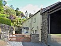
 Cottage and stone barn near Hole House - geograph.org.uk - 3635996.jpg 640 × 480; 110 KB
-
 Cottages on Stones Lane - geograph.org.uk - 5415167.jpg 640 × 427; 230 KB
-
 Cottages opposite St Peter's - geograph.org.uk - 4419517.jpg 640 × 480; 70 KB
-
 Country above Far Sawrey - geograph.org.uk - 5168374.jpg 2,592 × 1,944; 1.62 MB
-
 Country to the East of Outgate - geograph.org.uk - 3627024.jpg 4,320 × 3,240; 3.59 MB
-
 Cows Feeding at Bank Wood - geograph.org.uk - 4933159.jpg 4,524 × 2,742; 2.24 MB
-
 Crag Wood - geograph.org.uk - 5961311.jpg 1,024 × 768; 128 KB
-
 Crag Wood, Gillbank - geograph.org.uk - 4402202.jpg 2,592 × 1,944; 1.35 MB
-
 Crinkle Crags and Bow Fell from Latterbarrow - geograph.org.uk - 2839682.jpg 1,024 × 538; 98 KB
-
 Crow Holme - geograph.org.uk - 4650652.jpg 1,024 × 768; 583 KB
-
 Crow Holme, Windermere - geograph.org.uk - 4413646.jpg 2,504 × 1,839; 1.72 MB
-
 Crow Holme, Windermere - geograph.org.uk - 5719591.jpg 831 × 559; 145 KB
-
 Cuckoo Brow Inn - geograph.org.uk - 4933165.jpg 2,441 × 3,229; 1.52 MB
-
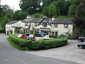 Cuckoo Brow Inn, Far Sawrey - geograph.org.uk - 5455977.jpg 640 × 480; 97 KB
-
 Culvert above Belle Grange - geograph.org.uk - 894372.jpg 640 × 425; 118 KB
-
 Cunsey Beck - geograph.org.uk - 4706259.jpg 530 × 800; 698 KB
-
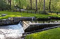 Cunsey Beck hydroelectric scheme - geograph.org.uk - 4706044.jpg 800 × 530; 618 KB
-
 Cunsey Beck in spate - geograph.org.uk - 2263925.jpg 640 × 426; 301 KB
-
 Cunsey Bridge.jpg 800 × 530; 737 KB
-
 Cunsey Mill - geograph.org.uk - 4709067.jpg 800 × 530; 582 KB
-
 Cut benchmark, High Wray - geograph.org.uk - 4428735.jpg 640 × 480; 138 KB
-
 Cyclist at Wise Een Tarn - geograph.org.uk - 6002392.jpg 960 × 720; 175 KB
-
 Dividing track above Sawrey - geograph.org.uk - 3395737.jpg 3,872 × 2,592; 4.55 MB
-
 Drive entrance to Gillbank - geograph.org.uk - 2502148.jpg 640 × 426; 338 KB
-
 Driveway - geograph.org.uk - 5984073.jpg 1,024 × 678; 851 KB
-
 Driveway to Gillbank, Colthouse - geograph.org.uk - 2502106.jpg 426 × 640; 444 KB
-
 Edge of Moss Eccles Tarn - geograph.org.uk - 5415190.jpg 640 × 427; 224 KB
-
 Ees Wyke - geograph.org.uk - 954003.jpg 640 × 426; 54 KB
-
 Ees Wyke, from the south-east. - geograph.org.uk - 953876.jpg 640 × 426; 43 KB
-
 Entrance Lodge to Wray Castle - geograph.org.uk - 4748552.jpg 640 × 428; 96 KB
-
 Entrance to Crag Wood - geograph.org.uk - 2502145.jpg 640 × 426; 451 KB
-
 Entrance to Crag Wood - geograph.org.uk - 3394167.jpg 3,872 × 2,592; 6.27 MB
-
 Entrance to Garnett Wood - geograph.org.uk - 4563351.jpg 640 × 480; 102 KB
-
 Esthwaite How Farm - geograph.org.uk - 4007923.jpg 640 × 483; 302 KB
-
 Esthwaite Water - geograph.org.uk - 4747535.jpg 640 × 428; 52 KB
-
 Esthwaite Water and view northwards, sunset - geograph.org.uk - 3358626.jpg 1,600 × 1,067; 235 KB
-
 Fallen Tree - geograph.org.uk - 1161839.jpg 640 × 480; 89 KB
-
 Fallen tree at Moss Eccles Tarn - geograph.org.uk - 2046323.jpg 3,968 × 2,976; 2.8 MB
-
 Fallen Tree, Windermere, Cumbria - geograph.org.uk - 2759886.jpg 1,024 × 683; 287 KB
-
 Far Sawrey - geograph.org.uk - 4532724.jpg 530 × 800; 576 KB
-
 Far Sawrey buildings (1) - geograph.org.uk - 6218212.jpg 3,939 × 2,954; 3.17 MB
-
 Far Sawrey buildings (2) - geograph.org.uk - 6220803.jpg 4,320 × 3,240; 5 MB
-
 Far Sawrey buildings (3) - geograph.org.uk - 6220804.jpg 4,320 × 3,240; 3.43 MB
-
 Far Sawrey buildings (4) - geograph.org.uk - 6220807.jpg 4,320 × 3,240; 2.84 MB
-
 Far Sawrey buildings (5) - geograph.org.uk - 6220834.jpg 4,320 × 3,240; 4.47 MB
-
 Far Sawrey houses (1) (geograph 6220826).jpg 4,320 × 3,240; 3.85 MB
-
 Far Sawrey houses (10) (geograph 6222383).jpg 4,320 × 3,240; 3.27 MB
-
 Far Sawrey houses (2) (geograph 6220828).jpg 3,861 × 2,895; 3.18 MB
-
 Far Sawrey houses (3) (geograph 6220830).jpg 3,479 × 2,609; 2.88 MB
-
 Far Sawrey houses (4) - geograph.org.uk - 6222359.jpg 4,320 × 3,240; 3.28 MB
-
 Far Sawrey houses (5) - geograph.org.uk - 6222361.jpg 4,320 × 3,240; 3.42 MB
-
 Far Sawrey houses (6) - geograph.org.uk - 6222365.jpg 3,719 × 2,789; 2.2 MB
-
 Far Sawrey houses (7) - geograph.org.uk - 6222368.jpg 4,320 × 3,240; 3.62 MB
-
 Far Sawrey houses (8) - geograph.org.uk - 6222379.jpg 4,004 × 3,004; 3.09 MB
-
 Far Sawrey houses (9) - geograph.org.uk - 6222380.jpg 4,027 × 3,020; 3.43 MB
-
 Farm buildings - geograph.org.uk - 1386928.jpg 640 × 480; 111 KB
-
 Farm buildings at Town End, Hawkshead - geograph.org.uk - 5214198.jpg 4,896 × 3,672; 1.16 MB
-
 Farmland above Near Sawrey - geograph.org.uk - 5415176.jpg 640 × 427; 217 KB
-
 Farmland at Low Wray - geograph.org.uk - 6129362.jpg 1,024 × 683; 369 KB
-
 Farmland near Esthwaite Water - geograph.org.uk - 4007919.jpg 640 × 480; 257 KB
-
 Fellborough Cottage - geograph.org.uk - 6278881.jpg 1,024 × 683; 240 KB
-
 Ferry House seen through trees from the lake - geograph.org.uk - 2784486.jpg 1,024 × 621; 273 KB
-
 Ferry House, Windermere - geograph.org.uk - 2046311.jpg 3,968 × 2,976; 3.15 MB
-
 Ferry House, Windermere - geograph.org.uk - 5455997.jpg 640 × 480; 101 KB
-
 Ferry on Windermere - geograph.org.uk - 4825399.jpg 3,264 × 2,448; 1.57 MB
-
 Field at Near Sawrey - geograph.org.uk - 6277034.jpg 1,024 × 683; 236 KB
-
 Field at Smooth Beck Bridge - geograph.org.uk - 5169980.jpg 640 × 428; 53 KB
-
 Field near High Cunsey - geograph.org.uk - 4708890.jpg 800 × 530; 499 KB
-
 Field north of Cunsey Beck - geograph.org.uk - 4707409.jpg 800 × 530; 471 KB
-
 Field north of Cunsey Beck - geograph.org.uk - 4707420.jpg 800 × 530; 583 KB
-
 Fields above Esthwaite Tarn - geograph.org.uk - 5415319.jpg 640 × 427; 210 KB
-
 Fields at Near Sawrey - geograph.org.uk - 5166809.jpg 640 × 427; 117 KB
-
 Fields near Outgate - geograph.org.uk - 5961310.jpg 1,024 × 768; 211 KB
-
 Fields off Stones Lane - geograph.org.uk - 5415170.jpg 640 × 427; 210 KB
-
 Fields opposite Hill Top - geograph.org.uk - 5166805.jpg 640 × 427; 113 KB
-
 Fisherty How - geograph.org.uk - 3400732.jpg 3,872 × 2,592; 3.22 MB
-
 Fleming Wood - geograph.org.uk - 1160283.jpg 480 × 640; 128 KB
-
 Footbridge over Blelham Beck - geograph.org.uk - 3134353.jpg 4,608 × 3,456; 3.43 MB
-
 Footbridge over Wilfin Beck - geograph.org.uk - 4662459.jpg 640 × 480; 122 KB
-
 Footpath above Near Sawrey - geograph.org.uk - 5415324.jpg 427 × 640; 319 KB
-
 Footpath on Old Intake - geograph.org.uk - 3628851.jpg 4,320 × 3,240; 4.19 MB
-
 Footpath on Old Intake - geograph.org.uk - 4427440.jpg 640 × 480; 92 KB
-
 Footpath sign opposite St Peter's - geograph.org.uk - 4419514.jpg 640 × 480; 56 KB
-

-
 Footpath to Near Sawrey - geograph.org.uk - 5415318.jpg 640 × 427; 257 KB
-
 Footpath to Near Sawrey - geograph.org.uk - 5415325.jpg 640 × 427; 243 KB
-
 Ford and footbridge over Wilfin Beck - geograph.org.uk - 894433.jpg 640 × 425; 115 KB
-
 Ford over Hollow Beck - geograph.org.uk - 4427429.jpg 640 × 480; 119 KB
-
 Forest Path - geograph.org.uk - 1160303.jpg 480 × 640; 120 KB
-
 Forest Track - geograph.org.uk - 1160301.jpg 640 × 480; 69 KB
-
 Forest Track - geograph.org.uk - 1160599.jpg 640 × 480; 87 KB
-
 Forest track near High Wray Basecamp - geograph.org.uk - 3655069.jpg 1,994 × 1,496; 1.15 MB
-
 Forest tracks on Claife Heights - geograph.org.uk - 5168316.jpg 2,592 × 1,944; 1.54 MB
-
 Forestry on Claife Heights - geograph.org.uk - 5168296.jpg 2,592 × 1,944; 1.5 MB
-
 Fork in the road - geograph.org.uk - 2061648.jpg 1,981 × 1,320; 706 KB
-
 Former quay - geograph.org.uk - 4709042.jpg 530 × 800; 627 KB
-
 Framed view from Claife Viewing Station - geograph.org.uk - 6278855.jpg 683 × 1,024; 198 KB
-
 Freshwater Biological Association centre - geograph.org.uk - 4413803.jpg 2,521 × 1,464; 1.78 MB
-
 From Old Intake - geograph.org.uk - 1160315.jpg 640 × 480; 74 KB
-
 Frozen Tarn - geograph.org.uk - 1161866.jpg 640 × 480; 69 KB
-
 Gardens at Hill Top - geograph.org.uk - 5166811.jpg 640 × 427; 178 KB
-

-
 Gateway south of Lake Bank - geograph.org.uk - 822329.jpg 480 × 640; 227 KB
-
 Geese on Windermere at Epley Point - geograph.org.uk - 3635976.jpg 640 × 480; 88 KB
-
 GR Postbox, Near Sawrey - geograph.org.uk - 4007376.jpg 480 × 640; 392 KB
-
 Grass Track by High Tock How - geograph.org.uk - 3627407.jpg 4,320 × 3,240; 4.07 MB
-
 Harvested timber, High Pate Crag - geograph.org.uk - 2840105.jpg 640 × 480; 137 KB
-
 Hawkrigg Farm - geograph.org.uk - 822334.jpg 622 × 466; 135 KB
-
 Hawkshead from Town End - geograph.org.uk - 3392760.jpg 3,872 × 2,592; 3.26 MB
-
 Heading to Dumbarton Wood - geograph.org.uk - 2998148.jpg 640 × 480; 78 KB
-
 Heading up the bridleway at Belle Grange - geograph.org.uk - 4428482.jpg 480 × 640; 170 KB
-
 Heald Wood - geograph.org.uk - 1160273.jpg 480 × 640; 124 KB
-
 Heald Wood - geograph.org.uk - 3132667.jpg 1,024 × 682; 278 KB
-
 High Blind How, Claife Heights (270m) - geograph.org.uk - 2837250.jpg 640 × 480; 126 KB
-
 High Cunsey - geograph.org.uk - 2263956.jpg 640 × 426; 220 KB
-
 High Cunsey - geograph.org.uk - 4543000.jpg 800 × 530; 472 KB
-
 High Cunsey - geograph.org.uk - 4707449.jpg 800 × 530; 593 KB
-
 High Cunsey - geograph.org.uk - 4709051.jpg 800 × 530; 464 KB
-
 High Cunsey, from the lake - geograph.org.uk - 6278891.jpg 1,024 × 683; 240 KB
-
 High Cunsey, Windermere - geograph.org.uk - 2881407.jpg 640 × 487; 378 KB
-
 High Pate Crag (2) - geograph.org.uk - 6002401.jpg 960 × 720; 229 KB
-
 High Pate Crag - geograph.org.uk - 6002398.jpg 960 × 720; 294 KB
-
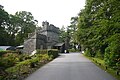
 High Wray Farm - geograph.org.uk - 2502309.jpg 640 × 426; 235 KB
-
 High Wray Village Hall - geograph.org.uk - 4825392.jpg 3,264 × 2,448; 2.25 MB
-
 Highs Moss Tarn - geograph.org.uk - 4662438.jpg 640 × 480; 127 KB
-
 Hill Top (1) - geograph.org.uk - 6222401.jpg 4,320 × 3,240; 4.32 MB
-
 Hill Top (2) - geograph.org.uk - 6222406.jpg 3,240 × 4,320; 4.45 MB
-
 Hill Top (3) (geograph 6222416).jpg 4,320 × 3,240; 4.97 MB
-
 Hill Top Farm, from the vegetable garden - geograph.org.uk - 6277029.jpg 1,024 × 683; 306 KB
-
 Hill Top Farm, Near Sawrey - geograph.org.uk - 6183446.jpg 4,032 × 3,024; 4.71 MB
-
 Hillside at Bryers Fold - geograph.org.uk - 3395785.jpg 3,872 × 2,592; 3.44 MB
-
 Hilltop Farm Sawrey - geograph.org.uk - 6026599.jpg 1,381 × 2,000; 2.2 MB


_-_geograph.org.uk_-_3488071.jpg)


_-_geograph.org.uk_-_6218212.jpg)
_-_geograph.org.uk_-_6220803.jpg)
_-_geograph.org.uk_-_6220804.jpg)
_-_geograph.org.uk_-_6220807.jpg)
_-_geograph.org.uk_-_6220834.jpg)
_(geograph_6220826).jpg)
_(geograph_6222383).jpg)
_(geograph_6220828).jpg)
_(geograph_6220830).jpg)
_-_geograph.org.uk_-_6222359.jpg)
_-_geograph.org.uk_-_6222361.jpg)
_-_geograph.org.uk_-_6222365.jpg)
_-_geograph.org.uk_-_6222368.jpg)
_-_geograph.org.uk_-_6222379.jpg)
_-_geograph.org.uk_-_6222380.jpg)


_-_geograph.org.uk_-_2837250.jpg)


_-_geograph.org.uk_-_6002401.jpg)


_-_geograph.org.uk_-_6222401.jpg)
_-_geograph.org.uk_-_6222406.jpg)
_(geograph_6222416).jpg)


