Category:City limit signs in Nord
Jump to navigation
Jump to search
Departments of Metropolitan France: Ain [01] · Aisne [02] · Allier [03] · Alpes-de-Haute-Provence [04] · Hautes-Alpes [05] · Alpes-Maritimes [06] · Ardèche [07] · Ardennes [08] · Ariège [09] · Aube [10] · Aude [11] · Aveyron [12] · Bouches-du-Rhône [13] · Calvados [14] · Cantal [15] · Charente [16] · Charente-Maritime [17] · Cher [18] · Corrèze [19] · Corse-du-Sud [2A]† · Haute-Corse [2B]† · Côte-d’Or [21] · Côtes-d'Armor [22] · Creuse [23] · Dordogne [24] · Doubs [25] · Drôme [26] · Eure [27] · Eure-et-Loir [28] · Finistère [29] · Gard [30] · Haute-Garonne [31] · Gers [32] · Gironde [33] · Hérault [34] · Ille-et-Vilaine [35] · Indre [36] · Indre-et-Loire [37] · Isère [38] · Jura [39] · Landes [40] · Loir-et-Cher [41] · Loire [42] · Haute-Loire [43] · Loire-Atlantique [44] · Loiret [45] · Lot [46] · Lot-et-Garonne [47] · Lozère [48] · Maine-et-Loire [49] · Manche [50] · Marne [51] · Haute-Marne [52] · Mayenne [53] · Meurthe-et-Moselle [54] · Meuse [55] · Morbihan [56] · Moselle [57] · Nièvre [58] · Nord [59] · Oise [60] · Orne [61] · Pas-de-Calais [62] · Puy-de-Dôme [63] · Pyrénées-Atlantiques [64] · Hautes-Pyrénées [65] · Pyrénées-Orientales [66] · Bas-Rhin [67] · Haut-Rhin [68] · departmental district of the Rhône [69] · Haute-Saône [70] · Saône-et-Loire [71] · Sarthe [72] · Savoie [73] · Haute-Savoie [74] · Paris [75] · Seine-Maritime [76] · Seine-et-Marne [77] · Yvelines [78] · Deux-Sèvres [79] · Somme [80] · Tarn [81] · Var [83] · Vaucluse [84] · Vendée [85] · Vienne [86] · Haute-Vienne [87] · Vosges [88] · Yonne [89] · Territoire de Belfort [90] · Essonne [91] · Hauts-de-Seine [92] · Seine-Saint-Denis [93] · Val-de-Marne [94] · Val-d'Oise [95]
Subcategories
This category has only the following subcategory.
M
Media in category "City limit signs in Nord"
The following 200 files are in this category, out of 369 total.
(previous page) (next page)-
 Abancourt (Nord) - Panneau d'entrée.jpg 2,988 × 5,312; 7.51 MB
-
 Abancourt (Nord) - Panneau de sortie.jpg 2,988 × 5,312; 7.82 MB
-
 Allennes-les-Marais - Panneau d'entrée.jpg 3,784 × 2,965; 4.13 MB
-
 Anor, City limit.jpg 3,098 × 2,507; 3.68 MB
-
 Armentières e010786302-v8.jpg 1,000 × 1,341; 242 KB
-
 Armentières e010786304-v8.jpg 1,000 × 1,353; 236 KB
-
 Attiches chapelle de-l Attarguette.jpg 4,000 × 3,000; 4.9 MB
-
 Attiches Hameau-Drumez.jpg 2,673 × 2,383; 1.42 MB
-
 Aubry-du-Hainaut (Nord, Fr) city limit sign.JPG 4,320 × 3,240; 4.52 MB
-
 Auby (Nord, Fr) city limit sign.JPG 4,320 × 3,240; 5.85 MB
-
 Auchy bersée3.JPG 1,280 × 960; 362 KB
-
 Auchy-lez-Orchies (Nord, Fr) city limit sign.JPG 4,320 × 3,240; 4.36 MB
-
 Avelin (Nord) entrée d'Ennetières.jpg 3,648 × 2,736; 3.89 MB
-
 Avelin (Nord) entrée.jpg 3,648 × 2,736; 3.94 MB
-
 Avelin - Vue du hameau d'Ennetières - 2.jpg 5,312 × 2,988; 6.59 MB
-
 Avelin Hameau du Roseau.JPG 4,896 × 3,672; 7.12 MB
-
 Avesnelles-FR-59-panneau d'agglomération-a1.jpg 3,024 × 4,032; 2.93 MB
-
 Avesnelles-FR-59-panneau d'agglomération-a2.jpg 4,032 × 3,024; 3.15 MB
-
 Avesnes-sur-Helpe-FR-59-panneau d'agglomération-a1.jpg 3,024 × 4,032; 2.81 MB
-
 Avesnes-sur-Helpe-FR-59-panneau d'agglomération-a2.jpg 4,032 × 3,024; 2.86 MB
-
 Bachy - Panneau d'entrée.jpg 2,988 × 5,312; 7.61 MB
-
 Bailleul city limit.jpg 3,672 × 4,896; 7.65 MB
-
 Bailleul.- Hameau de la Crèche en 2016.jpg 3,438 × 2,285; 1.75 MB
-
 Baisieux (Nord) - Entrée de commune.JPG 4,000 × 3,000; 5.12 MB
-
 Bantouzelle 21.jpg 4,237 × 2,929; 9.63 MB
-
 Bantouzelle city limit.jpg 4,320 × 3,240; 5.65 MB
-
 Bavinchove (Nord, Fr) city limit sign.JPG 4,320 × 3,240; 5.67 MB
-
 Beaucamps-Ligny - Panneau d'entrée.jpg 2,988 × 5,312; 6.44 MB
-
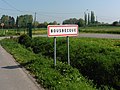
 Beaurieux city limit.JPG 1,989 × 1,782; 1.29 MB
-
 Bellaing (Nord, Fr) city limit sign.JPG 4,320 × 3,240; 5.6 MB
-
 Bellaing (Nord, Fr) en 2019 (5).JPG 4,000 × 2,197; 1.31 MB
-
 Bellaing, City limit.jpg 4,896 × 2,752; 6.55 MB
-
 Bersée (Nord, Fr) city limit sign La Cardonnerie.JPG 4,320 × 3,240; 4.9 MB
-
 Bettignies (Nord, Fr) City limit sign.JPG 4,320 × 3,240; 5.27 MB
-
 Bettignies, city limit sign.JPG 4,320 × 3,240; 5.37 MB
-
 Beuvrages (Nord, Fr) city limit sign.JPG 4,320 × 3,240; 5.37 MB
-
 Beuvry-la-Forêt (Nord, Fr) city limit sign.JPG 4,320 × 3,240; 4.49 MB
-
 Bierne - Panneau d'entrée.JPG 3,264 × 2,448; 1.41 MB
-
 Blaringhem - Panneau d'entrée.jpg 2,970 × 4,132; 2.26 MB
-
 Blaringhem - Renescure (Nord, Fr) City limit sign Le Pont-d'Asquin, recto.JPG 4,320 × 3,240; 5.74 MB
-
 Blaringhem - Renescure (Nord, Fr) City limit sign Le Pont-d'Asquin, verso.JPG 4,320 × 3,240; 5.49 MB
-
 Bléharies. Pont de Maulde.JPG 3,672 × 4,896; 6.82 MB
-
 Boseghem.-le vallon de la becque du Dah (4).jpg 4,000 × 3,000; 6.37 MB
-
 Bouchain.- Le Bassin Rond, (1).jpg 4,000 × 3,000; 4.69 MB
-
 Bourghelles hameau de la Posterie en 2019.jpg 4,896 × 3,672; 7.21 MB
-
 Bourghelles hameau de la Posterie.jpg 4,164 × 2,860; 6.51 MB
-
 Bousbecque avrit2018 (6).JPG 3,226 × 2,419; 2.24 MB
-
 Bousbecque, city limit en2018 (1).JPG 4,896 × 3,672; 7.23 MB
-
 Bousbecque, city limit en2018 (2).JPG 4,896 × 3,672; 6.81 MB
-
 Bousbecque01.jpg 4,608 × 2,119; 1.54 MB
-
 BoussoisEntrée161006 (9).JPG 2,816 × 2,112; 1,017 KB
-
 Bouvines (Nord) entrée.jpg 3,648 × 2,736; 4.09 MB
-
 Boëseghem (Nord, Fr) city limit sign.JPG 4,320 × 3,240; 5.4 MB
-
 Brillon (Nord, Fr) city limit sign.JPG 4,320 × 3,240; 4.64 MB
-
 Bruay-sur-l'Escaut (Nord, Fr) city limit sign.JPG 4,320 × 3,240; 5.31 MB
-
 Cambrai - Panneau d'entrée.jpg 2,988 × 5,312; 5.81 MB
-
 Camphin-en-Pevèle Pavé de la Justice (2).jpg 4,218 × 2,920; 6.12 MB
-
 Cappelle-Brouck - Panneau d'entrée.jpg 5,312 × 2,988; 4.05 MB
-
 Cassel (Nord, Fr) city limit sign.JPG 4,320 × 3,240; 5.75 MB
-
 Cassel (Nord,) city limit sur la D 218.jpg 2,627 × 3,310; 2.54 MB
-
 Château d'eau de Villers en Cauchies (19).jpg 1,080 × 1,920; 627 KB
-
 Château-l'Abbaye (Nord, Fr) city limit sign.JPG 4,320 × 3,240; 5.47 MB
-
 City limit de Bouvignies.JPG 4,608 × 3,456; 5.37 MB
-
 Comines (France) Hameau de Sainte-Marguerite en2019 (10).jpg 4,896 × 3,672; 7.96 MB
-
 Comines city limit en 2019.jpg 4,896 × 3,672; 8.69 MB
-
 Comines lla gare du hameau Ste Marguerite 2022.jpg 4,896 × 2,737; 2.45 MB
-
 Comines Ste Marguerite City limit.JPG 2,471 × 2,502; 1.24 MB
-
 Commune de glageon.jpg 3,456 × 4,608; 7 MB
-
 Coudekerque-Village - Panneau d'entrée.JPG 4,000 × 3,000; 5.22 MB
-
 Crochte - Panneau d'entrée.JPG 3,264 × 2,448; 1.54 MB
-
 Curgies (Nord, Fr) city limit sign.JPG 4,320 × 3,240; 5.83 MB
-
 Cysoing (Nord) entrée.jpg 3,648 × 2,736; 3.82 MB
-
 Deulemont00.jpg 4,605 × 2,125; 1.96 MB
-
 Deulémont Circuit des écluses (16).JPG 4,896 × 3,672; 6.93 MB
-
 Doignies - Panneau d'entrée.JPG 3,264 × 2,448; 1.49 MB
-
 Douai - Panneau d'entrée en sortie de Râches.jpg 2,892 × 4,387; 5.37 MB
-
 Douai entrée de ville.jpg 1,654 × 1,890; 1.1 MB
-
 Dourlers D33 290407 (41).JPG 2,816 × 2,112; 1.19 MB
-
 Ebblinghem (Nord, Fr) city limit sign.JPG 4,320 × 3,240; 5.78 MB
-
 Eecke (Nord, Fr) city limit sign.JPG 4,320 × 3,240; 4 MB
-
 Emmerin city limit.JPG 3,538 × 2,717; 2.4 MB
-
 Emmerin Hameau de la Nappe en2022 (5).jpg 3,672 × 4,896; 6.75 MB
-
 Ennetières-en-Weppes - Panneau d'entrée en 2023.jpg 3,823 × 3,149; 2.68 MB
-
 Ennetières-en-Weppes - Panneau d'entrée.jpg 2,577 × 2,347; 1.87 MB
-
 Ennevelin city limit signe.JPG 3,410 × 3,297; 3.68 MB
-
 Ennevelin city limit.jpg 3,039 × 2,075; 1.27 MB
-
 Ennevelin le Fourneau city limit signe.JPG 4,125 × 2,980; 3.11 MB
-
 Entrée de la ville d'Hornaing 1.jpg 541 × 960; 114 KB
-
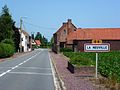
 Entrée de ville de Merville.jpg 1,200 × 800; 272 KB
-
 Entrée village Aibes160507 (31).JPG 2,816 × 2,112; 1.3 MB
-
 Entrée Village St Momelin.JPG 2,272 × 1,704; 950 KB
-
 Eringhem - Panneau d'entrée.JPG 3,264 × 2,448; 1.46 MB
-
 Erquinghem-le-Sec - Panneau d'entrée.jpg 2,752 × 4,180; 3.77 MB
-
 Erquinghem-Lys - Entrée.JPG 3,975 × 2,810; 3.09 MB
-
 Erre (Nord, Fr) city limit sign.JPG 4,320 × 3,240; 4.49 MB
-
 Escaudain (Nord, Fr) city limit sign.JPG 4,320 × 3,240; 5.55 MB
-
 Escautpont - Panneau d'entrée.jpg 2,988 × 5,312; 7.96 MB
-
 Escobecques - Panneau d'entrée.jpg 2,616 × 3,088; 4.15 MB
-
 Esquelbecq - Panneau d'entrée.JPG 3,255 × 2,246; 1.34 MB
-
 Estaires - Panneau d'entrée.jpg 2,970 × 4,272; 3.45 MB
-
 Estreux (Nord, Fr) city limit sign.JPG 4,320 × 3,240; 5.95 MB
-
 Faches-Thumesnil (Nord) entrée.jpg 3,648 × 2,736; 3.88 MB
-
 Faumont (Nord, Fr) city limit sign.JPG 4,320 × 3,240; 4.47 MB
-
 Fenain (Nord, Fr) city limit sign.JPG 4,320 × 3,240; 5.75 MB
-
 Ferriere la Petite D436.jpg 3,127 × 2,298; 2.28 MB
-
 Flines-lès-Mortagne (Nord, Fr) city limit sign.JPG 4,320 × 3,240; 5.51 MB
-
 Flêtre (Nord, Fr) city limit sign.JPG 4,320 × 3,240; 5.56 MB
-
 Flêtre city limit sign (1).JPG 4,896 × 3,672; 7.06 MB
-
 Flêtre city limit sign (2).JPG 3,672 × 4,896; 6.82 MB
-
 Flêtre city limit sign (3).JPG 4,005 × 2,256; 1.83 MB
-
 Flêtre city limit sur la D69.jpg 3,227 × 2,832; 2.11 MB
-
 Forest-sur-Marque - Entrée de commune.JPG 2,493 × 2,297; 1.55 MB
-
 Fournes-en-Weppes .- Bas-Flandre (1).JPG 4,896 × 3,672; 6.98 MB
-
 Fournes-en-Weppes .- Bas-Flandre (2).JPG 4,896 × 3,672; 6.5 MB
-
 Fournes-en-Weppes City limit.JPG 3,759 × 2,836; 2.08 MB
-
 Fournes-en-Weppes en Bas-Flandre (16).jpg 4,896 × 3,672; 6.49 MB
-
 Fournes-en-Weppes en Bas-Flandre (7).jpg 4,896 × 3,672; 6.53 MB
-
 Fournes-en-Weppes la fresnoy.jpg 4,522 × 3,672; 3.7 MB
-
 Frelinghien city limit (1).jpg 4,301 × 3,064; 2.75 MB
-
 Frelinghien city limit (2).jpg 4,661 × 3,495; 3.21 MB
-
 Fresnes-sur-Escaut - Panneau d'entrée.jpg 2,988 × 5,312; 7.22 MB
-
 Fressies - Panneau d'entrée.jpg 2,988 × 5,312; 7.93 MB
-
 Fressies - Panneau de sortie.jpg 5,312 × 2,988; 7.96 MB
-
 Fretin juin 2021 (1).JPG 3,672 × 4,896; 7.02 MB
-
 Fromelles city limit D22.jpg 4,896 × 3,672; 7.08 MB
-
 Frontière Franco-Belge Mortagne-du-Nord - Brunehaut.JPG 4,320 × 3,240; 5.99 MB
-
 Frétin (Nord) entrée.jpg 3,648 × 2,736; 3.75 MB
-
 Godewaersvelde (Nord, Fr) city limit sign.JPG 4,320 × 3,240; 4.21 MB
-
 Gondecourt city limit (1).jpg 3,672 × 4,896; 3.07 MB
-
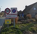 Gondecourt city limit (2).jpg 2,884 × 2,652; 1.54 MB
-
 Gondecourt city limit sur la D39.JPG 3,672 × 4,896; 6.88 MB
-
 Gondecourt, ancien garde barrière.JPG 4,896 × 3,672; 6.18 MB
-
 Gonnelieu - Panneau d'entrée.jpg 5,312 × 2,988; 5.59 MB
-
 Gouzeaucourt - Panneau d'entrée.jpg 4,590 × 2,634; 2.33 MB
-
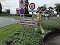 Grande-Synthe - Panneau d'entrée.JPG 4,000 × 3,000; 3.93 MB
-
 Gruson city limit..jpg 3,672 × 4,896; 6.78 MB
-
 Gruson.- Panneau d'entrée.jpg 3,396 × 2,953; 5.85 MB
-
 Gussignies.- City limit.JPG 4,896 × 3,672; 7.52 MB
-
 Habitat cités des Fosses Barrois et Lemay en 2015 (1).JPG 3,225 × 2,419; 1.73 MB
-
 Hallennes-lez-Haubourdin - Panneau d'entrée.jpg 5,312 × 2,988; 7.34 MB
-
 Hasnon (Nord, Fr) city limit sign.JPG 4,320 × 3,240; 5.91 MB
-
 Hasnon-la-Cataine city-limit.jpg 4,608 × 3,456; 5.22 MB
-
 Haulchin (nord, Fr) city limit sign.JPG 4,320 × 3,240; 4.54 MB
-
 Haveluy (Nord, Fr) city limit sign.JPG 4,320 × 3,240; 5.56 MB
-
 Haverskerque - Panneau d'entrée.jpg 3,851 × 2,946; 1.83 MB
-
 Hem (Nord) entrée.jpg 3,648 × 2,736; 4.2 MB
-
 Herlies city limit.jpg 3,932 × 2,556; 3.33 MB
-
 Holque - Panneau d'entrée.JPG 4,000 × 3,000; 5.12 MB
-
 Hondeghem (Nord, Fr) city limit sign.JPG 4,320 × 3,240; 5.82 MB
-
 Hondeghem city limit sur la D53.jpg 4,608 × 3,456; 9.5 MB
-
 Hordain city limit.jpg 1,024 × 768; 233 KB
-
 Hornaing (Nord, Fr) city limit sign Les cinq Fuciaux.JPG 4,320 × 3,240; 5.47 MB
-
 Hornaing (Nord, Fr) city limit sign.JPG 4,320 × 3,240; 5.25 MB
-
 Hornaing, city limit en 2018.JPG 3,621 × 3,360; 3.33 MB
-
 Houplines - Panneau d'entrée.jpg 2,988 × 5,312; 6.93 MB
-
 Houplines - Panneau de sortie.jpg 2,949 × 4,307; 5.47 MB
-
 Houplines03.jpg 3,747 × 2,164; 1.67 MB
-
 Houtkerque (C4) - France.jpg 2,048 × 1,536; 1.26 MB
-
 Hélesmes (Nord, Fr) city limit sign.JPG 4,320 × 3,240; 5.66 MB
-
 Hérin (Nord, Fr) city limit sign.JPG 4,320 × 3,240; 4.58 MB
-
 Illies - Pagneau de Ligny le Grand.jpg 2,988 × 5,312; 8.44 MB
-
 Illies - Panneau d'entrée.jpg 5,312 × 2,988; 5.36 MB
-
 Illies - Panneau de L'Aventure.jpg 2,988 × 5,312; 7.13 MB
-
 Illies - Panneau de sortie.jpg 2,988 × 5,312; 6.26 MB
-
 La Bassée - Panneau d'entrée - 1.jpg 2,494 × 3,990; 4.38 MB
-
 La Bassée - Panneau d'entrée - 2.jpg 2,709 × 4,884; 3.51 MB
-
 La Chapelle-d'Armentières - Panneau d'entrée.jpg 2,988 × 5,312; 6.38 MB
-
 La Flamengrie (Nord) Eté2017 (7).jpg 4,423 × 2,681; 2.94 MB
-
 La Gorgue - Panneau d'entrée.jpg 2,877 × 4,241; 3.76 MB
-
 La ligne haute tension entre Avelin et Tourmignies.jpg 4,896 × 3,672; 5.86 MB
-
 La Madeleine (Nord) entrée.jpg 3,648 × 2,736; 3.71 MB
-
 La Marque à Fretin.JPG 3,488 × 2,495; 3 MB
-
 La Neuville (Nord, Fr) city limit sign.JPG 4,320 × 3,240; 4.67 MB
-
 Landas (Nord, Fr) city limit sign.JPG 4,320 × 3,240; 4.93 MB
-
 Larouillies-FR-59-panneau d'agglomération-a1.jpg 3,024 × 4,032; 2.88 MB
-
 Larouillies-FR-59-panneau d'agglomération-a2.jpg 4,032 × 3,024; 2.88 MB
-
 Lauwin-Planque - Panneau d'entrée.JPG 4,000 × 3,000; 3.47 MB
-
 Laventie et La Gorgue - Limites de communes.JPG 2,975 × 2,340; 2.24 MB
-
 Le Doulieu city limit en2018 (2).JPG 4,896 × 2,752; 5.8 MB
-
 Le Doulieu city limit en2018.JPG 4,896 × 3,672; 6.74 MB
-
 Le Doulieu, France.- city limit en 2022.jpg 4,896 × 3,672; 5.23 MB
-
 Le Doulieu, France.- city limit.jpg 4,000 × 3,000; 2.74 MB
-
 Le Maisnil city limit.JPG 4,896 × 3,672; 6.82 MB
-
 Le Maisnil, Nord-Pas-de-Calais, (2).jpg 4,896 × 3,672; 6.72 MB
-
 Leers02.jpg 3,862 × 1,988; 1.49 MB
-
 Lesquin (Nord) entrée.jpg 3,648 × 2,736; 4.3 MB
-
 Lesquin - Panneau d'entrée.JPG 3,264 × 2,448; 1.53 MB
-
 Lez Fontaines, circuit du Verre Eté2017 (9).jpg 4,896 × 3,672; 6.77 MB
-
 Lieu-Saint-Amand - Panneau d'entrée.JPG 4,000 × 3,000; 5.1 MB
-
 Lille (Nord) entrée venant de La Madeleine.jpg 3,648 × 2,736; 4.22 MB
-
 Linselles - View 1.jpg 2,304 × 1,728; 1.63 MB
-
 Linselles city limit.jpg 2,013 × 2,731; 1.1 MB
-
 Loon-Plage (Nord) city limit sign.jpg 2,736 × 3,648; 4.15 MB
-
 Lynde (Nord, Fr) city limit sign.JPG 4,320 × 3,240; 5.61 MB
-
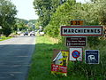 Marchiennes (Nord, Fr) city limit sign.JPG 4,320 × 3,240; 5.42 MB
-
 Marchiennes (Nord, Fr) Elpret, city limit sign.JPG 4,320 × 3,240; 5.9 MB
-
 Marly (Nord, Fr) city limit sign La Briquette.JPG 4,320 × 3,240; 5.42 MB
-
 Marly (Nord, Fr) city limit sign.JPG 4,320 × 3,240; 5.68 MB
-
 Marquette-lez-Lille (Nord) entrée.jpg 3,648 × 2,736; 3.85 MB
-
 Marquillies city limit (1).JPG 4,896 × 3,672; 5.41 MB
_-_Panneau_d%27entr%C3%A9e.jpg)
_-_Panneau_de_sortie.jpg)


_city_limit_sign.JPG)
_city_limit_sign.JPG)

_city_limit_sign.JPG)
_entr%C3%A9e_d%27Enneti%C3%A8res.jpg)
_entr%C3%A9e.jpg)


_-_Entr%C3%A9e_de_commune.JPG)


_city_limit_sign.JPG)


_city_limit_sign.JPG)
_en_2019_(5).JPG)

_city_limit_sign_La_Cardonnerie.JPG)
_City_limit_sign.JPG)

_city_limit_sign.JPG)
_city_limit_sign.JPG)


_City_limit_sign_Le_Pont-d%27Asquin,_recto.JPG)
_City_limit_sign_Le_Pont-d%27Asquin,_verso.JPG)

.jpg)
.jpg)


.JPG)
.JPG)
.JPG)

.JPG)
_entr%C3%A9e.jpg)
_city_limit_sign.JPG)
_city_limit_sign.JPG)
_city_limit_sign.JPG)

.jpg)

_city_limit_sign.JPG)
_city_limit_sur_la_D_218.jpg)
.jpg)
_city_limit_sign.JPG)

_Hameau_de_Sainte-Marguerite_en2019_(10).jpg)


_city_limit_sign.JPG)
_entr%C3%A9e.jpg)

.JPG)


.JPG)
_city_limit_sign.JPG)
_city_limit_sign.JPG)

.jpg)


.JPG)


_city_limit_sign.JPG)
_city_limit_sign.JPG)


_city_limit_sign.JPG)
_entr%C3%A9e.jpg)
_city_limit_sign.JPG)
_city_limit_sign.JPG)

_city_limit_sign.JPG)
_city_limit_sign.JPG)
.JPG)
.JPG)
.JPG)


.JPG)
.JPG)

.jpg)
.jpg)

.jpg)
.jpg)


.JPG)


_entr%C3%A9e.jpg)
_city_limit_sign.JPG)
.jpg)
.jpg)


.JPG)

_city_limit_sign.JPG)

_city_limit_sign.JPG)
_city_limit_sign.JPG)

_entr%C3%A9e.jpg)


_city_limit_sign.JPG)


_city_limit_sign_Les_cinq_Fuciaux.JPG)
_city_limit_sign.JPG)


_-_France.jpg)
_city_limit_sign.JPG)
_city_limit_sign.JPG)


_Et%C3%A92017_(7).jpg)


_entr%C3%A9e.jpg)

_city_limit_sign.JPG)
_city_limit_sign.JPG)


.JPG)


.jpg)

_entr%C3%A9e.jpg)

.jpg)

_entr%C3%A9e_venant_de_La_Madeleine.jpg)


_city_limit_sign.jpg)
_city_limit_sign.JPG)
_city_limit_sign.JPG)
_Elpret,_city_limit_sign.JPG)
_city_limit_sign_La_Briquette.JPG)
_city_limit_sign.JPG)
_entr%C3%A9e.jpg)
.JPG)