Category:Churches in the London Borough of Merton
Jump to navigation
Jump to search

Wikimedia category | |||||
| Upload media | |||||
| Instance of | |||||
|---|---|---|---|---|---|
| Category combines topics | |||||
| London Borough of Merton | |||||
borough in the London Region in England    | |||||
| Instance of | |||||
| Location | Greater London, London, England | ||||
| Legislative body |
| ||||
| Executive body |
| ||||
| Head of government |
| ||||
| Inception |
| ||||
| Population |
| ||||
| Area |
| ||||
| Different from | |||||
| official website | |||||
 | |||||
Subcategories
This category has the following 13 subcategories, out of 13 total.
A
C
- Christ Church, Colliers Wood (3 F)
E
- Emmanuel Church, Wimbledon (5 F)
M
- Morden Baptist Church (2 F)
R
S
W
- St Mark's Church, Wimbledon (13 F)
Media in category "Churches in the London Borough of Merton"
The following 73 files are in this category, out of 73 total.
-
 Apostolic church, Kohat Road - geograph.org.uk - 219421.jpg 640 × 480; 111 KB
-
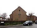
 Bethel Baptist Church - geograph.org.uk - 2168526.jpg 3,872 × 2,592; 2.29 MB
-
-

-

-

-

-
-

-
-
 Catholic Church of Christ the King - geograph.org.uk - 2501468.jpg 640 × 430; 67 KB
-
 Christ Church, West Wimbledon - geograph.org.uk - 3044676.jpg 640 × 480; 70 KB
-
 Christ the King Catholic Church - geograph.org.uk - 2501473.jpg 640 × 430; 68 KB
-
 Church of the Ascension, Pollards Hill - geograph.org.uk - 2676801.jpg 4,288 × 3,216; 5.86 MB
-
 Church of the Ascension, Pollards Hill, east end - geograph.org.uk - 3353394.jpg 1,024 × 768; 208 KB
-
 Church of the Ascension, Pollards Hill, hall - geograph.org.uk - 3353406.jpg 1,024 × 768; 223 KB
-

-
 Church of the Sacred Heart, Edge Hill, Wimbledon - geograph.org.uk - 2873039.jpg 1,064 × 1,600; 383 KB
-
 Church of the Sacred Heart, Edge Hill, Wimbledon - geograph.org.uk - 2873040.jpg 1,600 × 1,064; 530 KB
-
 Dundonald Congregational Church - geograph.org.uk - 1757312.jpg 640 × 480; 96 KB
-
 Emmanuel church, Morden - East end - geograph.org.uk - 1059657.jpg 640 × 480; 97 KB
-
 Emmanuel church, Morden - interior - geograph.org.uk - 1059665.jpg 640 × 480; 64 KB
-
 Emmanuel church, Morden - West end - geograph.org.uk - 1059661.jpg 640 × 480; 89 KB
-

-
 Emmanuel, Ridgway, Wimbledon - geograph.org.uk - 5705598.jpg 900 × 750; 292 KB
-

-
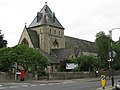
 Holy Trinity Church, South Wimbledon - geograph.org.uk - 2168531.jpg 3,872 × 2,592; 2.61 MB
-

-

-

-
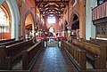
 Interior of Holy Trinity church - geograph.org.uk - 2732997.jpg 1,024 × 768; 175 KB
-
 Martin Way Methodist Church - geograph.org.uk - 2170670.jpg 640 × 480; 67 KB
-
 Merton Park Baptist Church Feb 24.jpg 3,024 × 4,032; 3.88 MB
-
 Merton Park Baptist Church SW20 - geograph.org.uk - 1512824.jpg 640 × 444; 91 KB
-
 Morden Baptist Church Tin Tabernacle on Crown Road.gif 488 × 307; 146 KB
-
 Raynes Park Methodist Church - geograph.org.uk - 1989201.jpg 3,072 × 2,304; 2.94 MB
-
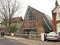
 Southfields Methodist Church - geograph.org.uk - 2551707.jpg 3,872 × 2,592; 3.41 MB
-
 St Andrew, Herbert Road - Brickwork - geograph.org.uk - 3426142.jpg 644 × 1,000; 221 KB
-
 St Andrew, Herbert Road - Chancel - geograph.org.uk - 3426122.jpg 1,000 × 732; 214 KB
-
 St Andrew, Herbert Road - East end - geograph.org.uk - 3426099.jpg 1,000 × 702; 239 KB
-
 St Andrew, Herbert Road - East end - geograph.org.uk - 3426101.jpg 1,000 × 619; 215 KB
-
 St Andrew, Herbert Road - Font - geograph.org.uk - 3426135.jpg 723 × 1,000; 180 KB
-
 St Andrew, Herbert Road - geograph.org.uk - 3426092.jpg 1,000 × 732; 223 KB
-
 St Andrew, Herbert Road - geograph.org.uk - 3426096.jpg 1,000 × 797; 219 KB
-
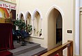
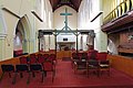
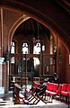
 St Andrew, Herbert Road - Interior - geograph.org.uk - 3426115.jpg 1,000 × 642; 199 KB
-
 St Andrew, Herbert Road - Nave altar - geograph.org.uk - 3426120.jpg 1,000 × 658; 210 KB
-
 St Andrew, Herbert Road - Sanctuary - geograph.org.uk - 3426127.jpg 1,000 × 631; 164 KB
-
 St Andrew, Herbert Road - South chapel - geograph.org.uk - 3426133.jpg 1,000 × 648; 194 KB
-
 St Andrew, Herbert Road - South chapel - geograph.org.uk - 3426144.jpg 650 × 1,000; 201 KB
-
 St Andrew, Herbert Road - Stained glass window - geograph.org.uk - 3426141.jpg 753 × 1,000; 318 KB
-
 St Andrew, Herbert Road - War Memorial WWI - geograph.org.uk - 3426139.jpg 612 × 1,000; 254 KB
-
 St Andrew, Herbert Road - West end - geograph.org.uk - 3426130.jpg 1,000 × 677; 228 KB
-
-
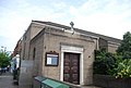
 St George's church, Central Road, Morden - geograph.org.uk - 938065.jpg 640 × 480; 103 KB
-
 St George's hall, Central Road, Morden - geograph.org.uk - 938071.jpg 640 × 480; 121 KB
-
 St James church, Martin Way. - geograph.org.uk - 21468.jpg 640 × 480; 54 KB
-
 St James Church, Merton - geograph.org.uk - 2170653.jpg 640 × 470; 66 KB
-
 St James Church, Merton - geograph.org.uk - 2170661.jpg 505 × 640; 64 KB
-
 St John Fisher church, Morden - geograph.org.uk - 2170645.jpg 640 × 434; 53 KB
-
 St John's church, pulpit - geograph.org.uk - 1941187.jpg 480 × 640; 68 KB
-
 St Matthew's Church, Raynes Park - geograph.org.uk - 2016030.jpg 3,685 × 2,485; 2.86 MB
-
 St Matthews Church, West Wimbledon - geograph.org.uk - 1989214.jpg 3,072 × 2,304; 3.63 MB
-
 Streatham Vale Baptist Church - geograph.org.uk - 2278061.jpg 640 × 425; 72 KB
-

-
 The Apostolic Church, Kohat Road - geograph.org.uk - 3426012.jpg 1,000 × 737; 267 KB
-
 The Apostolic Church, Kohat Road - geograph.org.uk - 3426016.jpg 1,000 × 622; 196 KB
-
 The Apostolic Church, Kohat Road - geograph.org.uk - 3426017.jpg 1,000 × 806; 222 KB
-
 The Apostolic Church, Kohat Road - geograph.org.uk - 3426021.jpg 726 × 1,000; 208 KB
-
 The Salvation Army, Kingston Road, South Wimbledon.jpg 4,106 × 2,933; 9.74 MB
-
-

-
 Elimpc-001.jpg 3,498 × 4,707; 2.8 MB
-
 Elimpc-002.jpg 5,147 × 3,432; 16.29 MB


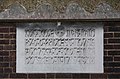
,_Mitcham_-_Foundation_stone_-_geograph.org.uk_-_2798228.jpg)


