Category:Church in Kublank
Jump to navigation
Jump to search
| Object location | | View all coordinates using: OpenStreetMap |
|---|
| Upload media | |||||
| Instance of | |||||
|---|---|---|---|---|---|
| Location | Kublank, Mecklenburgische Seenplatte District, Mecklenburg-Western Pomerania, Germany | ||||
 | |||||
Media in category "Church in Kublank"
The following 11 files are in this category, out of 11 total.
-
 Kublank Kirche 2011-08-03 248.JPG 1,944 × 2,592; 2.23 MB
-
 Kublank Kirche 2011-08-03 250.JPG 1,944 × 2,592; 2.23 MB
-
 Kublank Kirche 2011-08-03 252.JPG 2,592 × 1,944; 2.27 MB
-
 Kublank Kirche 2011-08-03 253.JPG 1,944 × 2,592; 2.27 MB
-
 Kublank Kirche 2011-08-03 256.JPG 1,944 × 2,592; 2.19 MB
-
 Kublank Kirche 2011-08-03 258.JPG 1,944 × 2,592; 2.3 MB
-
 Kublank Kirche 2011-08-03 259.JPG 1,944 × 2,592; 2.25 MB
-
 Kublank Kirche 2011-08-03 260.JPG 1,944 × 2,592; 2.24 MB
-
 Kublank Kirche 2011-08-03 261.JPG 1,944 × 2,592; 2.2 MB
-
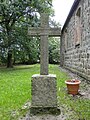 Kublank Kirche Grabkreuz 2011-08-03 254.JPG 1,944 × 2,592; 2.29 MB
-
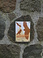 Kublank Kirche Schild Lebensraum Kirchturm 2011-08-03 249.JPG 1,944 × 2,592; 2.27 MB