Category:Church in Göhren (Woldegk)
Jump to navigation
Jump to search
| Object location | | View all coordinates using: OpenStreetMap |
|---|
| Upload media | |||||
| Instance of | |||||
|---|---|---|---|---|---|
| Location | Woldegk, Mecklenburgische Seenplatte District, Mecklenburg-Western Pomerania, Germany | ||||
 | |||||
Subcategories
This category has only the following subcategory.
C
Media in category "Church in Göhren (Woldegk)"
The following 11 files are in this category, out of 11 total.
-
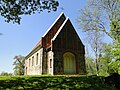
 Göhren (Woldegk) Kirche 2011-05-06 090.JPG 2,592 × 1,944; 2.29 MB
-
 Göhren (Woldegk) Kirche 2011-05-06 103.JPG 2,592 × 1,944; 2.25 MB
-
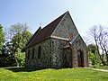
 Göhren (Woldegk) Kirche 2011-05-06 110.JPG 2,592 × 1,944; 2.22 MB
-
 Göhren (Woldegk) Kirche 2011-05-06 113.JPG 1,944 × 2,592; 1.3 MB
-
 Göhren (Woldegk) Kirche 2011-05-06 116.JPG 1,944 × 2,592; 2.2 MB
-
 Göhren (Woldegk) Kirche 2011-05-06 118.JPG 2,592 × 1,944; 2.27 MB
-
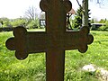
 Göhren (Woldegk) Kirche Grabkreuz 2011-05-06 105.JPG 1,944 × 2,592; 2.26 MB
-
 Göhren (Woldegk) Kirche Grabkreuz 2011-05-06 106.JPG 2,592 × 1,944; 2.24 MB
-
 Göhren (Woldegk) Kirche Grabstein 2011-05-06 108.JPG 1,944 × 2,592; 2.26 MB
-
 Göhren (Woldegk) Kirche Grabstein 2011-05-06 109.JPG 1,944 × 2,592; 2.23 MB
-
 Göhren (Woldegk) Kirche Grabstätte Schwerin 2011-05-06 115.JPG 2,592 × 1,944; 2.26 MB
_Kirche_2011-05-06_090.JPG)
_Kirche_2011-05-06_103.JPG)
_Kirche_2011-05-06_110.JPG)
_Kirche_2011-05-06_113.JPG)
_Kirche_2011-05-06_116.JPG)
_Kirche_2011-05-06_118.JPG)
_Kirche_Grabkreuz_2011-05-06_105.JPG)
_Kirche_Grabkreuz_2011-05-06_106.JPG)
_Kirche_Grabstein_2011-05-06_108.JPG)
_Kirche_Grabstein_2011-05-06_109.JPG)
_Kirche_Grabst%C3%A4tte_Schwerin_2011-05-06_115.JPG)