Category:Church in Blankenförde
Jump to navigation
Jump to search
| Object location | | View all coordinates using: OpenStreetMap |
|---|
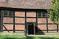
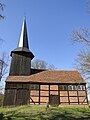
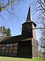
church building in Blankenförde, Germany | |||||
| Upload media | |||||
| Instance of | |||||
|---|---|---|---|---|---|
| Location | Mirow, Mecklenburgische Seenplatte District, Mecklenburg-Western Pomerania, Germany | ||||
| Heritage designation | |||||
 | |||||
Media in category "Church in Blankenförde"
The following 6 files are in this category, out of 6 total.
-
 Blankenfoerde-Kirche-11-05-2007-252.jpg 1,024 × 768; 294 KB
-
 Blankenfoerde-Kirche-11-IV-2007-262.jpg 768 × 1,024; 725 KB
-
 Blankenfoerde-Kirchentuer-11-05-2007-254-1.jpg 768 × 1,024; 226 KB
-
 Blankenförde Kirche 01.JPG 1,936 × 1,288; 2.09 MB
-
 Blankenförde Kirche 2010-04-07 218.jpg 1,944 × 2,592; 2.01 MB
-
 Blankenförde Kirche 2010-04-07 222.jpg 1,944 × 2,592; 2.1 MB