Category:Chiddingfold
Jump to navigation
Jump to search
village and civil parish in Surrey, England, UK  | |||||
| Upload media | |||||
| Instance of | |||||
|---|---|---|---|---|---|
| Location | Waverley, Surrey, South East England, England | ||||
| Population |
| ||||
| Area |
| ||||
| Said to be the same as | Chiddingfold (Wikimedia duplicated page, civil parish) | ||||
 | |||||
Subcategories
This category has the following 18 subcategories, out of 18 total.
A
- Ansteadbrook (10 F)
C
- Chiddingfold Baptist Church (3 F)
- Chiddingfold War Memorial (11 F)
- The Crown Inn, Chiddingfold (17 F)
H
- Hadmans (2 F)
- Highstreet Green, Surrey (3 F)
L
- Lythe Hill Hotel (4 F)
M
- Mesylls (5 F)
P
- Pickhurst (1 F)
R
- Ramsnest Common (4 F)
- Ramster (19 F)
S
- The Swan Inn, Chiddingfold (2 F)
V
- Chiddingfold Village Sign (2 F)
W
Media in category "Chiddingfold"
The following 200 files are in this category, out of 720 total.
(previous page) (next page)-
-
 2020 vision, Day 8 - geograph.org.uk - 6363025.jpg 640 × 480; 91 KB
-
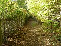
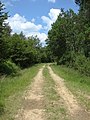
 A leafy Pockford Road Chiddingfold - geograph.org.uk - 2678363.jpg 4,000 × 3,000; 3.3 MB
-

-

-

-

-

-

-

-

-

-

-

-

-

-

-

-
 A view of the interior of the working Chiddingfold forge..jpg 5,817 × 1,005; 2.04 MB
-
 A walk around Ramster Gardens (1) - geograph.org.uk - 6122758.jpg 640 × 480; 88 KB
-
 A walk around Ramster Gardens (10) - geograph.org.uk - 6122954.jpg 640 × 480; 111 KB
-
 A walk around Ramster Gardens (11) - geograph.org.uk - 6122955.jpg 640 × 480; 123 KB
-
 A walk around Ramster Gardens (12) - geograph.org.uk - 6122957.jpg 640 × 480; 118 KB
-
 A walk around Ramster Gardens (13) - geograph.org.uk - 6122958.jpg 640 × 480; 103 KB
-
 A walk around Ramster Gardens (14) - geograph.org.uk - 6122959.jpg 640 × 480; 104 KB
-
 A walk around Ramster Gardens (15) - geograph.org.uk - 6122960.jpg 640 × 480; 111 KB
-
 A walk around Ramster Gardens (16) - geograph.org.uk - 6122962.jpg 640 × 480; 99 KB
-
 A walk around Ramster Gardens (17) - geograph.org.uk - 6122963.jpg 640 × 480; 90 KB
-
 A walk around Ramster Gardens (18) - geograph.org.uk - 6122965.jpg 640 × 480; 86 KB
-
 A walk around Ramster Gardens (19) - geograph.org.uk - 6122966.jpg 640 × 480; 119 KB
-
 A walk around Ramster Gardens (2) - geograph.org.uk - 6122764.jpg 640 × 480; 116 KB
-
 A walk around Ramster Gardens (20) - geograph.org.uk - 6122967.jpg 640 × 480; 119 KB
-
 A walk around Ramster Gardens (21) - geograph.org.uk - 6122969.jpg 640 × 480; 121 KB
-
 A walk around Ramster Gardens (22) - geograph.org.uk - 6122971.jpg 640 × 480; 107 KB
-
 A walk around Ramster Gardens (23) - geograph.org.uk - 6122972.jpg 640 × 480; 132 KB
-
 A walk around Ramster Gardens (24) - geograph.org.uk - 6122973.jpg 640 × 480; 142 KB
-
 A walk around Ramster Gardens (25) - geograph.org.uk - 6122974.jpg 640 × 480; 118 KB
-
 A walk around Ramster Gardens (26) - geograph.org.uk - 6122975.jpg 640 × 480; 130 KB
-
 A walk around Ramster Gardens (27) - geograph.org.uk - 6122976.jpg 640 × 480; 135 KB
-
 A walk around Ramster Gardens (28) - geograph.org.uk - 6122978.jpg 640 × 480; 121 KB
-
 A walk around Ramster Gardens (29) - geograph.org.uk - 6122979.jpg 640 × 480; 130 KB
-
 A walk around Ramster Gardens (3) - geograph.org.uk - 6122939.jpg 640 × 480; 88 KB
-
 A walk around Ramster Gardens (30) - geograph.org.uk - 6122980.jpg 640 × 480; 135 KB
-
 A walk around Ramster Gardens (31) - geograph.org.uk - 6122981.jpg 640 × 480; 101 KB
-
 A walk around Ramster Gardens (32) - geograph.org.uk - 6122982.jpg 640 × 480; 115 KB
-
 A walk around Ramster Gardens (33) - geograph.org.uk - 6122983.jpg 640 × 480; 122 KB
-
 A walk around Ramster Gardens (34) - geograph.org.uk - 6122985.jpg 640 × 480; 101 KB
-
 A walk around Ramster Gardens (35) - geograph.org.uk - 6122986.jpg 640 × 480; 99 KB
-
 A walk around Ramster Gardens (36) - geograph.org.uk - 6122987.jpg 640 × 480; 118 KB
-
 A walk around Ramster Gardens (37) - geograph.org.uk - 6122988.jpg 640 × 480; 111 KB
-
 A walk around Ramster Gardens (38) - geograph.org.uk - 6122989.jpg 640 × 480; 106 KB
-
 A walk around Ramster Gardens (39) - geograph.org.uk - 6122991.jpg 640 × 480; 112 KB
-
 A walk around Ramster Gardens (4) - geograph.org.uk - 6122940.jpg 640 × 480; 119 KB
-
 A walk around Ramster Gardens (40) - geograph.org.uk - 6122992.jpg 640 × 480; 113 KB
-
 A walk around Ramster Gardens (41) - geograph.org.uk - 6122993.jpg 640 × 480; 98 KB
-
 A walk around Ramster Gardens (42) - geograph.org.uk - 6122994.jpg 640 × 480; 114 KB
-
 A walk around Ramster Gardens (43) - geograph.org.uk - 6122997.jpg 640 × 480; 106 KB
-
 A walk around Ramster Gardens (44) - geograph.org.uk - 6122998.jpg 640 × 480; 129 KB
-
 A walk around Ramster Gardens (45) - geograph.org.uk - 6122999.jpg 640 × 480; 144 KB
-
 A walk around Ramster Gardens (46) - geograph.org.uk - 6123000.jpg 640 × 480; 126 KB
-
 A walk around Ramster Gardens (47) - geograph.org.uk - 6123001.jpg 640 × 480; 129 KB
-
 A walk around Ramster Gardens (48) - geograph.org.uk - 6123002.jpg 640 × 480; 116 KB
-
 A walk around Ramster Gardens (49) - geograph.org.uk - 6123003.jpg 640 × 480; 120 KB
-
 A walk around Ramster Gardens (5) - geograph.org.uk - 6122941.jpg 640 × 480; 96 KB
-
 A walk around Ramster Gardens (50) - geograph.org.uk - 6123004.jpg 640 × 480; 132 KB
-
 A walk around Ramster Gardens (51) - geograph.org.uk - 6123005.jpg 640 × 480; 137 KB
-
 A walk around Ramster Gardens (52) - geograph.org.uk - 6123007.jpg 640 × 480; 133 KB
-
 A walk around Ramster Gardens (53) - geograph.org.uk - 6123008.jpg 640 × 480; 127 KB
-
 A walk around Ramster Gardens (54) - geograph.org.uk - 6123010.jpg 640 × 480; 128 KB
-
 A walk around Ramster Gardens (55) - geograph.org.uk - 6123011.jpg 640 × 480; 138 KB
-
 A walk around Ramster Gardens (56) - geograph.org.uk - 6123013.jpg 640 × 480; 137 KB
-
 A walk around Ramster Gardens (57) - geograph.org.uk - 6123014.jpg 640 × 480; 121 KB
-
 A walk around Ramster Gardens (58) - geograph.org.uk - 6123015.jpg 640 × 480; 124 KB
-
 A walk around Ramster Gardens (59) - geograph.org.uk - 6123017.jpg 640 × 480; 122 KB
-
 A walk around Ramster Gardens (6) - geograph.org.uk - 6122948.jpg 640 × 480; 101 KB
-
 A walk around Ramster Gardens (60) - geograph.org.uk - 6123018.jpg 640 × 480; 127 KB
-
 A walk around Ramster Gardens (61) - geograph.org.uk - 6123019.jpg 640 × 480; 117 KB
-
 A walk around Ramster Gardens (62) - geograph.org.uk - 6123020.jpg 640 × 480; 123 KB
-
 A walk around Ramster Gardens (63) - geograph.org.uk - 6123021.jpg 640 × 480; 149 KB
-
 A walk around Ramster Gardens (64) - geograph.org.uk - 6123025.jpg 640 × 480; 136 KB
-
 A walk around Ramster Gardens (65) - geograph.org.uk - 6123026.jpg 640 × 480; 103 KB
-
 A walk around Ramster Gardens (66) - geograph.org.uk - 6123028.jpg 640 × 480; 118 KB
-
 A walk around Ramster Gardens (67) - geograph.org.uk - 6123031.jpg 640 × 480; 107 KB
-
 A walk around Ramster Gardens (68) - geograph.org.uk - 6123032.jpg 640 × 480; 115 KB
-
 A walk around Ramster Gardens (69) - geograph.org.uk - 6123034.jpg 640 × 480; 121 KB
-
 A walk around Ramster Gardens (7) - geograph.org.uk - 6122950.jpg 640 × 480; 137 KB
-
 A walk around Ramster Gardens (70) - geograph.org.uk - 6123035.jpg 640 × 480; 122 KB
-
 A walk around Ramster Gardens (71) - geograph.org.uk - 6123038.jpg 640 × 480; 131 KB
-
 A walk around Ramster Gardens (72) - geograph.org.uk - 6123040.jpg 640 × 480; 120 KB
-
 A walk around Ramster Gardens (73) - geograph.org.uk - 6123041.jpg 640 × 480; 132 KB
-
 A walk around Ramster Gardens (74) - geograph.org.uk - 6123042.jpg 640 × 480; 125 KB
-
 A walk around Ramster Gardens (75) - geograph.org.uk - 6123043.jpg 640 × 480; 137 KB
-
 A walk around Ramster Gardens (76) - geograph.org.uk - 6123045.jpg 640 × 480; 131 KB
-
 A walk around Ramster Gardens (77) - geograph.org.uk - 6123046.jpg 640 × 480; 135 KB
-
 A walk around Ramster Gardens (78) - geograph.org.uk - 6123047.jpg 640 × 480; 139 KB
-
 A walk around Ramster Gardens (79) - geograph.org.uk - 6123049.jpg 640 × 480; 144 KB
-
 A walk around Ramster Gardens (8) - geograph.org.uk - 6122951.jpg 640 × 480; 108 KB
-
 A walk around Ramster Gardens (80) - geograph.org.uk - 6123051.jpg 640 × 480; 132 KB
-
 A walk around Ramster Gardens (81a) - geograph.org.uk - 6123052.jpg 640 × 480; 136 KB
-
 A walk around Ramster Gardens (81b) - geograph.org.uk - 6123053.jpg 640 × 480; 128 KB
-
 A walk around Ramster Gardens (82) - geograph.org.uk - 6123054.jpg 640 × 480; 107 KB
-
 A walk around Ramster Gardens (83) - geograph.org.uk - 6123055.jpg 640 × 480; 124 KB
-
 A walk around Ramster Gardens (84) - geograph.org.uk - 6123057.jpg 640 × 480; 123 KB
-
 A walk around Ramster Gardens (85) - geograph.org.uk - 6123058.jpg 640 × 480; 122 KB
-
 A walk around Ramster Gardens (86) - geograph.org.uk - 6123060.jpg 640 × 480; 122 KB
-
 A walk around Ramster Gardens (87) - geograph.org.uk - 6123062.jpg 640 × 480; 127 KB
-
 A walk around Ramster Gardens (88) - geograph.org.uk - 6123063.jpg 640 × 480; 137 KB
-
 A walk around Ramster Gardens (89) - geograph.org.uk - 6123064.jpg 640 × 480; 114 KB
-
 A walk around Ramster Gardens (9) - geograph.org.uk - 6122952.jpg 640 × 480; 108 KB
-
 A walk around Ramster Gardens (90) - geograph.org.uk - 6123066.jpg 640 × 480; 126 KB
-
 A walk around Ramster Gardens (91) - geograph.org.uk - 6123068.jpg 640 × 480; 127 KB
-
 A walk around Ramster Gardens (92) - geograph.org.uk - 6123069.jpg 640 × 480; 121 KB
-
 A walk around Ramster Gardens (93) - geograph.org.uk - 6123070.jpg 640 × 480; 115 KB
-
 A walk around Ramster Gardens (94) - geograph.org.uk - 6123071.jpg 640 × 480; 105 KB
-
 A walk around Ramster Gardens (95) - geograph.org.uk - 6123072.jpg 640 × 480; 121 KB
-
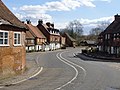
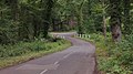
 A283 approaching Chiddingfold - geograph.org.uk - 2665270.jpg 640 × 428; 105 KB
-
 A283 at The Mulberry - geograph.org.uk - 5642754.jpg 640 × 426; 82 KB
-
 A283 at The Winterton Arms - geograph.org.uk - 5642774.jpg 640 × 426; 82 KB
-
 A283 entering Chiddingfold - geograph.org.uk - 3224276.jpg 640 × 430; 105 KB
-
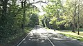
 A283 heading north - geograph.org.uk - 3224269.jpg 640 × 430; 99 KB
-
 A283 passes the Church of St Mary - geograph.org.uk - 3227832.jpg 3,648 × 2,048; 1.76 MB
-
 A283 passes The Mulberry - geograph.org.uk - 3228140.jpg 2,706 × 2,047; 1.32 MB
-
 A283 passes the Winterton Arms - geograph.org.uk - 3227180.jpg 3,648 × 2,048; 1.97 MB
-
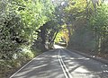
 A283 sharp bends north of Chiddingfold - geograph.org.uk - 3227183.jpg 3,648 × 2,048; 1.54 MB
-
 A283 south of Bethwins Farm - geograph.org.uk - 3228133.jpg 2,924 × 2,040; 1.25 MB
-
 A283 south of Chiddingfold - geograph.org.uk - 3038097.jpg 640 × 428; 110 KB
-
 A283 south of Millhouse Farm - geograph.org.uk - 3228136.jpg 3,648 × 2,048; 1.59 MB
-
 A283 to Northbridge - geograph.org.uk - 3220755.jpg 640 × 430; 101 KB
-
 A283 west of Northbridge Farm - geograph.org.uk - 3227176.jpg 2,838 × 2,048; 1.33 MB
-
 A283, Chiddingfold - geograph.org.uk - 3220740.jpg 640 × 430; 92 KB
-
 A283, Chiddingfold - geograph.org.uk - 5642768.jpg 640 × 426; 75 KB
-
 A283, northbound - geograph.org.uk - 5642758.jpg 640 × 426; 80 KB
-
 Access track, High Barn Farm - geograph.org.uk - 2602896.jpg 640 × 430; 59 KB
-
 Albino sparrow at Stonehurst - geograph.org.uk - 1980614.jpg 1,600 × 1,200; 502 KB
-
 An enquiring bovine^ - geograph.org.uk - 3234449.jpg 640 × 430; 107 KB
-
 April Cottage - geograph.org.uk - 3217721.jpg 640 × 430; 106 KB
-
 Artemis - geograph.org.uk - 2382330.jpg 1,920 × 2,560; 1.75 MB
-
 Ash Combe - geograph.org.uk - 3217752.jpg 640 × 430; 95 KB
-
 Autumn colour on footpath 216 in Fowlhurst Copse - geograph.org.uk - 2675431.jpg 4,000 × 3,000; 3.44 MB
-
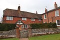
 Autumn Cottage And Pound Cottage, Chiddingfold.jpg 3,456 × 2,304; 4.25 MB
-
 Barfold Copse - geograph.org.uk - 2608715.jpg 640 × 430; 125 KB
-
 Barfold Copse - geograph.org.uk - 2608723.jpg 640 × 430; 143 KB
-
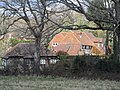
 Barn 10 Yards North of Upper Sydenhurst, Chiddingfold.jpg 4,000 × 3,000; 3.02 MB
-
 Barn north of Chiddingfold - geograph.org.uk - 3220748.jpg 640 × 430; 67 KB
-

-
 Barn, Chiddingfold - geograph.org.uk - 3217736.jpg 640 × 430; 100 KB
-
 Barn, Chiddingfold - geograph.org.uk - 3217742.jpg 640 × 430; 100 KB
-

-
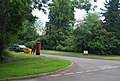
 Barnkids Nursery - geograph.org.uk - 3216567.jpg 640 × 430; 56 KB
-

-
 Beckhams Cottage, Little Beckhams, Chiddingfold.jpg 3,456 × 2,304; 4.1 MB
-
 Beckhams, Chiddingfold 2.jpg 3,456 × 2,304; 4.34 MB
-
 Beckhams, Chiddingfold.jpg 4,000 × 3,000; 3.91 MB
-
 Bend in the road, the A283 at Chiddingfold - geograph.org.uk - 2194071.jpg 1,024 × 768; 211 KB
-
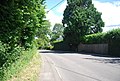
 Bend, Combe Lane - geograph.org.uk - 3216547.jpg 640 × 430; 104 KB
-
 Bend, Combe Lane - geograph.org.uk - 3216555.jpg 640 × 430; 113 KB
-
 Black Hams, Chiddingfold 2.jpg 3,456 × 2,304; 4.59 MB
-
 Black Hams, Chiddingfold.jpg 5,152 × 3,864; 9.19 MB
-
 Bluebells on Ant Hill - geograph.org.uk - 2382299.jpg 2,560 × 1,920; 1.67 MB
-
 Bog Garden - geograph.org.uk - 2382323.jpg 2,560 × 1,920; 1.69 MB
-
 Bollards on footpath at the eastern end of School Lane - geograph.org.uk - 2669648.jpg 4,000 × 3,000; 3.36 MB
-
 Botany Bay - geograph.org.uk - 2489207.jpg 480 × 640; 330 KB
-
 Botany Bay - geograph.org.uk - 2489213.jpg 640 × 480; 364 KB
-
 Botany Bay - geograph.org.uk - 2489276.jpg 480 × 640; 336 KB
-
 Botany Bay off High Street Green road - geograph.org.uk - 1913861.jpg 1,600 × 1,200; 658 KB
-
 Botley House, Chiddingfold.jpg 3,456 × 2,304; 4.95 MB
-
 Brick footpath bridge near Northbridge, Chiddingfold - geograph.org.uk - 2669841.jpg 4,000 × 3,000; 3.49 MB
-
 Bridge and bend on White Beech Lane - geograph.org.uk - 1392334.jpg 640 × 360; 66 KB
-
 Bridge by pond - geograph.org.uk - 1136912.jpg 640 × 360; 97 KB
-

-
 Bridge Cottage, Primrose Cottage, Chiddingfold.jpg 3,456 × 2,304; 3.87 MB
-
 Bridge over Anstead Brook on Killinghurst Lane - geograph.org.uk - 2074151.jpg 2,592 × 1,944; 2.04 MB
-
 Bridlebridge into Duns Copse - geograph.org.uk - 3263999.jpg 800 × 600; 170 KB
-
 Bridleway along the woodland edge - geograph.org.uk - 3231063.jpg 640 × 430; 94 KB
-
 Bridleway and stream in The Grove woodland - geograph.org.uk - 2671564.jpg 4,000 × 3,000; 3.73 MB
-
 Bridleway approaching drive to Dunsfold Ryse - geograph.org.uk - 1920848.jpg 1,600 × 1,200; 621 KB
-
 Bridleway bridge - geograph.org.uk - 2671572.jpg 4,000 × 3,000; 3.51 MB
-
 Bridleway bridge crosses stream - geograph.org.uk - 1136800.jpg 640 × 360; 107 KB
-
 Bridleway bridge north of Songhurst - geograph.org.uk - 1980483.jpg 1,600 × 1,200; 818 KB
-
 Bridleway east from Northbridge Chiddingfold - geograph.org.uk - 2671543.jpg 4,000 × 3,000; 3.52 MB
-
 Bridleway junction with West End Lane - geograph.org.uk - 2667103.jpg 4,000 × 3,000; 3.5 MB
-
 Bridleway nearing High Street Green - geograph.org.uk - 1920897.jpg 2,592 × 1,944; 1.74 MB
-
 Bridleway on Pockford Farm - geograph.org.uk - 2671920.jpg 4,000 × 3,000; 3.38 MB
-
 Bridleway to Pockford Farm - geograph.org.uk - 3231062.jpg 640 × 430; 89 KB
-
 Brockhurst, Chiddingfold.jpg 3,456 × 2,304; 3.56 MB
-

-
 Buckler fern, Dryopteris, Tugley Wood - geograph.org.uk - 2961413.jpg 882 × 1,176; 785 KB
-
 Burrell House, Chiddingfold.jpg 3,456 × 2,304; 2.74 MB
-
 By the A283 - geograph.org.uk - 3220751.jpg 640 × 430; 80 KB
-
 By Woodside Rd - geograph.org.uk - 3217740.jpg 640 × 430; 73 KB
-
 Catsprey, Chiddingfold.jpg 3,456 × 2,304; 4.71 MB
-
 Cattle grazing - geograph.org.uk - 3231064.jpg 640 × 430; 98 KB
-
 Chantry House, Chiddingfold.jpg 3,456 × 2,304; 4.52 MB
-
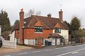
 Chiddingfold (8929120907).jpg 2,048 × 1,536; 1.35 MB
-
 Chiddingfold - Brockhurst - 20230603102244.jpg 4,000 × 3,000; 3.95 MB
-
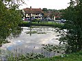
 Chiddingfold - geograph.org.uk - 2382495.jpg 2,560 × 1,920; 1.74 MB
-
 Chiddingfold - geograph.org.uk - 255196.jpg 640 × 480; 143 KB
-
 Chiddingfold - Grove Cottage - 20230603102325.jpg 4,000 × 3,000; 3.79 MB
-
 Chiddingfold - High Prestwick - 20230603112832.jpg 4,000 × 3,000; 4.91 MB
-
 Chiddingfold - High Prestwick - 20230603112840.jpg 4,000 × 3,000; 4.11 MB


_-_geograph.org.uk_-_3817682.jpg)
_-_geograph.org.uk_-_3817685.jpg)
_-_geograph.org.uk_-_3817686.jpg)
_-_geograph.org.uk_-_3817695.jpg)
_-_geograph.org.uk_-_3817840.jpg)
_-_geograph.org.uk_-_3817696.jpg)
_-_geograph.org.uk_-_3817698.jpg)
_-_geograph.org.uk_-_3817699.jpg)
_-_geograph.org.uk_-_3817754.jpg)
_-_geograph.org.uk_-_3817755.jpg)
_-_geograph.org.uk_-_3817842.jpg)
_-_geograph.org.uk_-_3817845.jpg)
_-_geograph.org.uk_-_3817853.jpg)
_-_geograph.org.uk_-_3817870.jpg)
_-_geograph.org.uk_-_3817874.jpg)
_-_geograph.org.uk_-_6122758.jpg)
_-_geograph.org.uk_-_6122954.jpg)
_-_geograph.org.uk_-_6122955.jpg)
_-_geograph.org.uk_-_6122957.jpg)
_-_geograph.org.uk_-_6122958.jpg)
_-_geograph.org.uk_-_6122959.jpg)
_-_geograph.org.uk_-_6122960.jpg)
_-_geograph.org.uk_-_6122962.jpg)
_-_geograph.org.uk_-_6122963.jpg)
_-_geograph.org.uk_-_6122965.jpg)
_-_geograph.org.uk_-_6122966.jpg)
_-_geograph.org.uk_-_6122764.jpg)
_-_geograph.org.uk_-_6122967.jpg)
_-_geograph.org.uk_-_6122969.jpg)
_-_geograph.org.uk_-_6122971.jpg)
_-_geograph.org.uk_-_6122972.jpg)
_-_geograph.org.uk_-_6122973.jpg)
_-_geograph.org.uk_-_6122974.jpg)
_-_geograph.org.uk_-_6122975.jpg)
_-_geograph.org.uk_-_6122976.jpg)
_-_geograph.org.uk_-_6122978.jpg)
_-_geograph.org.uk_-_6122979.jpg)
_-_geograph.org.uk_-_6122939.jpg)
_-_geograph.org.uk_-_6122980.jpg)
_-_geograph.org.uk_-_6122981.jpg)
_-_geograph.org.uk_-_6122982.jpg)
_-_geograph.org.uk_-_6122983.jpg)
_-_geograph.org.uk_-_6122985.jpg)
_-_geograph.org.uk_-_6122986.jpg)
_-_geograph.org.uk_-_6122987.jpg)
_-_geograph.org.uk_-_6122988.jpg)
_-_geograph.org.uk_-_6122989.jpg)
_-_geograph.org.uk_-_6122991.jpg)
_-_geograph.org.uk_-_6122940.jpg)
_-_geograph.org.uk_-_6122992.jpg)
_-_geograph.org.uk_-_6122993.jpg)
_-_geograph.org.uk_-_6122994.jpg)
_-_geograph.org.uk_-_6122997.jpg)
_-_geograph.org.uk_-_6122998.jpg)
_-_geograph.org.uk_-_6122999.jpg)
_-_geograph.org.uk_-_6123000.jpg)
_-_geograph.org.uk_-_6123001.jpg)
_-_geograph.org.uk_-_6123002.jpg)
_-_geograph.org.uk_-_6123003.jpg)
_-_geograph.org.uk_-_6122941.jpg)
_-_geograph.org.uk_-_6123004.jpg)
_-_geograph.org.uk_-_6123005.jpg)
_-_geograph.org.uk_-_6123007.jpg)
_-_geograph.org.uk_-_6123008.jpg)
_-_geograph.org.uk_-_6123010.jpg)
_-_geograph.org.uk_-_6123011.jpg)
_-_geograph.org.uk_-_6123013.jpg)
_-_geograph.org.uk_-_6123014.jpg)
_-_geograph.org.uk_-_6123015.jpg)
_-_geograph.org.uk_-_6123017.jpg)
_-_geograph.org.uk_-_6122948.jpg)
_-_geograph.org.uk_-_6123018.jpg)
_-_geograph.org.uk_-_6123019.jpg)
_-_geograph.org.uk_-_6123020.jpg)
_-_geograph.org.uk_-_6123021.jpg)
_-_geograph.org.uk_-_6123025.jpg)
_-_geograph.org.uk_-_6123026.jpg)
_-_geograph.org.uk_-_6123028.jpg)
_-_geograph.org.uk_-_6123031.jpg)
_-_geograph.org.uk_-_6123032.jpg)
_-_geograph.org.uk_-_6123034.jpg)
_-_geograph.org.uk_-_6122950.jpg)
_-_geograph.org.uk_-_6123035.jpg)
_-_geograph.org.uk_-_6123038.jpg)
_-_geograph.org.uk_-_6123040.jpg)
_-_geograph.org.uk_-_6123041.jpg)
_-_geograph.org.uk_-_6123042.jpg)
_-_geograph.org.uk_-_6123043.jpg)
_-_geograph.org.uk_-_6123045.jpg)
_-_geograph.org.uk_-_6123046.jpg)
_-_geograph.org.uk_-_6123047.jpg)
_-_geograph.org.uk_-_6123049.jpg)
_-_geograph.org.uk_-_6122951.jpg)
_-_geograph.org.uk_-_6123051.jpg)
_-_geograph.org.uk_-_6123052.jpg)
_-_geograph.org.uk_-_6123053.jpg)
_-_geograph.org.uk_-_6123054.jpg)
_-_geograph.org.uk_-_6123055.jpg)
_-_geograph.org.uk_-_6123057.jpg)
_-_geograph.org.uk_-_6123058.jpg)
_-_geograph.org.uk_-_6123060.jpg)
_-_geograph.org.uk_-_6123062.jpg)
_-_geograph.org.uk_-_6123063.jpg)
_-_geograph.org.uk_-_6123064.jpg)
_-_geograph.org.uk_-_6122952.jpg)
_-_geograph.org.uk_-_6123066.jpg)
_-_geograph.org.uk_-_6123068.jpg)
_-_geograph.org.uk_-_6123069.jpg)
_-_geograph.org.uk_-_6123070.jpg)
_-_geograph.org.uk_-_6123071.jpg)
_-_geograph.org.uk_-_6123072.jpg)


.jpg)


