Category:Cherington, Warwickshire
Jump to navigation
Jump to search
village and civil parish in Warwickshire. England, UK  | |||||
| Upload media | |||||
| Instance of | |||||
|---|---|---|---|---|---|
| Location | Stratford-on-Avon, Warwickshire, West Midlands, England | ||||
| Population |
| ||||
| Area |
| ||||
| official website | |||||
 | |||||
English: Cherington is a village and civil parish beside the River Stour about southeast of Shipston-on-Stour. Cherington is immediately adjacent to the village of Stourton. It is in the Stratford-on-Avon district of Warwickshire, England.
Subcategories
This category has only the following subcategory.
J
Media in category "Cherington, Warwickshire"
The following 49 files are in this category, out of 49 total.
-
 Ancient Well, Cherington - geograph.org.uk - 2153238.jpg 640 × 480; 94 KB
-
 Barns to be converted^ - geograph.org.uk - 1862428.jpg 4,000 × 3,000; 2.51 MB
-
 Bridge and gate - geograph.org.uk - 1862450.jpg 4,000 × 3,000; 2.59 MB
-
 Bridleway to North Farm - geograph.org.uk - 5179389.jpg 640 × 480; 55 KB
-
 Buildings on Margett's Hill - geograph.org.uk - 1556789.jpg 640 × 480; 73 KB
-
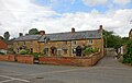 Cherington Cottages - geograph.org.uk - 5881864.jpg 1,600 × 1,007; 392 KB
-
 Cherington Hill - geograph.org.uk - 1862395.jpg 4,000 × 3,000; 1.95 MB
-
 Cherington Road Junction - geograph.org.uk - 6153590.jpg 1,600 × 1,200; 494 KB
-
 Cherington Sewage Works - geograph.org.uk - 1862461.jpg 4,000 × 3,000; 1.97 MB
-
 Cherington village entrance - geograph.org.uk - 2153183.jpg 640 × 480; 71 KB
-
 Cherington village from the footpath - geograph.org.uk - 1556766.jpg 640 × 480; 104 KB
-
 Cottage in the village of Cherington - geograph.org.uk - 510015.jpg 640 × 426; 113 KB
-
 Cottage on Margett's Hill - geograph.org.uk - 1556806.jpg 640 × 480; 97 KB
-
 Cottages at Sutton-under-Brailes - geograph.org.uk - 205283.jpg 640 × 480; 65 KB
-
 Down the hill - geograph.org.uk - 1862409.jpg 4,000 × 3,000; 3.43 MB
-
 Driveway to Cherington Hill - geograph.org.uk - 510960.jpg 640 × 426; 106 KB
-
 Entering Jenny Swift Plantation - geograph.org.uk - 5179392.jpg 480 × 640; 147 KB
-
 Farmland and view - geograph.org.uk - 1861920.jpg 4,000 × 3,000; 1.64 MB
-
 Footpath meets road - geograph.org.uk - 1862438.jpg 4,000 × 3,000; 1.57 MB
-
 Footpath near Cherington - geograph.org.uk - 1556779.jpg 640 × 480; 91 KB
-
 In Stourton Coppice - geograph.org.uk - 1556835.jpg 640 × 480; 147 KB
-
 Into Stourton Coppice - geograph.org.uk - 1556827.jpg 640 × 480; 149 KB
-
 Lower slopes of Margett's Hill - geograph.org.uk - 1556759.jpg 640 × 480; 66 KB
-
 Margetts's Hill - geograph.org.uk - 1556694.jpg 640 × 480; 63 KB
-
 Molly's Lodge - geograph.org.uk - 1731682.jpg 4,000 × 3,000; 2.28 MB
-
 New Stile - geograph.org.uk - 1556773.jpg 640 × 480; 141 KB
-
 Old Red Lion, Cherington - geograph.org.uk - 2153222.jpg 640 × 480; 92 KB
-
 Out of Drybank Meadow - geograph.org.uk - 407029.jpg 640 × 480; 121 KB
-
 River Stour - geograph.org.uk - 1862475.jpg 4,000 × 3,000; 5 MB
-
 Shakespeare's Way - geograph.org.uk - 4762904.jpg 640 × 480; 71 KB
-
 Shakespeare's Way - geograph.org.uk - 4762908.jpg 640 × 480; 83 KB
-
 Shakespeare's Way - geograph.org.uk - 4762933.jpg 640 × 480; 52 KB
-
 Sheep and woods - geograph.org.uk - 1556689.jpg 640 × 480; 99 KB
-
 Start of path - geograph.org.uk - 1862494.jpg 4,000 × 3,000; 2.69 MB
-
 The Cherington Arms - geograph.org.uk - 205278.jpg 640 × 480; 62 KB
-
 The Cherington Arms - geograph.org.uk - 2153201.jpg 640 × 480; 80 KB
-
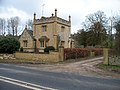
 The Old Red Lion House, Cherington - geograph.org.uk - 510018.jpg 640 × 426; 106 KB
-
 Towards Square Coppice - geograph.org.uk - 1556755.jpg 640 × 480; 96 KB
-
 Up the hill - geograph.org.uk - 1862418.jpg 4,000 × 3,000; 3.22 MB
-
 View from Margett's Hill - geograph.org.uk - 1556699.jpg 640 × 480; 93 KB
-
 Barn conversion on Cherington Hill - geograph.org.uk - 205281.jpg 640 × 480; 51 KB
-

-
 Cottages near Cherington House - geograph.org.uk - 205266.jpg 640 × 480; 74 KB
-
 Field with shed - geograph.org.uk - 271854.jpg 640 × 480; 96 KB
-
 Little Wolford Heath - geograph.org.uk - 271866.jpg 640 × 480; 106 KB
-
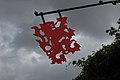 Red Lion inn sign - geograph.org.uk - 510020.jpg 640 × 426; 77 KB
-
 Spring in Cherington - geograph.org.uk - 510017.jpg 426 × 640; 156 KB
-
 Track towards Weston Gardens - geograph.org.uk - 268947.jpg 640 × 480; 143 KB
-
 Weston Park - geograph.org.uk - 268953.jpg 640 × 480; 104 KB


