Category:Chelsworth
Jump to navigation
Jump to search
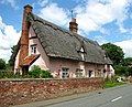
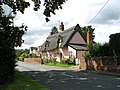
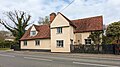
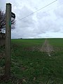
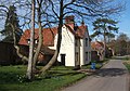
English: Chelsworth is a village and civil parish in Suffolk, England. Located on the B1115 road between Sudbury and Stowmarket, it is part of Babergh district. The parish also contains the hamlet of Chelsworth Common.
village and civil parish in Suffolk, UK  | |||||
| Upload media | |||||
| Instance of | |||||
|---|---|---|---|---|---|
| Location | Babergh, Suffolk, East of England, England | ||||
 | |||||
Subcategories
This category has the following 6 subcategories, out of 6 total.
A
G
- The Grange, Chelsworth (3 F)
O
- The Old Forge, Chelsworth (2 F)
P
- The Peacock Inn, Chelsworth (8 F)
- Princhetts (2 F)
W
- Whistlecraft Cottage (2 F)
Media in category "Chelsworth"
The following 69 files are in this category, out of 69 total.
-
 'The Street' Chelsworth - geograph.org.uk - 509271.jpg 2,074 × 1,402; 849 KB
-
 1988 Parsonage Lane Chelsworth (west end) in Autumn - geograph.org.uk - 5229567.jpg 3,498 × 2,352; 5.7 MB
-
 36 and 38 The Street, Chelsworth (geograph 7529883).jpg 1,600 × 900; 507 KB
-
 70 and 72 The Street, Chelsworth (geograph 7541737).jpg 1,600 × 900; 559 KB
-
 A pretty thatched cottage, Chelsworth - geograph.org.uk - 3048227.jpg 640 × 520; 200 KB
-
 B1115 enters Chelsworth - geograph.org.uk - 3584659.jpg 3,303 × 2,323; 1.37 MB
-
 B1115 passes Ivy House - geograph.org.uk - 3584682.jpg 3,544 × 2,531; 1.44 MB
-
 B1115 road through Chelsworth - geograph.org.uk - 3048226.jpg 640 × 480; 177 KB
-
 Bridge Farmhouse (geograph 7541630).jpg 1,600 × 900; 740 KB
-
 Chelsworth Bridge - geograph.org.uk - 5440535.jpg 4,000 × 3,000; 4.66 MB
-
 Chelsworth village sign (close-up) - geograph.org.uk - 3048218.jpg 480 × 640; 236 KB
-
 Chelsworth village sign (detail) - geograph.org.uk - 4389954.jpg 768 × 1,024; 433 KB
-
 Chelsworth village sign - geograph.org.uk - 3048217.jpg 480 × 640; 278 KB
-
 Chelsworth village sign - geograph.org.uk - 4389951.jpg 768 × 1,024; 591 KB
-
 Chestnut Cottages, Chelsworth (geograph 7529913).jpg 1,600 × 900; 753 KB
-
 Churchyard chickens, Chelsworth - geograph.org.uk - 3048214.jpg 640 × 480; 279 KB
-
 Classic English scene - geograph.org.uk - 5440568.jpg 4,000 × 3,000; 4.96 MB
-
 Colourful cottage front, Chelsworth - geograph.org.uk - 3048224.jpg 480 × 640; 221 KB
-
 Cottage in The Street, Chelsworth - geograph.org.uk - 3048220.jpg 640 × 480; 165 KB
-
 Cottage in The Street, Chelsworth - geograph.org.uk - 3048221.jpg 640 × 480; 178 KB
-
 Cottage in The Street, Chelsworth - geograph.org.uk - 3048222.jpg 640 × 480; 163 KB
-
 Cottages in Chelsworth - geograph.org.uk - 3048231.jpg 640 × 480; 97 KB
-
 Field, Chelsworth Common - geograph.org.uk - 5373183.jpg 640 × 480; 75 KB
-
 Finger Post - geograph.org.uk - 2298829.jpg 1,600 × 1,200; 537 KB
-
 Footbridge - geograph.org.uk - 2298232.jpg 1,200 × 1,600; 976 KB
-
 Footpath - geograph.org.uk - 2298843.jpg 1,600 × 1,200; 490 KB
-
 Footpath Junction - geograph.org.uk - 2297985.jpg 1,600 × 1,200; 779 KB
-
 Hall Road bridge over the River Brett - geograph.org.uk - 3584698.jpg 3,343 × 2,570; 1.52 MB
-

-
 Houses on the main road through Chelsworth - geograph.org.uk - 4073918.jpg 1,600 × 1,281; 1.25 MB
-
 Ivy House, Chelsworth (geograph 7541717).jpg 1,600 × 900; 526 KB
-
 Jackdaws Ford, Chelsworth (geograph 7529878).jpg 1,600 × 900; 355 KB
-
 Kingswood, Chelsworth (geograph 7541722).jpg 1,600 × 900; 598 KB
-
 Meadown Cottage, Chelsworth (geograph 7541746).jpg 1,600 × 900; 577 KB
-
 Middle House and The Old Manor, Chelsworth (geograph 7529902).jpg 1,600 × 900; 502 KB
-
 Minor road towards Chelsworth - geograph.org.uk - 5373189.jpg 640 × 480; 78 KB
-
 Old bridge at Chelsworth - geograph.org.uk - 724571.jpg 640 × 463; 136 KB
-
 Over The Hill - geograph.org.uk - 2298833.jpg 1,200 × 1,600; 387 KB
-
 Pink Cottage - geograph.org.uk - 2298804.jpg 1,600 × 1,200; 361 KB
-
 Pink Cottage on the B1115 - geograph.org.uk - 2348845.jpg 640 × 427; 65 KB
-
 River Brett - geograph.org.uk - 2298825.jpg 1,600 × 1,200; 774 KB
-
 River Brett at Chelsworth - geograph.org.uk - 322343.jpg 640 × 425; 270 KB
-
 River Brett from the Hall Road Bridge - geograph.org.uk - 3584701.jpg 2,736 × 3,648; 2.25 MB
-
 Road Junction - geograph.org.uk - 2298840.jpg 1,600 × 1,200; 712 KB
-
 Row of pollarded trees, Chelsworth - geograph.org.uk - 724582.jpg 476 × 640; 113 KB
-

-
 Thatched cottage beside the B1115 road - geograph.org.uk - 3048234.jpg 640 × 480; 184 KB
-
 Thatched cottage in Parsonage Lane - geograph.org.uk - 5440545.jpg 4,000 × 3,000; 4.76 MB
-
 Thatching in Chelsworth - geograph.org.uk - 4389959.jpg 1,024 × 768; 530 KB
-
 The Grange, Chelsworth - geograph.org.uk - 5440605.jpg 4,000 × 3,000; 4.68 MB
-
 The Old School House, Chelsworth - geograph.org.uk - 5440562.jpg 4,000 × 3,000; 4.73 MB
-
 The River Brett from Chelsworth Bridge - geograph.org.uk - 5440551.jpg 4,000 × 3,000; 4.7 MB
-
 The Street - geograph.org.uk - 2298830.jpg 1,600 × 1,200; 609 KB
-
 The Street, Chelsworth in 1968 - geograph.org.uk - 2405940.jpg 466 × 640; 66 KB
-
 The Victory Hall at Chelsworth - geograph.org.uk - 4631952.jpg 3,456 × 2,592; 3.93 MB
-
 Track to the north of Chelsworth Woodland - geograph.org.uk - 5440555.jpg 4,000 × 3,000; 4.87 MB
-
 Village sign, Chelsworth - geograph.org.uk - 5440614.jpg 3,000 × 4,000; 3.74 MB
-
 Waterfall Cottage, Chelsworth (geograph 7529889).jpg 1,600 × 900; 480 KB
-
 Weavers Cottage, Chelsworth (geograph 7541749).jpg 1,600 × 900; 504 KB
-
 Width Restriction - geograph.org.uk - 2298827.jpg 1,600 × 1,200; 745 KB
-
 Woodstock Cottage, Chelsworth (geograph 7541742).jpg 1,600 × 900; 520 KB
-

-
 Chelsworth Bridge - geograph.org.uk - 509266.jpg 2,074 × 1,408; 1.03 MB
-
 Footpath with bridge - geograph.org.uk - 251958.jpg 640 × 480; 142 KB
-
 Giant haystacks near Chelsworth - geograph.org.uk - 724585.jpg 640 × 480; 84 KB
-
 Hall Road, looking towards Semer - geograph.org.uk - 277600.jpg 640 × 480; 81 KB
-
 Lane south of Chelsworth, looking north - geograph.org.uk - 724577.jpg 640 × 448; 108 KB
-
 Stormy skies over Suffolk - geograph.org.uk - 251962.jpg 640 × 480; 72 KB
-
 The B1115 at Chelsworth - geograph.org.uk - 277594.jpg 640 × 480; 69 KB

_in_Autumn_-_geograph.org.uk_-_5229567.jpg)
.jpg)
.jpg)


.jpg)

_-_geograph.org.uk_-_3048218.jpg)
_-_geograph.org.uk_-_4389954.jpg)


.jpg)


.jpg)
.jpg)
.jpg)
.jpg)
.jpg)


.jpg)
.jpg)

.jpg)


