Category:Chapelle Saint-Libert de Tours
Jump to navigation
Jump to search
| Object location | | View all coordinates using: OpenStreetMap |
|---|
|
This building is inscrit au titre des monuments historiques de la France. It is indexed in the base Mérimée, a database of architectural heritage maintained by the French Ministry of Culture, under the reference PA00098154
|
chapel located in Indre-et-Loire, in France  | |||||
| Upload media | |||||
| Pronunciation audio | |||||
|---|---|---|---|---|---|
| Instance of | |||||
| Location | Tours, Indre-et-Loire, Centre-Val de Loire, Metropolitan France, France | ||||
| Street address |
| ||||
| Heritage designation |
| ||||
 | |||||
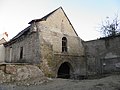
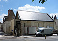
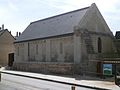
La Chapelle Saint-Libert est un édifice situé à Tours, attesté au Xe siècle et dont les vestiges datent du XIIe siècle.
Media in category "Chapelle Saint-Libert de Tours"
The following 36 files are in this category, out of 36 total.
-
 Chapelle Saint Libert Tours 2012 pradigue 01.JPG 3,264 × 2,448; 3.04 MB
-
 Chapelle Saint Libert Tours 2012 pradigue 02.JPG 2,448 × 3,264; 3.08 MB
-
 Chapelle Saint Libert Tours 2012 pradigue 03.JPG 2,448 × 3,264; 3.53 MB
-
 Chapelle Saint Libert Tours 2012 pradigue 04.JPG 3,264 × 2,448; 2.93 MB
-
 Chapelle Saint Libert Tours 2012 pradigue 05.JPG 3,264 × 2,448; 3.04 MB
-
 Chapelle Saint Libert Tours 2012 pradigue 06.JPG 3,264 × 2,448; 3.37 MB
-
 Chapelle Saint Libert Tours 2012 pradigue 07.JPG 3,264 × 2,448; 3.34 MB
-
 Chapelle Saint Libert Tours 2012 pradigue 08.JPG 3,264 × 2,448; 3.12 MB
-
 Chapelle Saint Libert Tours 2012 pradigue 09.JPG 3,264 × 2,448; 2.99 MB
-
 Chapelle-saint-libert-façade-no.jpg 370 × 298; 48 KB
-
 Chapelle-saint-libert-vue-nord-est.jpg 374 × 243; 66 KB
-
 DSC01101.jpeg 751 × 1,001; 186 KB
-
 DSC01105.jpeg 856 × 605; 396 KB
-
 DSC01617.jpeg 1,001 × 751; 191 KB
-
 Four-cloche.jpg 320 × 401; 81 KB
-
 MOINES.jpg 264 × 219; 85 KB
-
 Projet-tardits.jpg 419 × 307; 127 KB
-
 Saint-Libert ange adorateur.jpg 1,817 × 2,837; 771 KB
-
 Saint-Libert fin travaux.jpg 1,727 × 1,184; 473 KB
-
 Saint-Libert mur1.JPG 1,920 × 1,440; 763 KB
-
 Saint-Libert mur2.JPG 1,440 × 1,920; 723 KB
-
 Saint-Libert mur3.JPG 1,920 × 1,440; 724 KB
-
 Saint-Libert muraille.jpg 1,920 × 1,440; 1.11 MB
-
 Saint-Libert muraille2.jpg 1,187 × 1,066; 190 KB
-
 Saint-Libert parvis.jpg 1,920 × 1,440; 534 KB
-
 Saint-Libert pilastre.jpg 2,400 × 3,200; 1.75 MB
-
 Saint-Libert portail.jpg 2,400 × 3,200; 1.68 MB
-
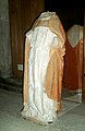 Saint-Libert statue.jpg 1,013 × 1,557; 849 KB
-
 Saint-Libert évêque.jpg 2,400 × 3,200; 1.86 MB
-
 Saint-libert-2012-sylvain-naudin-2.jpg 4,288 × 2,848; 4.36 MB
-
 Saint-libert-2012-sylvain-naudin.jpg 4,288 × 2,848; 4.55 MB
-
 Saint-libert.jpg 299 × 410; 108 KB
-
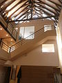
 St Libert charpente.jpg 1,920 × 1,440; 608 KB
-
 St Libert cuve.jpg 1,440 × 1,920; 657 KB
-
 St Libert module1.jpg 1,440 × 1,920; 680 KB
-
 St Libert vitrail.jpg 1,440 × 1,920; 501 KB


