Category:Chapel of the Good Shepherd, Carlett Park
Jump to navigation
Jump to search
| Object location | | View all coordinates using: OpenStreetMap |
|---|
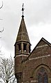
Grade II listed church in the United kingdom  | |||||
| Upload media | |||||
| Instance of | |||||
|---|---|---|---|---|---|
| Dedicated to | |||||
| Location | |||||
| Architectural style | |||||
| Architect | |||||
| Heritage designation |
| ||||
| Inception |
| ||||
 | |||||
Media in category "Chapel of the Good Shepherd, Carlett Park"
The following 9 files are in this category, out of 9 total.
-
 Chapel of the Good Shepherd, Carlett Park 1.jpg 4,782 × 3,357; 21.41 MB
-
 Chapel of the Good Shepherd, Carlett Park 2.jpg 3,408 × 5,037; 12.4 MB
-
 Chapel of the Good Shepherd, Carlett Park 3.jpg 4,932 × 3,339; 18.96 MB
-
 Chapel of the Good Shepherd, Carlett Park 4.jpg 4,984 × 3,367; 17.39 MB
-
 Chapel of the Good Shepherd, Carlett Park 5.jpg 3,917 × 5,823; 16.72 MB
-
 Chapel of the Good Shepherd, Carlett Park 6.jpg 2,964 × 4,792; 8.9 MB
-
 Chapel of the Good Shepherd, Carlett Park 7.jpg 5,083 × 3,440; 23.33 MB
-
 Chapel of the Good Shepherd, Carlett Park, Merseyside, UK - 20120319.jpg 2,832 × 4,256; 7.12 MB
-
 Datestone, Chapel of the Good Shepherd, Carlett Park.jpg 4,639 × 2,826; 9.27 MB


